The 2016 Atlantic Hurricane Season was an active season that took place between June 1-November 30, 2016. The season featured 16 total depressions, 14 named storms, 10 hurricanes, and seven major hurricanes including 3 storms that easily surpassed C5 status, causing much destruction across the Atlantic. During the course of the season, many of the storms made landfalls in unusual places, including Cape Verde; Venezuela, Nicaragua, Nova Scotia, and Morocco. An example of this: Hurricane Grace made landfall in South Africa as a Category 3 hurricane. Due to these occurrences, the 2016 season was quite unusual and different than a normal season.
Season Summary[]
The season began mainly inactive and weak, with only four storms forming in the month of June, and only storm (Ashlyn) of those four reached hurricane status.
The season started with Hurricane Ashlyn and ended with Tropical Storm Quinn.
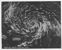
Hurricane Ashlyn was the first named storm, as well as, the first hurricane of the season. The storm formed near Turks and Caicos and eventually made landfall in both Florida and Georgia, causing severe damage.
Tropical Storm Bryan was a severe tropical storm that formed and dissipated in the Gulf. The storm peaked near hurricane intensity, but disorganized structure and wind shear led to its dissipation near Florida.
Tropical Storm Caitlyn remained in the Caribbean, being inhibited to developing further due to continuous landfalls in the Virgin Islands and Puerto Rico. Caitlyn caused relatively minor damages and resulted in one death.
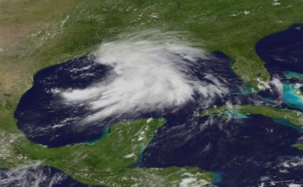
Hurricane Derek was a more destructive storm that made several landfalls in the Caribbean, Florida, and the Gulf. In Cuba, Derek caused severe damage to the farming industry in Cuba due to devastating coastal flooding, as well as destructive winds. Derek then strengthened to a Category 2 in the Gulf Of Mexico, eventually landfalling in Louisiana, where more landfalls of destructive hurricane would follow.
Hurricane Elisa, a devastating Category 4 hurricane, peaked at 155 MPH, becoming one of the strongest storms of the season (until later). Elisa was a classic Cape Verde-type major hurricane that quite unusually

Hurricane Elisa was one of the most destructive storms of the season, peaking at 155 MPH, and resulting in 1,000+ fatalities and over $130 billion in damages, making the hurricane one of the most destructive Atlantic cyclones on record.
made landfall in Venezuela, causing extensive damage to the unprepared citizens of that country. Elisa is currently one of the most destructive storms of the season, resulting in $100+ billion in damages and over 1,000 lives claimed.
Tropical Storm Fernando was a short-lived storm that made landfall in Mississippi, resulting in $38 million in damages and over 30 fatalities. Fernando remained extratropical for an extended period of time; dissipating in Kentucky two days after landfall.
Hurricane Grace was a powerful Category 4 hurricane that formed near Cape Verde which took an unusual Southeast turn. Grace entered the South Atlantic and eventually made landfall in South Africa as Category 3. Grace resulted in hundreds of fatalities as well as several billion dollars in damages.
Hurricane Henry was a destructive Category 1 hurricane that made landfall in the Caribbean and Lousiana. Henry first made landfall as a Severe Tropical Storm in Haiti, causing widespread damage. Henry then entered the Gulf of Mexico, where favorable conditions allowed for intensification to Category 1 prior to making landfall in Cocodrie, Louisiana, resulting in severe damages due to 90+ MPH winds and storm surge.
Tropical Depression Nine formed in the Gulf of Mexico simultaneously as Henry was making landfall in Louisiana. Nine did not intensify beyond depression due to wind shear from Hurricane Henry, and was later forced into Galveston, Texas only a day later, having some effects on the city.
Tropical Storm Iris was a weak system that formed near Bermuda and caused minor damages in both Bermuda and North Carolina before dissipating altogether in Virginia.
Hurricane Jacy was a powerful major Category 3 storm that cuased extensive damage in the Lesser Antilles and Turks and Caicos. The storm was another very destructive one, despite not being the strongest of the season. Jacy then took a track similar to Sandy and grew in size as a subtropical C1 hurricane that dissipated near the Carolinas.
Pre-Season Forecasts[]
In late November 2015, the NHC released their predictions for the 2016 Atlantic hurricane season. A Modoki El Nino caused an inactive beginning, but, in late August 2016, the season became active and more destructive with more storms and many of them becoming stronger in intensity. The NHC forecasted a total of 25 depressions, 22 named storms, and 16 hurricanes including 8 major hurricanes. In reality, the season resulted in 22 total depressions, 18 named storms, and 12 hurricanes including 7 hurricanes.
Storms[]
Hurricane Ashlyn[]
| Category 1 hurricane | |
 | |
| Duration | June 2 – June 17 |
|---|---|
| Peak intensity | 85 mph (135 km/h) (1-min) 977 mbar (hPa) |
On June 2, Tropical Depression One had formed out of a tropical wave stalled Northeast of Turks and Caicos. The system underwent rapid intensification due to warm water temperatures of 90º Fahrenheit, an unusual occurrence that happened rather early in the season. Continuing WNW, on June 5, the slowly-moving storm became Tropical Storm Ashlyn, and, later that day, Category 1 Hurricane Ashlyn, becoming the first named storm of the season. Low relative wind shear and warm water temperatures allowed for stronger intensification to take place, even though Ashlyn was located only 12 miles North of Turks and Caicos. Ashlyn reached a top speed of 85 MPH and then made landfall in St. Marys, GA later on that day. Land interaction continued to weaken Ashlyn as the system persisted Northeast across the U.S. Atlantic Coast as remnant low, producing 60 MPH winds and heavy rains, causing flash flooding in most areas, as well causing widespread blackouts in the Carolinas. By June 15, Ashlyn's remnants were still active in West Virginia, having started to shift NNW; towards the Great Lakes. The next day, Ashlyn's remnants hit Cleveland, Ohio as a 40 MPH storm, causing moderate damage along the Lake Erie Coast. Ashlyn dissipated completely over Erie, PA on June 17. In total, the storm caused over $645 million in damages and resulted in 38 fatalities.
Tropical Storm Bryan[]
| Tropical storm | |
 | |
| Duration | June 14 – June 17 |
|---|---|
| Peak intensity | 65 mph (100 km/h) (1-min) 998 mbar (hPa) |
The NHC began monitoring a tropical disturbance located NE of the Yucatán Peninsula on June 14. Within hours, the system reached 35 MPH, thus resulting in the formation of Tropical Depression 2. The system continued to strengthen into the next day, reaching wind speeds of 65 MPH, earning the name Bryan, but, the system lacked organization and closed circulation, causing it to weaken back to a depression by the end of the day. The storm remained a depression until June 17, when wind shear tore the slow-moving storm apart before it could make landfall in Tampa, Florida. Bryan caused no damages and resulted in no fatalities because the storm never touched land. Ironically, Bryan dissipated only hours before Ashlyn dissipated on the same day; June 17, 2016.
Tropical Storm Caitlyn[]
| Tropical storm | |
 | |
| Duration | June 18 – June 21 |
|---|---|
| Peak intensity | 50 mph (85 km/h) (1-min) 993 mbar (hPa) |
On June 18, a westward-moving tropical wave merged with a low-pressure system which resulted in the formation of Tropical Depression 3 in the Central Atlantic. The storm continued to move NW towards the Virgin Islands, where the NHC issued a Tropical Storm Watch as TD 3 approached. The next day, Three intensified to Tropical Storm when a recon flight reported that 45 MPH winds were present in the storm's core. Later that day, Caitlyn later peaked at 50 MPH as the system's organization continued to improve. Early June 20, Caitlyn weakened back to 45 MPH. The NHC the issued Tropical Storm Warnings for the Virgin Islands as Caitlyn made landfall there that same day, causing minor damage and resulting in only one fatality. Later that day, Caitlyn degenerated back to a depression that made landfall in Puerto Rico, causing slight damage. Caitlyn further degenerated to a remnant low on June 21, dissipating over Puerto Rico that same day. Damages from Caitlyn were mainly minor, and the storm resulted in only one death.
Hurricane Derek[]
| Category 2 hurricane | |
 | |
| Duration | June 29 – July 7 |
|---|---|
| Peak intensity | 110 mph (175 km/h) (1-min) 974 mbar (hPa) |
On June 29, a tropical wave the NHC had been monitoring for several days near the Lesser Antilles strengthened to 35 MPH, making the system becomes Tropical Depression Four. Within hours, convection picked up within the storm's core as organization continued to improve and the wind speed increased to 50 MPH, making the storm Tropical Storm Derek. Continuing on a WNW path, later that day the storm moved through the Lesser Antilles, causing moderate damage, and then emerged over the Caribbean. Low wind shear, couple with other favorable conditions including water temperatures near 90º Fahrenheit, caused TS Derek to reach hurricane status. A recon flight found 90 MPH winds within the storm's inner eye-wall, as well as a pressure of 987 mbar. Over the next several days, the storm changed little in intensity, until a wind shift sent the storm to make landfall in Santiago de Cuba as a powerful C1 hurricane. The storm caused severe destruction, including considerable damage to wooden buildings and trailers, as well as destroying crops and causing massive coastal flooding. Damages totaled near $800 million, and the storm resulted in nearly 150 fatalities on the island.
On June 4, Derek exited Cuba and emerged over the Gulf of Mexico as slightly weakened C1 storm. Winds remained at 85 MPH, and the pressure further decreased to 982 mbar. By June 5, Derek had re-intensified to C2 as Severe Hurricane Warnings were issued along the Gulf Coast by the NHC, most noticeably in Alabama. Winds increased to 105 MPH as Derek continued to press NNW. On June 6, the storm weakened to 100 MPH as the storm's landfall inbounded in Houma, Louisiana. Derek caused heavy destruction across Louisiana, including massive power outages, flooding, and severe wind damage. On June 7, Derek became an extratropical C1 equivalent storm with 75 MPH winds, still pushing NE across the United States. The remnants of the storm caused severe damage, including several localized tornado watches in Mississippi and Alabama, as well as widespread blackouts and other devastation. Derek officially dissipated on June 7 in Birmingham, Alabama, having caused over $64 billion in damages and about 1,737 fatalities.
Hurricane Elisa[]
| Category 4 hurricane | |
 | |
| Duration | July 13 – July 25 |
|---|---|
| Peak intensity | 155 mph (250 km/h) (1-min) 926 mbar (hPa) |
A tropical depression formed over the Central Atlantic from a Cape Verde-type tropical wave on July 13. The storm slowly intensified; becoming Tropical Storm Elisa on July 15, when a recon flight reported winds of 50 MPH in the storm's core. Elisa tracked westward, moving at a slow 40 MPH across the Central Atlantic, allowing moisture to build up within the storm. On July 16, Elisa became a C1 hurricane as a small, ragged eye appeared in the center. Wind speeds increased to 80 MPH and pressure dropped to a low 977 mbar. On July 17, the NHC issued Hurricane Watches on the Lower Lesser Antilles as Elisa slowly approached, forecasted to landfall there on July 21 as a strong C3. Elisa strengthened further as the storm's speed suddenly picked, further increasing convection in the core, strengthening the storm to a 105 MPH Category 2. Later that same day, another recon flight, sent to report on the storm's intensity, mysteriously disappeared after flying into Elisa's eye. By July 19, Elisa was fully organized and stable; still rapidly intensifying due to favorable conditions all across the Atlantic. On July 20, when Elisa was 2 days away from the Lesser Antilles, the storm strengthened further to 140 MPH, becoming the first C4 of the season.
On July 20, Elisa further strengthened to C4, with winds sustained at 140 MPH. That same day, the NHC updated the warnings for the Lower Lesser Antilles to "Major Hurricane Warning." Later that day, Elisa peaked at 155 MPH, causing profound and strong indirect effects on the islands, most noticeably on the island of Grenada, where 8-foot waves crashed against the shoreline, causing moderate coastal flooding and beach erosion. Powerful rip currents resulted in the deaths of several boaters and swimmers pulled out to sea by high tides before Elisa even made landfall. The U.S. aided in successfully evacuating all people off the island before Elisa arrived. On July 21, as the NHC predicted, Elisa made landfall as a slightly weakened C4 hurricane with 150 MPH winds. Elisa eroded the eastern half of the island due to a twenty-foot storm surge that caused massive destruction across the island. After landfalling there, Elisa weakened to 145 MPH and took an unusual shift SW, making an unexpected landfall in Barcelona, Venezuela, as a powerful 120 MPH C3. Because of the unexpected direction change, both damages and the amount of fatalities were heavy. Over 1,000 lives were claimed by the storm, and damages totaled nearly $120 billion. Because of this, Elisa was classified as one of the most devastating storms to hit South America. On July 25, Elisa had finished her extratropical transition and later dissipated that same day.
Tropical Storm Fernando[]
| Tropical storm | |
 | |
| Duration | July 23 – July 26 |
|---|---|
| Peak intensity | 70 mph (110 km/h) (1-min) 999 mbar (hPa) |
On July 23, a tropical wave pushing across the Central Atlantic entered the warm, moist environment of the Caribbean. Later that day, the wave gradually became more organized and intensified to 30 MPH. The next day, the depression reached speeds of 45 MPH, earning the system the name Fernando. Fernando continued to push NNW and made landfall in Cuba that same night. The storm caused minimal damage in Cuba and emerged over the Gulf of Mexico on July 25. Low wind shear and water temperatures at 90º Fahrenheit caused Fernando to strengthen rapidly, peaking at 70 MPH right before making landfall in Gulfport, Mississippi as a 60 MPH storm. Fernando caused moderate damage along the Mississippi shores; including minor coastal flooding, power outages, and slight building damage across the state. Later that day, Fernando turned extratropical as it continued to push across the state as a 40 MPH remnant low. Over 10 inches of rain was calculated to have fallen during the storm, resulting in heavy flash flooding across the state. A small tornado was said to have formed near Natchez, Mississippi, causing minor damage as an EF0. In total, Fernando caused over $28 million in damages and resulted in 30 deaths. Fernando later dissipated on July 26 in Covington, Kentucky.
Hurricane Grace[]
| Category 4 hurricane | |
 | |
| Duration | July 24 – August 2 |
|---|---|
| Peak intensity | 150 mph (240 km/h) (1-min) 936 mbar (hPa) |
On July 24, a tropical wave over Cape Verde began to organize and define itself, intensifying to 35 MPH, automatically becoming Tropical Depression Seven. Seven began a westward track away from Cape Verde and into the Central Atlantic, where rapid intensification in the storm's core, dropping the storm's overall barometric pressure as wind speeds increased to 90 MPH, basically skipping over TS status. At this, the NHC issued several alerts and watches on the storm, now named Grace. At this, a wind shift sent Grace SE into the South Atlantic, so it was moving parallel to the African Coast. Despite the hard change in direction, low wind shear and a moist environment continued to fuel the storm, as the structure of the eye and eye-wall began to become more defined, Grace further intensified to C3 by July 28, as the NHC issued Major Hurricane Watches in Angola, Namibia, and South Africa. On July 29, Grace further intensified to 140 MPH as the pressure took another deep spike down, to 940 mbar. Grace continued to increase in size as the major hurricane bore down on Cape Town, South Africa. American soldiers stationed in the country assisted with evacuating Cape Town and other nearby cities alike as Grace continued to approach. At 11 P.M. EST July 29, Grace peaked at 150 MPH, and by 5 A.M. the next day, max winds were estimated to have fallen to 125 MPH. That same day, Grace then made landfall in Cape Town at 7:30 P.M. EST.
Grace caused major damage in Cape Town, Stellenbosch, and Hermanus. Power outages were widespread throughout that area of the country. A storm surge exceeding twenty feet pounded the coast, resulting in massive flooding 2-4 miles inland. By July 30, Grace had weakened to C1, and, soon after, began an extratropical transition with max winds topping 50 MPH, resulting in considerable damage as the system continued to push across the country. By August 2, Grace's remnants dissipated Beaufort West, having caused over $165 billion in damages and nearly 1,000 fatalities.
Hurricane Henry[]
| Category 1 hurricane | |
 | |
| Duration | August 6 – August 12 |
|---|---|
| Peak intensity | 90 mph (150 km/h) (1-min) 982 mbar (hPa) |
On August 6, a tropical wave pushing into the Caribbean began to undergo rapid intensification into a tropical depression. Within hours, the organizing system became Tropical Depression Eight. The system continued pushing NNW across the Caribbean, strengthening to 50 MPH by August 7, earning the name "Henry". Later that day, a recon flight found winds near 65 MPH in the inner eye-wall, along with a pressure of 991 mbar. On August 8, Henry briefly intensified to 70 MPH before weakening back to 60 MPH prior to making landfall in Haiti. Henry caused moderate damage in Haiti; resulting in heavy crop damage and collapsed wooden buildings due to high winds. Total damages were estimated to be $578 million, and nearly 230 lives were lost. On August 10, the NHC issued Tropical Storm Watches for Florida and the Eastern Gulf Coast as Henry approached. Later that day, Henry shifted NW and entered a more favorable part of the Gulf. At 10 P.M. EST, Henry intensified to 85 MPH, becoming a C1 hurricane. Within hours, Henry peaked at 90 MPH as Hurricane Warnings were issued for Mississippi and Louisiana. On August 11, Henry made landfall at peak intensity in Cocodrie, LA, causing extensive damage with 90 MPH winds and storm surge. Land interaction caused Henry to degenerate rapidly; beginning an extratropical transition several hours after landfall. On August 12, Henry shifted ENE as winds died to 40 MPH. Late August 12, Henry dissipated completely near Brookhaven, Mississippi. In total, Henry resulted in $18 billion in damages and resulted in nearly 600 lives lost.
Tropical Depression Nine[]
| Tropical depression | |
 | |
| Duration | August 11 – August 12 |
|---|---|
| Peak intensity | 30 mph (45 km/h) (1-min) 1011 mbar (hPa) |
On August 11, a zone of disturbed weather in the Gulf of Mexico began to collectively organize itself into Tropical Depression Nine. However, wind shear produced by Hurricane Henry tore parts of Nine off the main cell. On August 12, the structure of the storm gradually became more disorganized; dissipating altogether later that day off the coast of Galveston, Texas.
Tropical Storm Iris[]
| Tropical storm | |
 | |
| Duration | August 14 – August 16 |
|---|---|
| Peak intensity | 60 mph (95 km/h) (1-min) 993 mbar (hPa) |
On August 14, a tropical wave near Bermuda organized and strengthened to 35 MPH, becoming Tropical Depression 10. Organization continued to improve later that day, as the system strengthened to 45 MPH, earning the name "Iris." That same day, Iris moved into Bermuda, causing minor damage and no deaths. On August 15, Iris continued to grow more intense, developing a small, ragged eye as well as strengthening to 60 MPH. However, iris underwent an eyewall-replacement cycle as it approached North Carolina, leaving much of the structure to deteriorate. Iris then made landfall in Morehead City, North Carolina as a 45 MPH storm, causing slight damage, but, once again resulting in no deaths. On August 16, Iris began to turn extratropical, weakening to 35 MPH Salisbury, Virginia. Later that day, the remnants of Iris dissipated completely, having resulted in $38 million in damages but no fatalities.
Hurricane Jacy[]
| Category 3 hurricane | |
 | |
| Duration | August 21 – August 29 |
|---|---|
| Peak intensity | 115 mph (185 km/h) (1-min) 953 mbar (hPa) |
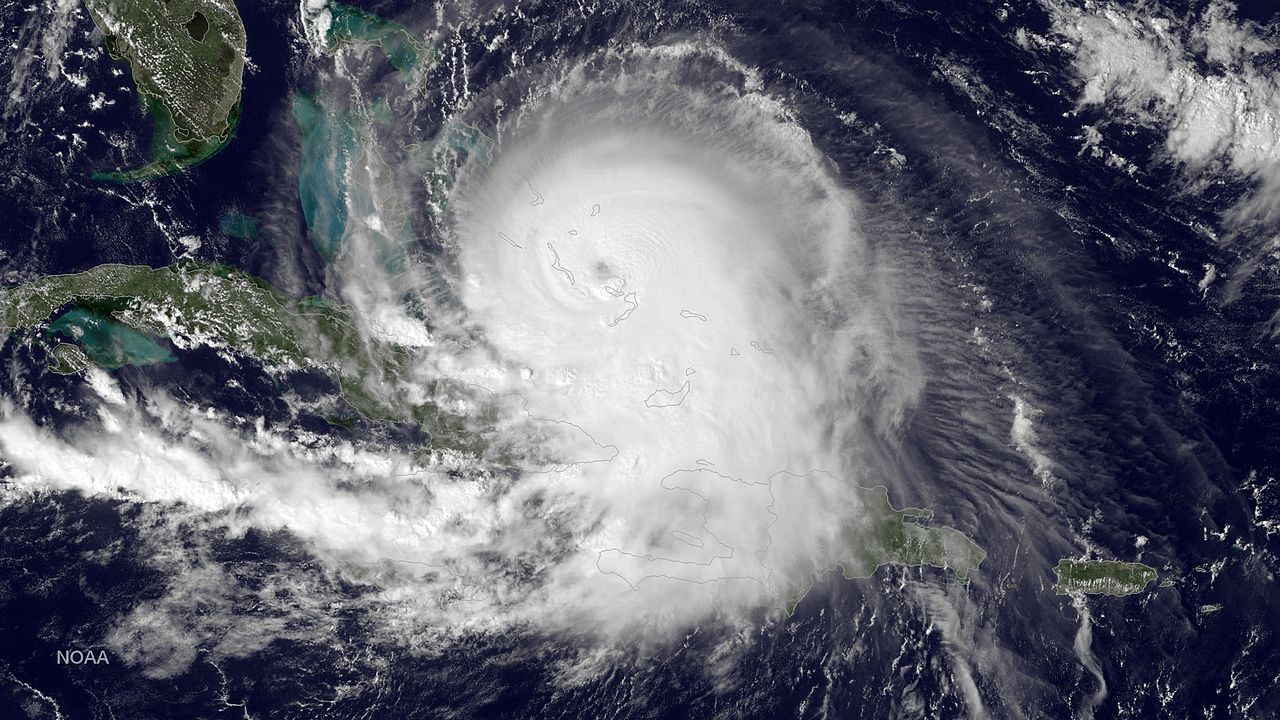
On August 21, a tropical wave over the Central Atlantic began to organize and rapidly intensify over the next several days that followed the system's formation. On August 22, the wave skipped over Tropical Depression status when a recon flight reported that the system had winds maxing out at 65 MPH, earning the name Jacy. The NHC issued Severe Hurricane Watches for the Lesser Antilles as Jacy continued to strengthen. Later that same day, Jacy shifted NNW, turning towards the Virgin Islands. Early August 23, Jacy reached 80 MPH prior to making landfall in Dominica. Jacy then entered the Caribbean and shifted NNW into a favorable environment. Water temperatures at 92º Fahrenheit caused Jacy to strengthen to 115 MPH. Convection continued to increase, causing more updrafts within the eye-wall, further increasing Jacy's speed. The NHC issued Major Hurricane Warnings for Puerto Rico as Jacy made landfall in Ponce on August 25, causing major damage including debarked trees, heavy flash flooding, and widespread blackouts. In Puerto Rico and parts of the Dominican Republic, over 400 fatalities resulted due to slow evacuations and Jacy's intensity. Damages totaled near $37 billion due to extensive and widespread damage. The worst of the damage was located in Villalba, Puerto Rico, where an EF3 tornado touched down and remained on the ground for nearly 60 minutes, having claimed nearly 100 lives and resulting in $12 billion in damages alone.
After landfalling in Puerto Rico, Jacy shifted WNW once again, skirting the northern edge of the Dominican Republic, on a track towards Turks and Caicos. Jacy strengthened back to 105 MPH whilst slamming into Cockburn Town, causing mass destruction to buildings and neighborhoods. Waves exceeding 15 feet pounded shores and destroyed buildings throughout the islands. The next day, Jacy reached the Bahamas, having grown in size but not changing in intensity. High winds near 110 MPH caused widespread power outages and heavy damage to trees and weak structures. After landfalling in the Bahamas, the NHC forecasted a direct landfall in South Carolina, after skirting the edge of Florida. Oddly enough, Jacy had begun weakening, and yet was still growing in size. Jacy had grown to the size of Sandy in 2012 as well as beginning a subtropical transition due to cooler ocean waters. On August 28, Jacy was officially classified as a "Subtropical Hurricane" due to 95 MPH winds within the storm's core, even though the structure of the storm was gradually becoming more disorganized due to its relatively large size. Later that day, Jacy made landfall in Charleston, South Carolina with peak winds estimated at 80 MPH. Eventually, Jacy's large size could not keep the storm stable, and it eventually dissipated in Greenville, North Carolina on August 29. In total, Jacy resulted in $198 billion in damages, and 1,436 lives were claimed in the storm, making the storm one of the most destructive in history.
Hurricane Kali[]
| Category 5 hurricane | |
 | |
| Duration | August 26 – September 8 |
|---|---|
| Peak intensity | 175 mph (280 km/h) (1-min) 921 mbar (hPa) |
On August 26, a tropical wave developing over Cape Verde began to increase in size and wind speed, forming a defining structure mimicking a Tropical Storm. Winds increased to 35 MPH as the new depression continued to intensify. The next day, the depression reached Tropical Storm status when winds were found to be 60 MPH in the core. At this point, The NHC gave the new storm the name "Kali." Kali remained stalled near Cape Verde into the next day, bringing wet and windy conditions as the islands remained under a Tropical Storm Warning until August 28. That same day, Kali had winds of 70 MPH along with a centralized core pressure of 992 mbar. Kali then developed a small, ragged eye that gradually became more circular in shape as the storm's intensification continued. Kali changed little in intensity until August 30, when sudden decrease in wind shear allowed for explosive intensification to take place. Within hours, winds in Kali's inner eye-wall reached 90 MPH, essentially making Kali a Category 1.
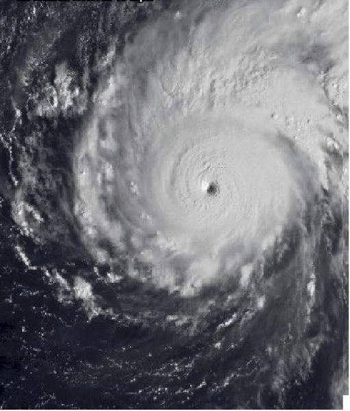
The explosive intensification trend in Hurricane Kali's track continued to September 3, when Kali intensified to Category 5; with winds near 165 MPH and a pressure of 927 mbar found in the inner eyewall. The NHC issued Major Hurricane Warnings for the Lesser Antilles and parts of the Caribbean as Kali approached; forecasted to make landfall in Barbados early the next day. On September 4, Kali peaked at 175 MPH. The U.S. aided in successfully evacuating citizens off the islands of Barbados and Dominica prior to Kali's landfall as a powerful C5. At 10 A.M. EST, Kali made landfall in the Upper Lesser Antilles with the highest winds near 170 MPH. Kali caused catastrophic damage; a 17-foot storm surge resulted in massive flooding and damages near $60 billion. In total, Kali resulted in damages near $70 billion alone in the Lesser Antilles. A relatively low number of fatalities near 130 was due to the evacuation efforts conducted by the United States. Kali briefly re-attained 175 MPH winds when emerging in the Caribbean on September 5 before slamming into the island of Hispaniola. As in the Lesser Antilles, Kali caused massive devastation. 170 MPH winds resulted in widespread and long-lived power outages. The island remained inhospitable for the next seven months after the storm due to a massive storm surge that resulted in large-scale building damage and heavy destruction to farms. In the Caribbean, Kali caused over $102 billion in damages and was responsible for claiming the lives of over 400 people.
Hurricane Kali weakened back to 150 MPH after exiting the Caribbean and made an indirect landfall in Key West, Florida, missing the island directly but still causing problems with hurricane-force winds and storm surge. Kali continued on a NNW track, skimming the western part of the Florida peninsula. Kali's indirect impacts included gale-force winds and high tides along the Florida Gulf Coast. Due to Kali's effects, many Florida beaches closed. Kali then made landfall in Pensacola, Florida as a rapidly-weakening Category 3 hurricane with 115 MPH winds. Kali caused extensive damage, including a complete contamination of local Florida panhandle water sources as well as widespread power outages. Properties alongside Pensacola Bay were pounded by storm surge, resulting in heavy devastation. Kali began an extratropical transition due to land interaction after crossing into Georgia, still producing 75 MPH winds despite the structure of the storm was starting to deteriorate. The next day, September 8, the remnants of Kali dissipated over North Carolina, having caused extensive damage in the U.S. In Atlanta, Georgia, Kali produced multiple weak tornadoes that caused $600 million in damages to homes and buildings. In Raleigh, North Carolina, Kali produced 60 MPH winds which resulted in widespread power outages and even road closures due to torrential rain. In the U.S., Kali caused over $122 billion in damages and nearly 900 fatalities. When put together, Hurricane Kali is one of the most costliest and destructive hurricanes since the Labor Day Hurricane of 1935.
Tropical Depression Thirteen[]
| Tropical depression | |
 | |
| Duration | September 7 – September 9 |
|---|---|
| Peak intensity | 30 mph (45 km/h) (1-min) 1007 mbar (hPa) |
On September 7, a weak cluster of tropical showers and thunderstorms organized under weak circulation. Wind shear inhibited further development for the depression, which peaked under 30 MPH. By the next day, the system approached Puerto Rico, rapidly weakening. By the next day, TD Thirteen completely fell apart, resulting in its dissipation on September 9. Thirteen resulted in no damage and no fatalities.
[]
Tropical Storm Lawrence[]
| Tropical storm | |
 | |
| Duration | September 12 – September 16 |
|---|---|
| Peak intensity | 65 mph (100 km/h) (1-min) 994 mbar (hPa) |
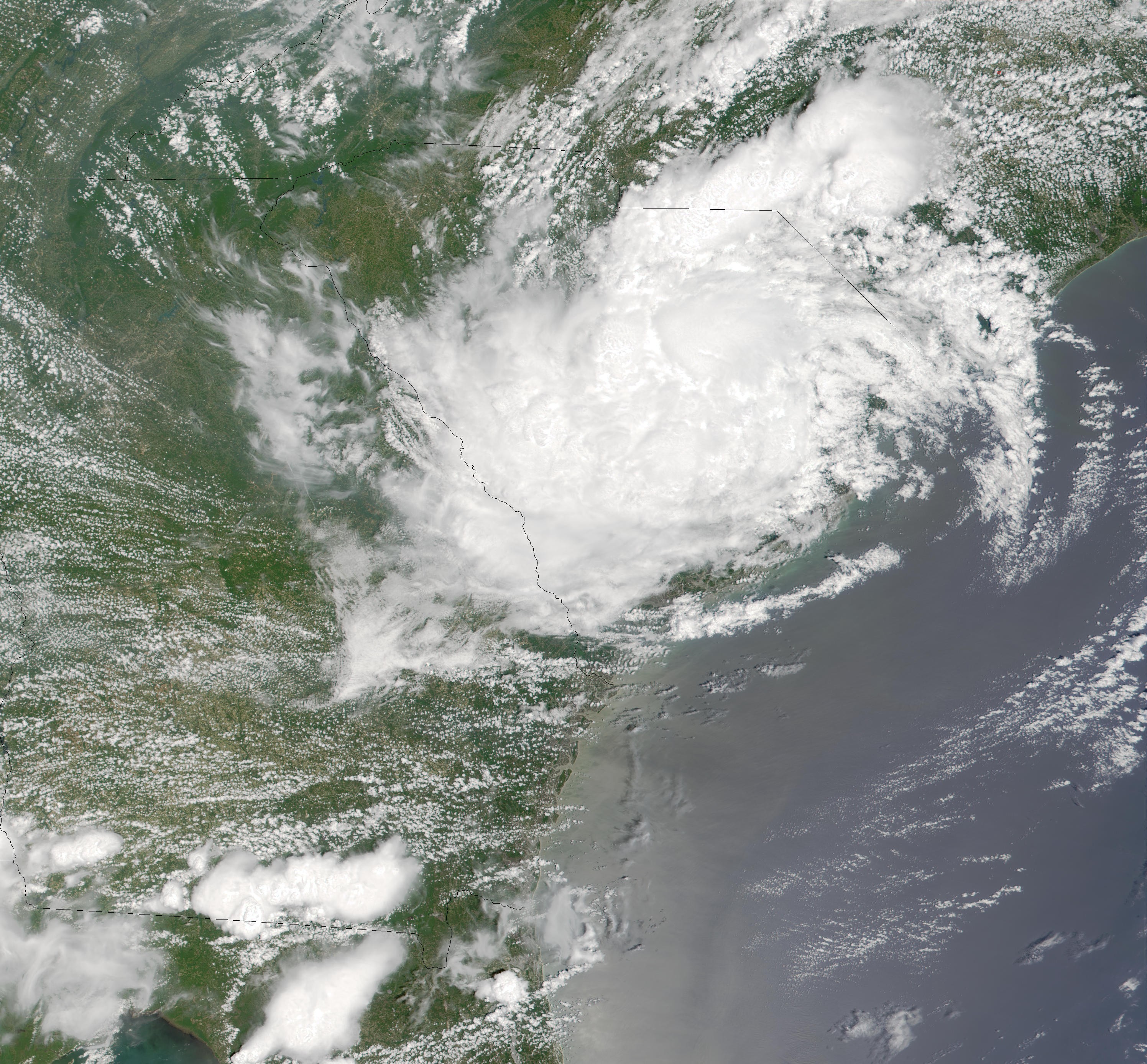
On September 12, a tropical invest near the Cayman Islands began to organize under increasing closed circulation. By the end of the day, winds within the core were estimated to be 35 MPH, becoming Tropical Depression Fourteen. Fourteen changed little in intensity until September 14, when the system emerged in the Gulf of Mexico and began to explosively intensify, becoming Tropical Storm Lawrence. Winds briefly peaked at 65 MPH until Lawrence shifted WSW and skimmed the coast of the Yucatán Peninsula, causing minor damage and coastal flooding. On September 15, Lawrence officially made landfall in the Yucatán, bringing high winds and heavy rain. The worst of the storm's damage was found near Cancún, where an EF1 tornado had formed and remained for nearly 25 minutes, causing over $670 million in damages and resulting in 18 fatalities. In other places in the Yucatán, Lawrence caused widespread power outages, flash flooding, and severe building damage including shattered windows and roofs torn off homes. Lawrence continued to weaken as the storm re-emerged in the Caribbean as a rapidly-weakening extratropical depression, having made a track that resembled a complete loop around the Yucatán. The remnants of Lawrence later dissipated on September 16 near the Cayman Islands, having caused over $12 billion in damages and resulting in 60 fatalities, making the storm one of the most deadliest and destructive tropical storms to hit the Yucatán.
Hurricane Matea[]
| Category 4 hurricane | |
 | |
| Duration | September 14 – September 20 |
|---|---|
| Peak intensity | 150 mph (240 km/h) (1-min) 919 mbar (hPa) |
On September 14, an invest located several miles SSW of Cape Verde slowly gained in strength and increased to 30 MPH. Within hours, the intensification trend continued and winds within the depression's core reached 45 MPH, earning the new Tropical Storm the name "Matea." Tropical Storm Matea continued on a track NW throughout the Central Atlantic, where warm, moist air and low levels of wind shear allowed for more development to take place. The next day, Matea became a C1 when a recon flight found winds exceeding 80 MPH in Matea's inner eye-wall. Matea continued to intensify as the hurricane passed to the west of Cape Verde and entered the Northern Atlantic. Favorable conditions continued to persist as Matea increased to 125 MPH, becoming a Category 3 Major Hurricane. Matea briefly shifted NW prior to making another turn Northeast. On September 17, Matea peaked at 150 MPH, having become a Category 4 hurricane. That same day, Matea hit the Azores, resulting in major damage across the islands. Matea brought nearly 30 inches of rain, resulting in catastrophic flooding and mudslides across the islands. A 16-foot storm surge obliterated coastal areas and beachfront cities, as well as damaging crop fields and isolating communities by destroying bridges and roads, leaving thousands stranded in the mountains. 150 MPH winds caused widespread blackouts and heavy damage to forests and reinforced buildings. In total, Matea caused well over $467 million in damages and resulted in the deaths of nearly 180 people, making the hurricane the most devastating to strike the Azores in Atlantic history.
Hurricane Matea gradually weakened after hitting Azores, weakening to 90 MPH on September 18 and remaining at the strength even as the storm turned extratropical. The Category 1 equivalent storm continued to track northeast as the NHC issued Severe Weather Warnings for the UK as the storm approached. On September 19, the remnants of Matea made landfall in Cork, Ireland, bringing 90 MPH winds and torrential rain. The storm's intensity resulted in severe damage across the UK, including spotty power outages extending as far as Aberdeen, Scotland. Extratropical Storm Matea also caused localized flooding; heavily concentrated in Wales and Southern England, as a result of heavy rain. The remnants of Matea resulted in the deaths of two people in Oxford, England when 90 MPH wind gusts uprooted a tree that fell onto a car, killing the two people inside. In the UK, Matea's remnants caused nearly $336 million in damages and resulted in two fatalities. The storm officially dissipated the next day, September 20, off the coast of Esberg, Denmark.
Invest 90U[]
| Tropical Invest | |
 | |
| Duration | September 29 – October 1 |
|---|---|
| Peak intensity | 25 mph (35 km/h) (1-min) 1024 mbar (hPa) |
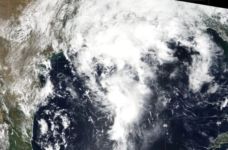
Ordinarily, invests would not be listed as part of a hurricane season. However, Invest 90U is listed due to the controversy in the NHC as to whether or not the storm actually developed into a tropical depression. Invest 90U developed as an upper-level low near the Azores on September 29 and began to slowly organize. The invest continued to gain in strength, eventually peaking at 25 MPH, having not strengthened into a depression. However, some NHC scientists argue that Invest 90U briefly took on a cyclonic shape at peak intensity, in which they believed the system peaked at 30 MPH, otherwise known as tropical depression-intensity. The next day, the invest failed to organize as the pressure in the system's core rose, eventually leading to the system's dissipation North of the Azores.
Hurricane Nicholas[]
| Category 6 hurricane | |
 | |
| Duration | October 4 – October 12 |
|---|---|
| Peak intensity | 245 mph (400 km/h) (1-min) 857 mbar (hPa) |
On October 4, a well-developed invest 335 NNW of Cape Verde began to improve in organization and convection increased at the storm's core. The system became increasingly well-defined over the next several days, eventually strengthening to 60 MPH and becoming Tropical Storm Nicholas on October 6. Nicholas continued to track NW across the Northern Atlantic, becoming an 80 MPH C1 at the end of the same day. On October 7, Hurricane Nicholas began an explosive intensification trend that ended the day with Nicholas exceeding speeds of 190 MPH. The NHC issued Major Hurricane Warnings for Bermuda as C5 Hurricane Nicholas approached Bermuda. On October 8, a recon flight found winds of 240 MPH in Nicholas's inner eyewall, along with a pressure of 857 mbar, making Hurricane Nicholas the strongest storm to occur in hurricane history, let alone being the strongest hurricane to occur in the Atlantic basin. At peak intensity, Nicholas measured more than 1300 miles across.
Bermuda was evacuated completely by October 8 as Nicholas continued to approach. Due to the storm's massive size, the outer rain bands hit a day ahead of the actual storm, causing light showers and wind across the island. By October 9, Nicholas had weakened to a 150 MPH C4 that had begun to disorganize. Layer by layer, the storm's outer bands began to shred and break off Nicholas's eyewall and dissipate. Later that day, Nicholas hit with winds maxing at 145 MPH. Nicholas caused major damage in Bermuda with a 50-foot storm surge resulting in massive devastation to beaches and cities along the shorelines. The island lost power for nearly three weeks prior to being restored. Water and resource losses were total and lasted for several months. In total, Nicholas caused nearly $140 billion in damages in Bermuda, but did not result in any fatalities there, making Nicholas the costliest storm to occur in the Atlantic, even surpassing Katrina of 2005.
Hurricane Nicholas weakened to C3 after slamming Bermuda, on a track to make landfall in North Carolina. However, Nicholas had begun an eyewall-replacement cycle when making landfall in Bermuda, and the storm had been rapidly weakening since then. By the end of the day October 10, Nicholas was an extratropical system equivalent to a 75 MPH C1 storm. At 11 P.M. EST, the remnants of Nicholas made landfall in Cape Hatteras, North Carolina. The storm caused minor damage with a 7-foot surge that flooded only a quarter mile inland, resulting in beach erosion and rip tides that presented dangers to swimmers and boaters alike. Due to large waves and high tides, a small sailboat named Piper disappeared the day Nicholas's remnants made landfall in North Carolina. Within hours, of making landfall, Nicholas's circulation dissipated and the storm turned into a rapidly moving squall line, causing major damages along the East Coast, nailing Boston, MA with hailstorms and multiple weak tornadoes. In Richmond, Virginia, 60+ MPH straight-line winds blew roofs off homes and downed trees and electrical wires all over the city. In total, Nicholas caused $324 million in damages and resulted in 12 fatalities. Nicholas's remnants eventually dissipated in New York, New York on October 12.
Storm Names[]
The 2016 Atlantic Hurricane Season underwent a names list revision in late 2015. Instead of the list that was used in 2010, the NHC retired all names from the aged list and replaced every name with a replacement. Names not assigned are marked in gray.
|
|
|
Retirement:[]
In the spring of 2017, the NHC officially met to retire 6 names from the list: Derek, Elisa, Jacy, Kali, Matea, and Nicholas due to the intensity, damages, and fatalities of the storms. They were replaced with Drew, Eveleyn, Jaden, Karlie, Margo, and Neil for the 2022 Atlantic hurricane season, respectively.