NOTICE: If you are new to the usercane concept, check out this page. All updated usercane information is provided here, including an overview of the NUC functions.

The 2017 Atlantic usercane season was the first season in the most recent and ongoing negative Atlantic multidecadal oscillation period ("low-quality era") within the basin. It was an above-average Atlantic usercane season that featured the highest amount of named userstorms until the following 2018 season, but it was well below-average in the number of usercanes with only six - the lowest since 2012.
Most of the storms that formed during the season were weak and short-lived. It had the slowest start since 2013, with only two storms forming before the month of April. Despite the uptick in named storms in early June, only two achieved major usercane intensity — Usercane Chap and Usercane Alissa — with the latter only achieving usercane intensity for a short time. In late September, there was an explosive increase in activity, with eight userstorms forming in late September alone. However, the season remained weak with no new usercanes originally during the month. One of the userstorms from said month, Dezcrafter (later renamed Dez and then to Kiko) attained usercane status during August of 2020, setting one of the longest gaps between initial formation and intensification into a usercane on record. The explosion of activity continued on in October, even setting the record for the most named storms in any usercane season.
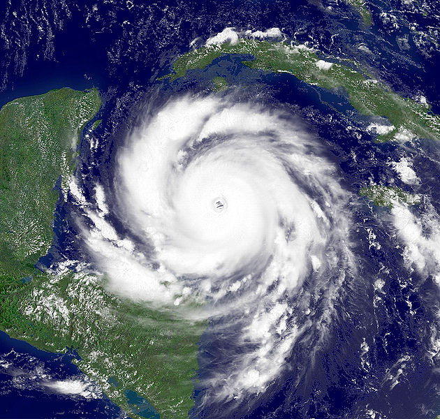
The season's second strongest storm, Usercane Cooper, was the first Category 5 usercane of the season. Its strongest storm, Usercane Alex, strengthened much later. The season also featured Usercane Prism, which reached Category 3 strength in the central Atlantic, and Usercane Chap, which attained high-end Category 4 strength in the western Atlantic.
All forecasting agencies predicted an above-average season, with many predicting a high amount of tropical userstorms. They reduced their seasonal predictions in June, particularly in the number of usercanes and major usercanes. The weak activity is believed to be attributed to a significant weakening of the thermohaline circulation during the spring of 2017, creating unfavorable conditions in the Atlantic — especially in the Main Development Region (MDR). During post-season analysis, 6 unnoticed userstorms were identified: Tropical Userstorm Justin, Tropical Userstorm Barney, Tropical Userstorm Nicholas, Tropical Userstorm Orange, Tropical Userstorm Nibiru, as well as an unnoticed tropical userpression. Furthermore, the remnants of a long-lived userstorm spawned a new and more intense userstorm in 2022 that was recognized in post-analysis.
Timeline[]

Seasonal forecasts[]
| Source | Date | Named storms |
Usercanes | Major usercanes | |
| Average (2010–2016) | 15.1 | 7.7 | 6.0 | ||
| Record high activity | 33 | 22 | 14 | ||
| Record low activity | 4 | 2 | 2† | ||
| GIHC | December 4, 2016 | 25 | 7 | 5 | |
| NUC/BNWC | December 14, 2016 | 25-30 | 7-10 | 5-8 | |
| AHUC (pre-season update) | December 23, 2016 | 34-38 | 9-13 | 7-11 | |
| FMC/PLS | December 23, 2016 | 26-31 | 7-10 | 4-7 | |
| BNMA | December 23, 2016 | 27-36 | 6-11 | 5-8 | |
| SMWC | December 25, 2016 | 28-33 | 8-12 | 4-8 | |
| ICON | December 26, 2016 | 28 | 11 | 8 | |
| KMC | December 26, 2016 | 25 | 11 | 4 | |
| MHNHHC (winter) | December 26, 2016 | 21 | 11 | 5 | |
| HTMC | December 30, 2016 | 27 | 14 | 6 | |
| MKNHC | December 31, 2016 | 29 | 16 | 8 | |
| BPWPC | January 6, 2017 | 26-31 | 10-12 | 4-8 | |
| MHC | January 6, 2017 | 23 | 12 | 5 | |
| NUC/BNWC | February 24, 2017 | 21-26 | 6-10 | 4-6 | |
| FMC/PLS | April 1, 2017 | 21-26 | 5-10 | 3-7 | |
| AHUC (spring update) | April 9, 2017 | 22-24 | 7-10 | 4-7 | |
| BPWPC (2) | April 29, 2017 | 12-19 | 3-8 | 0-4 | |
| HTMC (updated) | May 18, 2017 | 13-17 | 6-10 | 2-5 | |
| GIHC | May 18, 2017 | 15 | 5 | 4 | |
| AHUC (late spring update) | May 31, 2017 | 15-20 | 3-6 | 1-4 | |
| NUC/BNWC | June 4, 2017 | 17-22 | 4-9 | 3-5 | |
| FMC/PLS | June 15, 2017 | 16-21 | 3-9 | 2-6 | |
| MKNHC | June 27, 2017 | 11 | 4 | 1 | |
| MHNHHC (summer) | June 27, 2017 | 18-21 | 3-6 | 0-3 | |
| BNMA | June 27, 2017 | 15-20 | 3-7 | 0-2 | |
| GIHC | June 27, 2017 | 13-16 | 1-5 | 0-3 | |
| NUC/BNWC | June 30, 2017 | 13-18 | 2-5 | 1-2 | |
| BPWPC (3) | September 24th, 2017 | 18-21 | 1-4 | 1-2 | |
| Actual activity |
39 | 8 | 4 | ||
| * June–November only. † Most recent of several such occurrences. (see all) | |||||
Ahead of and during the season, several usercane centers release seasonal forecasts. On December 4, 2016, the Garfield International Hurricane Center (GIHC) released its forecast, predicting above-average activity with 25 named storms, 7 usercanes and 5 major usercanes, which is slightly above the long-term average but significantly less active than the 2015 and 2016 seasons. On December 14, the National Usercane Center released their first 2017 forecast, predicting above-average activity with 25-30 named storms, 7-10 usercanes, and 5-8 major usercanes. A third hurricane center, the Akio Hypothetical Usercane Center (AHUC), made its prediction on December 23, 2016, predicting well above average activity with 34-38 Tropical Storms, 9-13 usercanes, and 7-11 Major usercanes. On the same day as the AHUC, the Floyd Meteorological Center (FMC) released their 2017 forecasts, predicting slightly above-average activity with 26-31 named storms, 7-10 usercanes and 4-7 major usercanes. The same day, the Brick National Meteorological Agency issued their forecast, predicting above-average activity, with 27-36 named storms, with 6-11 of those becoming usercanes (74 mph+), and 5-8 major usercanes (111 mph+). On December 26, 2016, ICON released its official prediction of 28 named storms, 11 usercanes, and 8 major usercanes for the 2017 season. That same day, the Keranique Meteorological Center (KMC) released their forecast, predicting an overall above-average season with 25 named storms, 11 usercanes, but a below-average 4 major usercanes. Also on that same day, the Money Hurricane National Hypothetical Hurricanes Center (MHNHHC) released their forecast, also predicting above-average activity but a less active season than 2015 and 2016, with 21 named storms, 11 usercanes and 5 major usercanes. On December 30, the HTs Meteorological Center (HTMC) released its forecast, predicting above-average activity as well with 27 named storms, 14 usercanes and 6 major usercanes. On December 31, the Mushroom Kingdom National Hurricane Center (MKNHC) released its seasonal prediction for 2017, predicting above-average activity with 29 named storms, 16 usercanes and 8 major usercanes. On January 6, the BPWPC made its prediction for the 2017 usercane season, predicting 26-31 storms, 10-12 hurricanes, and 4-8 major hurricanes, an above-average season. Later the same day, the Minecraft Hurricane Center (MHC) released its forecast for the season, predicting above-average activity, with 25 named storms, 11 usercane, and 5 major usercanes. On April 29, 2017, the BPWPC made its updated forecast, taking actual storms into account. It predicted 12-19 named storms, 3-8 usercanes, and 0-4 major usercanes. On June 27, the Mushroom Kingdom National Hurricane Center released its forecast, significantly lower than previous predictions - only predicting 11 named storms, 4 usercanes and only 1 major usercane. This was due to the observation of a significant decrease in the strength of the userthermohaline circulation, creating conditions in the Atlantic similar to what is observed in the spring.
Seasonal summary[]
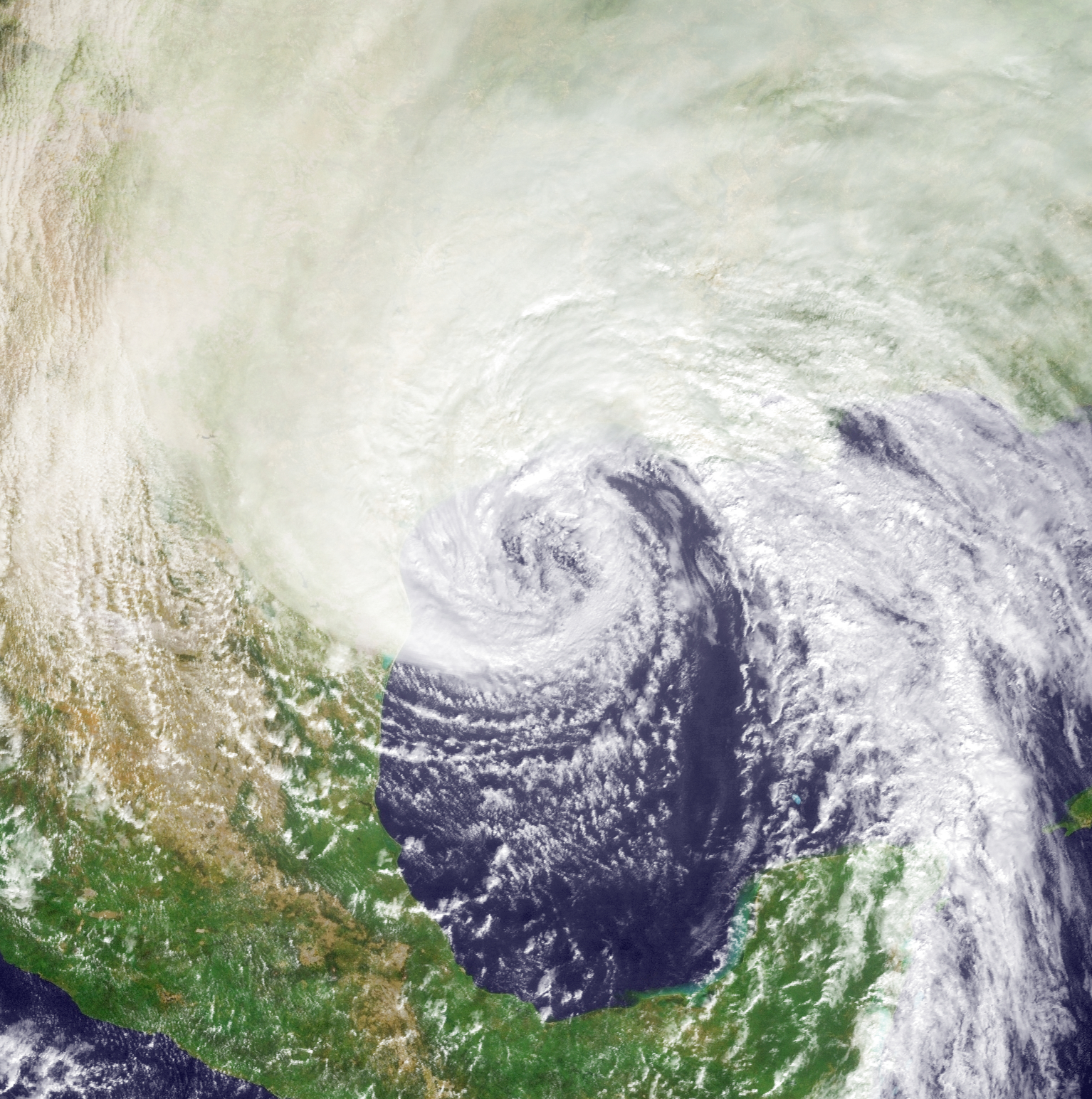
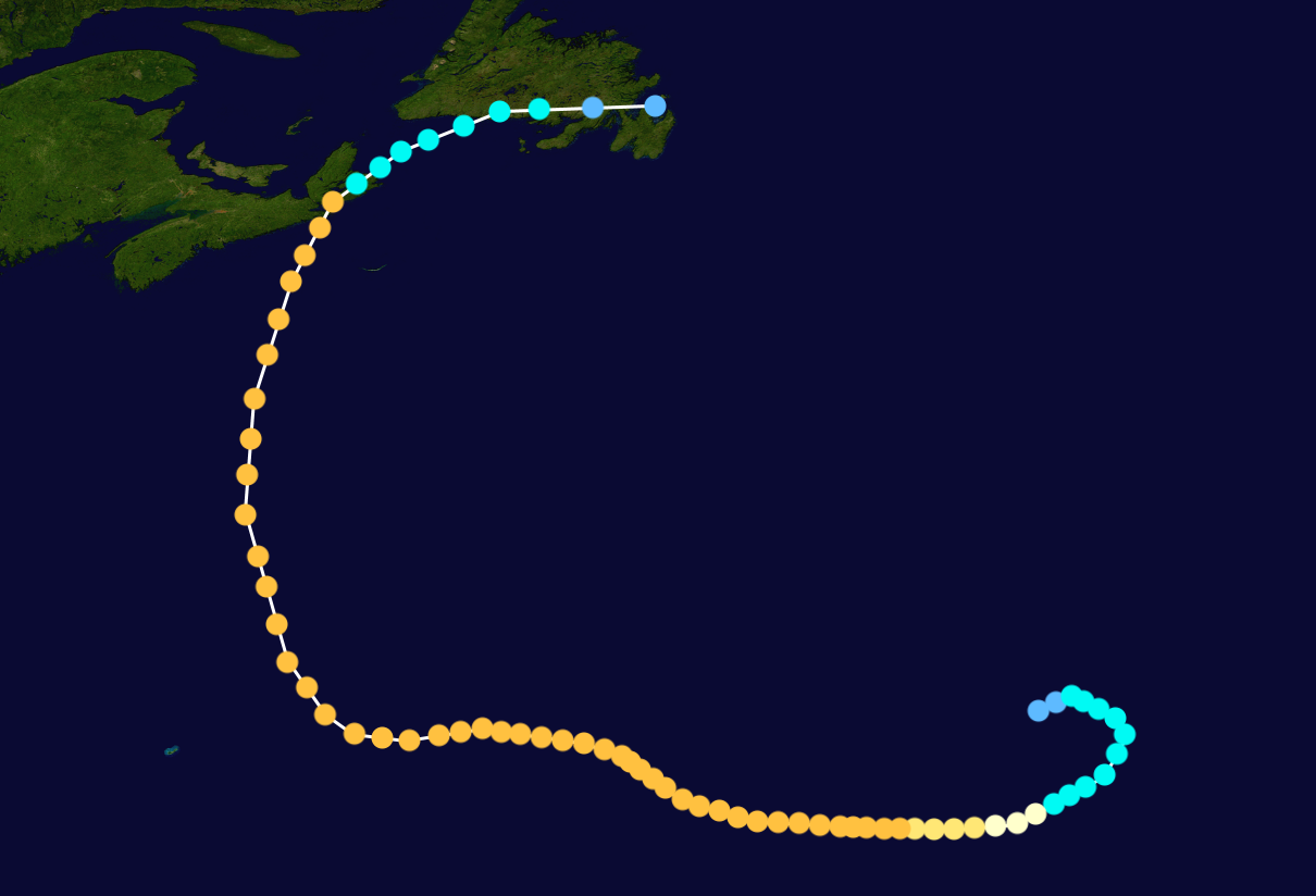
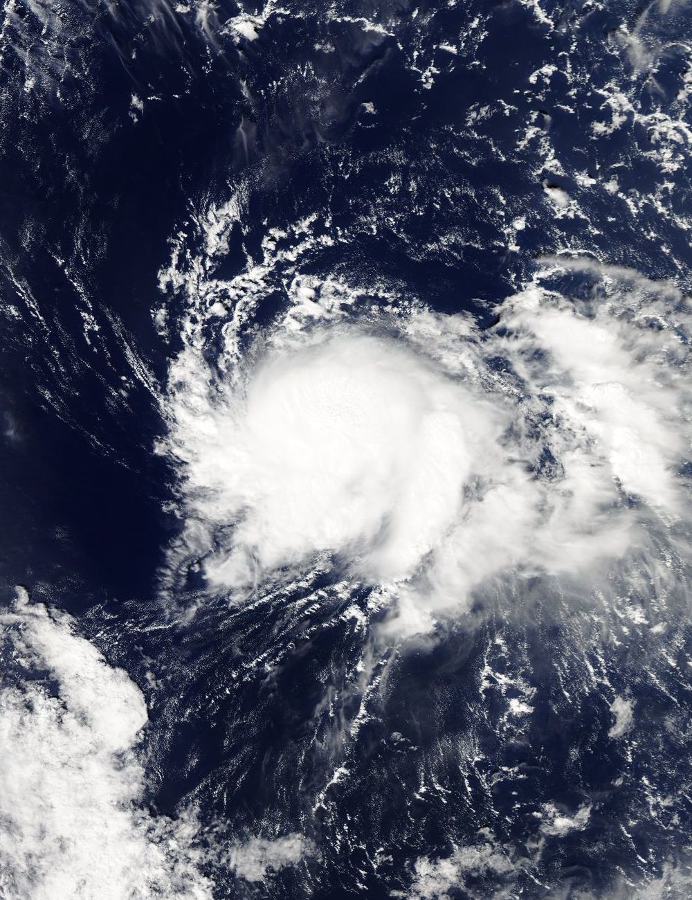
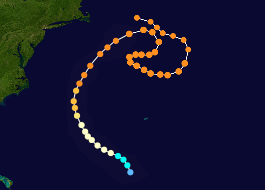
All the usercanes entering 2017 as of December 31, 2016.
Numerous storms that formed in 2015 and 2016 or earlier were active at the start of 2017: Major hurricanes included Usercane Hype, Usercane Bob, Usercane Anthony, Usercane Keranique, Usercane Bumblebee, Usercane Akio, Usercane Floyd, Usercane Roussil, Usercane Darren, Usercane James, Usercane Minecraft, Usercane Garfield and Hurricane Brick. There were also several non-major hurricanes as well as tropical storms.
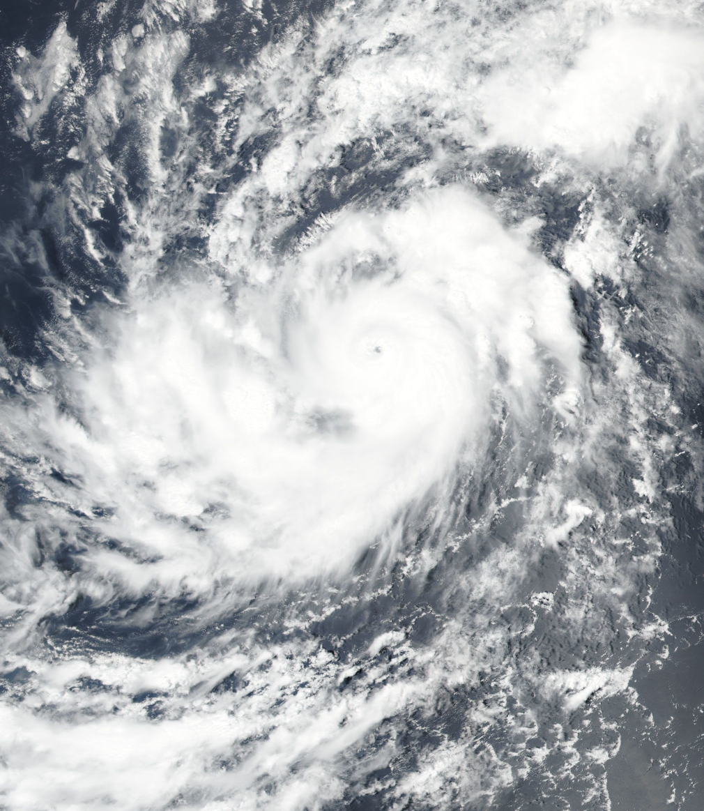
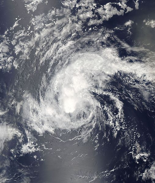
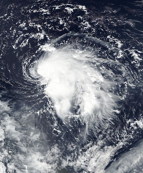
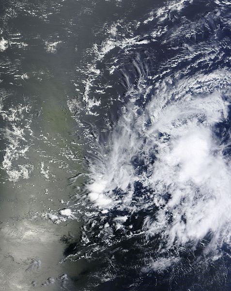
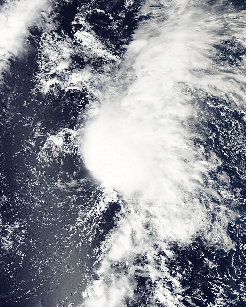
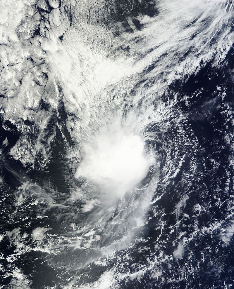
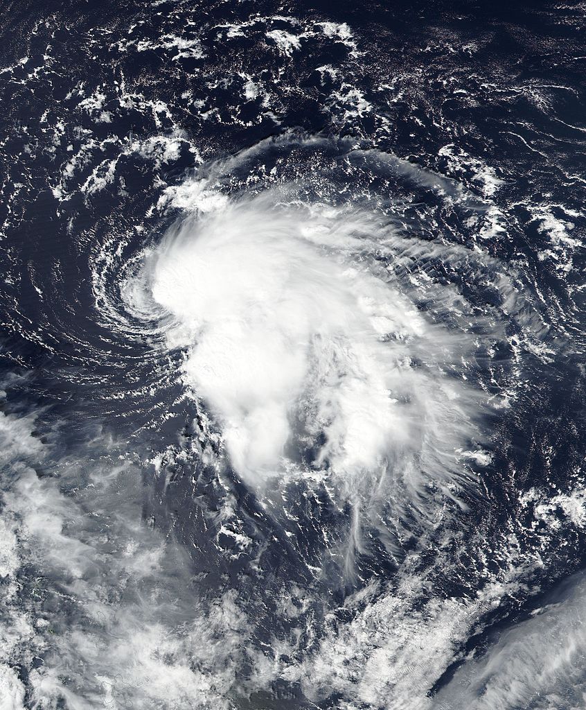
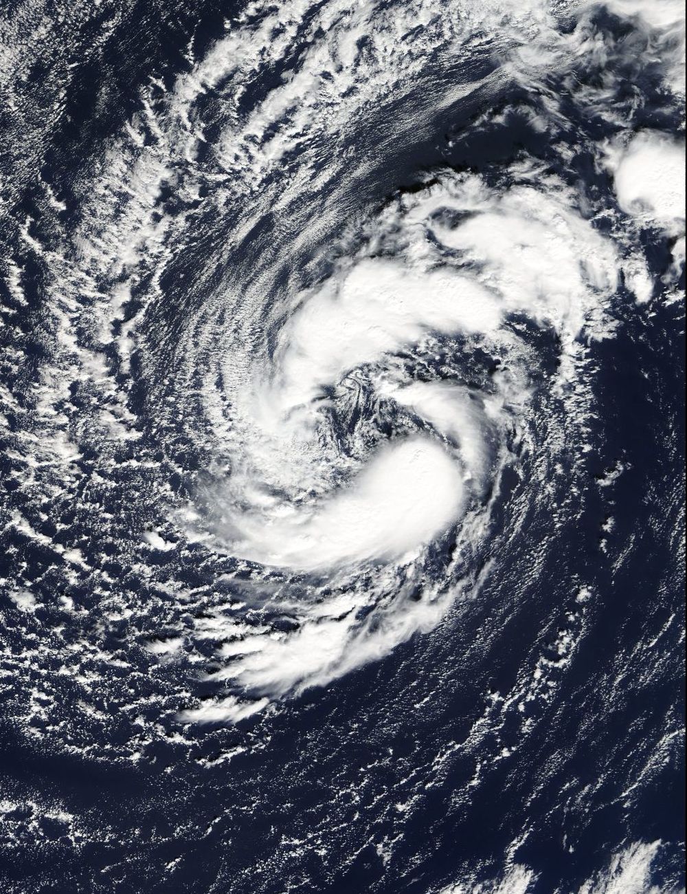
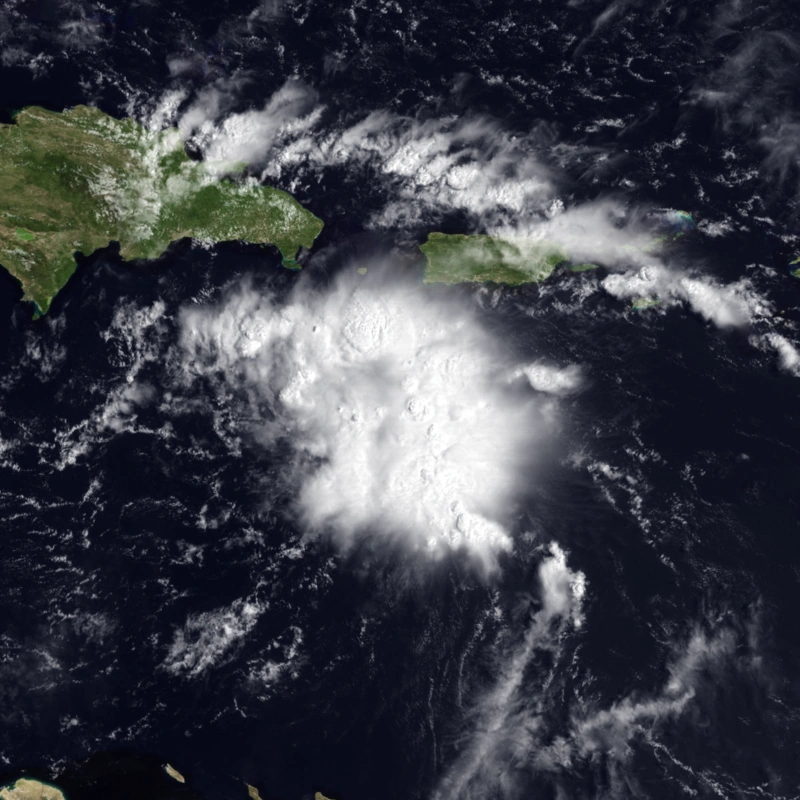
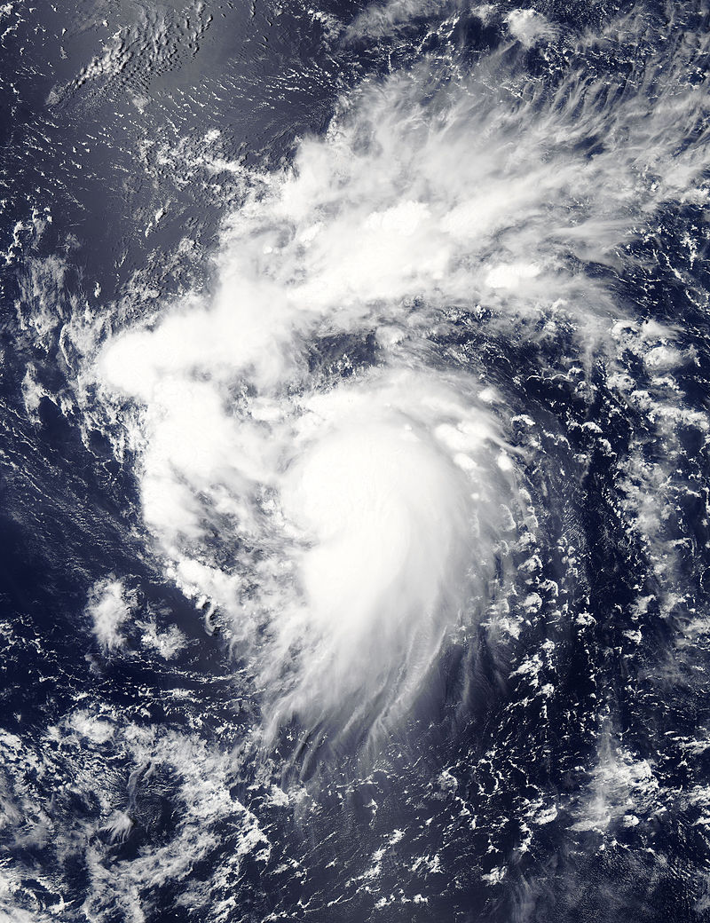
Tropical Userstorm Chap on late-January.
January[]
Like 2016, it has an early start, Tropical Userstorm Chaser formed on January 6, six days after the season began. It didn't get past 40 mph, attaining pressure of 1006 mbar. However, on January 22, Chaser did degenerate into a remnant low. Usercane Chap also formed, it did a good, organized structure causing it to strengthen in the following month. Tropical Userstorm Mli also formed near Cape Verde, but struggled to strengthen due to shear later.
February[]
No storms formed in this month, but some changes in userstorm strength were observed. Only known change is observed, and that is Chap strengthened into the first usercane of the season.
March[]
No storms formed in this month, and no changes happened.
April[]

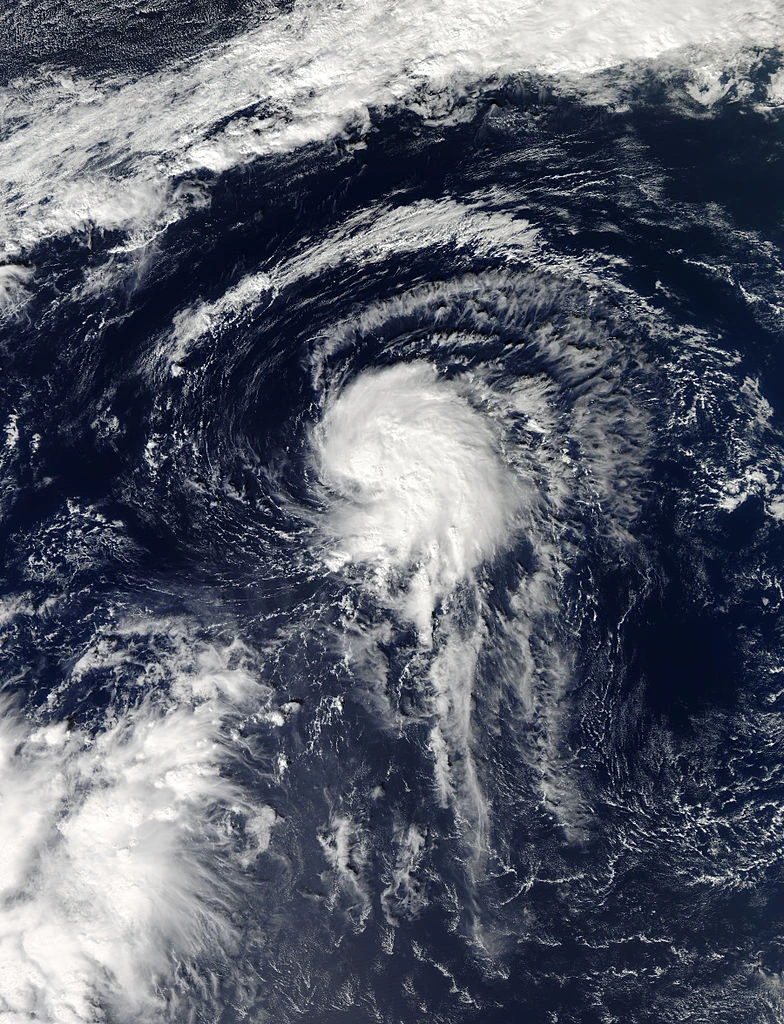
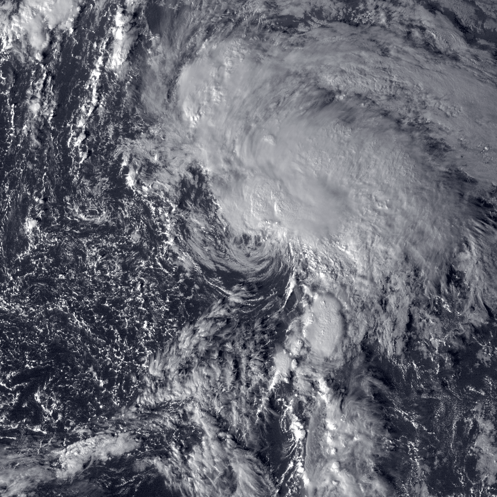
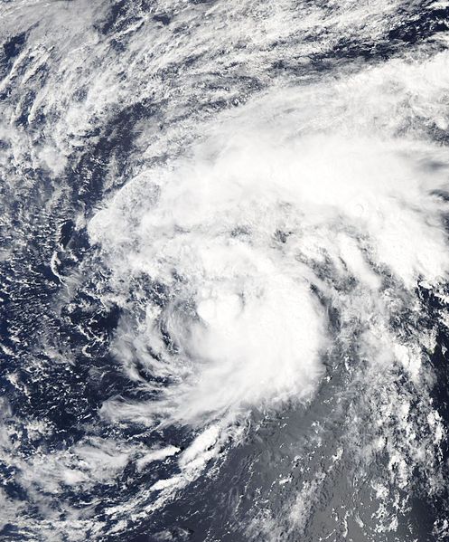
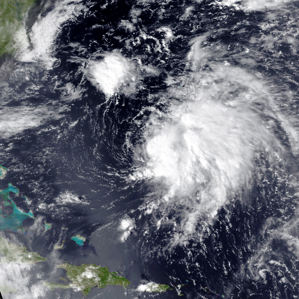
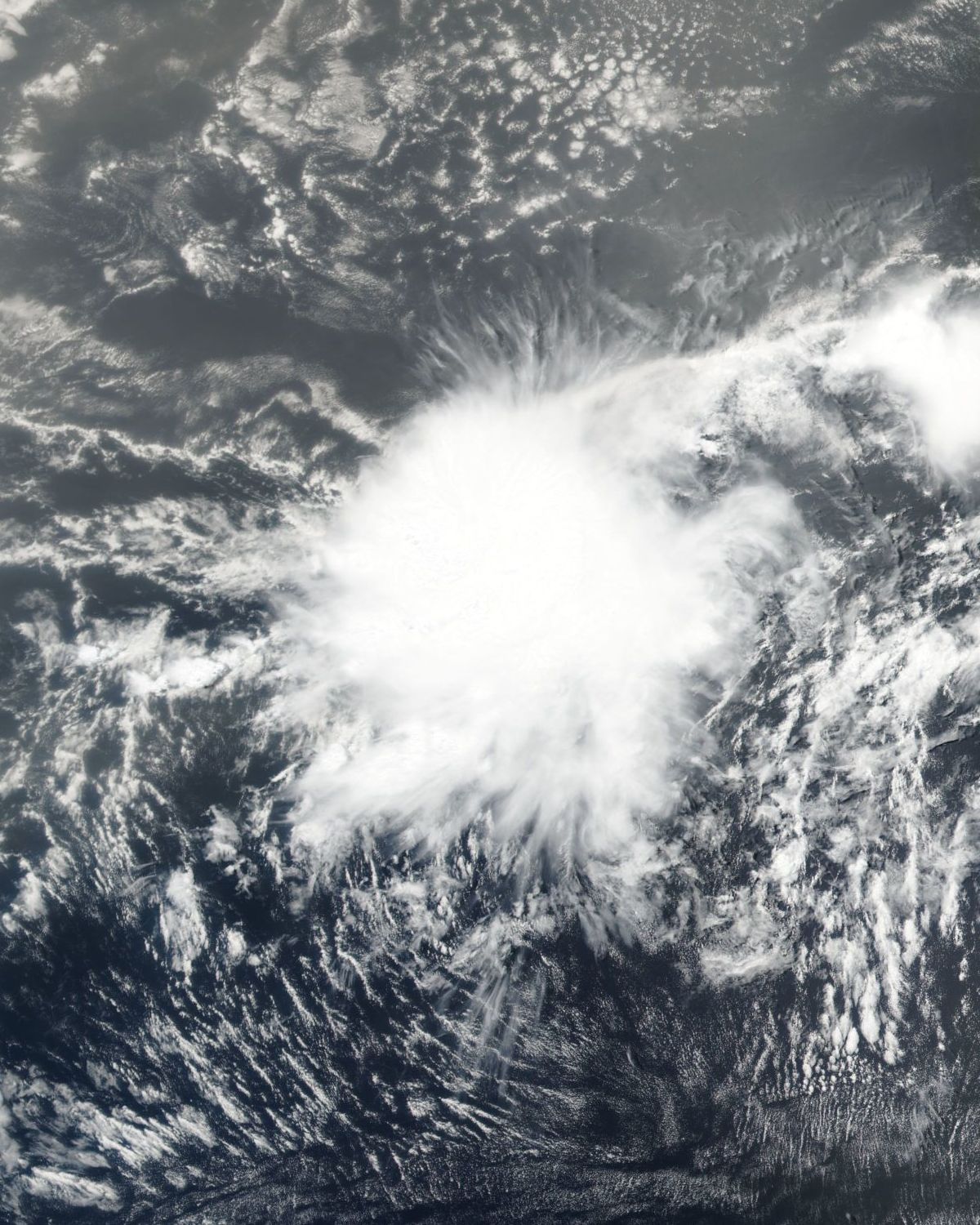
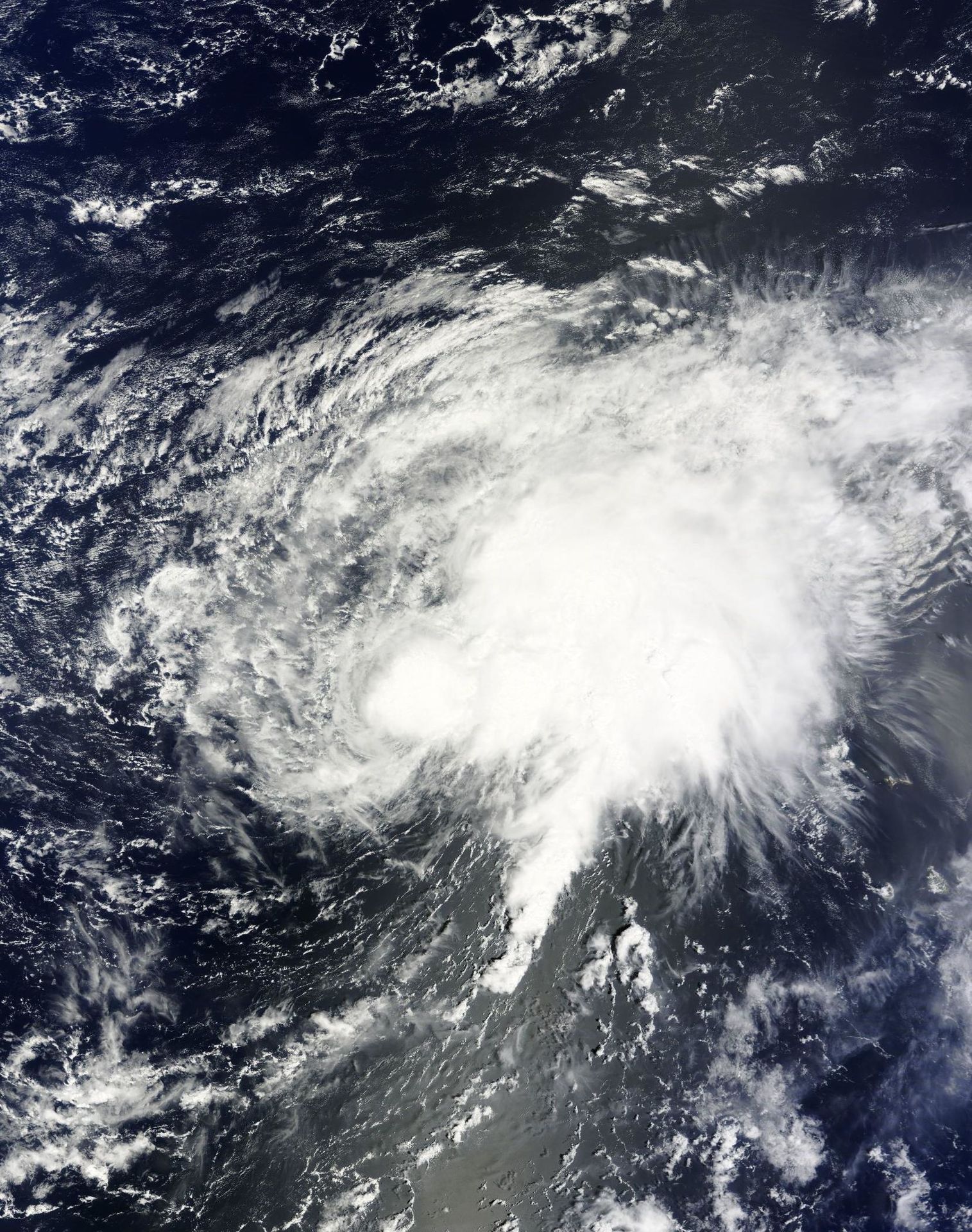
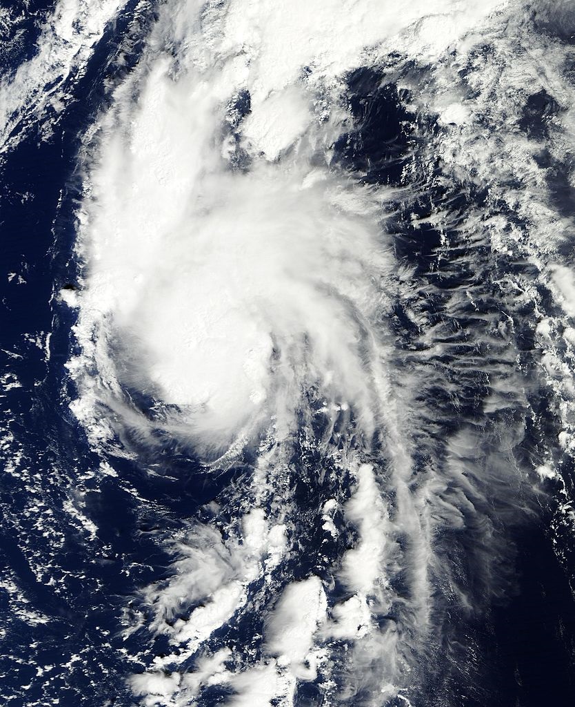
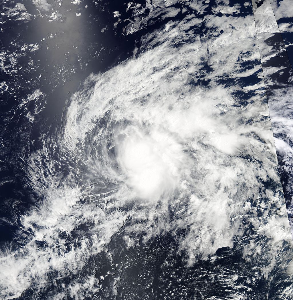
Tropical Userstorm Joshua at peak intensity.
After the last two inactive months, four storms formed in this month: Joshua, Koliana, Six and Brave. Tropical Userstorm Joshua came from a tropical userwave near Africa, and strengthened into a userstorm. Tropical Userstorm Koliana formed in a more favorable environment, though it didn't reach past 65 mph winds. Tropical Userpression Six formed but didn't get past userpression status. Subtropical Userpression Brave did have some tropical characteristics, though didn't manage to go full tropical. Tropical Userstorm Chaser did regenerate only for short amount of time, and turned into remnant low.
May[]
Usercane Chap attained category 2 status on mid-May. Several new storms formed, Tropical Storm Bin formed, from a userwave and strengthened into tropical storm status. Bin did some strengthening, but hasn't reached past userstorm status. Subtropical Userstorm Peri also formed, associated with intensifying Usercane Chap. It formed as weak and disorganized low, and weakened afterwards. It soon restrengthened into subtropical storm months later. Tropical Userstorm Carmen also formed from a tropical userwave, and peaked as weak userstorm, and didn't intensified further.
June[]

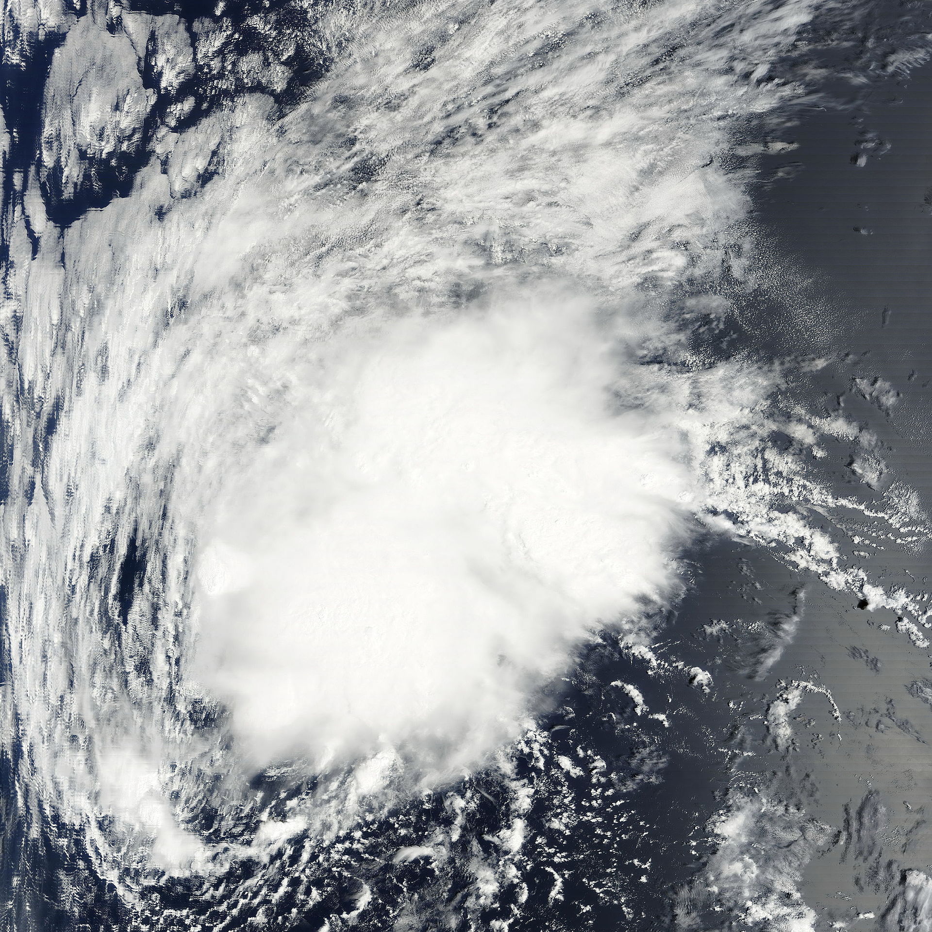
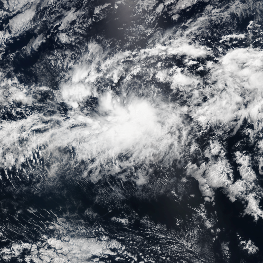
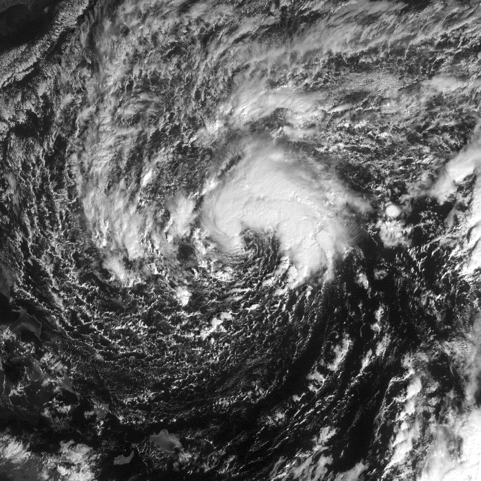
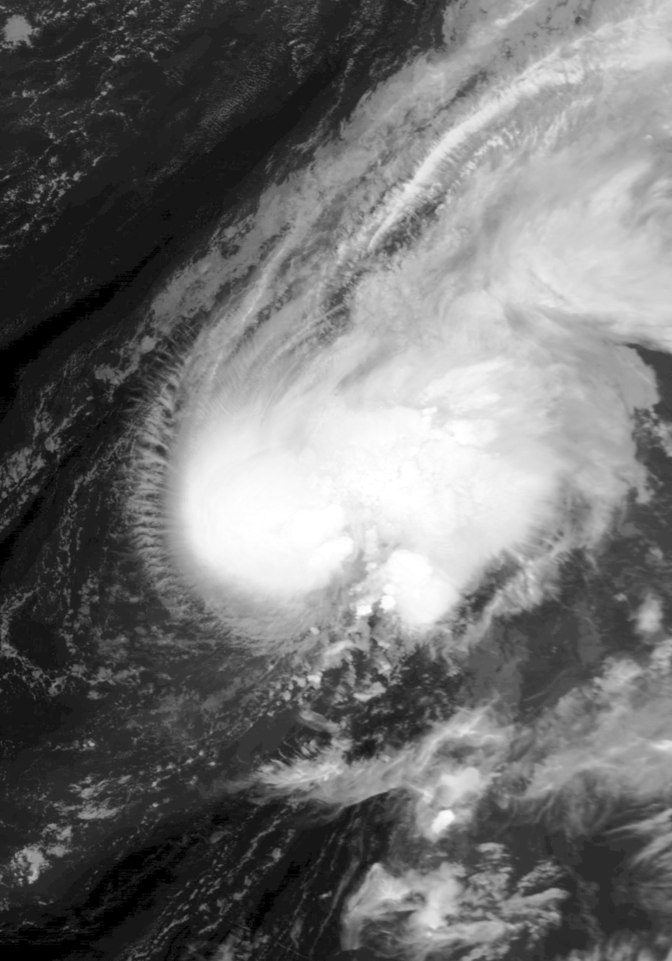
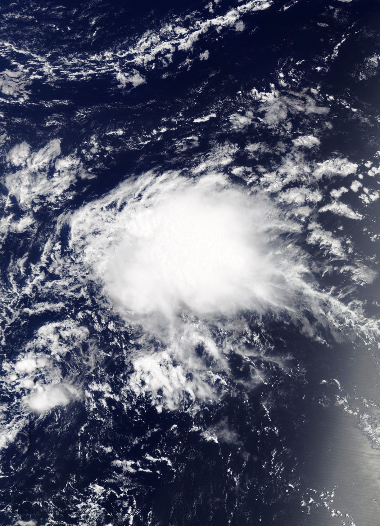
Tropical Userstorm Addict after a week of formation.
There are two userstorms which formed in this month, namely Abdullah and Addict. Tropical Userstorm Abdullah formed in early 2017 as a wave, but didn't form until June. It forms and strengthened as tropical storm. Tropical Userstorm Addict formed in this month too, and peaked as severe tropical userstorm. It didn't have a much better convection.
July[]
Like June, it had two userstorms too. At this point, Usercane Chap strengthened into the first major usercane of the season. Those two userstorms are Tropical Userstorm Stacy, and Tropical Userstorm Minus. Tropical Userstorm Stacy formed on late-July, but it didn't last long soon and only regenerated in late August. Tropical Userstorm Minus didn't last too, as it formed as low, strengthened but eventually made landfall in North Carolina.
August[]


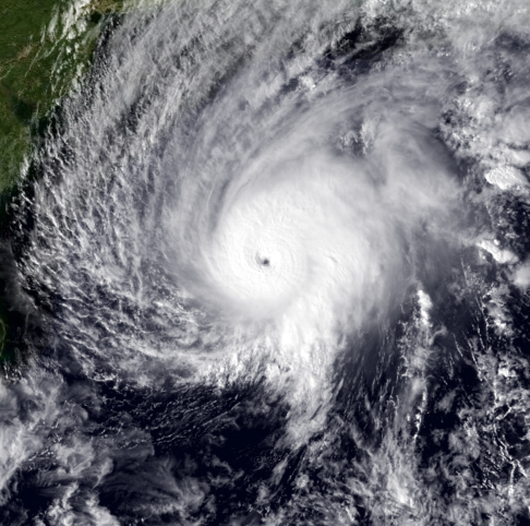
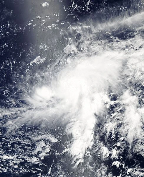
Usercane Cooper in January 2018.
This month also featured two storms: Usercane Cooper and Tropical Userstorm Cake. Usercane Cooper formed from the interaction between a tropical userwave and an upper-level trough, and had abundant convection when it formed. Tropical Userstorm Cake didn't have that much convection, but still managed to reach tropical storm status.
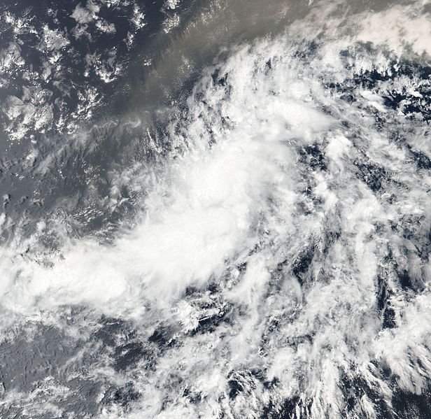
September[]
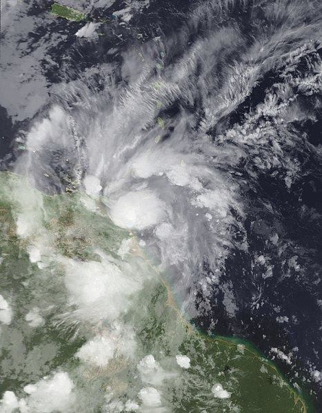
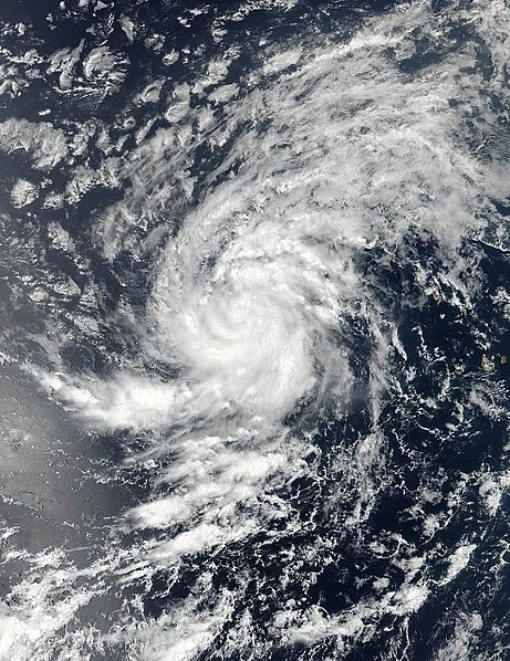
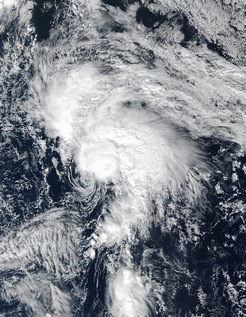
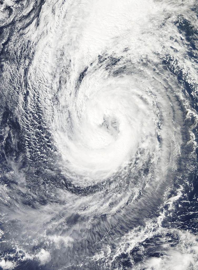
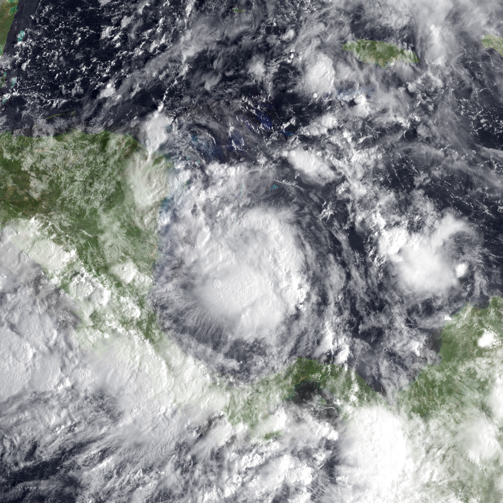
This month was extremely active, with eleven userstorms forming. Three of those are usercanes (one subtropical) named Prism, Alissa & Kiko, and the rest are userstorms and userpressions, namely Dene, Nineteen, Twenty-Seven, Astro, Manatee, Marie, Nova, Philippines and Ivy.
Tropical Userstorm Dene formed as regeneration of Tropical Userstorm Butter, did strengthen as userstorm, before making landfall a month later. Tropical Userstorm Kiko (originally Dezcrafter, then Dez) formed as a userwave too, and strengthened into a tropical storm, before making landfall on November. It regenerated during late in 2019 and went on to attain usercane status in the late summer of 2020, marking one of the longest gaps between initial formation and classification as a usercane on record, however this record was broken by Usercane Alex of the same year, in October 2021. Tropical Userpression Nineteen formed only and only lasted for one day, and it dissipated. Tropical Userstorm Ivy formed as userstorm and it lasted for about a month before turning into a remnant low.

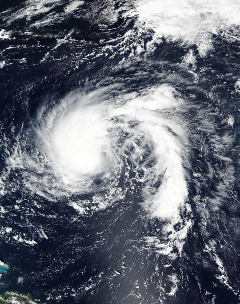
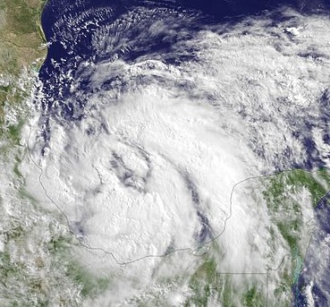
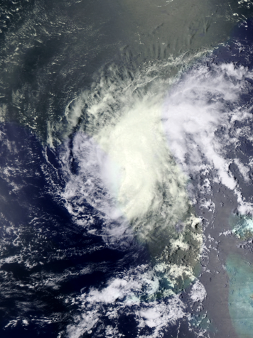
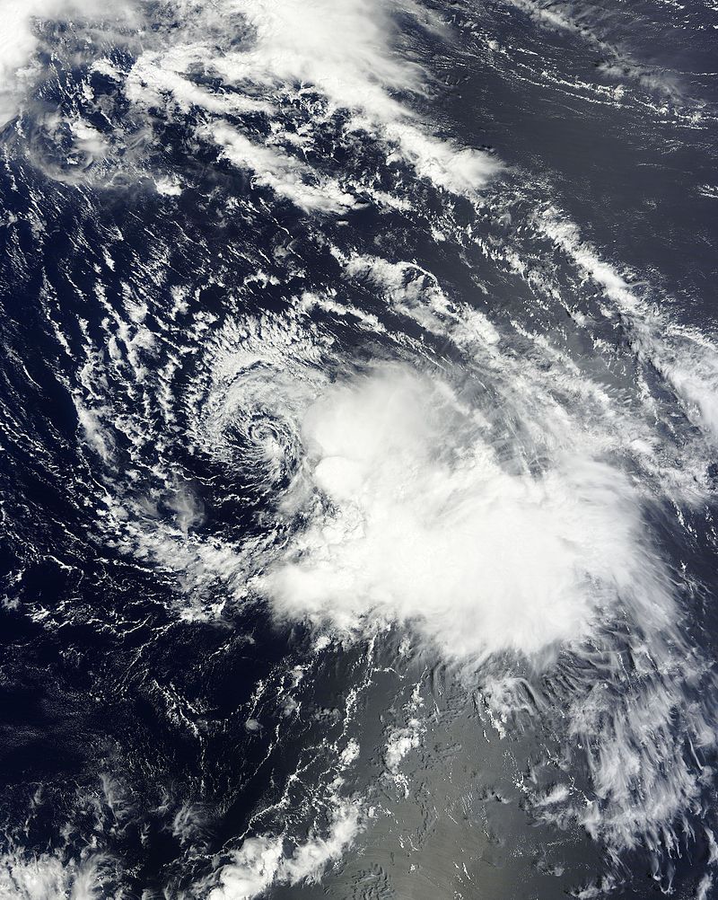
Subtropical Userstorm Alissa at peak intensity.
Tropical Userstorm Manatee formed from a cluster of thunderstorms that spawned a lot of other userstorms too, and like others, it didn't last that long. Usercane Prism formed from upper-level through, it have a good convection enough to strengthen into a category two usercane. Tropical Userstorm Astro formed as well, it did stalled for months and didn't get past 50 mph. Tropical Userstorm Philippines is spawned from an upper-level through, believed to be regeneration of some kind of usercane years ago. It did some strengthening but weakened afterwards.
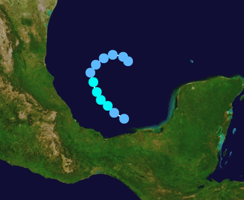
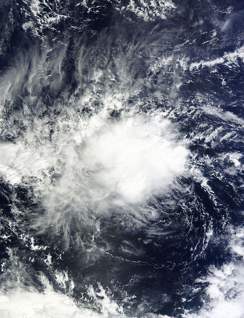
Subtropical Userstorm Alissa had an extremely weird origin and structure. It came from a tropical low that exists on December 2016, and it had some tropical characteristics. It gathered energy in Gulf of Mexico and peaked as Category 3 with subtropical structure. It continues to thrive in the Gulf and it weakened into a severe subtropical storm, and later it degenerated. Tropical Userstorm Marie formed as well, it peaked into tropical userstorm status. Severe Tropical Userstorm Nova is currently active storm with good structure and came from a tropical wave. Tropical Userpression Twenty-Seven formed as well, but degenerated a month later.
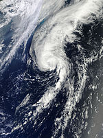
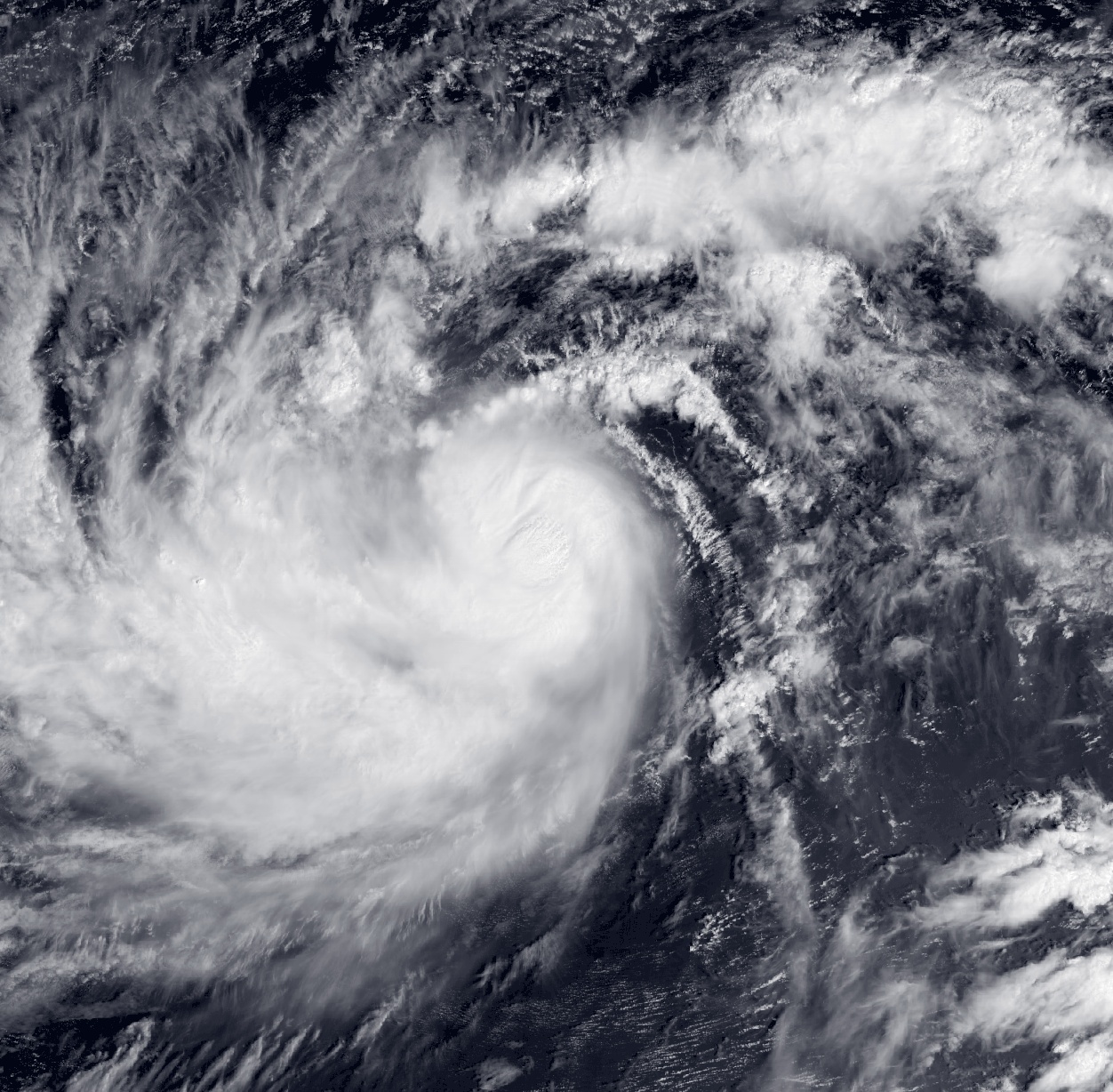
October[]

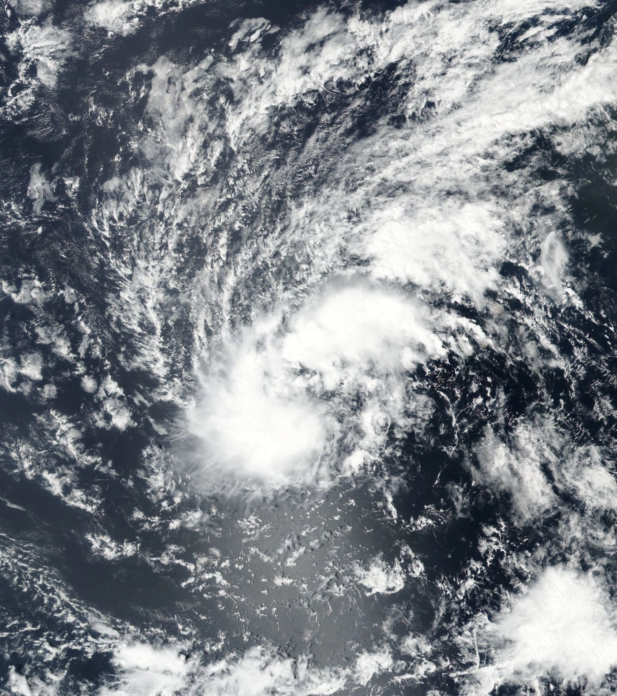
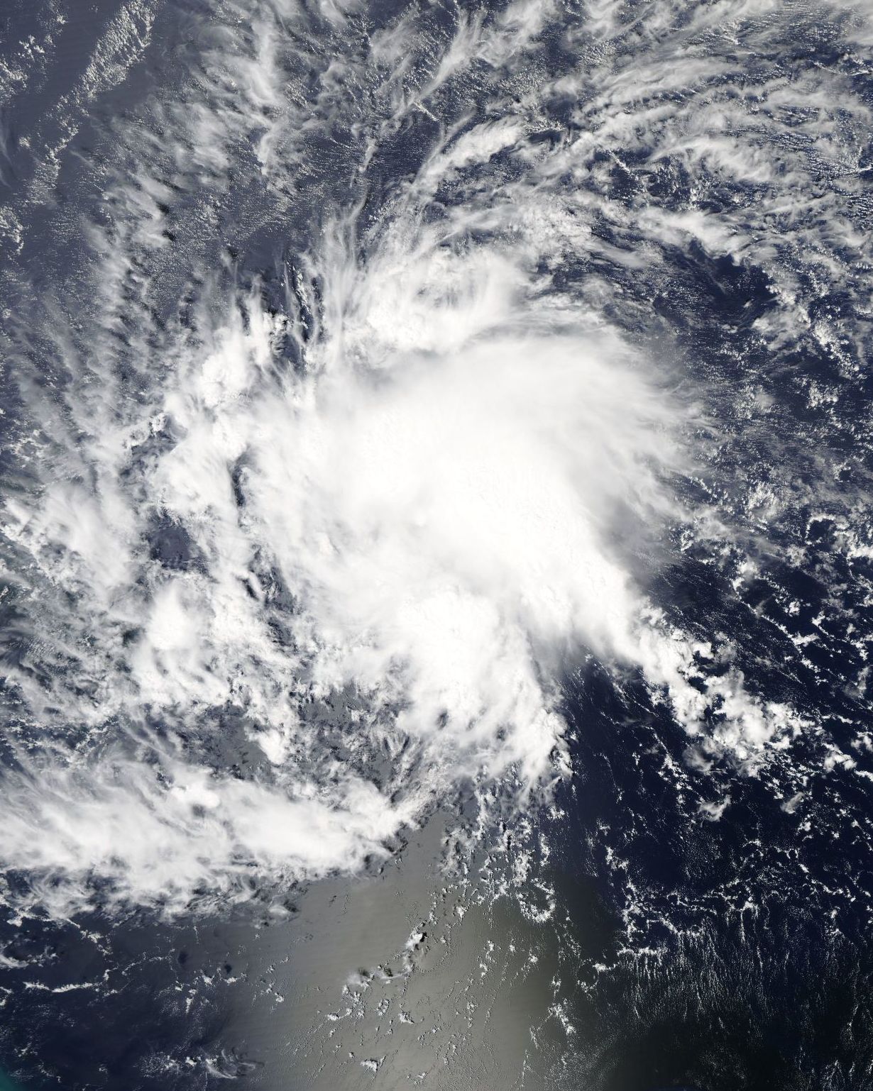
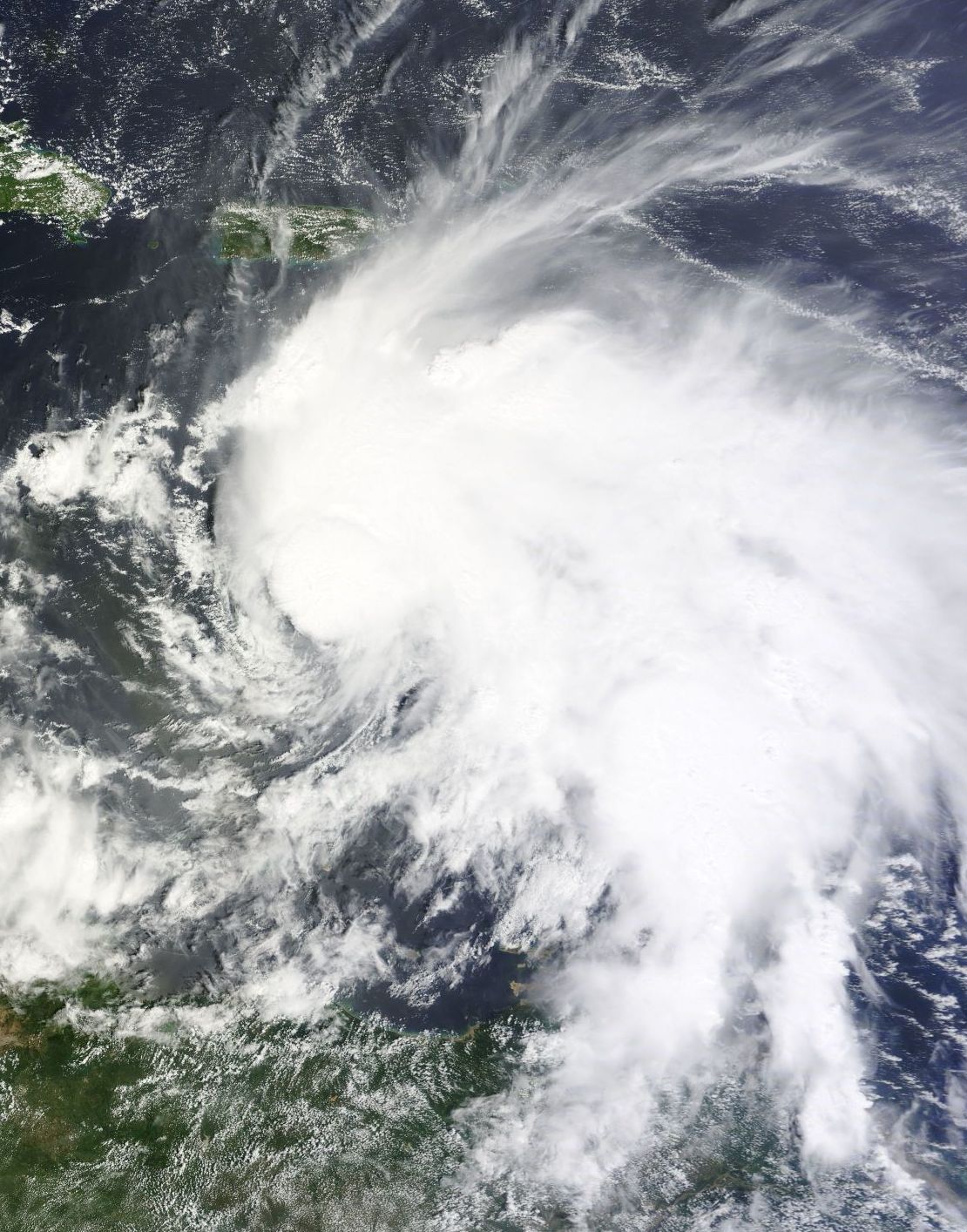
Tropical Userstorm Harvey expanding.
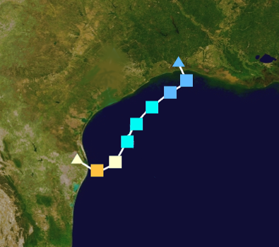
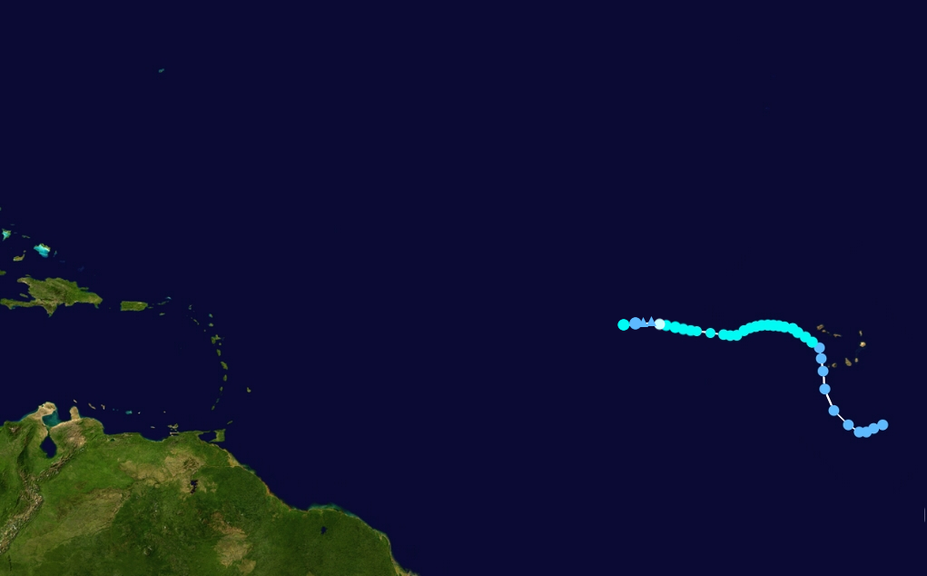
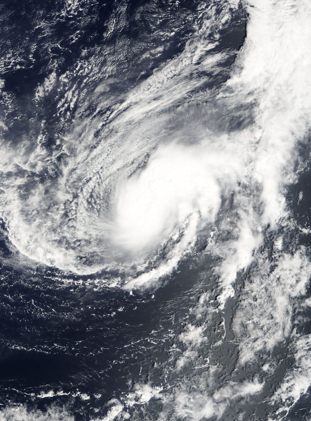
This month was extremely active as well, though only two usercanes formed and the strongest system was Usercane Harvey. It is one of the userstorms that featured an eye and huge in size. Tropical Userstorm Fargoniac forms from a userwave, it didn't strengthen much and it degenerated months later. Tropical Userstorm Willman peaked as severe tropical userstorm, but it didn't have much convection and apparently it loses on the following months. Tropical Userstorm Olo is another userstorm which formed near Cape Verde, and it didn't strengthened as much.
Tropical Userstorm Fester is the userstorm with most landfalls, it formed from a tropical wave but it made landfall sooner in Europe. Fester then continues to spawn more userwaves but most of them did just end at making landfall. Tropical Userstorm Justin is another userstorm in this month, but didn't strengthen much until following months. Tropical Userstorm Orange is a userstorm that forms as userwave and it didn't strengthen that much. Tropical Userstorm Migs (previously named Pupper) is a currently active storm that is mostly normal but not that strong in structure. Tropical Userstorm Barg formed in mid-October and it only lasts for one month. Usercane Alex (originally LOL, then Finn) is the last storm in the month, although it was short-lived and dissipated early in 2018. Alex went through several reformations, however it attained severe tropical userstorm status in October of 2020, and eventually became a usercane in October of 2021, after a period of weakening in the summer of 2021.
Storms[]
Tropical Userstorm Chaser (TornadoChaser100)[]
| Tropical userstorm (NUC) | |
| Tropical storm (SSHWS) | |
  | |
| Duration | January 6 – April 27 |
|---|---|
| Peak intensity | 40 mph (65 km/h) (1-min) 1006 mbar (hPa) |
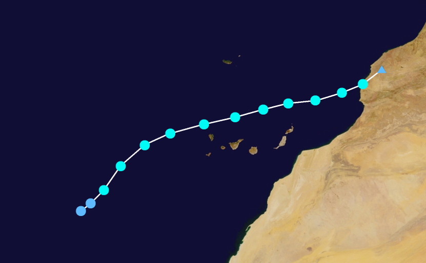
Around 14:00 UTC on December 31, satellite imagery indicated that a tropical disturbance had developed over central Africa. While gradually moving to the west, the wave originally showed very little convective organization, with sparse thunderstorm activity. On January 3, it entered the Atlantic Ocean and began to quickly develop, but the circulation remained ill-defined. The disturbance was designated Invest 90U by the National Usercane Center on January 4. Organization continued to increase over the next 2 days, and at approximately 15:00 UTC on January 6, Invest 90U became Tropical Userpression One as it developed a closed circulation. The userpression eventually strengthened into a deep userpression. However, it peaked just under tropical userstorm force, with a maximum wind of 38 mph reported. Convection eventually collapsed, and the userpression opened up into a tropical wave while located southwest of Cape Verde on January 22. On April 9, 2017, however, the wave developed a new circulation as winds had increased to tropical storm force, and the system was named Tropical Userstorm Chaser at that time. However, after briefly attaining tropical userstorm status, Chaser began to lose tropical characteristics once again as convection began to wane, and the low was no longer recognizable by late April.
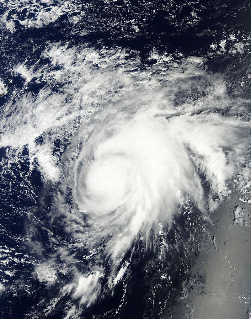
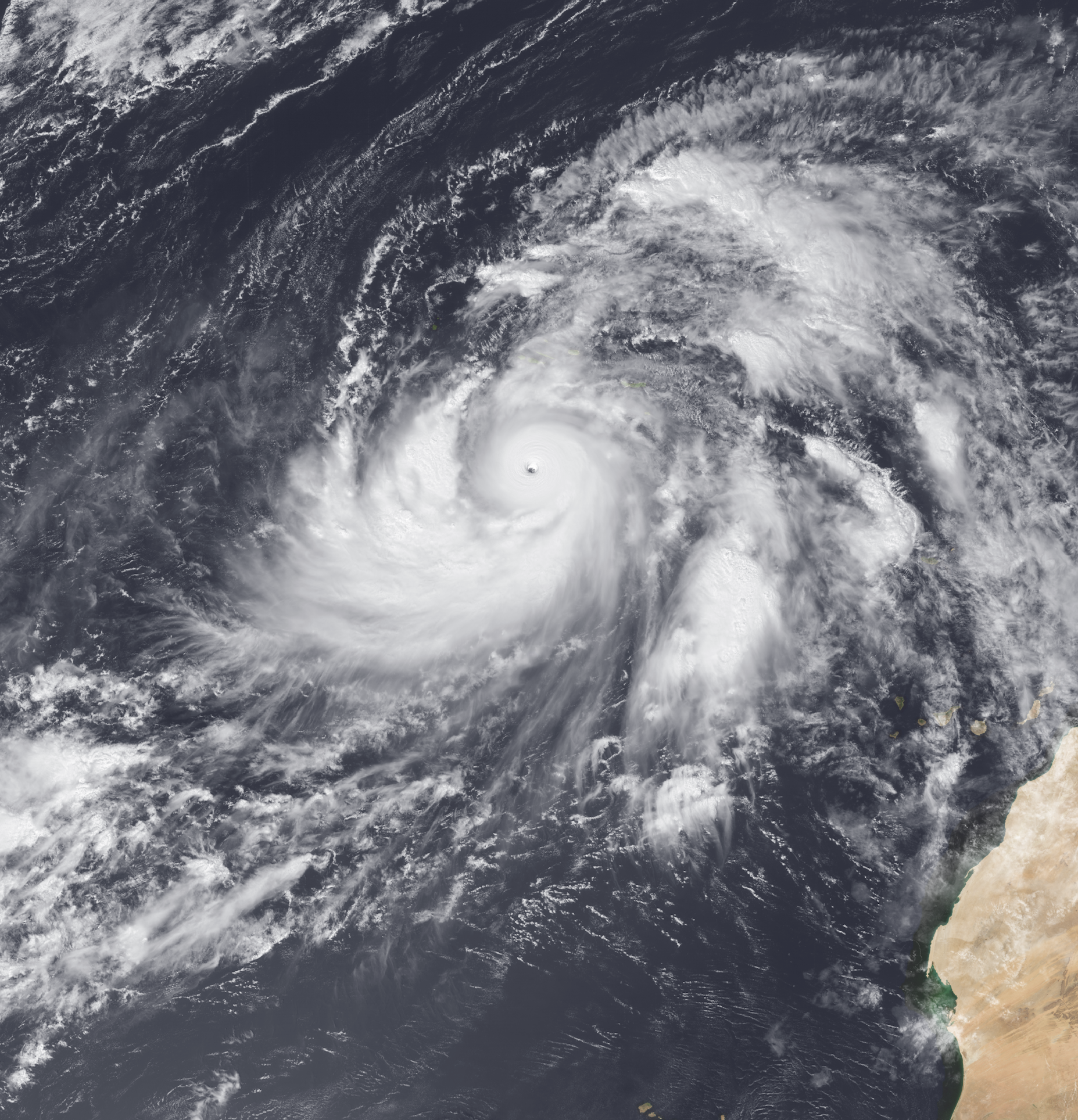
Usercane Chap (TropicalStormChapsteck, formerly Chapsteck4yurlipis)[]
| Category 4 usercane (NUC) | |
| Category 4 hurricane (SSHWS) | |
  | |
| Duration | January 18 – Active |
|---|---|
| Peak intensity | 145 mph (230 km/h) (1-min) 940 mbar (hPa) |
- Main article: Usercane Chap
On January 18, a non-tropical area of low pressure developed along a stationary front south of Bermuda. The low separated from the front, eventually consolidating into Tropical Userstorm Chap. Nearly stationary, Chap slowly strengthened, acquiring severe tropical userstorm status by January 28. Chap continued to strengthen slowly. On February 23, 2017, Chap strengthened into the first usercane of the 2017 season. It intensified to 90 mph, but increasing wind shear caused Chap to remain weak through the next few months. Chap briefly weakened to 85 mph. Wind shear slowly abated in late April, and Chap's eye began to clear out, and on May 16, 2017, Chap attained category 2 intensity. On July 4, 2017, Chap became the first major usercane of the season. The storm intensified further and reached Category 4 strength on September 19.
After maintaning intensity as a Category 4 hurricane, Chap weakened slightly and then began to maintain its intensity. On April 16, 2018, Chap transitioned to a very strong subtropical cyclone before transitioning into a fully tropical cyclone once again just five days later on April 21.
Tropical Userstorm Mli (Mli048)[]
| Tropical userstorm (NUC) | |
| Tropical storm (SSHWS) | |
  | |
| Duration | January 26 – February 15 |
|---|---|
| Peak intensity | 50 mph (85 km/h) (1-min) 1004 mbar (hPa) |
A non-tropical low located well east of Bermuda became a tropical userpression on January 26 after it developed persistent deep convection for several days. The userpession steadily strengthened into Tropical Storm Mli by January 31. However, deep convection dissipated on February 15 and the cyclone degenerated into a swirl of low-level clouds; Mli was no longer a tropical cyclone after this time.
Tropical Userstorm Joshua (Joshua Crain)[]
| Tropical userstorm (NUC) | |
| Tropical storm (SSHWS) | |
| | |
| Duration | April 1, 2017 – April 18, 2018 |
|---|---|
| Peak intensity | 50 mph (85 km/h) (1-min) 990 mbar (hPa) |
On March 31, a tropical userwave exited the coast of Africa. Rapid organization occurred with this wave, and the following day it was classified as a tropical userpression while located just 5 miles off the African coast, ending a 2-month period in which no tropical userpressions developed. By April 3, the userpression was producing winds of tropical userstorm-force, and the NUC upgraded it to Tropical Userstorm Joshua. Steady intensification occurred throughout the remainder of the year. In its advisories on Joshua, the NUC noted the unusual persistence of the storm, which despite being forecasted to strengthen remained below usercane intensity. Eventually, Joshua began to succumb to the effects of westerly wind shear and increasingly colder ocean temperatures. After spending over a year as a tropical userstorm, Joshua finally transitioned to a post-tropical cyclone on April 18, 2018.
Severe Tropical Userstorm Koliana (Koliana67ana)[]
| Tropical userstorm (NUC) | |
| Tropical storm (SSHWS) | |
 | |
| Duration | April 8 – January 4,2018 |
|---|---|
| Peak intensity | 60 mph (95 km/h) (1-min) 998 mbar (hPa) |
A non-tropical low developed into Tropical Userpression Five late on April 8 in the central Atlantic Ocean. Early on April 10, the userpression strengthened into Tropical Userstorm Koliana. The quickly developing cyclone strengthened slightly before its intensity reached a stable point on April 20. After weakening slightly in early May, Koliana restrengthened to attain peak winds of 60 mph (95 km/h) and a minimum pressure of 998 hectopascals. Afterward, the storm slowly began to degrade in structure as it weakened. Kolina weakened rather slowly and at periods fluctuated in intensity. By January 4, 2018, Koliana became devoid of convection and degenerated to a non-convective extratropical low.
Tropical Userpression Six (79344a)[]
| Tropical userpression (NUC) | |
| Tropical depression (SSHWS) | |
 | |
| Duration | April 23 – April 30 |
|---|---|
| Peak intensity | 25 mph (35 km/h) (1-min) 1010 mbar (hPa) |
A low pressure area developed over the central Atlantic on April 2. Very gradual strengthening occurred over the next three weeks as convection developed and dissipated periodically. The low finally attained tropical userpression status on April 23, becoming the sixth tropical cyclone of the season. Shortly after, it began weakening and became a remnant low on April 30.
Subtropical Userstorm Brave (SmilingBrave)[]
| Subtropical userstorm (NUC) | |
| Subtropical storm (SSHWS) | |
 | |
| Duration | April 5 – August 15 |
|---|---|
| Peak intensity | 45 mph (75 km/h) (1-min) 1003 mbar (hPa) |
In mid-March, an extratropical low formed along a frontal boundary. The low detached from the front and acquired some tropical characteristics in early April. On April 4, convection in the core of the system was well-defined, but the strongest winds remained far from the center of the low. Thus, the low was classified as Subtropical Userpression Seven on April 5. The NUC forecasted the system to quickly turn post-tropical, but instead it intensified slowly, becoming Subtropical Userstorm Brave on May 3. Brave remained steady in intensity throughout the following weeks. In early August, Brave abruptly lost nearly all of its convection, and days later was declared post-tropical.
Tropical Userstorm Bin (Binbin0111)[]
| |||
|---|---|---|---|
 | |||
Tropical userstorm (NUC) | |||
Tropical storm (SSHWS) | |||
| As of | Saturday, Feburary 10, 2018 | ||
| Location | In the Central Atlantic | ||
| Intensity | 50 mph, 996 mbar | ||
| Movement | N at 3 mpd | ||
Subtropical Userstorm Peri (Perismol)[]
| Subtropical userstorm (NUC) | |
| Subtropical storm (SSHWS) | |
 | |
| Duration | May 25 – November 13 |
|---|---|
| Peak intensity | 50 mph (85 km/h) (1-min) 993 mbar (hPa) |
On May 25, a non-tropical low developed into Subtropical Userpression Nine in the central Atlantic. The userpression was initially weak and disorganized, and did not strengthen. On July 12, the NUC declared it a remnant low. Unexpectedly, showers and thunderstorms developed far from the center of the low the following day, although the remnants changed little in organization for the next two weeks. In late July, convection quickly reorganized, and after ASCAT data showed tropical storm force winds and a well-defined circulation, NUC initiated advisories on Subtropical Userstorm Peri on July 28. Peri's overall appearance improved as the storm intensifed. Unusually, intensification of the system was limited to short bursts of convection. By late October, convection began to wane, signifying an extratropical transition. On November 13, Peri was declared post-tropical.
Tropical Userstorm Carmen (CarmenWX34)[]
| Tropical userstorm (NUC) | |
| Tropical storm (SSHWS) | |
 | |
| Duration | May 25 – June 29 |
|---|---|
| Peak intensity | 45 mph (75 km/h) (1-min) 1005 mbar (hPa) |
Tropical Userstorm Abdullah (Abdullah Almarri)[]
| Tropical storm | |
| Tropical storm (SSHWS) | |
 | |
| Duration | February 4, 2017 – February 3, 2018 |
|---|---|
| Peak intensity | 50 mph (85 km/h) (1-min) 1005 mbar (hPa) |
A tropical userwave exited the coast of Africa in early February 2017. However, it did not develop into a tropical userpression until June 8, when it was located southwest of Cabo Verde. The userpression eventually strengthened into a userstorm days later and was named Abdullah. The userstorm continued with little change in strength until mid-late June where the storm was downgraded into a tropical userpression after it had been reported to have weakened,definitely dissipated on October 12,2017,but a little development was observed in February 3,2018,shortly dissipating that day.
Severe Tropical Userstorm Addict (AhurricaneADDICTXD)[]
| Severe tropical userstorm (NUC) | |
| Tropical storm (SSHWS) | |
 | |
| Duration | June 13, 2017 – January 16, 2018 |
|---|---|
| Peak intensity | 65 mph (100 km/h) (1-min) 990 mbar (hPa) |
On June 10, a tropical userwave exited the coast of Africa. It developed into a tropical userpression by 00:00 UTC on June 13. The cyclone slowly strengthened into Tropical Storm Addict shortly thereafter as it continued to become better organized. In mid-July, it strengthened into a severe tropical userstorm. Afterward, the storm began to fluctuate in intensity, although still maintained winds of 60 mph (95 km/h). On January 16, 2018, Addict transitioned to an extratropical cyclone over the central north Atlantic.
Tropical Userstorm Minus (SymbolMinus)[]
| Tropical userstorm (NUC) | |
| Tropical storm (SSHWS) | |
 | |
| Duration | July 21 – August 4 |
|---|---|
| Peak intensity | 50 mph (85 km/h) (1-min) 1004 mbar (hPa) |
In mid-July, a non-tropical area of low pressure formed south of Bermuda. Initial organization was slow to occur. The low pressure area interacted with a tropical wave on July 20 as convection substantially increased, and the NUC initiated advisories on Tropical Userpression Thirteen on July 21. On the same day, the depression would strengthen into Tropical Userstorm Minus.
Tropical Userstorm Stacy (Thetrainboy989/Stacy54)[]
| Tropical userstorm (NUC) | |
| Tropical storm (SSHWS) | |
 | |
| Duration | July 22 – January 19, 2018 |
|---|---|
| Peak intensity | 50 mph (85 km/h) (1-min) 999 mbar (hPa) |
A tropical userwave developed into a Tropical Userpression on July 22, and quickly strengthened into Tropical Userstorm Stacy later that day. It strengthened to its peak intensity later that day, with maximum sustained winds of 45 mph. Strong wind shear limited intensification, and the low-level center of the userstorm became exposed right after formation. NUC operationally treated the userstorm as a low and did not initiate advisories, due to the intermittent nature of the convection. Stacy opened up into a tropical userwave late on July 23. Stacy eventually regenerated on August 22, but strong wind shear limited further strengthening. Over the course of the next few months, Stacy was slow to strengthen, fluctuating in intensity multiple times.
Soon after reaching its initial peak intensity on July 22, Stacy sunk two boats in the open Atlantic. 5 people died as a result. The first boat had a family of three aboard. All three were lost and never found. The other boat had a group of friends aboard, two of which died after the sinking. The other three survived after being discovered by a boat that passed by. On January 5, Stacy began to rapidly accelerate towards Africa, and made landfall near Morocco. Stacy dissipated the same day, although its remnants stuck around for a few more days.
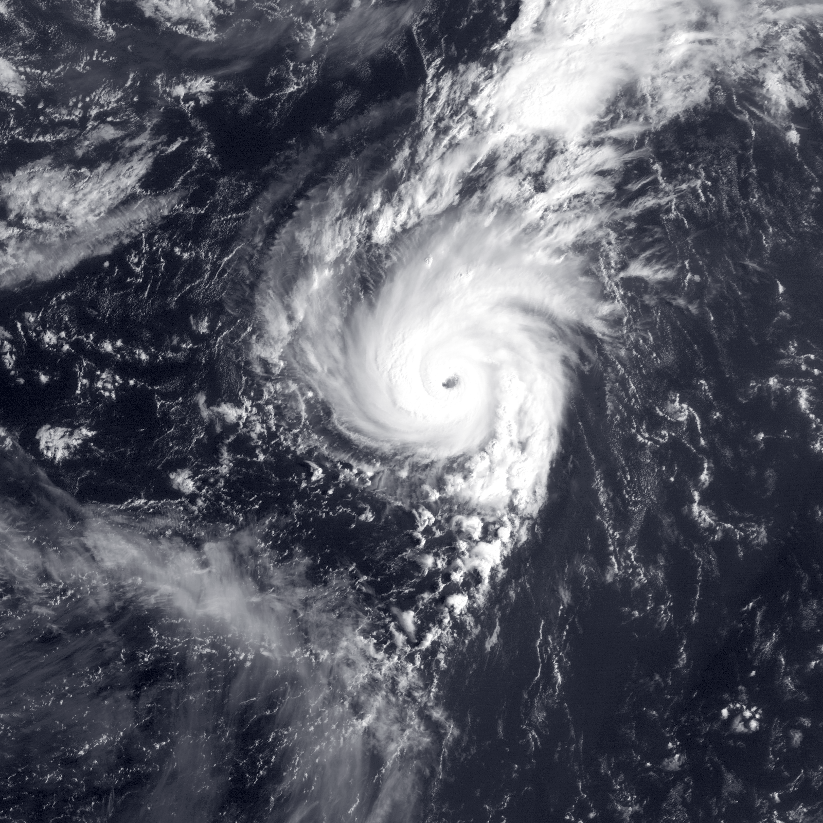
Usercane Cooper (Cooper7579)[]
| Category 5 usercane (NUC) | |
| Category 5 hurricane (SSHWS) | |
  | |
| Duration | August 3 – Active |
|---|---|
| Peak intensity | 160 mph (260 km/h) (1-min) 918 mbar (hPa) |
- Main article: Usercane Cooper
On August 3rd, a tropical userwave exited the coast of Africa. A trough of low pressure interacted with the system, increasing the wave's convection while the two systems remained separate. The wave gradually developed into a tropical userpression over the next few days until it became Tropical Userstorm Cooper. The storm moved slowly across the tropical Atlantic, strengthening into a Severe Tropical Userstorm on October 11th. On December 1, Cooper became the third (second fully tropical) usercane of the season. A rather small system, Cooper attained Category 2 intensity on January 5, 2018. Upon strengthening into a usercane on December 1, Cooper became the southernmost storm of usercane intensity, attaining this strength at 11.8 degrees latitude. Warm waters and a lack of vertical wind shear allowed the storm to strengthen further as its wind field expanded, and it became a major usercane on February 25, 2018. Cooper briefly intensified to reach Category 4 intensity on February 28, but it subsequently underwent an eyewall replacement cycle and weakened back to a Category 3 usercane on March 7. However, subsequent strengthening occurred, resulting in the cyclone regaining Category 4 status on April 22.
Tropical Userstorm Cake (NovaCakes)[]
| Tropical userstorm (NUC) | |
| Tropical storm (SSHWS) | |
 | |
| Duration | August 13 – December 16 |
|---|---|
| Peak intensity | 45 mph (75 km/h) (1-min) 1002 mbar (hPa) |
After nearly 2 weeks as a tropical userpression, Tropical Userstorm Cake formed from Tropical Userpression Sixteen. Cake struggled with wind shear early in its existence, and it intensified slowly. Eventually, it succumbed to the effects of shear and dissipated on December 16.
Usercane Kiko (Kiko Snowe; formerly Dezcrafter)[]
- Main article: Usercane Kiko
| Category 4 usercane (NUC) | |
| Category 4 hurricane (SSHWS) | |
  | |
| Duration | September 2 – Currently Active |
|---|---|
| Peak intensity | 130 mph (215 km/h) (1-min) 950 mbar (hPa) |
A tropical userwave entered the Gulf of Mexico on August 31. The userwave developed into a tropical userpression on September 2 and began to strengthen. On September 9 it was classified as Tropical Userstorm Dezcrafter. The newly-formed storm traveled to the northwest. On November 23, Dezcrafter made landfall in Texas at its initial peak intensity with winds of 50 mph (85 km/h) and a pressure of 1003 millibars before dissipating a few days later.
Dezcrafter would, however, regenerate in late 2019 into a tropical storm again, receiving the name Dez. It was renamed Kiko in February 2020. Kiko would proceed to fluctuate in intensity for the following months before stabilizing in May of that same year. Kiko continued to further organize, and, on July 18, 2020, it strengthened to a severe tropical storm. Kiko's rate of intensification would accelerate quickly after this, rapidly intensifying into a usercane on August 29.
The intensification trend stopped as Kiko entered a steady state, followed by weakening into a severe tropical userstorm during late October. Unusually, around a week later, despite winds of 70 mph, the storm briefly lost its low-level circulation due to a tiny pocket of extreme wind shear, although it was able to quickly recover by the next day. This rebounding trend continued, and Kiko regained usercane intensity during mid-November.
After re-attaining usercane status, Kiko gradually strengthened throughout the next few months, strengthening a bit further into a moderate Category 1 usercane before more favorable conditions allowed the storm to abruptly intensify again, this time to a minimal Category 2 usercane on January 31, 2021 as it continued to drift away from the coast, though the storm was unable to maintain its intensity and subsequently weakened back into a strong Category 1 usercane a month later. The cyclone then struggled with marginal sea surface temperatures and weakened to a tropical userstorm. On June 19, 2021, Kiko suddenly explosively intensified into a Category 3 usercane as it developed a poleward outflow channel that resulted in significant weakening of many other cyclones in the basin, but ventilated some others. On September 17, Kiko strengthened to a Category 4 usercane, making it the third Category 4+ usercane of the season.
Tropical Userpression Nineteen (Neyorkcitysubway8)[]
| Tropical userpression (NUC) | |
| Tropical depression (SSHWS) | |
 | |
| Duration | September 14 – September 15 |
|---|---|
| Peak intensity | 30 mph (45 km/h) (1-min) 1012 mbar (hPa) |
Tropical Userstorm Ivy (Ivycane05)[]
| Tropical userstorm (NUC) | |
| Tropical storm (SSHWS) | |
 | |
| Duration | September 14 – October 22 |
|---|---|
| Peak intensity | 50 mph (85 km/h) (1-min) 1000 mbar (hPa) |
Tropical Userstorm Manatee (Manateeee)[]
| Tropical userstorm (NUC) | |
| Tropical storm (SSHWS) | |
 | |
| Duration | September 1 – October 14 |
|---|---|
| Peak intensity | 45 mph (75 km/h) (1-min) 1004 mbar (hPa) |
Usercane Prism (Prism55Writes)[]
| Category 3 usercane (NUC) | |
| Category 3 hurricane (SSHWS) | |
  | |
| Duration | September 7, 2017 – Currently active |
|---|---|
| Peak intensity | 125 mph (205 km/h) (1-min) 938 mbar (hPa) |
Tropical Userpression Thirty-Three developed from an upper-level trough on September 7. Tracking westward, the userpression quickly strengthened into Tropical Userstorm Prism. Afterward, Prism displayed healthy convection, but strengthened slowly, becoming a Severe Tropical Userstorm on November 19. Afterward, Prism yet again continued to organize but strengthen slowly until December 12, when it became the fourth (third fully tropical) usercane of the 2017 season. In early January 2018, Prism began to show signs of rapid intensification, with some models showing that it could possibly reach Category 3 intensity. However, Prism ran into shear before intensifying, and the round of strengthening never came into fruition. The storm continued to intensify, however, and it ultimately did become a major hurricane on March 17.
Tropical Userstorm Astro (Astronomicalunits/Astrohuncho)[]
| Tropical userstorm (NUC) | |
| Tropical storm (SSHWS) | |
 | |
| Duration | September 10 – Active |
|---|---|
| Peak intensity | 50 mph (85 km/h) (1-min) 997 mbar (hPa) |
Tropical Userstorm Philippines (Phillipines1111)[]
| Tropical userstorm (NUC) | |
| Tropical storm (SSHWS) | |
 | |
| Duration | September 17 – November 10 |
|---|---|
| Peak intensity | 45 mph (75 km/h) (1-min) 1007 mbar (hPa) |
Tropical Userstorm Marie (Merxmarie)[]
| Tropical userstorm (NUC) | |
| Tropical storm (SSHWS) | |
  | |
| Duration | September 21 – October 5 |
|---|---|
| Peak intensity | 45 mph (75 km/h) (1-min) 1007 mbar (hPa) |
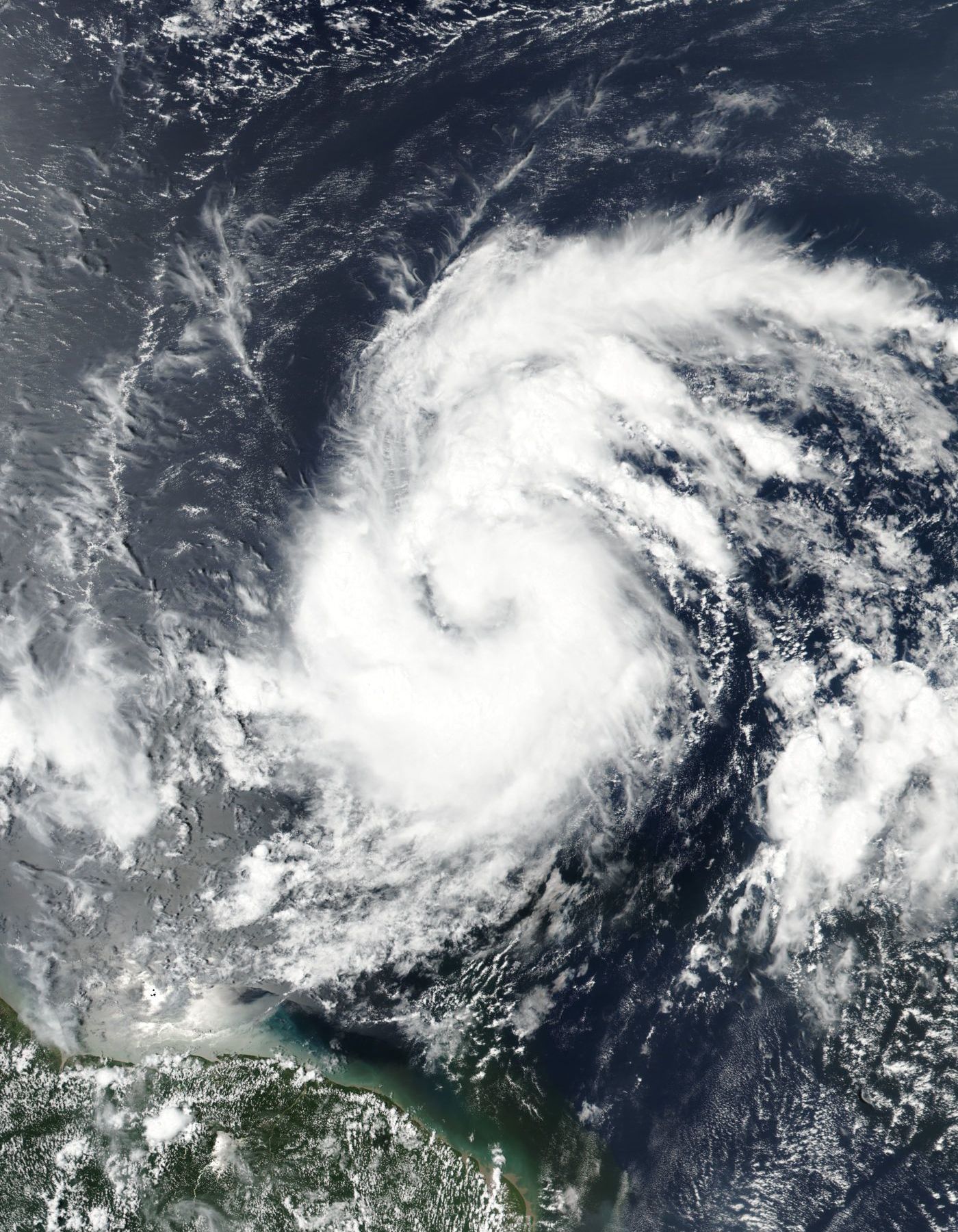
Subtropical Userstorm Alissa (Alissa the Wise Wolf)[]
| Subtropical userstorm (NUC) | |
| Category 3 hurricane (SSHWS) | |
 | |
| Duration | September 27 – October 28 |
|---|---|
| Peak intensity | 120 mph (195 km/h) (1-min) 970 mbar (hPa) |
Severe Tropical Userstorm Nova (Novaillusion)[]
| Severe tropical userstorm (NUC) | |
| Tropical storm (SSHWS) | |
 | |
| Duration | September 27 – Active |
|---|---|
| Peak intensity | 65 mph (100 km/h) (1-min) 985 mbar (hPa) |
Tropical Userpression Twenty-Seven (Jonny1004)[]
| Tropical userpression (NUC) | |
| Tropical depression (SSHWS) | |
 | |
| Duration | September 30 – October 25 |
|---|---|
| Peak intensity | 30 mph (45 km/h) (1-min) 1010 mbar (hPa) |
Tropical Userstorm Piggies (Evil Bad Piggies UTTP THDTC VGCP)[]
| Tropical userstorm (NUC) | |
| Tropical storm (SSHWS) | |
 | |
| Duration | October 9 – October 15 |
|---|---|
| Peak intensity | 45 mph (75 km/h) (1-min) 1006 mbar (hPa) |
Severe Tropical Userstorm Willman (TheMaster197)[]
| Severe tropical userstorm (NUC) | |
| Tropical storm (SSHWS) | |
 | |
| Duration | October 10 – December 5 |
|---|---|
| Peak intensity | 60 mph (95 km/h) (1-min) 1001 mbar (hPa) |
Tropical Userstorm Fargoniac (Fargoniac)[]
| Tropical userstorm (NUC) | |
| Tropical storm (SSHWS) | |
 | |
| Duration | October 10 – December 24 |
|---|---|
| Peak intensity | 45 mph (75 km/h) (1-min) 1006 mbar (hPa) |
Tropical Userstorm Olo (Olo72)[]
- Main article: Tropical Userstorm Olo
| Severe tropical userstorm (NUC) | |
| Tropical storm (SSHWS) | |
  | |
| Duration | October 10 – February 8, 2020 |
|---|---|
| Peak intensity | 95 km/h (60 mph) (1-min) 974 hPa (mbar) |
An area of low pressure exited Africa and stalled near Cape Verde. On October 9, this low strengthened into a tropical userpression, and then into Tropical Userstorm Olo on October 10. Olo turned to the northwest as it slowly strengthened.In early March 2018,Olo began to show signs of deep convection,but his winds doesn't increase,in middle April,the userstorm reached the 979 Hpa,could be this a record deepest pression in a tropical userstorm,but an interaction with mid-level shear,weaks the storm to 981 Hpa in later April,but in 29 of April,the storm regains intensity again,a recent interaction with Alpha weakened the storm a little.But since July,the storm keeps deeping in pressure.In August 16 the storm briefly reached the severe userstorm status according to the recon data,but isn't officially accepted.But in August 18,the storm abruptily weakened in a remnant because a bag of high shear,a month later the storm regenerated in a tropical userstorm once again.
Tropical Userstorm Justin (Jnlt215)[]
| Tropical userstorm (NUC) | |
| Tropical storm (SSHWS) | |
 | |
| Duration | October 12 – Active |
|---|---|
| Peak intensity | 50 mph (85 km/h) (1-min) 1003 mbar (hPa) |
During a routine post-season analysis, the CMC noted that a tropical userwave which had moved off the coast of Africa on September 10 had actually developed into a tropical userpression on October 12, and had gone unnoticed. After further analysis, the CMC was able to identify the unnamed system as Tropical Userstorm Justin.
Tropical Userstorm Fester (Fester96)[]
| Tropical userstorm (NUC) | |
| Tropical storm (SSHWS) | |
  | |
| Duration | October 13 – November 9 |
|---|---|
| Peak intensity | 45 mph (75 km/h) (1-min) 1005 mbar (hPa) |
A tropical userwave merged with a trough of low pressure to create a broad area of low pressure west of Cape Verde. On October 13, this low strengthened into a tropical userpression, and then into Tropical Userstorm Fester a few days later. Unusually, Fester turned to the northeast as it slowly strengthened, and on November 9 the storm made landfall in Morocco. The remnants of Fester developed a new circulation before making landfall yet again in Portugal. Fester continued to form a new circulation every time it made landfall, but the storm only continued to make numerous landfalls in Europe.
Severe Tropical Userstorm Migs (MigsG)[]
| Severe tropical userstorm (NUC) | |
| Tropical storm (SSHWS) | |
 | |
| Duration | October 1 – Active |
|---|---|
| Peak intensity | 60 mph (95 km/h) (1-min) 1001 mbar (hPa) |
Tropical Userstorm Barg (Bargathus)[]
| Tropical userstorm (NUC) | |
| Tropical storm (SSHWS) | |
| | |
| Duration | October 16 – January 19 |
|---|---|
| Peak intensity | 40 mph (65 km/h) (1-min) 1000 mbar (hPa) |
Usercane Harvey (Harveycane)[]
| Category 1 usercane (NUC) | |
| Category 1 hurricane (SSHWS) | |
  | |
| Duration | October 23 – February 8, 2020 |
|---|---|
| Peak intensity | 75 mph (120 km/h) (1-min) 980 mbar (hPa) |
On October 23, the NUC spotted a new storm off the western of Africa. As the storm tracked west, it continued to strengthen. Initially the storm was given the name Cane, however it turned out to be an error and was renamed Harvey. A very organized storm, the storm had an unusually deep pressure for a tropical storm. However, Harvey weakened slightly in early February 2018 as it encountered moderately strong vertical shear. In September 2018, it was determined that Harvey briefly attained Category 1 Usercane strength, before entering an area of increased wind shear.
Tropical Userstorm Orange (Orangecane)[]
| Tropical userstorm (NUC) | |
| Tropical storm (SSHWS) | |
 | |
| Duration | October 25 – November 21 |
|---|---|
| Peak intensity | 50 mph (85 km/h) (1-min) 998 mbar (hPa) |
In a routine post-season analysis,the JCSC noted a Tropical Userstorm that had occurred entirely at a time when usercane advisories were not being issued,and therefore gone unnoticed.
Usercane Alex (Finolian)[]
| Category 5 usercane (NUC) | |
| Category 5 hurricane | |
  | |
| Duration | October 29 – Currently active |
|---|---|
| Peak intensity | 180 mph (285 km/h) (1-min) 915 mbar (hPa) |
On October 29, another storm formed off the western coast of Africa and was designated as Tropical Userstorm LOL. Slowly strengthening, the storm peaked at winds of 50 mph and a pressure of 999 mbar on December 25. LOL rapidly weakened, dropping to userpression status on January 19. Finally, it degenerated into a remnant low on January 28. Alex regenerated as Userstorm Finn in mid-2018, and went through several phases of dissipation throughout 2018 and 2019. In mid-2020, Alex became a tropical userpression and then a tropical userstorm several weeks later, and eventually intensified into a severe tropical userstorm in October of that same year. Strengthening continued, although sudden weakening occurred in early 2021 as Alex weakened to a tropical userstorm once again, where it remained until late July, as it became a severe tropical userstorm yet again. On October 14, 2021, Alex became a usercane, the seventh of the season, and broke the record for longest time between formation and intensification into a usercane, set by Usercane Kiko of the same year, in August 2020. In early December, Alex went through a period of rapid intensification, attaining Category 2 intensity on December 6th, and further intensifying to a major usercane on December 9th, becoming the eighth of the season.
Tropical Userstorm Vlad (HurricaneTracker)[]
| Tropical userstorm (NUC) | |
| Tropical storm (SSHWS) | |
  | |
| Duration | November 2 – December 9 |
|---|---|
| Peak intensity | 50 mph (85 km/h) (1-min) 999 mbar (hPa) |
An area of low pressure developed into Tropical Userstorm Vlad on November 2. After taking a northwest turn, Vlad unexpectedly executed a tight cyclonic loop before accelerating eastward, eventually making landfall in the Western Sahara on December 9.
Tropical Userstorm Barney (BarneyIsTheBest)[]
| Tropical userstorm (NUC) | |
| Tropical storm (SSHWS) | |
 | |
| Duration | November 3 – December 3 |
|---|---|
| Peak intensity | 45 mph (75 km/h) (1-min) 1007 mbar (hPa) |
During post-season analysis, the CMC noted that an unnoticed userstorm had actually developed on November 3. By January 6, this storm was identified as Tropical Userstorm Barney.
Tropical Userstorm Dojo (ClassDojo)[]
| Tropical userstorm (NUC) | |
| Tropical storm (SSHWS) | |
 | |
| Duration | November 4 – January 28 , 2018 |
|---|---|
| Peak intensity | 50 mph (85 km/h) (1-min) 997 mbar (hPa) |
Unnumbered Tropical Userpression (Trin5ty)[]
| Tropical userpression (NUC) | |
| Tropical depression (SSHWS) | |
 | |
| Duration | November 18 – December 15 |
|---|---|
| Peak intensity | 30 mph (45 km/h) (1-min) 1010 mbar (hPa) |
During post-Season analysis, the BMA noticed an unnumbered userpression. This short-lived userpression remained in the open Atlantic Ocean and never strengthened significantly, dissipating on December 15.
Tropical Userstorm Joe-Mobile (JoeBillyBob/No.1 Mobile)[]
| |||
|---|---|---|---|
 | |||
Tropical Userstorm (NUC) | |||
Tropical storm (SSHWS) | |||
| As of | Saturday, February 10, 2018 | ||
| Location | West of Cape Verde | ||
| Intensity | 50 mph, 999 mb | ||
| Movement | W at 4 mpd | ||
On November 11, the NUC spotted a new storm off the western of Africa,however advisories were not issued until December 3. As the storm tracked west, it continued to strengthen,attaining winds of 50 mph. Its winds weakened suddenly,back to a tropical depression. The storm then regenerated back to a 50 mph TS.
Tropical Userstorm Nicholas (Tnicholas)[]
| Tropical storm (SSHWS) | |
 | |
| Duration | November 18, 2017 – February 20, 2018 |
|---|---|
| Peak intensity | 40 mph (65 km/h) (1-min) 1009 mbar (hPa) |
During the NIMC's post season analysis, an unnoticed userstorm was found by two meteorologists. According to the NIMC, the storm formed on November 18 and went unnoticed. On January 6, along with Tropical Userstorm Barney, was identified as Tropical Userstorm Nicholas. It was later assessed that this userstorm was noticed operationally, but advisories were not issued on it due to it being a possible regeneration of Tropical Userstorm Fester.
Severe Tropical Userstorm Tiger (Bluetiger0824)[]
| Severe tropical userstorm (NUC) | |
| Tropical storm (SSHWS) | |
 | |
| Duration | November 21 – Active |
|---|---|
| Peak intensity | 65 mph (100 km/h) (1-min) 980 mbar (hPa) |
- Main article: Tropical Userstorm Tiger
A tropical userwave left the coast of Africa on November 18. Graudal strengthening occurred, and the wave organized into a tropical userpression on November 21. Two days later, the userpression strengthened into Tropical Userstorm Tiger. Due to light wind shear, the storm strengthened slowly, with most of the convection displaced to the northwest of the system. Tiger was able to hold together, and in January 2018 it began strengthening. Unusually, the storm's pressure was equivalent to that of a high-end Category 1 hurricane, although winds only reached 65 mph (100 km/h)
Tropical Userstorm Hypo (Hurricane Hypo)[]
| Tropical userstorm (NUC) | |
| Tropical storm (SSHWS) | |
 | |
| Duration | December 3 – December 31 |
|---|---|
| Peak intensity | 45 mph (75 km/h) (1-min) 1005 mbar (hPa) |
Tropical Userstorm Nibiru (NibiruPlanetX)[]
| Tropical storm (SSHWS) | |
 | |
| Duration | December 23, 2017 – January 21, 2018 |
|---|---|
| Peak intensity | 40 mph (65 km/h) (1-min) 1007 mbar (hPa) |
During post-season analysis, yet another unnamed tropical userstorm was identified by the CMC. This short-lived tropical userstorm spent much of its life as an unnumbered userpression before dissipating on January 21, 2018.
Other Systems[]

Tropical Userstorm Dene on October 3
A tropical userpression formed over the Central Atlantic on September 2. It was operationally classified as Tropical Userstorm Dene, and on October 25 it made landfall on Hispaniola. In post-season analysis, it was found to have been a regeneration of Tropical Userstorm Butter.

Tropical Userstorm Alpha on March 22, 2018
A tropical userpression formed on October 17, and was operationally classified as Tropical Userstorm Alpha. However, in post-season analysis, Alpha was found to have been a complex regeneration of Tropical Userstorm Wiz.

Tropical Userstorm Lenny on March 22, 2018
During the NIMC's post season analysis, an unnoticed userstorm was found by a group of meteorologists. They later named it Lenny on January 4, 2018 as it gained organization. It was then found that Lenny had actually been observed before post-season analysis, but advisories on the system were not issued until January 2018. However, a January 2019 reanalysis confirmed that the userpression that would go on to become Lenny formed on January 1, 2018 - the earliest formation for any tropical/subtropical system in the Atlantic basin on record.
Season effects[]
This is a table of all the storms that have formed in the 2017 Atlantic usercane season. It includes their duration, names, landfall(s), denoted in parentheses, damages, and death totals. Deaths in parentheses are additional and indirect (an example of an indirect death would be a traffic accident), but were still related to that storm. Damage and deaths include totals while the storm was extratropical, a wave, or a low, and all the damage figures are in 2017 USD.
| NUC usercane scale | |||||||
| TD | TS | STS | C1 | C2 | C3 | C4 | C5 |
| Storm name |
Dates active | Storm category at peak intensity |
Max 1-min wind mph (km/h) |
Min. press. (mbar) |
Areas affected | Damage (USD) |
Deaths | |||
|---|---|---|---|---|---|---|---|---|---|---|
| Chaser | January 6 – April 27 | Tropical storm | 40 (65) | 1006 | None | None | None | |||
| Chap | January 18 – Currently Active | Category 4 hurricane | 140 (220) | 943 | None | None | None | |||
| Mli | January 26 – February 15 | Tropical storm | 50 (80) | 1004 | None | None | None | |||
| Joshua | April 1 2017– April 18 2018 | Tropical storm | 50 (85) | 997 | Cape Verde | Minimal | None | |||
| Koliana | April 8 – Currently Active | Severe tropical storm | 60 (95) | 998 | None | None | None | |||
| Six | April 23 – April 30 | Tropical depression | 25 (40) | 1010 | None | None | None | |||
| Brave | April 5 – Currently Active | Subtropical storm | 40 (65) | 1005 | None | None | None | |||
| Bin | May 16 – July 14 | Tropical storm | 45 (70) | 1003 | Cape Verde | Minimal | None | |||
| Perismol | May 25 – Currently Active | Subtropical storm | 40 (65) | 1007 | None | None | None | |||
| Carmen | May 27 – June 29 | Tropical storm | 40 (65) | 1008 | None | None | None | |||
| Abdullah | June 7 – Currently Active | Tropical storm | 40 (65) | 1005 | None | None | None | |||
| Addict | June 10 - Currently Active | Severe tropical storm | 65 (105) | 996 | None | None | None | |||
| Minusl | July 21 – Currently Active | Tropical storm | 40 (65) | 1005 | None | None | None | |||
| Stacy | July 22 – January 19, 2018 | Tropical storm | 50 (85) | 999 | Morocco | Minimal | 5 | |||
| Cooper | August 3 – Currently Active | Category 5 hurricane | 155 (250) | 919 | Lesser Antilles, Puerto Rico, Hispaniola, Jamaica, Cayman Islands, Cuba, Central America, Mexico | Minimal | None | |||
| Dene | September 2 – October 25 | Tropical storm | 50 (75) | 996 | Antigua | Minimal | None | |||
| Kiko | September 2 – Currently Active | Category 2 hurricane | 100 (160) | 970 | Eastern United States, Texas | $1.3 billion | 5 | |||
| Nineteen | September 14 – September 14 | Tropical depression | 30 (45) | 1012 | None | None | None | |||
| Ivy | September 14 -October 22 | Tropical storm | 50 (85) | 1003 | None | None | None | |||
| Manatee | September 1 – October 14 | Tropical storm | 45 (75) | 1004 | None | None | None | |||
| Marie | September 21 – October 5 | Tropical storm | 45 (75) | 1006 | None | None | None | |||
| Prism | September 7, 2017 - August 12, 2019 | Category 3 hurricane | 125 (205) | 938 | None | None | None | |||
| Alissa | September 27 - October 28 | Category 3 hurricane | 115 (185) | 970 | Texas | $700 million | 19 | |||
| Nova | September 27 - Present | Tropical storm | 65 (100) | 985 | Cape Verde | None | None | |||
| Twenty-Seven | September 30 - Present | Tropical depression | 30 (45) | 1010 | None | None | None | |||
| Piggies | October 9 - October 15 | Tropical storm | 45 (65) | 1006 | None | None | None | |||
| Olo | October 10 - present | Tropical storm | 50 (75) | 974 | Cape Verde | $45 million | 4 | |||
| Joe-Mobile | November 9 - Present | Tropical storm | 50 (80) | 997 | None | None | None | |||
| Season aggregates | ||||||||||
| 44 systems | January 6 – Season ongoing | 140 (220) | 943 | $746 million | 28 | |||||
| v • e Atlantic usercane seasons | |
|---|---|
| Pre-2010 • 2010 • 2011 • 2012 • 2013 • 2014 • 2015 • 2016 • 2017 • 2018 • 2019 2020 • 2021 • 2022 • 2023 • 2024 • Post-2024 | |