The 2020 Pacific hurricane season was another hyperactive season, continuing the sequence of active seasons in place since 2014. It featured 30 depressions, all of which became tropical storms. A record-breaking 21 hurricanes formed, of which 16 became major hurricanes, another record for the Eastern Pacific basin. The season also accumulated a total of 488 ACE units, beating the previous record holder, 2018, by far. The Eastern Pacific naming list for the year was exhausted due to the extreme activity, leading to the usage of the Greek alphabet for naming for the first time ever; however, only five tropical cyclones affected land, one of which made landfall, and damage totals remained very low, in spite of the record-breaking activity. Activity occurred in the off season as well.
Seasonal forecasts
| Record | Named storms | Hurricanes | Major hurricanes | |
|---|---|---|---|---|
| Average (1981–2010): | 15.4 | 7.6 | 3.2 | |
| Record high activity: | 27 | 16 | 11 | |
| Record low activity: | 8 | 3 | 0 | |
| Source | Date | Named storms | Hurricanes | Major hurricanes |
| SMN | 14/01/2020 | 15 | 8 | 3 |
| NOAA | 01/02/2020 | 16 | 11 | 6 |
| TWR | 16/03/2020 | 17 | 10 | 6 |
| Actual Activity | ||||
| EPAC | 25 | 19 | 16 | |
| CPAC | 5 | 2 | 0 | |
Forecast summary will be out soon.
Season summary

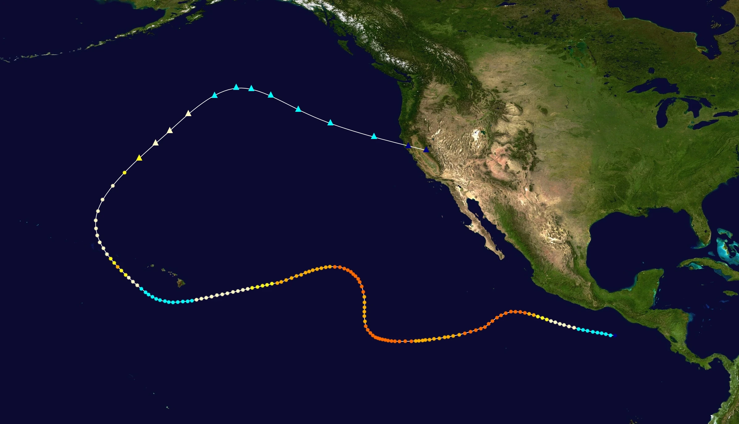
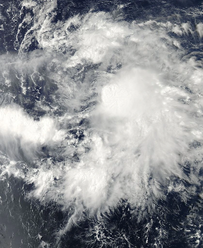
The first storm of the season, Hurricane Ema, formed over the Central Pacific on April 11. Over the next few days, the storm moved westwards, strengthened gradually, and crossed the International Date Line (IDL) on April 20, as a Category 2 hurricane.
Shortly after the official beginning of the season, a flurry of storms occured over the Eastern Pacific: six storms developed over a period of 5 weeks, all of which became hurricanes. Four of them - Amanda, Boris, Douglas and Elida went on to cross into the Western Pacific. All the storms formed south of Mexico and moved westwards, well south of Hawaii, due to a strong ridge existing over the Eastern and Central Pacific, while strengthening due to anomalously warm waters and low wind shear.
Activity slowed down in July as a result of upwelling of cold waters by the powerful storms; only 3 storms formed, of which one, Genevieve, strengthened into a major hurricane. The other two storms, Hernan and Iselle, were weak, short-lived tropical cyclones.
Activity dramatically increased in August, with 6 cyclones forming. The record activity continued into September and October, with 10 storms forming during these months. However, only 3 storms formed in November, two of which persisted into December. The final tropical cyclone of the year, Hurricane Alpha, formed near 140W on 29 December, intensified into a Category 4 hurricane over the Central Pacific, and crossed the International Date Line on 7 January 2021, bringing a record-breaking season to a close.
NOTE : Summary under construction
Storms
Hurricane Ema
| Category 2 hurricane (SSHWS) | |
 | |
| Duration | 11 April – 20 April (exited basin) |
|---|---|
| Peak intensity | 105 mph (165 km/h) (1-min) 971 mbar (hPa) |
TBA
Hurricane Amanda
Main Article: Hurricane Amanda (2020, JavaHurricane)
| Category 5 hurricane (SSHWS) | |
  | |
| Duration | 16 May – 1 June (exited basin) |
|---|---|
| Peak intensity | 175 mph (280 km/h) (1-min) 910 mbar (hPa) |
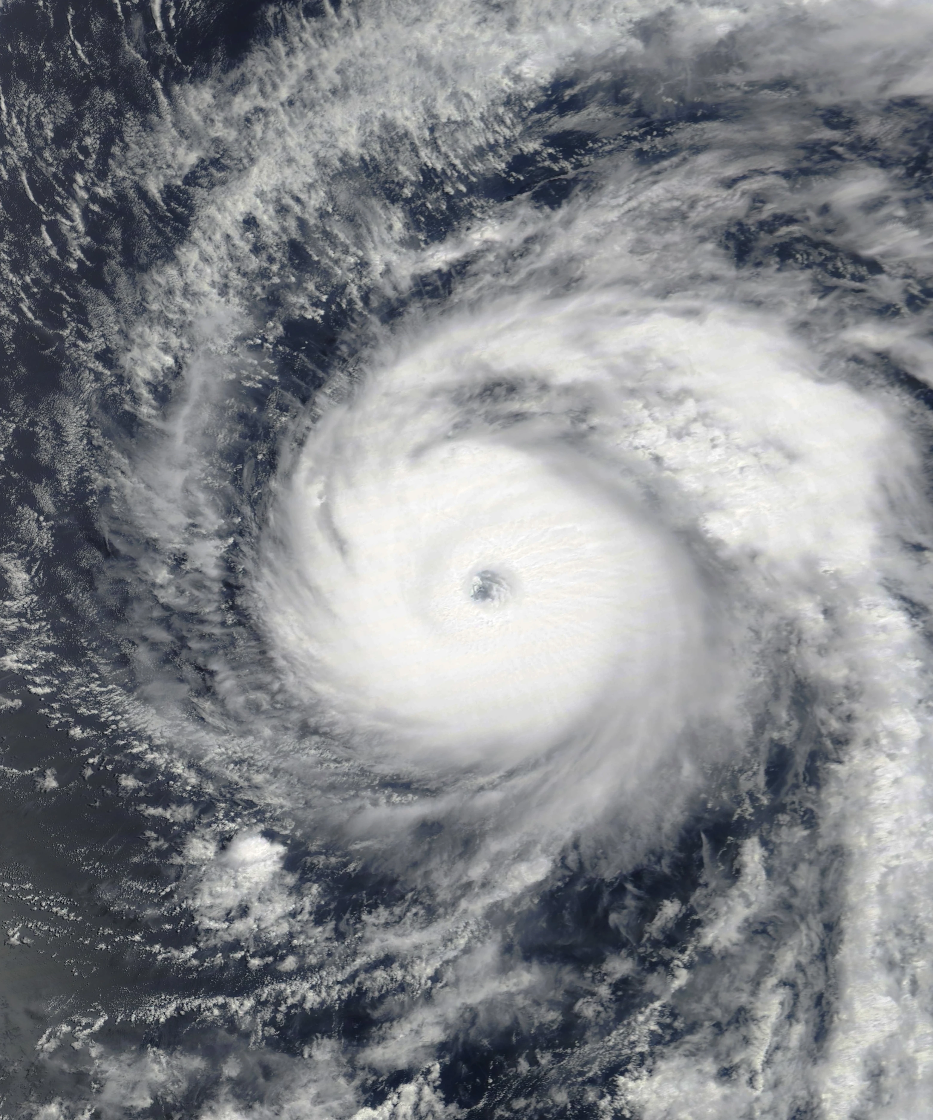
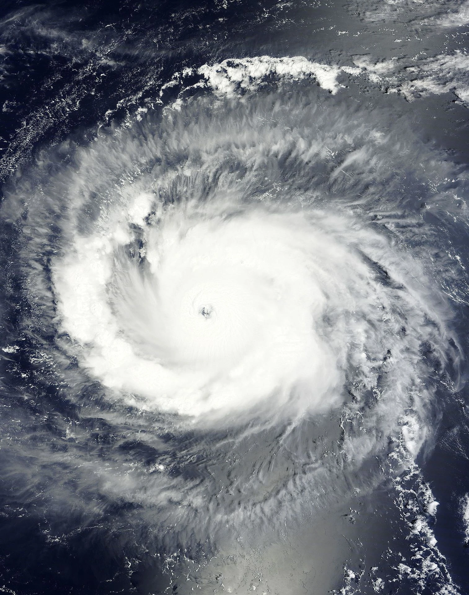
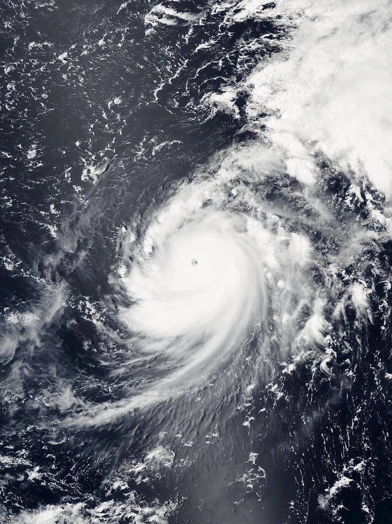
On 1 May, the NHC began to issue special TWOs for a disturbance located near Central America, expecting significant development in 5 days. The disturbance tracked slowly westwards over the next few days, as it failed to organize due to high wind shear from a nearby region of high pressure. By 11 May, the wind shear relaxed, allowing the disturbance to gradually coalesce. On 16 May, the NHC began issuing advisories on Tropical Depression One-E, while it was located 285 nm southwest of Acapulco, Mexico. Twelve hours later, the storm was upgraded to Tropical Storm Amanda after ASCAT data indicated gale-force winds. Over the next three days, the cyclone moved westwards while gradually intensifying. On 19 May, Amanda was upgraded to hurricane strength, while located 995 miles WSW of Socorro Island. At the same time, Amanda began to rapidly strengthen; the cyclone's intensity increased 60 kt (70 mph; 110 kmph) in a 24 hour time period, and the cyclone strengthened into a Category 4 hurricane. Intensification slowed down thereafter the cyclone was plagued by dry air. On 20 May, Amanda crossed into Central Pacific. On 26 May, Amanda strengthened into a Category 5 hurricane while located 250 miles northwest of Johnston Atoll, but weakened shortly thereafter due to an eyewall replacement cycle and moderate shear. After weakening to 120 kt, the cyclone entered a more favourable environment on 30 May. Rapid strengthening ensued, and Amanda reached winds of 150 kt and a pressure of 910 mbar on June 1, immediately before crossing into the Western Pacific, thus becoming the strongest tropical cyclone on record in the Central Pacific.
Hurricane Boris
| Category 5 hurricane (SSHWS) | |
  | |
| Duration | 17 May – 7 June |
|---|---|
| Peak intensity | 160 mph (260 km/h) (1-min) 919 mbar (hPa) |
TBA
Hurricane Cristina
| Category 4 hurricane (SSHWS) | |
  | |
| Duration | 24 May – 20 June |
|---|---|
| Peak intensity | 150 mph (240 km/h) (1-min) 920 mbar (hPa) |
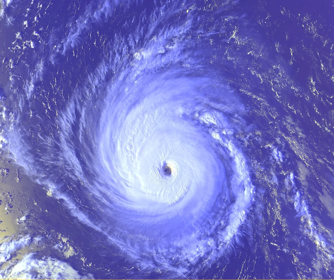
On May 20, the NHC began to track an area of low pressure near Central America for tropical development. Over the next four days, the low quickly developed, and, defying NHC predictions, strengthened into a tropical depression at 06Z on May 24. Six hours later, the system strengthened into the fourth named storm of the year, Cristina. The cyclone rapidly developed in a very favourable environment over the next few days, and reached Category 4 strength 250 miles west of Manzanillo. On 29 May, the cyclone reached its initial peak of 130 kt and 940 mbar. In spite of forecasts for further strengthening, Cristina stalled in strength, and weakened while turning southwest due to eyewall replacement cycles.
For the next several days, Cristina fluctuated in strength while changing direction several times due to changes in the positions of ridges, troughs and steering currents. Finally, Cristina crossed into the Central Pacific while weakening rapidly due to wind shear; the cyclone passed within 250 miles of South Point on 16 June as a minimal tropical storm. Thereafter, Cristina rapidly intensified to Category 3 strength in more favourable conditions while paralleling the Hawaiian Islands. Due to cooler waters, the storm rapidly weakened while passing over the Papahānaumokuākea Marine National Monument on 18 June. Maintaining hurricane strength, the storm turned west and became extratropical at 1800Z on 20 June. The extratropical storm turned southeast and made landfall in California before dissipating on 22 June.
Hurricane Douglas
| Category 5 hurricane (SSHWS) | |
 | |
| Duration | 1 June – 19 June (exited basin) |
|---|---|
| Peak intensity | 165 mph (270 km/h) (1-min) 915 mbar (hPa) |
TBA
Hurricane Elida
| Category 5 hurricane (SSHWS) | |
 | |
| Duration | 12 June – 28 June (exited basin) |
|---|---|
| Peak intensity | 175 mph (280 km/h) (1-min) 909 mbar (hPa) |
TBA
Hurricane Fausto
| Category 2 hurricane (SSHWS) | |
| | |
| Duration | 24 June – 30 June |
|---|---|
| Peak intensity | 100 mph (155 km/h) (1-min) 919 mbar (hPa) |
TBA
Hurricane Genevieve
| Category 5 hurricane (SSHWS) | |
 | |
| Duration | 6 July – 29 July |
|---|---|
| Peak intensity | 160 mph (260 km/h) (1-min) 919 mbar (hPa) |
TBA
Tropical Storm Hernan
| Tropical storm (SSHWS) | |
 | |
| Duration | – |
|---|---|
| Peak intensity | 40 mph (65 km/h) (1-min) 1000 mbar (hPa) |
TBA
Tropical Storm Iselle
| Tropical storm (SSHWS) | |
 | |
| Duration | – |
|---|---|
| Peak intensity | 40 mph (65 km/h) (1-min) 1005 mbar (hPa) |
TBA
Hurricane Julio
| Category 4 hurricane (SSHWS) | |
 | |
| Duration | 1 August – 21 August |
|---|---|
| Peak intensity | 155 mph (250 km/h) (1-min) 919 mbar (hPa) |
TBA
Tropical Storm Hone
| Tropical storm (SSHWS) | |
 | |
| Duration | 4 August – 6 August (exited basin) |
|---|---|
| Peak intensity | 75 km/h (45 mph) (1-min) 991 hPa (mbar) |
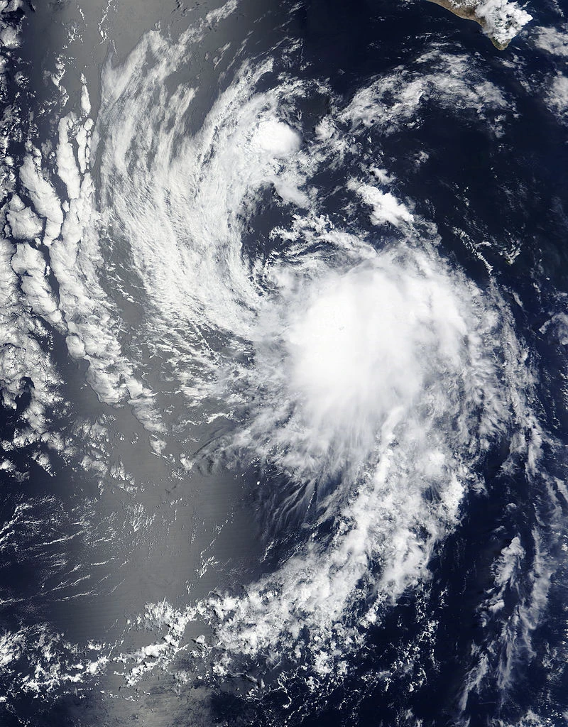
On 1 August, the CPHC began to track a region of disturbed weather located near Johnston Atoll for potential development. Over the next few days, the low tracked westwards and organized, prompting the CPHC to issue advisories on Tropical Depression Two-C on 4 August. The storm strengthened into Tropical Storm Hone the following day. The storm moved out of the basin on August 6, and went on to become a powerful typhoon in the Western Pacific.
Hurricane Karina
| Category 3 tropical cyclone (SSHWS) | |
| | |
| Duration | 4 August – 6 August (exited basin) |
|---|---|
| Peak intensity | 185 km/h (115 mph) (1-min) 963 hPa (mbar) |
TBA
Tropical Storm Lowell
| Tropical storm (SSHWS) | |
| | |
| Duration | 4 August – 6 August (exited basin) |
|---|---|
| Peak intensity | 85 km/h (50 mph) (1-min) 991 hPa (mbar) |
TBA
Tropical Storm Marie
| Tropical storm (SSHWS) | |
| | |
| Duration | 4 August – 6 August (exited basin) |
|---|---|
| Peak intensity | 110 km/h (70 mph) (1-min) 991 hPa (mbar) |
TBA
Hurricane Norbert
| Category 5 tropical cyclone (SSHWS) | |
| | |
| Duration | – |
|---|---|
| Peak intensity | 305 km/h (190 mph) (1-min) 896 hPa (mbar) |
TBA
Tropical Storm Odalys
| Tropical storm (SSHWS) | |
| | |
| Duration | – |
|---|---|
| Peak intensity | 110 km/h (70 mph) (1-min) 985 hPa (mbar) |
TBA
Hurricane Marco-Polo
| Category 5 tropical cyclone (SSHWS) | |
| | |
| Duration | 4 August – 6 August (exited basin) |
|---|---|
| Peak intensity | 325 km/h (200 mph) (1-min) 886 hPa (mbar) |
TBA
Tropical Storm Rachel
| Tropical storm (SSHWS) | |
| | |
| Duration | – |
|---|---|
| Peak intensity | 95 km/h (60 mph) (1-min) 998 hPa (mbar) |
TBA
Tropical Storm Simon
| Tropical storm (SSHWS) | |
| | |
| Duration | – |
|---|---|
| Peak intensity | 75 km/h (45 mph) (1-min) 1000 hPa (mbar) |
TBA
Hurricane Trudy
| Category 3 tropical cyclone (SSHWS) | |
| | |
| Duration | – |
|---|---|
| Peak intensity | 185 km/h (115 mph) (1-min) 940 hPa (mbar) |
TBA
Hurricane Vance
| Category 1 hurricane (SSHWS) | |
| | |
| Duration | – |
|---|---|
| Peak intensity | 90 mph (150 km/h) (1-min) 977 mbar (hPa) |
TBA
Tropical Storm Iona
| Tropical storm (SSHWS) | |
| | |
| Duration | – |
|---|---|
| Peak intensity | 60 mph (95 km/h) (1-min) 988 mbar (hPa) |
TBA
Tropical Storm Keli
| Tropical storm (SSHWS) | |
| | |
| Duration | – |
|---|---|
| Peak intensity | 65 km/h (40 mph) (1-min) 991 hPa (mbar) |
TBA
Hurricane Winnie
| Tropical storm (SSHWS) | |
| | |
| Duration | 4 August – 6 August (exited basin) |
|---|---|
| Peak intensity | 45 mph (75 km/h) (1-min) 991 mbar (hPa) |
TBA
Hurricane Xavier
| Tropical storm (SSHWS) | |
| | |
| Duration | 4 August – 6 August (exited basin) |
|---|---|
| Peak intensity | 45 mph (75 km/h) (1-min) 991 mbar (hPa) |
TBA
Hurricane Yolanda
| Tropical storm (SSHWS) | |
| | |
| Duration | 4 August – 6 August (exited basin) |
|---|---|
| Peak intensity | 45 mph (75 km/h) (1-min) 991 mbar (hPa) |
TBA
Hurricane Zeke
| Tropical storm (SSHWS) | |
| | |
| Duration | 4 August – 6 August (exited basin) |
|---|---|
| Peak intensity | 45 mph (75 km/h) (1-min) 991 mbar (hPa) |
TBA
Hurricane Lala
| Category 1 hurricane (SSHWS) | |
| | |
| Duration | TBD – TBD |
|---|---|
| Peak intensity | 80 mph (130 km/h) (1-min) 980 mbar (hPa) |
TBA
Hurricane Alpha
| Category 4 hurricane (SSHWS) | |
| | |
| Duration | 25 December – 7 January |
|---|---|
| Peak intensity | 145 mph (230 km/h) (1-min) 977 mbar (hPa) |
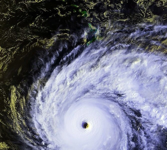
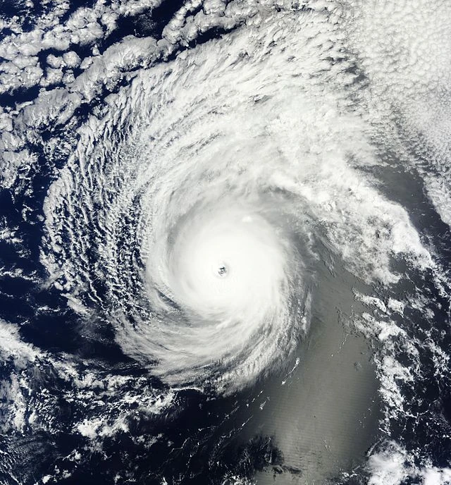
On December 21, the NHC began tracking an area of disturbed weather for possible development into a tropical cyclone. Over the next four days, the disturbance gradually organized, leading to the NHC to issue advisories on Tropical Depression Twenty Five at 1200 UTC on December 25. The depression gradually organized and be came Tropical Storm Alpha twelve hours later. Owing to unusually favourable conditions, Alpha continued to strengthen.
Storm names
Eastern Pacific
The following names were used to name storms that formed in the northeastern Pacific Ocean during 2014. No names were retired by the WMO in the spring of 2021, so all the names from this list will be used again in the 2026 season. This is the same list used in the 2014 season with the exception of Odalys, which replaced Odile; the name Odalys was used for the first time this year.
|
|
|
Due to the extreme activity, the name "Alpha" (from the Greek alphabet) was used after the naming list was exhausted.
Central Pacific
The CPHC hs its own rotating naming list for storms that form between 140W and the International Date Line. Five storm names were used this season. No name was retired.
|
|
|
|
|
Storm effects
| Storm name | Duration | Regions affected | Damage
(2020 $US) |
Fatalities |
|---|
Records
Records will be completed once the whole Season is completed.