| WARNING! MANY BROWSERS OR COMPUTERS HAVE EXTREME DIFFICULTY VIEWING THIS PAGE. |
Hello! This is a remake of my very first article, the 2027 Atlantic hurricane season (Litia Von Lucerna). I hope that you will enjoy this blast to the past!
-Litia Von Lucerna
The 2027 Atlantic hurricane season was the deadliest and most damaging tropical cyclone season on record, with dozens of exceptionally powerful storms devastating countries all over the basin, with one going as far as creating a massive chasm dividing North America into two parts while severely altering Earth's climate. With a staggering 100 depressions, 96 named storms, 79 hurricanes, and 64 major hurricanes, 2027 holds the record for the most active Atlantic hurricane season, beating the previous record holder, 2020, by over threefold. Due to abnormally high sea surface temperatures of over 68 degrees Celsius (150 degrees Fahrenheit), dozens of storms achieved peak winds of well over 200 mph, causing the NHC to add several new categories to the Saffir–Simpson scale (though this was also influenced by the construction of buildings with the ability to withstand Category 5 winds). A total of 36 storms reached categories above Category 5, with 11 storms - Hurricanes Nicholas, Heath, Orlanda, Beta, Eta, Theta, Iota, Mu, Omega, Zayin, and Collin - going even further and becoming hypercanes. The extreme activity led not only to the first instances of Q, U, X, Y, and Z names being used and the new auxiliary list being used, but the first instance of the new auxiliary list being exhausted - the Greek alphabet list had to be reused due to the unprecedented amount of storms. However, even the Greek list was exhausted, prompting the WMO to use the Hebrew Alphabet to name storms. However, even that was exhausted, so another auxiliary list composed of entirely new names was made.
The extreme activity was caused by a meteor impacting the Mid-Atlantic Ridge on August 11, 2026, destabilizing it and leading to an immense flood basalt event. The magma ejected from the eruption caused the waters in the Atlantic to be heated up to exceptionally high temperatures, leading to the apocalyptic intensity of the season. The immense destruction caused by 2027's storms led to the collapse of many of Earth's nations and the eventual rise of a fascist regime known as the Holy Empire of Earth-Kalgamania.
New scale[]
| Rating | Wind speeds mph (km/h) | Abbreviation |
| Tropical Depression | ≤38 (≤62) | TD |
| Tropical Storm | 39-73 (63–118) | TS |
| Category 1 Hurricane | 74-95 (119–153) | C1 |
| Category 2 Hurricane | 96-110 (154–177) | C2 |
| Category 3 Major Hurricane | 111-129 (178–208) | C3 |
| Category 4 Major Hurricane | 130-156 (209–251) | C4 |
| Category 5 Major Hurricane | 157-194 (252-312) | C5 |
| Category 6 Extreme Hurricane | 195-220 (313-354) | C6 |
| Category 7 Extreme Hurricane | 221-240 (355-386) | C7 |
| Category 8 Extreme Hurricane | 241-260 (387-418) | C8 |
| Category 9 Extreme Hurricane | 261-280 (419-450) | C9 |
| Category 10 Extreme Hurricane | 281-299 (451-481) | C10 |
| Hypercane | 300-399 (482-642) | HYC |
| Megacane | ≥400 (≥643) | MGC |
Due to the occurrence of numerous storms with record-breaking wind speeds as well as due to the invention of structures capable of withstanding Category 5 storms, the NHC made the decision to add several new categories to the SSHWS starting in the beginning of 2027. The added categories are listed below. Information on other, older categories can be found here.
Category 6[]
| Category 6 | |
|---|---|
| Sustained winds | Example |
| 313–354 km/h 195-220 mph |
 Jasper making landfall on Cuba at peak intensity. |
Very catastrophic damage will occur
Storms of Category 6 hurricane strength cause complete building failures on most residences and businesses. Roof and wall collapse is certain regardless of the type of building, and the total destruction of large wood-frame homes is very common. Even concrete and steel offices, apartments, hotels, parking garages, and other large buildings can sustain major damage. Not even the hardiest trees remain standing and coastlines are altered to the point of being unrecognizable. Any building with less than three floors is guaranteed to be extremely damaged or destroyed by flooding. Coastal structures are destroyed without a trace. Large-scale evacuations in inhabited areas are necessary for survival if a Category 6 hurricane is forecast to make landfall on a populated area or come close to doing so, as hurricanes can still cause exceptional damage without making a true landfall. Any city predicted to be affected by a Category 6 is guaranteed to experience a total, extremely long-lived power outage and water shortage which may last for almost a year.
Category 7[]
| Category 7 | |
|---|---|
| Sustained winds | Example |
| 355–386 km/h 221-240 mph |
 Octavia moving into the Gulf of Mexico near peak intensity. |
Extremely catastrophic damage will occur
It is simply impossible for most structures to survive a Category 7 hurricane. The total destruction of any building that is not a large reinforced concrete or steel building located inland is guaranteed whenever a Category 7 makes landfall. And even then, said large concrete or steel buildings will not escape without extremely severe, irreparable damage. Smaller buildings such as residential homes or businesses will not only be destroyed, but will be hurled into the air as debris. Large trains, ships, and other vehicles will also become airborne projectiles and chunks of concrete will be torn off. As surviving a hurricane of this magnitude is impossible, huge evacuations are the only option for survival. Power outages may span thousands of counties and cities due to the tendency of storms of Category 7 strength to be large in size, and flooding will be so widespread that it may be visible from satellite. Power outages may also be able to span whole provinces and will last for nearly a year unless power sources are repaired quickly, efficiently, and effectively.
Category 8[]
| Category 8 | |
|---|---|
| Sustained winds | Example |
| 387–418 km/h 241-260 mph |
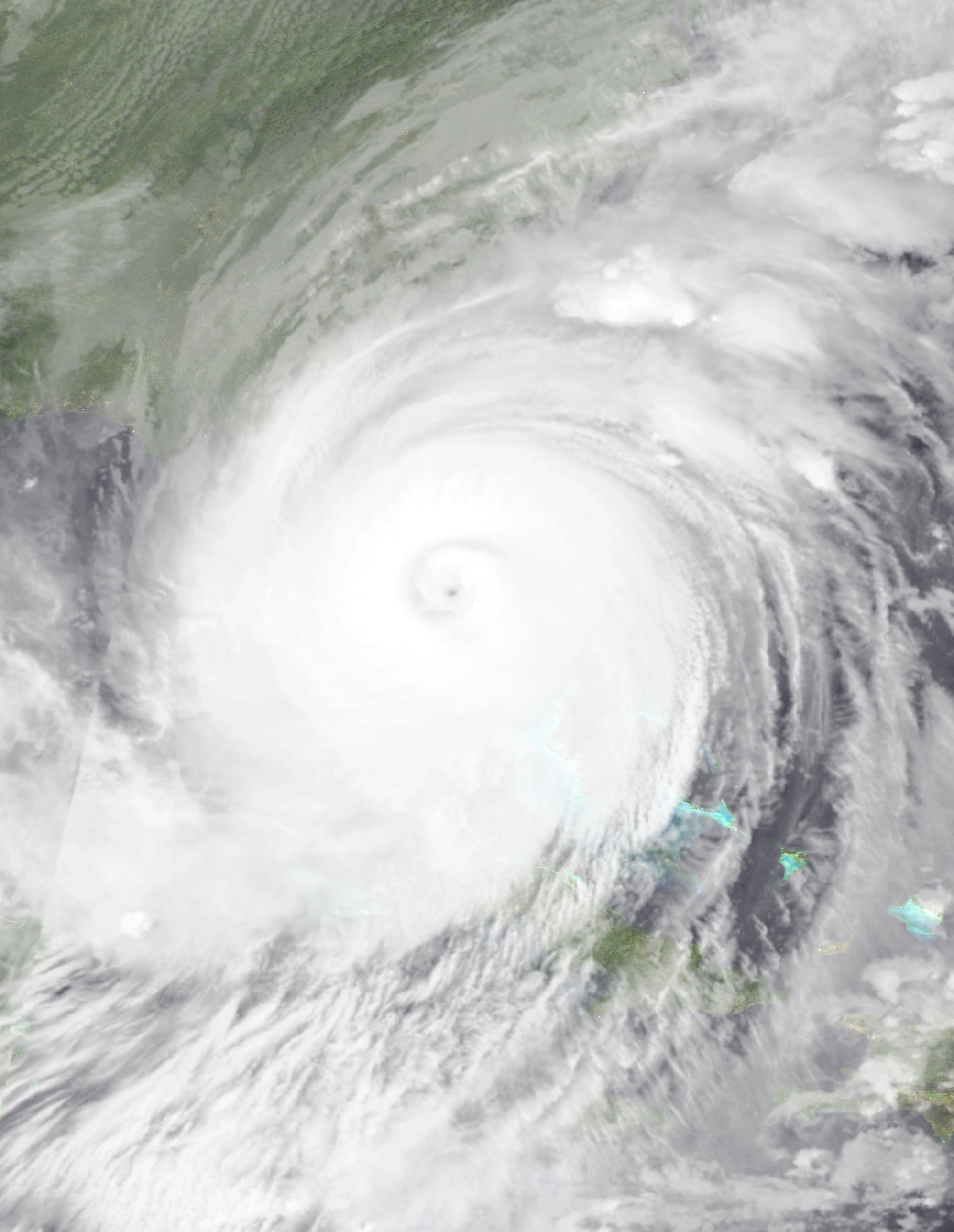 Powerful Zachary impacting Florida and other nearby areas at peak intensity. |
Cataclysmic damage will occur
It is simply impossible for any structure to survive a Category 8 hurricane. The total destruction of any building is certain - large reinforced concrete or steel buildings will not be able to withstand a Category 8 and will collapse. Smaller buildings such as residential homes or businesses will not only be destroyed, but will be hurled into the air as debris. Large trains, ships, and other vehicles will also become airborne projectiles and chunks of concrete, roads, and the ground will be torn off. As surviving an extreme hurricane in any city is impossible, huge evacuations are the only option for survival. Power outages and flooding will span entire provinces due to a hurricane's large size and will last for nearly a year unless rescue efforts are brought in to repair power sources and drain flooding quickly, efficiently, and effectively.
Category 9[]
| Category 9 | |
|---|---|
| Sustained winds | Example |
| 419–450 km/h 261-280 mph |
 Foster near peak over the open ocean. |
Very cataclysmic damage will occur
It is simply impossible for any structure to survive a Category 9. The total destruction of any building is certain - large reinforced concrete or steel buildings will not be able to withstand a Category 9 and will collapse. Smaller buildings such as residential homes or businesses will not only be destroyed, but will be hurled into the air as debris. Large trains, ships, and other vehicles will also become airborne projectiles and chunks of concrete, roads, and the ground will be torn off. As surviving in an extreme hurricane is impossible, huge evacuations are the only option for survival. Power outages and flooding will span entire provinces due to a Category 9's large size and will last for nearly a year unless advanced technology is used to repair power sources and drain flooding quickly, efficiently, and effectively.
Category 10[]
| Category 10 | |
|---|---|
| Sustained winds | Example |
| 451–481 km/h 281-299 mph |
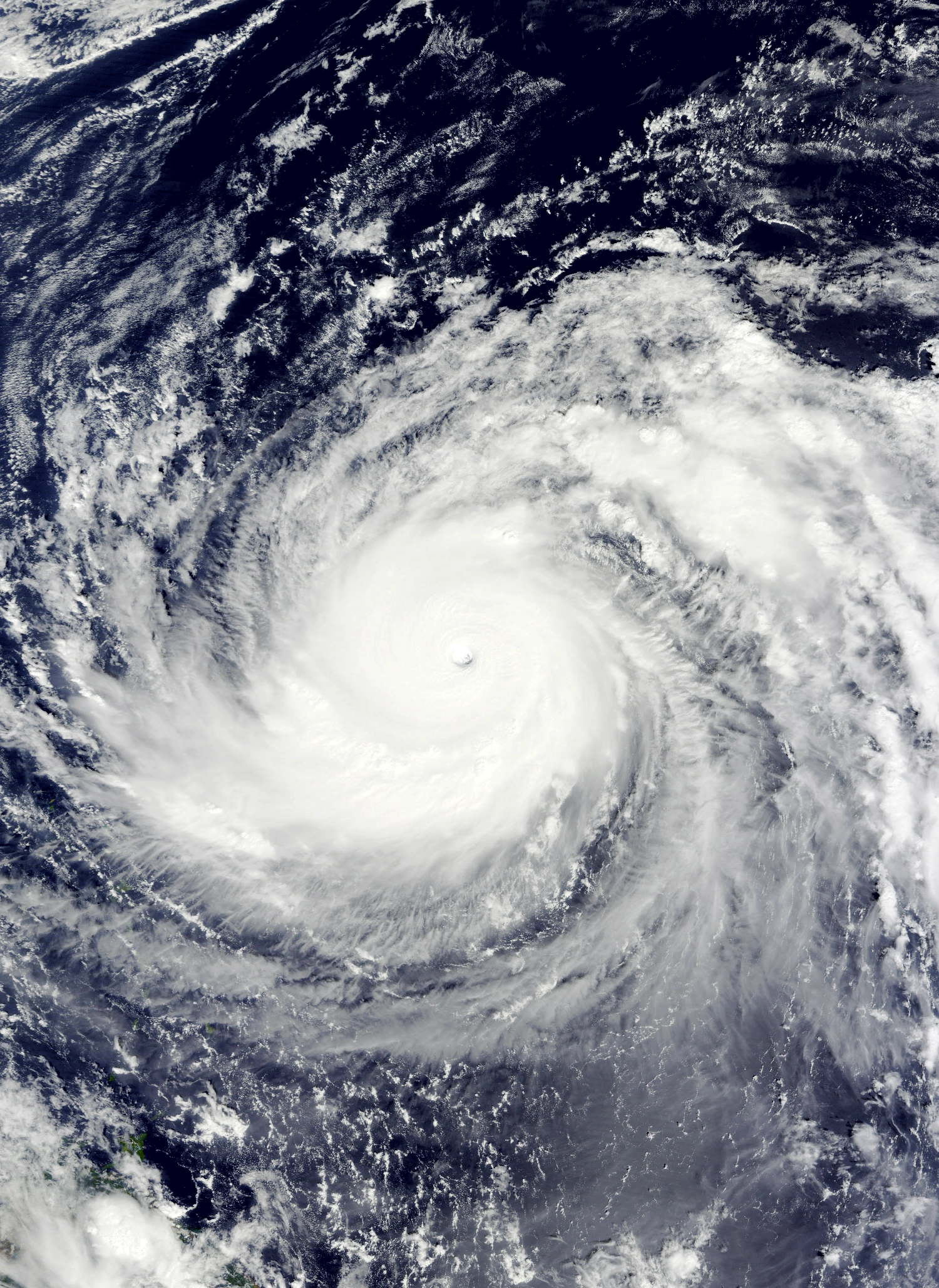
 The enormous Sam at its maximum intensity traveling along the coast of the eastern United States. |
Extremely cataclysmic damage will occur
It is simply impossible for any structure to survive a Category 10 hurricane. The total destruction of any building is certain - large reinforced concrete or steel buildings will not be able to withstand a Category 10 and will collapse. Smaller buildings such as residential homes or businesses will not only be destroyed, but will be hurled into the air as debris. Large trains, ships, and other vehicles will also become airborne projectiles and large chunks of concrete, roads, and the ground will be torn off. As surviving an extreme hurricane is impossible, huge evacuations are the only option for survival. Power outages and flooding will span entire provinces due to a Category 10's large size and will last for nearly a year unless advanced technology is used to repair power sources and drain flooding quickly, efficiently, and effectively.
These storms are also capable of altering the environment detrimentally enough to require human intervention. The extreme flooding left from a Category 10 may destroy habitats while creating the conditions for invasive aquatic species to move in. Due to these storms being able to tear chunks off the ground, natural landscapes may be altered and several animals and plants may lose their habitats. Entire coastlines can be altered and small sandy islands, inlets, and bars completely erased, which may endanger shoreline ecosystems. In general, given the extreme strength of a Category 10 hurricane, any natural habitat is exceptionally unlikely to survive any storm of said strength, so relocation or capture of endangered species whose natural environments are within the storm's path is highly necessary in order to ensure the species' survival.
Hypercane[]
| Hypercane | |
|---|---|
| Sustained winds | Example |
| 482–642 km/h 300-399 mph |
 Hypercane Nicholas making its historic landfall on Mexico at peak intensity. |
Apocalyptic devastation will occur on a continental scale
It is simply impossible for any structure - both man-made and natural landforms such as hills and valleys - to survive a hypercane. All buildings, including large, reinforced buildings, will be hurled into the air as debris. Smaller buildings and vehicles will be blown away and may land dozens of miles away from their original location. Large chunks of roads and pavement will be torn off of the ground. Equally large chunks of soil and rock may also be torn off of the ground in more rural areas; the appearance of whole landscapes may be slightly altered due to this. Coastlines affected by a hypercane are guaranteed to be altered to the point of becoming unrecognizable. As hypercanes are often comparable to small continents in size, flooding may span whole countries while power outages can last for years. Furthermore, these storms may harm the ozone layer due to how high they reach up into the atmosphere, rendering affected areas even more uninhabitable. Since surviving a hypercane is virtually impossible regardless of the location, immense evacuations are required if a hypercane were to threaten land. Furthermore, extreme humanitarian crises will occur unless intervention on a massive scale takes place within a short period of time.
Much like Category 10 hurricanes, hypercanes are capable of altering the environment detrimentally enough to require human intervention. The extreme flooding left from a hypercane may destroy habitats while creating the conditions for invasive aquatic species to move in. Due to these storms being able to tear chunks off the ground, natural landscapes may be altered and several animals and plants may lose their habitats. Entire coastlines can be altered and small sandy islands, inlets, and bars completely erased, which may endanger shoreline ecosystems. In general, given the extreme strength of a hypercane, any natural habitat is exceptionally unlikely to survive any storm of said strength, so relocation or capture of endangered species whose natural environments are within the storm's path is highly necessary in order to ensure the species' survival.
Megacane[]
| Megacane | |
|---|---|
| Sustained winds | Example |
| 643–803 km/h 400-499 mph |
 Mu hitting the remains of the Florida Peninsula at peak. |
Very apocalyptic devastation will occur on a continental scale
It is simply impossible for any structure - both man-made and natural landforms such as hills and valleys - to survive a megacane. All buildings, including large reinforced buildings such as offices, apartments, and parking structures as well as large vehicles like trucks and trains will be hurled into the air as debris and may land several miles or kilometers away. Entire streets may be laid bare as the cyclone may rip pavement off of whole city blocks. Equally large chunks of soil and rock may also be torn off of the ground in more rural areas; the appearance of whole landscapes may be visibly altered due to this. Coastlines affected by a megacane are guaranteed to be altered to the point of becoming unrecognizable, with what would be equivalent of several centuries of erosion occurring within the span of a few hours of exposure to megacane conditions. Power outages and flooding may span an entire continent depending on how large the landmass is. Furthermore, these storms may harm the ozone layer due to how high they reach up into the atmosphere, rendering affected areas even more uninhabitable. Since surviving a megacane is virtually impossible regardless of the location, immense evacuations are required if a megacane were to threaten land. Furthermore, extreme humanitarian crises are guaranteed unless international powers act immediately after the storm.
Much like Category 10 hurricanes and hypercanes, megacanes are capable of altering the environment detrimentally enough to require human intervention. The extreme flooding left from a megacane may destroy habitats while creating the conditions for invasive aquatic species to move in. Due to these storms being able to tear chunks off the ground, natural landscapes may be altered and several animals and plants may lose their habitats. Entire coastlines can be altered and small sandy islands, inlets, and bars completely erased, which may endanger shoreline ecosystems. In general, given the extreme strength of a megacane, any natural habitat is guaranteed to be destroyed by any storm of said strength, so relocation or capture of endangered species whose natural environments are within the storm's path is highly necessary in order to ensure the species' survival.
Infinite Storm[]
| Infinite Storm | |
|---|---|
| Sustained winds | Example |
| ≥804 km/h ≥500 mph |
 Infinite Storm Zayin a few hours after peak intensity near Florida. |
Extremely apocalyptic devastation will occur on a continental scale
It is simply impossible for any structure - both man-made and natural landforms such as hills and valleys - to survive an infinite storm. All buildings, including large reinforced buildings and heavy vehicles, will be hurled into the air as debris and may land hundreds of miles or kilometers away. Infinite storms may tear off the concrete foundations of entire cities off of the ground and into the air, creating extremely dangerous and life-threatening conditions. The same may also happen to chunks of the ground in rural areas. In addition to entire hills, valleys, lakes, cliffs, etc. being erased or created by storms of this strength, the resultant large debris can be thrown around by the wind and fall onto the ground, causing destruction akin to a meteorite impact. Coastlines affected by an infinite storm are guaranteed to be altered to the point of becoming unrecognizable, with what would be equivalent of several millenia of erosion occurring within the span of a few hours of exposure to infinite storm conditions. Power outages and flooding may span an entire continent and last decades. Furthermore, these storms may harm the ozone layer due to how high they reach up into the atmosphere, rendering affected areas even more uninhabitable. In order to ensure any chance of survival, huge evacuations spanning tens of millions of people is warranted if an infinite storm threatens land. Furthermore, extreme humanitarian crises that can persist for centuries are certain - international help may mitigate them, but there is still no guarantee that it will actually help.
Much like Category 10 hurricanes, hypercanes, and megacanes, infinite storms are capable of altering the environment detrimentally enough to require human intervention. Because infinite storms often completely alter any environments in their paths, any natural habitat is guaranteed to be destroyed by any storm of said strength. Relocation or capture of any endangered species whose natural environments are within the storm's path is highly necessary in order to ensure the species' survival.
Armageddon Storm[]
| Armageddon Storm | |
|---|---|
| Sustained winds | Example |
| ≥1609 km/h ≥1000 mph |
 Collin at its exceptionally powerful peak intensity approaching North Carolina. |
Mass extinction events and climatic catastrophes will occur on a global scale, threatening the future of life and civilization as we know it
Armageddon storms are an extreme class of infinite storm only possible if sea surface temperatures reached over 212 degrees Fahrenheit/100 degrees Celsius, the boiling point of water. With winds in excess of 1000 mph (1609 km/h) and a central pressure of nearly zero millibars, such storms would have winds faster than the speed of sound, leading to a perpetual deafening noise in the eyewall due to constant sonic booms. Their zero mbar eyes would essentially be a vacuum, suffocating any lifeform in it and sometimes even causing a rapid collapse of the storm, leading to the formation of a small black hole. They, like other hypercane+ categories, have the capability to alter the shapes of entire landmasses, create and destroy whole seas and mountain ranges, and kill millions and possible billions during a direct landfall while leaving behind no traces of any structures caught in its path.
The most lethal part of an armageddon storm, however, are its aftereffects. An armageddon storm would launch dust and debris into the atmosphere, which would alter climate and temperatures across the world. This would disrupt ecosystems, weather, and other essential processes, likely leading to extensive famine and starvation all over the Earth. Armageddon storms would also be able to cover whole hemispheres and annihilate over 50% of the ozone layer, leading to an extreme influx of UV radiation and other harmful forms of radiation. This would destroy ecosystems even further while causing genetic mutations and diseases among a large percentage of the Earth's population. Furthermore, the rapid land alteration common with armageddon storms can cause large megatsunamis which have the potential to devastate coastal areas all around the globe. Earth's climate will likely be permanently altered and rendered uninhabitable for generations, and a mass extinction event of species is likely to follow an armageddon storm's occurrence.
Seasonal summary[]

Systems[]
|
Tropical Storm Ana[]
| Tropical storm (SSHWS) | |
|---|---|
  | |
| Duration | January 2 – January 4 |
| Peak intensity | 50 mph (80 km/h) (1-min) 996 mbar (hPa) |
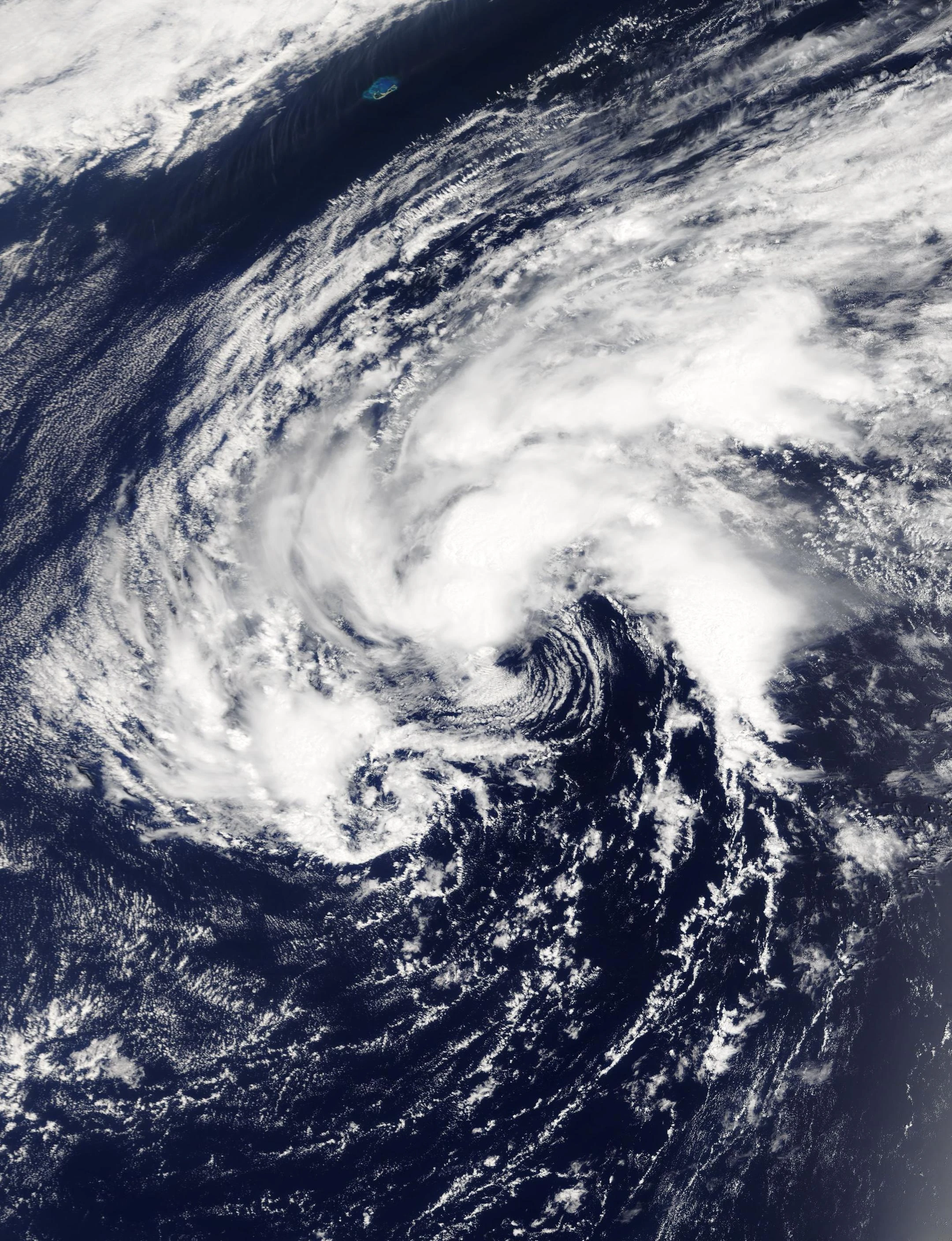
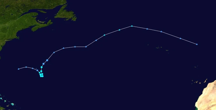
Early on January 1, an area of low pressure formed along a cold front situated several hundred kilometers east of Bermuda. This area eventually began to detach from its associated front and transition into a tropical cyclone, prompting the NHC to designate it as Subtropical Depression One at 02:00 UTC on January 2. A few hours later, as the system curved south, the subtropical depression intensified into a subtropical storm and was given the name Ana before becoming fully tropical at 15:00 UTC that day. Afterwards, an extratropical cyclone to the northeast caused the storm to make a sharp turn to the north the next day, which was also when Ana reached its peak intensity of 50 mph and 996 mbar at 10:00 UTC. After peaking, wind shear began to tear the system's structure apart, causing Ana to weaken. Just before midnight on January 3, Ana weakened back into a tropical depression. At 13:00 UTC on January 4, the presence of a large tail of convection to Ana's south along with a recorded temperature drop in said tail from a hurricane hunter plane prompted the NHC to downgrade Ana into an extratropical cyclone. Its remnants traversed the open Atlantic before dissipating on January 6 west of the Azores.
Ana dropped a total of 101 mm (4 in) of rain onto Bermuda and 50 mm (2 in) of rain onto the Azores. No fatalities or economic losses were recorded in association with the storm.
Subtropical Storm Bill[]
| Subtropical storm (SSHWS) | |
|---|---|
  | |
| Duration | January 4 – January 5 |
| Peak intensity | 60 mph (95 km/h) (1-min) 991 mbar (hPa) |
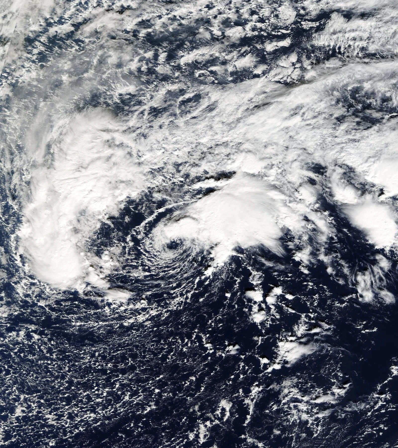
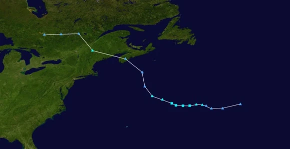
During the afternoon hours of January 2, an extratropical cyclone over southern Canada began to be tracked by the NHC. The system was monitored for possible tropical transition as it moved out into the open Atlantic the following day. Sure enough, the cyclone eventually began to develop central convection and detach from its weather fronts at 18:00 UTC on January 4, marking the formation of Subtropical Storm Bill. However, due to persistent wind shear, Bill failed to become fully tropical. At 10:00 UTC on January 5, Bill reached its peak intensity of 60 mph (95 km/h) over open waters while exhibiting a partially exposed core and disorganized convection before reverting back into an extratropical low later that day.
As an extratropical cyclone, Bill produced heavy rain and gusty winds to the northeastern United States and southeastern Canada. Damage mostly consisted of downed tree branches and isolated flooding, with the only damage to human property being the loss of loose roof shingles. In all, Bill caused only minimal damage and one death when a surfer went missing in New York.
Tropical Storm Claudette[]
| Tropical storm (SSHWS) | |
|---|---|
  | |
| Duration | January 17 – January 19 |
| Peak intensity | 70 mph (110 km/h) (1-min) 984 mbar (hPa) |
On January 14, a low pressure system formed along the cold front of a large extratropical cyclone over the United States. After moving over the southeastern United States for several days, it emerged into the waters near Virginia and North Carolina just after 00:00 UTC on January 17. That same day, the low began to quickly transition into a tropical cyclone as convection blew up in the storm's center; the NHC eventually designated it as Tropical Storm Claudette at 08:00 UTC. Moving northeast due to being steered by the same extratropical low it formed from, Claudette quickly strengthened due to unusually warm waters and eventually peaked at 16:00 UTC that day with winds of 70 mph and a central surface pressure of 984 mbar. The storm also developed a large eye-like feature. During the morning hours of January 18, the storm made landfall in southeastern Massachusetts with winds of 60 mph. Claudette then weakened due to land interaction and wind shear and eventually became extratropical again just after midnight on January 19. Its remnants went on to affect Maine and the east coast of Canada before dissipating over the open Atlantic on January 21.
Upon formation, tropical storm watches and warnings were issued for many East Coast states in the U.S. as the storm travelled northwest towards Massachusetts. In the landfall location, heavy rain and gusty winds were recorded which snapped numerous trees which caused some property damage to homes and businesses. The wind itself also damaged some roofs, tore small chunks off of wooden walls, and cracked some windows. Flooding occurred in isolated areas which inundated a few structures and blocked some roadways. Wave heights of up to 13 feet were recorded in association with the storm along the coast. Rain and wind damage also occurred in the southeastern U.S. and eastern Canada, where Claudette passed through as an extratropical low. Overall, the storm caused $415 million in damages and claimed 9 lives, mostly from drowning in either rough surf or flooding.
Tropical Depression Four[]
| Tropical depression (SSHWS) | |
|---|---|
  | |
| Duration | February 1 – February 3 |
| Peak intensity | 35 mph (55 km/h) (1-min) 1003 mbar (hPa) |
On January 30, the NHC began to monitor an extratropical cyclone over the open Atlantic ocean for possible development. Though the chances of it becoming a tropical cyclone were low due to high wind shear, the cyclone eventually developed a central dense overcast and broke away from its fronts at 17:00 UTC on February 1. This led to the designation of Subtropical Depression Four shortly after. After making a small cyclonic loop, Four became fully tropical at 09:00 UTC on February 2 while carrying winds of 35 mph. However, the system still had a very disorganized appearance on satellite, with little banding features and poorly developed convection. No further strengthening occurred after its tropical transition due to hostile environmental conditions and the system became extratropical again at 07:00 UTC on February 3.
Hurricane Danny[]
| Category 1 hurricane (SSHWS) | |
|---|---|
  | |
| Duration | February 9 – February 16 |
| Peak intensity | 90 mph (145 km/h) (1-min) 985 mbar (hPa) |
Danny's origins could be traced back to an extratropical cyclone near the Azores that began to be tracked on February 7. Gaining gale-force winds the next day, the storm began to exhibit signs of a transition into a tropical or subtropical cyclone, causing the NHC to designate it as an invest. The system eventually became organized enough to be classified as Subtropical Storm Danny at 06:00 UTC on February 9. Danny went on to complete its tropical transition by the end of the day. As the storm began making a small cyclonic loop, it slowly intensified in spite of relatively high wind shear. At 01:00 UTC on February 11, Danny developed an eye-like feature and was upgraded into a hurricane, becoming one of the easternmost hurricanes in the Atlantic basin. However, an increase in wind shear and a decrease in sea surface temperatures caused the system to weaken back into a tropical storm later that day after nearly 24 hours of being a hurricane. While moving west due to a large anticyclone to the north, Danny re-intensified back into a hurricane on February 13 at 10:00 UTC. A few hours later, Danny redeveloped an eye and reached its highest sustained winds of 90 mph while its atmospheric pressure dropped to 985 mbar. Soon after, an extratropical cyclone moved in and caused Danny to accelerate northeast and weaken. At 19:00 UTC on February 14, Danny weakened into a tropical storm as its convection began to wane and become elongated and its eye became cloud-filled. The system was further downgraded into a tropical depression at around noon on the 15th, with its appearance on satellite becoming large and disorganized. Eventually, Danny became extratropical at 13:00 UTC on February 16.
Danny brought light rain to the Azores both as a precursor invest and as a post-tropical frontal cyclone. Only minimal damage was reported, but two people were killed during a car accident in Ponta Delgada triggered by moist roads caused by the storm.
Tropical Storm Elsa[]
| Tropical storm (SSHWS) | |
|---|---|
  | |
| Duration | February 23 – February 25 |
| Peak intensity | 45 mph (70 km/h) (1-min) 1004 mbar (hPa) |
Early on February 23, the NHC began tracking an extratropical low over the open Atlantic due to the system exhibiting signs of a tropical transition. This transition was eventually completed at 20:00 UTC that day as the storm detached from its cold front, leading to the designation of Tropical Storm Elsa. Early the next day, Elsa reached its peak intensity of 45 mph and 1004 mbar before high wind shear and cooler waters caused it to rapidly weaken. At 07:00 UTC on February 25, Elsa became extratropical again.
(Elsa? More like Ewsa)
Tropical Storm Fred[]
| Tropical storm (SSHWS) | |
|---|---|
  | |
| Duration | March 1 – March 3 |
| Peak intensity | 65 mph (105 km/h) (1-min) 997 mbar (hPa) |
On February 28, a frontal low formed off several hundred miles off the coast of North Carolina. As it began to detach from its associated front and began developing thunderstorms at its center, the storm was monitored for possible development into a tropical or subtropical cyclone. Soon enough, the frontal low became organized enough to be called a subtropical storm at 04:00 UTC on March 1, earning the name Fred. Curving north due to a large trough to Fred's northeast, the newly-named cyclone became a fully tropical cyclone at 11:00 UTC on March 2. Fred then slowly strengthened and eventually peaked later that day with winds of 65 mph and a central pressure of 997 mbar. Afterwards, the storm's central thunderstorms began to become slightly displaced to the northwest due to wind shear as it made its way toward Nova Scotia. Fred's winds decreased to only 45 mph when it made landfall on the peninsula at 16:50 UTC on March 3. Land interaction from said landfall caused Fred to weaken even faster into a tropical depression. The storm eventually became extratropical just before midnight that day while over the Gulf of St. Lawrence.
Upon formation, Fred triggered tropical storm warnings for Nova Scotia as well as some tropical storm watches and high surf advisories for the New England states. Despite the storm's relatively low intensity, Fred inflicted moderate damage on Nova Scotia due to the area not being designed to withstand tropical cyclone conditions. Flooding of low-lying areas and high winds inflicted $4 million in property damage and killed 3 people; two people were swept out to sea due to high waves caused by the storm while one person died after being pinned by a fallen power line. Approximately 3,000 households in Nova Scotia reported losing power during the storm's passage. Thankfully, Fred's effects were limited by the storm's fast forward motion.
Hurricane Grace[]
| Category 2 hurricane (SSHWS) | |
|---|---|
  | |
| Duration | March 8 – March 13 |
| Peak intensity | 100 mph (160 km/h) (1-min) 968 mbar (hPa) |
On March 6, the NHC began tracking a weak frontal low moving westward south of the Azores for possible development into a subtropical or tropical cyclone. Though formation chances were low due to some dry air, the low eventually developed into a subtropical storm at 08:00 UTC on March 8 and received the name Grace. Early the next day, Grace developed hurricane-force winds; at this point, the NHC assumed the storm to have become fully tropical and upgraded it into a Category 1. At 05:00 UTC on March 10, Grace reached its peak intensity of 100 mph and 968 mbar, a Category 2 hurricane on the SSHWS, while developing a large but ragged eye in the center of its CDO. It weakened back into a Category 1 later that day as a trough to the northwest began steering Grace northeast into more hostile conditions. At 10:00 UTC on March 12, Grace lost hurricane status and its convection began to wane and become displaced from the center of its circulation. Eventually, with the formation of an attached cold front in the southeastern quadrant of the storm, Grace was designated extratropical at 18:00 UTC on March 13.
Aside from moderate rainfall in the Azores, western Spain, and Portugal from Grace's extratropical remnants, the storm did not affect land. Tropical storm watches and warnings were issued for the Azores but were discontinued by the 14th.
Hurricane Henri[]
| Category 4 hurricane (SSHWS) | |
|---|---|
  | |
| Duration | March 14 – March 22 |
| Peak intensity | 145 mph (235 km/h) (1-min) 940 mbar (hPa) |
On March 13, a trough merged with the cold front of an extratropical cyclone off the coast of the Carolinas and produced an area of low pressure. This low pressure area was monitored by the NHC as it slowly moved southwest towards the Bahamas. Eventually, its central convection deepened enough to be designated Tropical Depression Nine at 06:00 UTC on March 14. Nine developed further into Tropical Storm Henri at 19:00 UTC on March 19. Intensification then slowed for over a day due to a temporary increase in wind shear, but it soon sped up again at 01:00 UTC on March 16 with Henri's upgrade into a hurricane. That same day, warm waters and a lack of any inhibiting factors for strengthening caused the storm to begin rapidly intensifying. By the end of the day, the hurricane had achieved Category 3 strength, becoming the earliest major hurricane on record in the Atlantic. At 00:00 UTC on March 17, as Henri developed a well-defined eye and deep convection in its spiral rainbands and CDO while making a tight counterclockwise loop over Grand Bahamas, the NHC upgraded the storm to Category 4 strength. At 06:00 UTC that day, Henri reached its initial peak intensity of 130 mph and 952 mbar before beginning an eyewall replacement cycle. The storm briefly weakened into a Category 3 due to this, but soon re-strengthened back into a Category 4 at 15:00 UTC on March 18 while gaining some annular features. Henri reached its true peak intensity on March 19 at 05:00 UTC carrying winds of 145 mph and a central surface atmospheric pressure of 940 millibars. Later that day, as the storm began moving roughly parallel to the East Coast, cooler waters and increased wind shear began to degrade Henri's overall structure, causing it to lose Category 4 status at 21:00 UTC that day. At 10:00 UTC on March 20, Henri weakened further into a Category 2 while convection became shallow and displaced. At 11:00 UTC on March 21, the storm lost hurricane status altogether before making landfall near Montauk, Long Island at 20:30 UTC that day. There, Henri rapidly weakened into a depression and eventually dissipated at 13:00 UTC on March 22 over Maine.
Henri affected the northern Bahamas for multiple days, causing significant damage in places like Grand Bahama and numerous other islands. Major hurricane-force wind gusts caused severe damage on homes and businesses, breaking walls and destroying roofs. Hundreds of trees were uprooted, causing even more damage. Storm surge and flooding also contributed to the damage, with waves of up to 20 feet flooding communities. Due to the storm conditions, power on multiple islands was lost. Henri caused a total of $185 million in damages in the Bahamas alone. In addition to the Bahamas, numerous states along the southeastern and eastern United States received effects from Henri as well, with reports of hurricane-force winds, high waves, and flooding. Many roads became flooded or blocked by debris while homes sustained noticeable damage from winds and inundation. Damage was particularly severe in the states near Long Island, where Henri made landfall as a tropical storm. Hundreds of businesses and homes were damaged while power was knocked out for 457,000 customers. Cuba received some rain from Henri's outer bands while it curved over the Bahamas. In all, Henri caused $445 million in economic losses along with 52 deaths - 34 of which occurred in the Bahamas and 18 in the United States.
Hurricane Ida[]
| Category 2 hurricane (SSHWS) | |
|---|---|
  | |
| Duration | March 27 – April 1 |
| Peak intensity | 105 mph (170 km/h) (1-min) 967 mbar (hPa) |
Ida originated from an extratropical low that was first noted by the NHC over the open ocean at around noon on March 26. The low began detaching from its weather front while gaining thunderstorms near the center of the storm. At 09:00 UTC on March 27, the NHC designated the system as subtropical; due to the precursor low already carrying gale-force winds, it was immediately named Ida. Within less than an hour, Ida became fully tropical and began to quickly intensify. At 19:00 UTC that day, Ida developed an eye and was upgraded to hurricane status, which was also when Ida entered a tight clockwise loop due to weak steering currents. At 14:00 UTC on March 28, the storm reached its peak sustained winds of 105 mph while exhibiting a large eye. Afterwards, wind shear began to degrade Ida as it moved out of its tight loop, with the system weakening back into a Category 1 at 11:00 UTC on March 29 and into a tropical storm at 01:00 UTC on March 30 as its convection began to wane. At 06:00 UTC on March 31, Ida weakened into a tropical depression as its motion began to shift north and as convection became sprawling and shallow. The storm then developed a cold front early on April 1 and the NHC ended advisories on the system at 11:00 UTC that day, deeming Ida extratropical. Ida's remnant went on to meander in the open Atlantic before its low collapsed on April 7 south of Ireland.
Hurricane Ida brought some torrential rain and gust winds to Newfoundland and the British Isles, triggering some high wind warnings. A gust of 58 mph (93 km/h) was recorded in Bay Roberts while waves of up to 14 feet high occurred along the coast. A few trees were downed, some of which caused property damage. In the British Isles, Ida brought more rain and winds, though damage was much less significant than in Newfoundland. In total, Ida caused $1.3 million in economic losses. 1 death occurred when a 24-year-old man drowned in rough surf in Eastport while another fatality occurred near St. John's when a tree branch crushed a woman's car with the woman inside.
Tropical Depression Eleven[]
| Tropical depression (SSHWS) | |
|---|---|
  | |
| Duration | April 3 – April 4 |
| Peak intensity | 35 mph (55 km/h) (1-min) 1008 mbar (hPa) |
The NHC first noted a weak extratropical cyclone over the open Atlantic ocean on April 2. This cyclone began to show signs of transitioning into a tropical cyclone the next day, and it was eventually designated Subtropical Depression Eleven at 07:00 UTC the next day. By 15:00 UTC, Eleven had become fully tropical. However, due to persistent wind shear and low water temps, the depression was unable to strengthen beyond its initial intensity of 35 mph and 1008 mbar and formed only sporadic, disorganized convection at best. Near the end of April 4, TD Eleven lost all convection and was absorbed into a larger frontal system without affecting any landmasses.
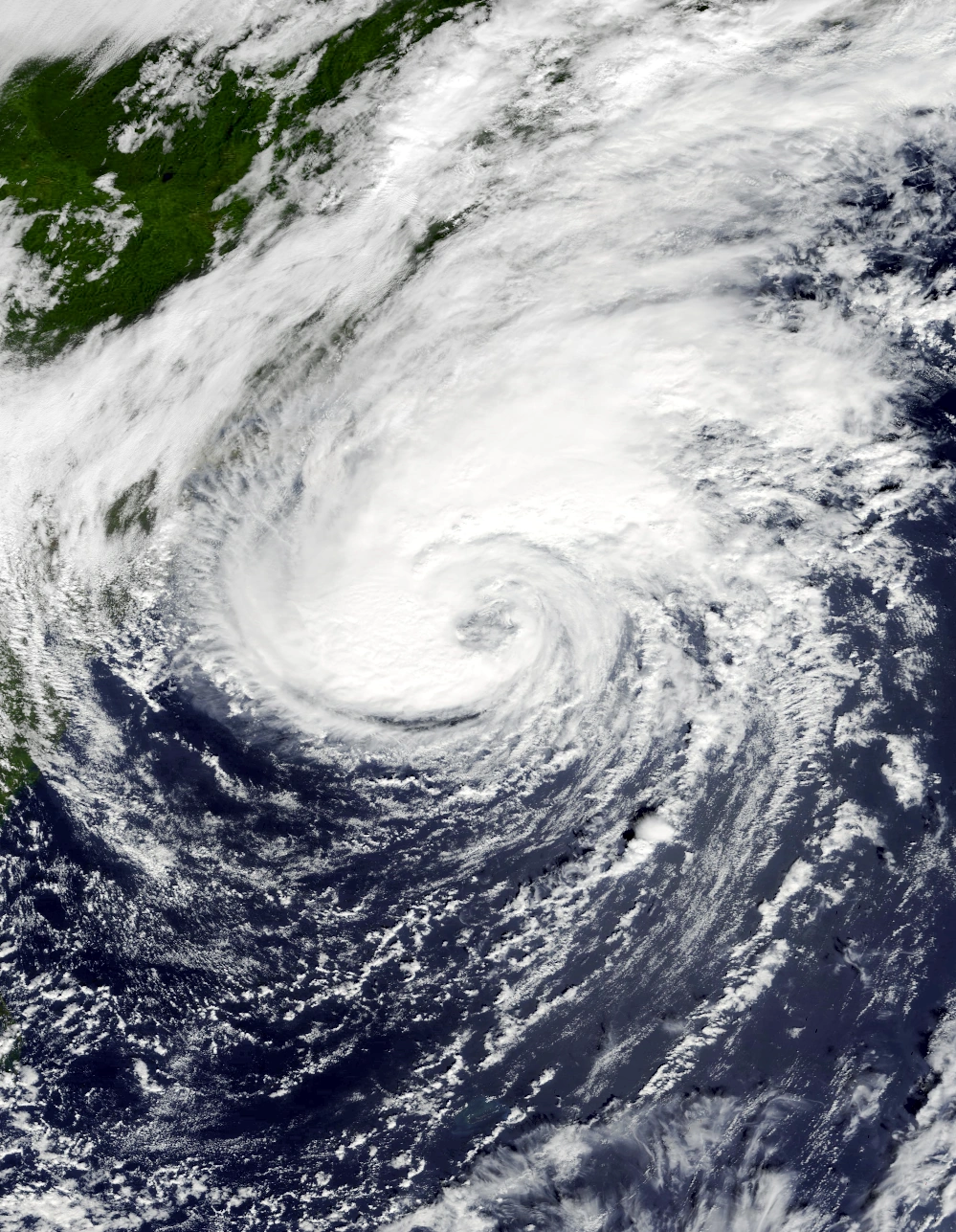
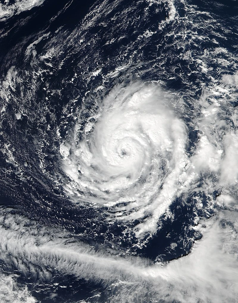
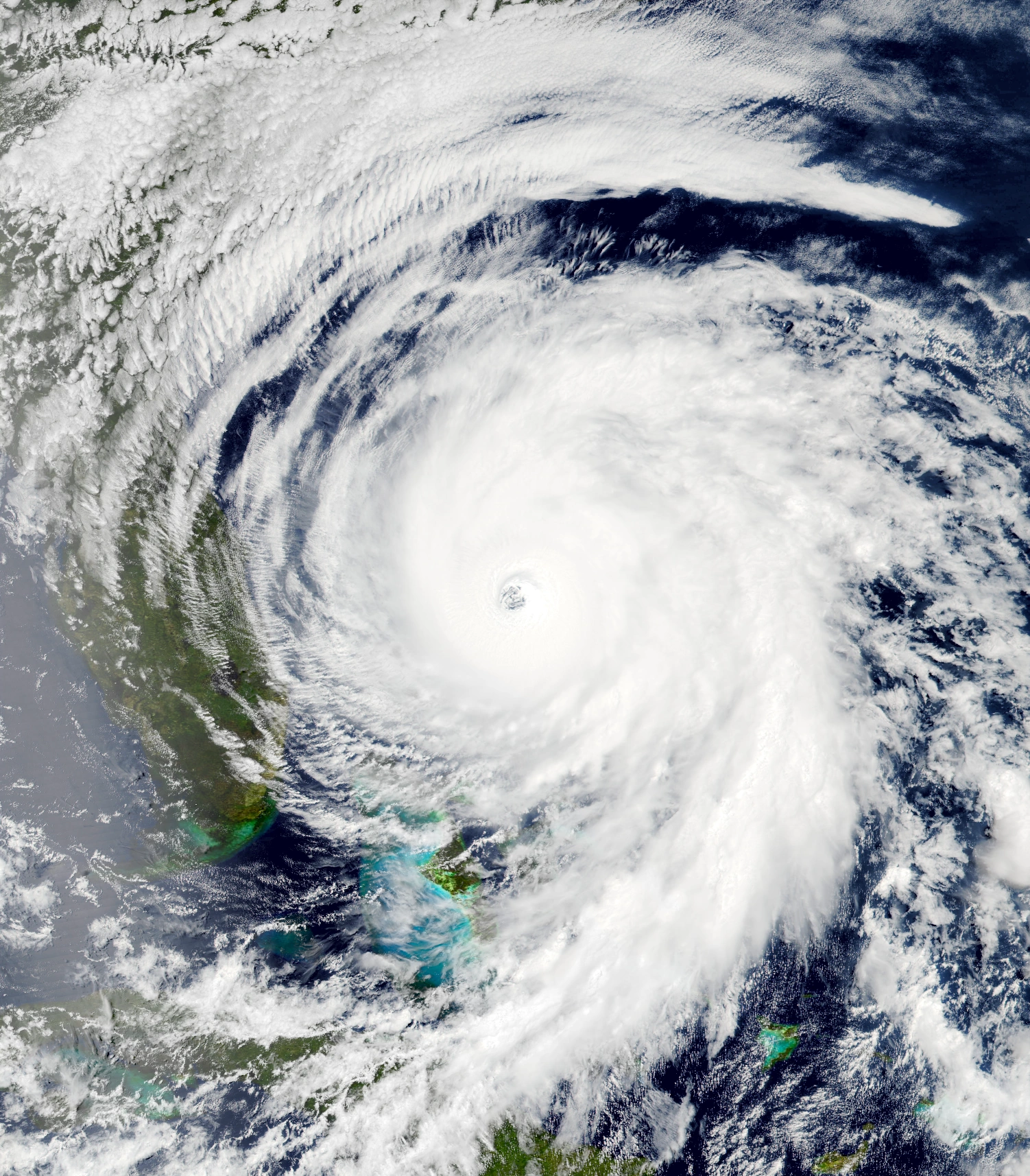
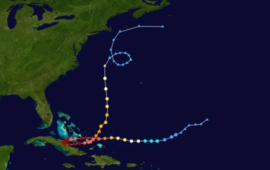
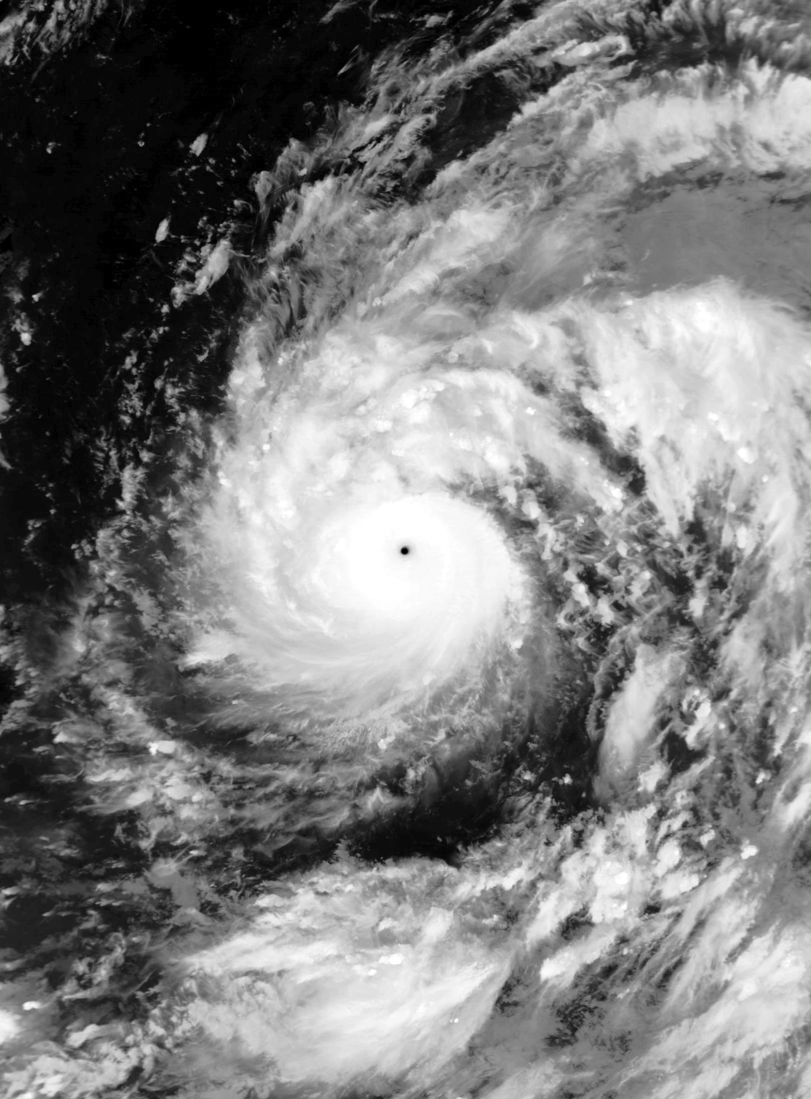
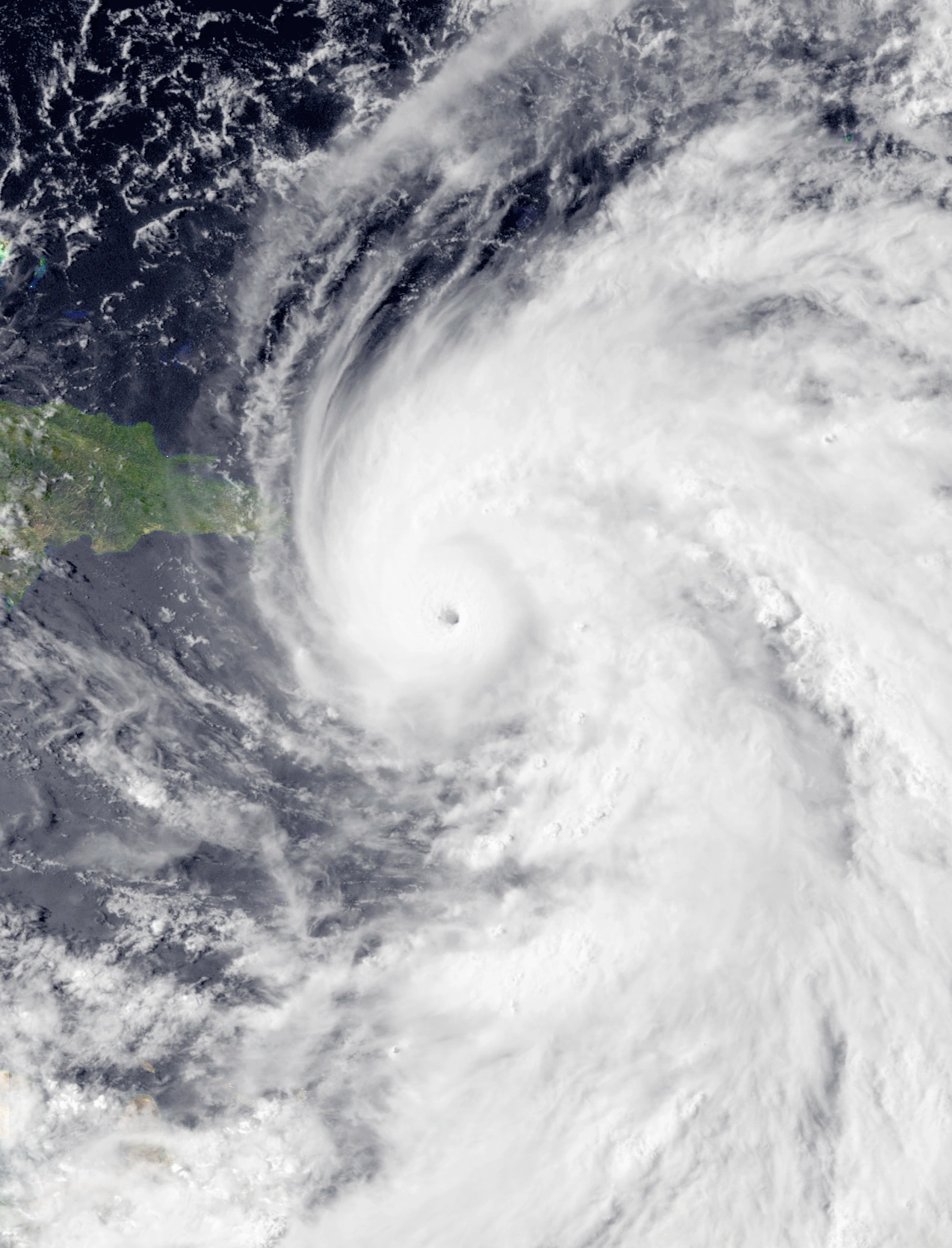
Hurricane Jasper[]
| Category 6 hurricane (SSHWS) | |
|---|---|
 | |
| Duration | April 8 – April 17 |
| Peak intensity | 205 mph (330 km/h) (1-min) 869 mbar (hPa) |
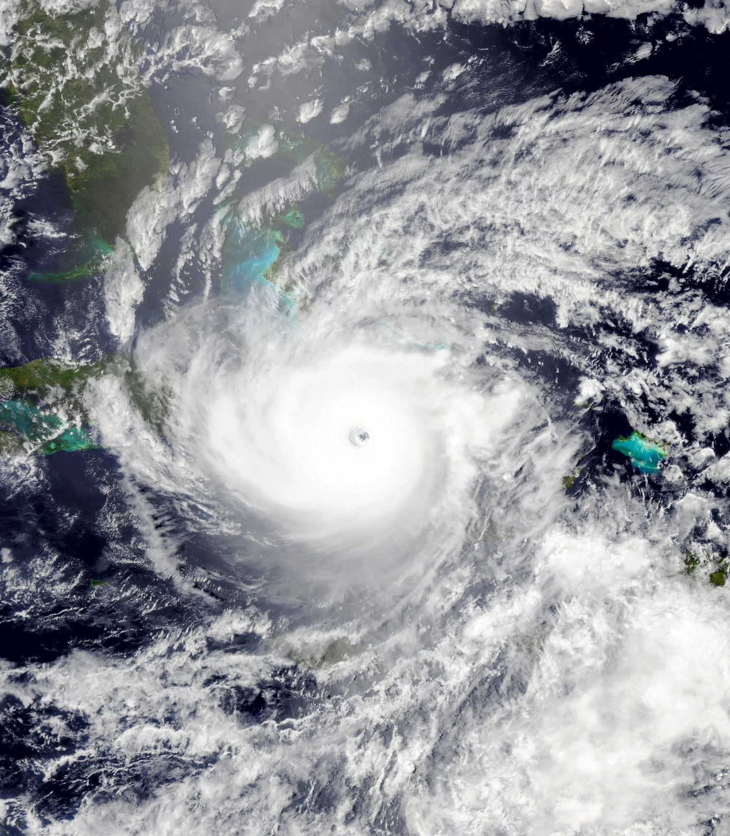
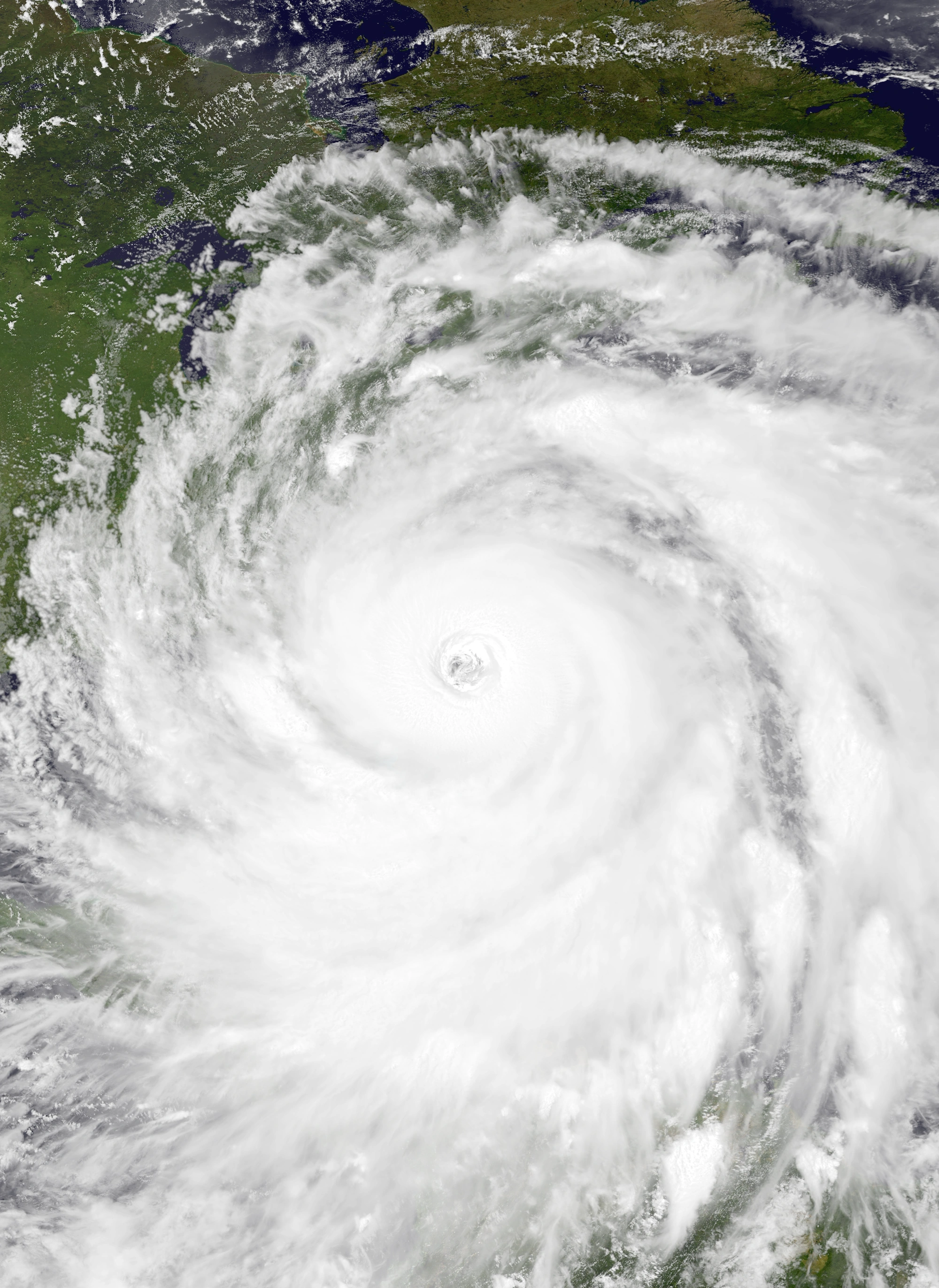
A frontal low pressure system was noted several hundred miles northeast of Puerto Rico on April 6. As it was steered west-southwest by the Bermuda High, it began to separate from its cold front while developing characteristics reminiscent of a tropical cyclone, attracting attention from the NHC. Eventually, the low developed enough to be designated Tropical Depression Twelve at 03:00 UTC on April 8. Continuing its path westward, the depression slowly intensified, becoming a tropical storm at 22:00 UTC the same day and receiving the name Jasper. As more and more convection developed and wrapped around a tight, well-developed central dense overcast, Jasper strengthened into a hurricane at 12:00 UTC on April 9, though an eye had yet to develop at the time. This changed early the following day, when a pinhole eye began to appear as the storm began rapidly intensifying on its approach to the Turks and Caicos Islands and the southern Bahamas thanks to very warm ocean waters and unusually low wind shear for the time of the year. Jasper attained Category 3 major hurricane status at 15:00 UTC on April 10 and further became a Category 5 at 02:00 UTC on the 11th. At 11:00 UTC that day, Jasper's winds exceeded 195 mph (315 km/h), making it the first tropical cyclone to ever be designated a Category 6 since the new categories were first invented at the beginning of the year. Afterwards, Jasper began to weaken slightly as an eyewall replacement cycle began to commence; while it did so, it passed within a few miles of Crooked Island, Bahamas. At 04:00 UTC on April 12, Jasper weakened back into a Category 5 for a short time due to said eyewall replacement cycle, but then re-strengthened back into a Category 6 at 13:00 UTC that day when the storm completed creating a new eyewall and became an annular hurricane. Just after midnight on April 13, Jasper made landfall on Cayo Romano at its peak intensity of 205 mph and 869 mbar - these readings made Jasper the strongest and most intense tropical cyclone ever recorded in the Atlantic Basin, though its record would be beaten by Hypercane Nicholas and other storms later in the year. The appearance of a trough to the west caused Jasper to begin making a narrow turn to the east, all while remaining a powerful Category 6 thanks to a brown ocean effect. Late on April 13, Jasper finally exited Cuba and began curving north into cooler waters, where it began to weaken. Jasper lost Category 6 status at 14:00 UTC on April 14, major hurricane status at 01:00 UTC on April 16, and hurricane status at 19:00 UTC that same day all while the storm's eye collapsed and its appearance on satellite became degraded and distorted thanks to wind shear. At 18:00 UTC on April 17, the NHC downgraded Jasper into a post-tropical cyclone while at Category 1 strength. Jasper's remnant continued to meander off the coast of the northeastern United States before being absorbed into a larger system on April 21.
Jasper was the worst hurricane to ever hit Cuba due to its extreme wind gusts, record amount of rainfall, and slow movement. Despite the storm's relatively small size, numerous areas on the island sustained major damage from Jasper. EF5 tornado-force winds as well as a 30-foot storm surge that penetrated up to 2.1 miles inland caused an estimated 400,000 structures on the island to become damaged or destroyed, with economic losses totaling $79 billion USD. 5,935 people died in Cuba during the storm, making Jasper one of the deadliest tropical cyclones as well. In addition, during landfall, Jasper dumped over 2,000 millimeters of rain, making it one of the wettest tropical cyclones. Federal aid was sent to Cuba in order to assist recovery efforts after the storm, with many nurses and other recovery personnel attending to the thousands affected by Jasper. Similar damage occurred in the Turks and Caicos Islands and other islands in the Bahamas, with every single man-made structure being destroyed on some islands. Not even the larger high-rise buildings remained standing following Jasper. Large 30-foot waves produced by the storm not only inundated many communities already damaged by winds, but radically altered beaches and shorelines. Thankfully, prompt evacuations kept the death toll in these islands low, but property damage was very high and was estimated to take years to repair (this was lengthened even more when even stronger storms formed and hit). Swells and rip currents were produced all over the east coast of the United States and Canada which killed 6. In total, Jasper caused 5,984 fatalities and $81 billion in damages.
Hurricane Kate[]
| Category 3 hurricane (SSHWS) | |
|---|---|
  | |
| Duration | April 10 – April 12 |
| Peak intensity | 115 mph (185 km/h) (1-min) 964 mbar (hPa) |
On April 8, the NHC noted an extratropical cyclone northwest of the Azores for possible tropical development. Due to very unfavorable conditions, its chances of becoming a tropical cyclone were very slim. As the cyclone gained gale-force winds on the 9th and approached the Iberian Peninsula, development chances increased slightly, though they still remained low. Most forecast models predicted the cyclone to soon dissipate without any further development. However, at 16:00 UTC on April 10, a small convective vortex formed within the system, which was deemed a subtropical storm and was named Kate. Just hours later, Kate began rapidly intensifying and became a hurricane as an eye began to form. The storm continued to quickly strengthen and develop bursts of deep convection in spite of hostile environmental conditions, eventually reaching its peak intensity of 115 mph and 964 mbar at 12:00 UTC on April 11. Less than an hour later, the storm made landfall just a few miles away from Lisbon at peak intensity. Over land, dry air became entrapped in Kate's core, and this combined with land interaction caused Kate to explosively weaken. By 09:00 UTC on April 12, Kate had become a remnant low over central Spain and soon merged with a larger system.
Due to the storm's highly unusual nature, Kate caused extensive damage to Portugal and parts of Spain. Due to buildings not being designed to withstand tropical cyclones, the hurricane caused more property damage than what would normally be expected from a cyclone of its strength. Thousands of buildings were flattened, most of which were small homes and businesses but also included a few larger apartments and offices. Wind gusts of over 125 mph battered the coast and inland, creating 17-foot waves and downing numerous trees which disrupted traffic and caused additional property damage. Flooding was widespread and affected hundreds of communities, with at least a hundred thousand homes being inundated in some form. Power went out for a reported 4.2 million customers. In all, Hurricane Kate was responsible for 153 deaths and $5.8 billion in damage costs. The storm was the worst tropical cyclone to affect the Iberian Peninsula and the first major hurricane to do so, but its record would be broken by other storms later in the year.
Tropical Storm Larry[]
| Tropical storm (SSHWS) | |
|---|---|
  | |
| Duration | April 14 – April 16 |
| Peak intensity | 45 mph (70 km/h) (1-min) 1003 mbar (hPa) |
On April 10, a tropical wave emerged from the coast of Africa and merged with a trough on April 13. The merger produced a tropical area of low pressure that was monitored by the NHC for possible development. Though it initially struggled to gain a well-defined central circulation, one eventually developed alongside deep bursts of central convection the next day. At 07:00 UTC on April 14, the NHC declared the formation of Tropical Depression Fourteen. Due to relatively low wind shear and warm sea waters, Fourteen quickly strengthened into Tropical Storm Larry at 12:00 UTC that day. However, an influx of dry air caused Larry to stop strengthening soon after it reached its peak intensity of 45 mph/70 km/h at 21:00 UTC. Early on April 15, Larry lost tropical storm status and was downgraded into a depression as its convection began to rapidly decrease. Soon, Larry was nothing more than a poorly-defined mesoscale circulation surrounded by sporadic, disorganized thunderstorms, though the storm hung on to tropical status for over a day before opening up into a trough at 02:00 UTC on April 16.
Larry's precursor disturbance brought heavy rain of around 2 inches (50 mm) to Cabo Verde. No property damage was reported from the wave.
Hurricane Mindy[]
| Category 5 hurricane (SSHWS) | |
|---|---|
  | |
| Duration | April 22 – April 30 |
| Peak intensity | 175 mph (280 km/h) (1-min) 917 mbar (hPa) |
On April 21, the NHC began tracking an area of low pressure several miles east of the Lesser Antilles. Due to relatively favorable conditions for development, the low slowly gathered its strength. At 11:00 UTC on April 22, the system's central circulation became organized enough to be considered a tropical depression. The newly-formed tropical cyclone then made a turn north due to another low pressure area to its west as it slowly intensified. At 05:00 UTC the following day, the depression strengthened into a tropical storm and was given the name Mindy and at 16:00 UTC the same day, Mindy became a hurricane and began to form an eye. On April 24, Mindy began to stall over the open ocean due to a lack of strong steering factors while maintaining its gradual rate of intensification. The storm continued to stall until April 26, which was when Mindy became a major hurricane and began curving northwest. That same day, Mindy underwent a brief eyewall replacement cycle that caused the storm to gain annular characteristics, with most of its outer bands fizzling out and its eye growing to a size of nearly 30 miles/48 kilometer in diameter. The storm continued to intensify slowly until its eventual peak intensity of 175 mph and 917 mbar at 22:00 UTC on April 28. Afterwards, as the storm entered an area of cooler waters and higher wind shear, it weakened slowly like most annular storms do. At 23:10 UTC on April 29, Mindy, still a Category 4, made landfall on Ocracoke, North Carolina. Thereafter, Mindy rapidly weakened over land as it began to curve northeast. Less than 24 hours after making landfall, Mindy became extratropical over the Delaware Bay while a hurricane.
A state of emergency was declared in North Carolina in anticipation of the powerful storm, with the governor of the state forcing over 1.4 million people to evacuate - one of the largest mass evacuations in history. Despite this, Mindy still had a severe impact on North Carolina, with $35 billion in economic losses and 79 deaths in the state as a result of the hurricane. Torrential rainfall and a high storm surge of over 20 feet led to beach erosion and flooding, with around 37,000 homes being inundated by floodwaters and damaged, numerous coastal structures such as boardwalks and piers being damaged or destroyed, and hundreds of communities becoming isolated. Many small boats broke their moorings and were sent loose, with some settling on land or crushing homes. Power was lost for more than 6.7 million households. Agricultural losses also occurred, with over ten thousand acres of crops being lost to flooding and thousands of livestock being killed. Damage in North Carolina overall was the worst since Hurricane Florence in 2018. Mindy also caused severe flooding further north. Virginia, Maryland, and Delaware all received major flooding and wind damage, with a combined total of 22,314 buildings being flooded and 7,819 instances of wind damage being reported. In total, Mindy caused $37.2 billion in economic losses and 85 deaths.
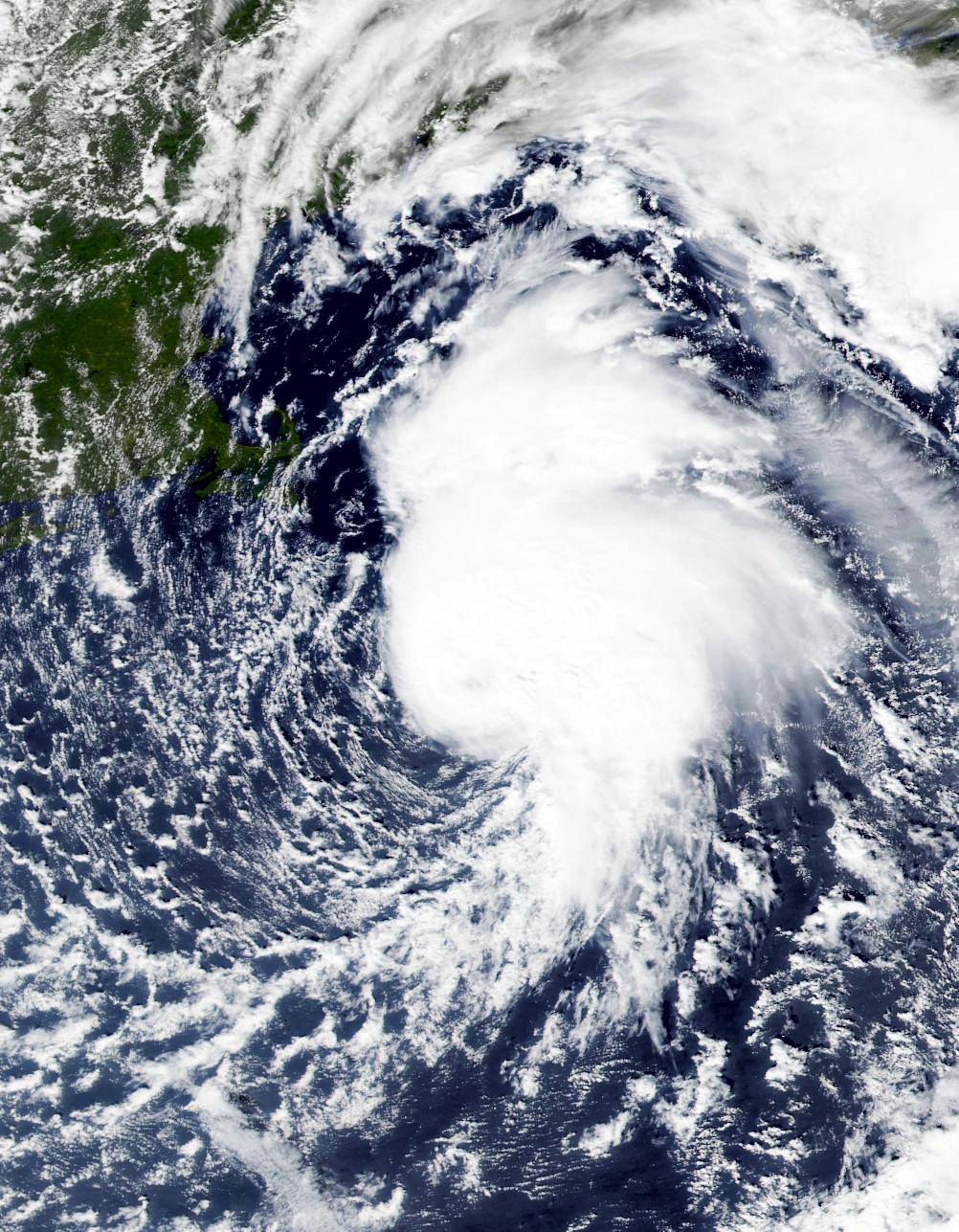
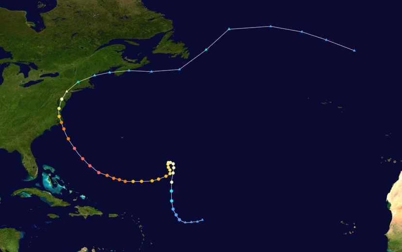
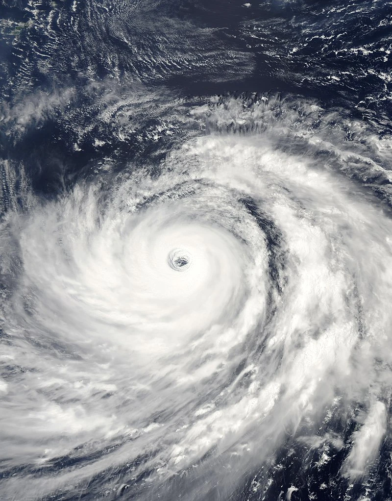
Hypercane Nicholas[]
| Hypercane (SSHWS) | |
|---|---|
 | |
| Duration | May 1 – June 1 |
| Peak intensity | 315 mph (505 km/h) (1-min) 782 mbar (hPa) |
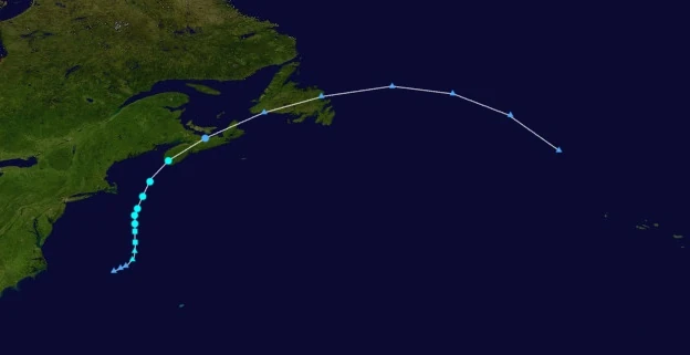
On April 27, a tropical wave moved west off of Cabo Verde and quickly began to develop its own area of low pressure. Its convection and central low-level circulation then gradually organized until they became defined enough to be designated Tropical Depression Sixteen at 03:00 UTC on May 1. The depression continued to move west while slowly intensifying like most Cabo Verde-type storms do. Though moderate wind shear was present, Sixteen managed to keep its circulation covered by a small CDO and gained tropical storm-force winds at 05:00 UTC on May 2. The newly-named Tropical Storm Nicholas then became a hurricane at 01:00 UTC on May 3 as it developed an eye and as its movement shifted slightly to the northwest due to an anticyclone. After becoming a major hurricane at 21:00 UTC on May 5 a few dozen miles northeast of the Leeward Islands, Nicholas began to rapidly intensify due to an uptick in water temperatures and the dissipation of the moderate wind shear mentioned prior. Early on May 7, Nicholas, now with a pinhole eye and excellent outflow, achieved Category 5 strength just north of Puerto Rico. At 13:00 UTC the same day, the storm became a Category 6 hurricane, the second of the season, before making landfall on the Dominican Republic with winds of 195 mph (315 km/h) just before midnight. After landfall, the mountainous terrain of Hispaniola combined with an eyewall replacement cycle caused much of Nicholas' convection to dissipate and the system to weaken into a mere Category 4 hurricane upon re-entering open waters. However, persistent favorable conditions caused Nicholas to re-strengthen into a Category 5 just before hitting Port Antonio, Jamaica at 05:25 UTC on May 9. Nicholas did not lose Category 5 strength at any point during its landfall and went on to become a Category 6 again at 15:00 UTC that day after emerging back into the Caribbean. Another phase of rapid intensification occurred the next day as the storm approached the Yucatan; it became the first recorded Category 7 hurricane at 02:00 UTC on May 10 while its pressure dropped to 862 mbar, making Nicholas surpass Jasper as the most powerful tropical cyclone ever recorded at the time. However, the hurricane would go on to strengthen even further into a 275 mph Category 9 hurricane right before its landfall on Quintana Roo at 05:10 UTC on May 11. Over the Yucatan, Nicholas weakened into a Category 8 hurricane, but quickly regained Category 9 strength upon entering the infamously warm Gulf of Mexico early on May 12. That same day, Nicholas began rapidly intensifying yet again and became the first ever Category 10 hurricane by noon. Soon, at 14:00 UTC on May 13, Nicholas reached its record-breaking peak intensity of 315 mph (505 km/h) and 782 millibars, making it the first hypercane ever recorded, while located just a few miles off the coast of Laguna Madre, Mexico. Nicholas was also over 2,000 miles (3218 kilometers) in diameter at peak, making it the largest tropical cyclone on record, though it would later be beaten by Sam and then numerous other storms later in the year. Over the next few days, Nicholas paralleled the coasts of northern Mexico and Texas while weakening slowly due to a brown ocean effect. It was not until 06:00 UTC on May 14 that Nicholas weakened below hypercane status. Eventually, Nicholas began to be steered east by an extratropical cyclone to the north on May 15. At 17:00 UTC on May 16, the storm weakened into a Category 7 due to a slight increase in wind shear, but quickly re-intensified into not only a Category 8, but a Category 9 at exactly 11:00 UTC on May 17. Upon exiting Florida later that day, Nicholas began to move north while slowly succumbing to cooler waters. With its convection waning and becoming misplaced, Nicholas lost extreme hurricane status at 10:00 UTC on May 20. Very early on May 22, Nicholas, now a mere Category 3 hurricane, made landfall on Long Island before becoming extratropical at 16:00 UTC that day.
Nicholas' remnant moved over the open Atlantic for several days without any notable changes. However, at 05:00 UTC on May 29, the remnants had reportedly reorganized into a subtropical cyclone in the waters between the Azores and the Iberian Peninsula, prompting the NHC to resume advisories on Nicholas. Nicholas became fully tropical by 12:00 UTC that day and further intensified into a hurricane early on May 30. At 18:00 UTC that day, the storm reached its final peak intensity of 120 mph and 967 mbar before hitting Portugal at peak intensity, making 2027 the first recorded year where two tropical cyclones impacted Europe while tropical. Afterwards, wind shear, land interaction, and dry air tore apart the system and caused it to rapidly weaken. Nicholas merged with a frontal system at 07:00 UTC on June 1 over western Spain.
Nicholas was by far the most devastating tropical cyclone ever recorded at the time, with its EF5-force winds and tsunami-like storm surge causing cataclysmic destruction all across the Atlantic basin. Dozens of millions of people evacuated in anticipation of Nicholas, but the storm still caused an inconceivably high loss of life - a total of 1,354,978 people died in the United States alone, with 925,634 deaths in Mexico, 10,266 deaths in Jamaica, 6,488 deaths in Hispaniola, 4,592 deaths in Portugal, 2,763 deaths in Cuba, 942 deaths in Puerto Rico, and 315 deaths in Canada, becoming the deadliest tropical cyclone ever recorded, though it would be surpassed by several other storms of the same year. In addition, Nicholas wrought havoc on the economies of the countries it affected, with total economic losses adding up to 1.9 trillion (2020 USD), making it the costliest cyclone, though this record, too, would be broken later on. The areas unfortunate enough to experience Nicholas's violent winds and flooding were completely flattened, with even the sturdiest skyscrapers being uplifted and torn into smithereens. Many coastlines were permanently altered by Nicholas, with entire cities being put totally underwater for a time. The President of the U.S, who personally visited the affected areas, described the damage as "apocalyptic" and "like something out of the extinction of the dinosaurs". Even the White House itself was not immune to the effects of the storm, with hurricane-force winds being recorded in Washington D.C. Many famous landmarks were destroyed by the biblical strength of the storm; Universal Studios in Orlando, Florida was completely swept clean along with the rest of the whole state due to sustained winds as fast as an EF5 tornado. In New York City, where Nicholas made landfall as a Category 3, the Statue of Liberty was toppled by an immense storm surge, the vegetation in Central park was all wiped clean, the subway stations and tunnels became underwater rivers due to a 12 foot storm surge, and the Empire State Building, Chrysler Building, and the World Trade Center buildings all sustained major structural damage. Nearly every wealthy nation in the world offered some form of aid to the countries affected, sending in rescue personnel, nurses, and money. Furthermore, Nicholas's storm clouds reached all the way up to the stratosphere, which had catastrophic effects on the ozone layer. This led to an increase in cancer cases across North and South America, which claimed an estimated 3.57 million lives which counted towards indirect deaths. Overall, Nicholas is remembered as one of the most cataclysmic natural disasters to have ever occurred on Planet Earth, though it would come to pale in comparison to even stronger hypercanes later in the season.
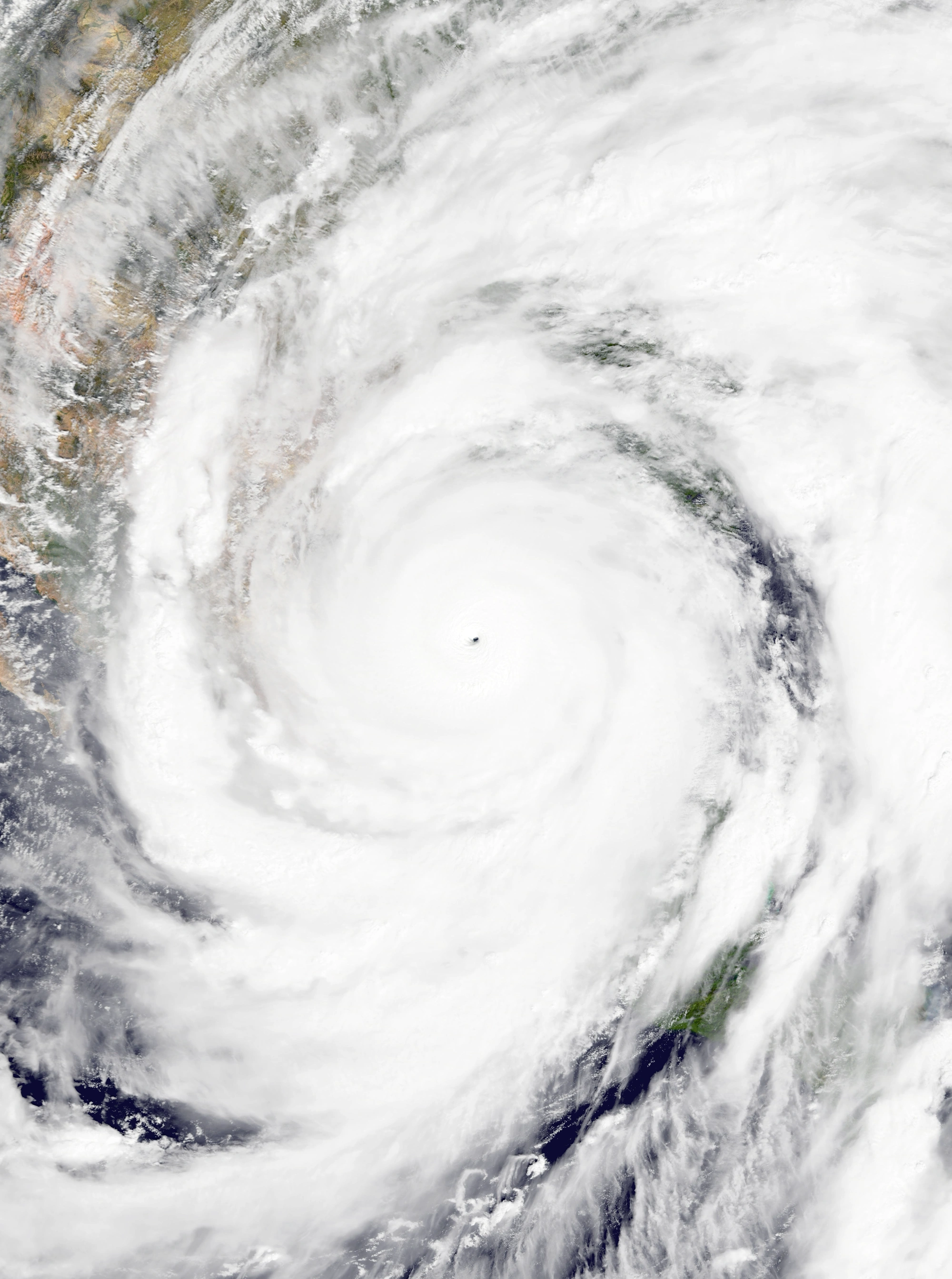
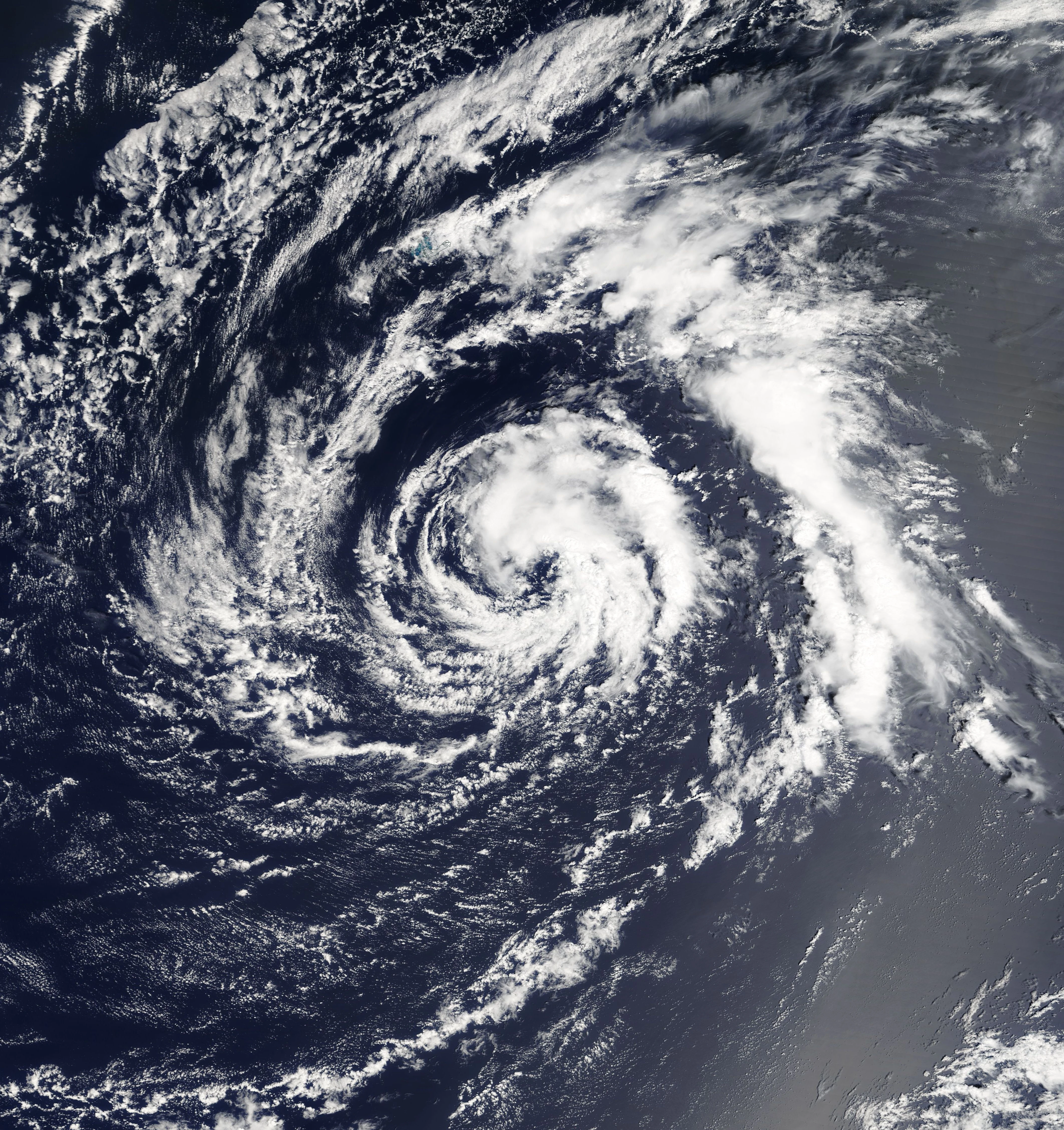
Hurricane Octavia[]
| Category 7 hurricane (SSHWS) | |
|---|---|
 | |
| Duration | May 21 – May 29 |
| Peak intensity | 240 mph (385 km/h) (1-min) 849 mbar (hPa) |
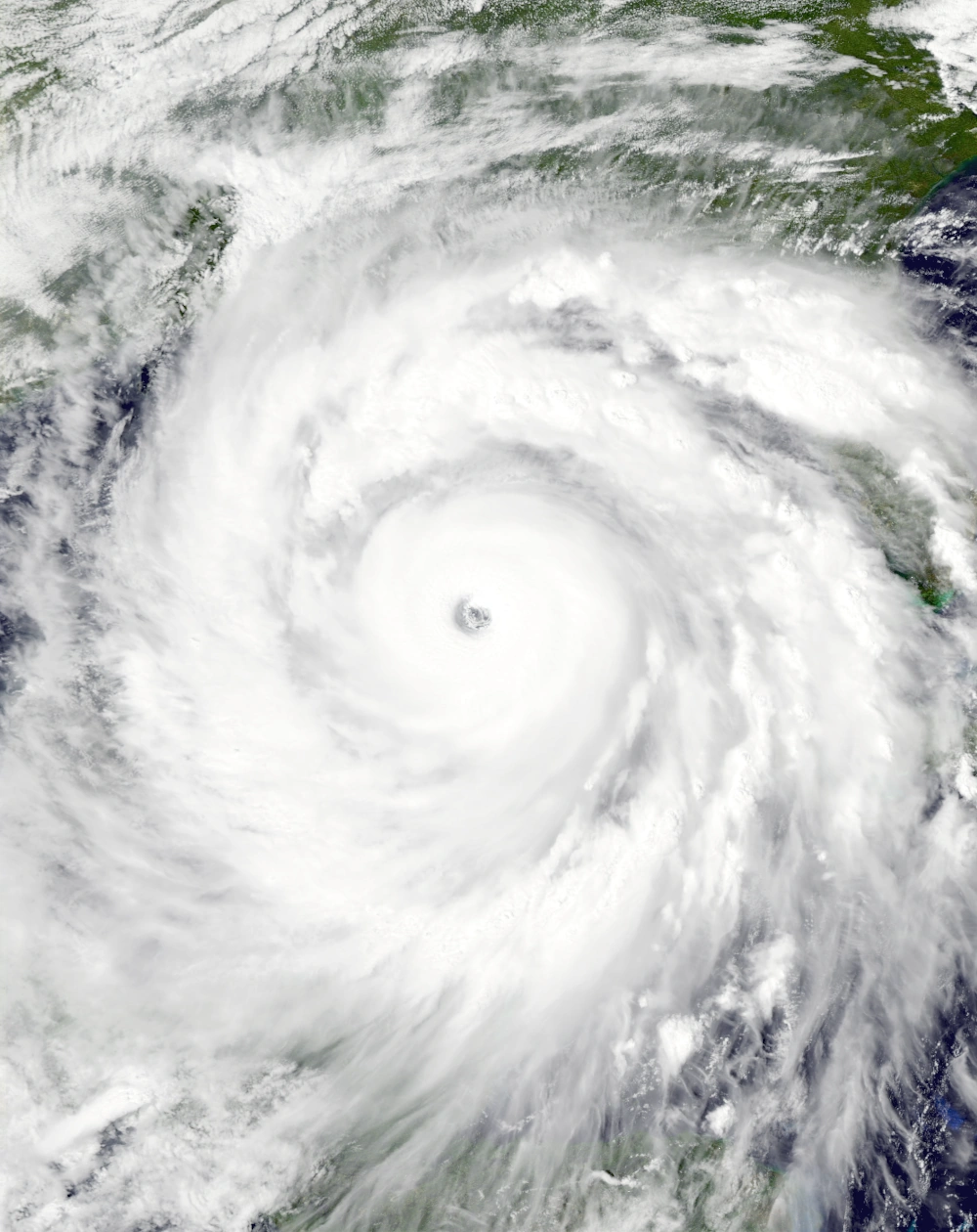
On May 16, a tropical wave emerged from Africa and began moving westward like most tropical cyclones do. Due to a cold wake left by Hypercane Nicholas, the wave struggled to develop any form of convection or central circulation. Significant organization did not occur until May 21 while located south of the Dominican Republic, when more favorable conditions allowed the low to begin forming thunderstorms. At 16:00 UTC that day, the NHC upgraded the wave into a tropical wave and designated it Seventeen. At 09:00 UTC the following day, a recon flight found sustained winds of over 40 mph (65 km/h), prompting an upgrade to tropical storm status and the assignment of the name Octavia. Octavia was the first of three storms that formed on the same day and intensified to similar intensities at peak. Shifting northward due to a small high pressure area to its east, Octavia reached hurricane status at 22:00 UTC that day. On May 23, the storm passed within a few miles of the Tiburon Peninsula, but did not make a true landfall as it continued to slowly strengthen. At 17:00 UTC that day, Octavia reached an initial peak intensity of 100 mph and 972 mbar, but soon weakened back into a Category 1 due to interference from the nearby islands of Hispaniola and Cuba. However, it soon strengthened back into a Category 2 on the 24th after another near miss in southeastern Cuba and a shift in motion to the west. Rapid intensification began on May 25 when Octavia began to curve northwest and passed through very warm waters untouched by Nicholas. The storm intensified into a major hurricane at 10:00 UTC and developed a well-defined eye. Octavia then further reached extreme hurricane status at 06:00 UTC on May 26 as the storm began rapidly growing in size. At 18:00 UTC that day, Octavia reached peak strength and carried winds of 240 mph (385 km/h), a strong Category 7. Octavia held Category 7 status for three advisories as it approached Louisiana before beginning to weaken thanks to Nicholas' cold wake, becoming a Category 6 on May 27. At 22:00 UTC that same day, Octavia hit the parish of Terrebonne, LA with winds of 200 mph before rapidly weakening over land. By 08:00 UTC on May 29, the NHC had downgraded the system to a remnant low over northern Alabama.
Octavia's economic loss and fatality totals were not very high for a storm of such strength due to Nicholas already impacting the areas it affected, but the storm was still proved to be a devastating blow. Recovery efforts post-Nicholas had to be halted in Haiti, Jamaica, Cuba, the Yucatan, and Louisiana due to the threat of Octavia. Those occupying temporary hospitals and shelters were forced to quickly relocate in order to escape the powerful storm; some even died on the way, leading to an indirect death toll of 67. Recovery personnel such as rescue workers and nurses also had to evacuate, unfortunately leaving many people trapped in rubble left by Nicholas left to die. Many buildings which had survived Nicholas' powerful winds and storm surge were destroyed by Octavia while numerous rivers re-flooded. As all of the areas affected by Octavia were all in a roughly equal state after Hypercane Nicholas, damage did not vary much between affected places. In all, Octavia was responsible for $91 billion in damages and 3,170 direct deaths.
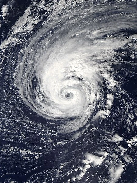
Hurricane Peter[]
| Category 7 hurricane (SSHWS) | |
|---|---|
  | |
| Duration | May 21 – May 27 |
| Peak intensity | 230 mph (370 km/h) (1-min) 833 mbar (hPa) |
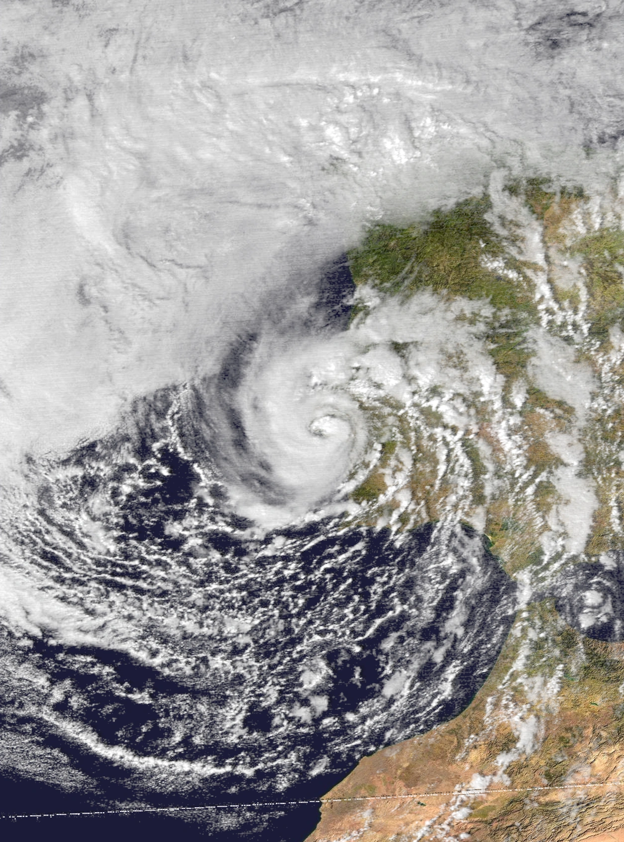
On May 20, the NHC began monitoring a tropical wave situated in the open Atlantic for possible development. Thanks to favorable conditions, the disturbance quickly developed a closed central circulation and was designated Tropical Depression Eighteen at 17:00 UTC on May 21, just an hour after the system that would become Octavia was upgraded as well. Because the area Eighteen formed in was untouched by Nicholas, it steadily intensified and eventually became Tropical Storm Peter at 11:00 UTC on May 22. Moving in a generally west direction, Peter further intensified into a hurricane at 18:00 UTC that day while intermittent bursts of convection appeared on satellite. The storm eventually reached an initial peak intensity of 115 mph, a minimal Category 3 hurricane, at 16:00 UTC on May 23 while well away from landmasses. Afterwards, an increase in wind shear and cooler waters caused Peter to begin losing convection as the Bermuda High began steering the storm north. Shortly after peaking, Peter lost major hurricane status and by 23:00 UTC on May 24, it had lost hurricane status altogether and became a tropical storm. With almost no organized convection and a deteriorating circulation, Peter was forecast to dissipate soon after. However, on May 26, Peter passed over an area of extremely high water temperatures near Bermuda caused by the unexpected eruption of Bermuda's undersea volcano, which was thought to be extinct. In just 12 hours, Peter's winds increased by 185 mph (295 km/h) and its pressure dropped by 168 mbar, making it the fastest intensifying tropical cyclone ever recorded, as it rapidly developed exceptionally deep convection and a very well-defined pinhole eye. At exactly noon on the 26th, Peter reached its peak intensity of 230 mph and 833 mbar, a low-end Category 7, just before making landfall directly on Bermuda at peak. Afterwards, the storm quickly weakened due to an eyewall replacement cycle and increasing wind shear. By the end of the 26th, Peter had weakened into a Category 4 hurricane. At 09:00 UTC on May 27, Peter developed a comma-like tail of convection while a Category 3 hurricane and was downgraded into an extratropical low. The remnant eventually was absorbed into a larger system on June 1 north of the Azores.
Bermuda, which had escaped most of the other destructive storms of the season, was the hardest hit area by Peter, as it was completely wiped off of the map when the storm explosively intensified right over the island. A 50-foot storm surge put much of the island underwater for several weeks and permanently changed the island's shape forever due to extreme beach erosion; some survivors claim that they witnessed a huge wave of water, possibly indicating that Peter's intensification was rapid enough for a meteotsunami to form. Every structure on the island was destroyed during the storm and only the highest peaks remained above water. Many people in Bermuda were unprepared for Peter's rapid intensification, leading to the deaths of almost everyone on the island - 62,852 people lost their lives during the storm, nearly 85% of the entire population at the time. Economic losses totaled $5 billion (nearly as much as the entire GDP of the island) and Bermuda became completely uninhabited after the storm. A town called New Bermuda was formed in the United Kingdom by survivors of the storm. A 40-foot tall monument listing the names of everyone who perished during Peter along with a museum displaying surviving objects were built along with the town to commemorate the loss of the island and its inhabitants.
Hurricane Quinn[]
| Category 7 hurricane (SSHWS) | |
|---|---|
  | |
| Duration | May 21 – May 29 |
| Peak intensity | 225 mph (360 km/h) (1-min) 855 mbar (hPa) |
On May 21, the NHC began tracking a near-stationary non-tropical area of low pressure several hundred miles south of the Azores. Due to favorable conditions, the low pressure area shed its weather fronts and became a subtropical cyclone at 18:00 UTC that day, just hours after the formations of Octavia and Peter and becoming the final of three storms to form in the same day. Due to maintaining winds in excess of 50 mph throughout the low's transition, the subtropical storm was immediately Quinn. A lack of steering caused Quinn to meander in the vicinity of the place it formed as it steadily strengthened. At 10:00 UTC on May 22, Quinn became a hurricane as it began making a tight clockwise loop. At 13:00 UTC the next day, Quinn became a major hurricane, with a large eye and well-developed spiral rainbands becoming apparent on radar. Exiting the loop and moving southward, the storm achieved Category 5 status at 16:00 UTC on May 24 and further became a Category 6 at 19:00 UTC that day, becoming the first extreme hurricane to form out of an extratropical cyclone. After turning east, Quinn reached peak winds of 225 mph (360 km/h) on May 25 at 15:00 UTC while still south of the Azores. At peak, the storm also maintained the large eye it had developed while a major hurricane, with the NHC estimating its diameter to be at least 40 miles (65 kilometers). Afterwards, Quinn began accelerating northeast due to being carried by the jet stream towards Iberia while undergoing gradual weakening due to progressively cooler waters and drier air, though the storm did briefly re-attain Category 7 status at 10:00 UTC on May 26. After falling below extreme hurricane strength at 18:00 UTC on the 26th, major hurricane status at 22:00 UTC on May 27, hurricane status at 06:00 UTC on May 28, and tropical storm status early on May 29 as Quinn's eye collapsed and its convection became shallow and displaced. At 23:00 UTC that day, Quinn dissipated in the waters between Madeira and Iberia.
Besides some rainfall in the Azores and Madeira, Quinn had no effect on land. One person in Madeira died due to drowning in rip currents produced by the storm.
Hurricane Rose[]
| Category 4 hurricane (SSHWS) | |
|---|---|
 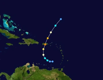 | |
| Duration | May 28 – May 31 |
| Peak intensity | 130 mph (210 km/h) (1-min) 951 mbar (hPa) |
On May 28, a tropical disturbance was detected north of the Paria Peninsula in Venezuela. Due to sufficiently high sea surface temperatures of 87 degrees Fahrenheit (31 degrees Celsius) and low wind shear, the disturbance quickly organized and was designated Tropical Depression Twenty at 20:00 UTC that day. Favorable conditions continued to persist and the depression developed further into a tropical storm at 09:00 UTC on the 29th, receiving the name Rose. At this point, an upper level low to the northwest began steering Rose north towards Puerto Rico. After becoming a hurricane at 22:00 UTC that day, very warm waters of over 90 degrees F (32 degrees C) led to a period of rapid deepening. By 10:00 UTC on May 30, Rose had already become a Category 4 storm with a small, tight CDO and large, well-developed rainbands. Just an hour later, intensification was halted by Rose's landfall on Puerto Rico and later cooler waters left by Hurricane Peter. At 18:00 UTC that day, Rose dipped below major hurricane status and by the beginning of May 31, below hurricane status as its thunderstorms rapidly fizzled out and dissipated. At 13:00 UTC on the 31st, Rose was declared a remnant low.
Rose was a short-lived but powerful storm that caused devastation in Puerto Rico. Though accurate forecasting saved many lives, with several Puerto Ricans evacuating the island prior to the storm hitting land and numerous residences boarding up windows and using sandbags, the storm still caused much damage to the territory. Economic losses amounted to $6 billion and 250 people were killed, with hundreds of structures damaged by high winds and storm surge. Nearly 75% of the island was left without power. Furthermore, the area was still recovering from a close pass by Hurricane Nicholas while it was a Category 5. Several routes to airports on the island were blocked by debris, which hindered evacuation efforts. Luckily, Rose did not stay in the area long and quickly weakened as it hit, which helped mitigate its effects. Heavy rain also fell in northern Venezuela and the Lesser Antilles, though effects there were mostly minimal.
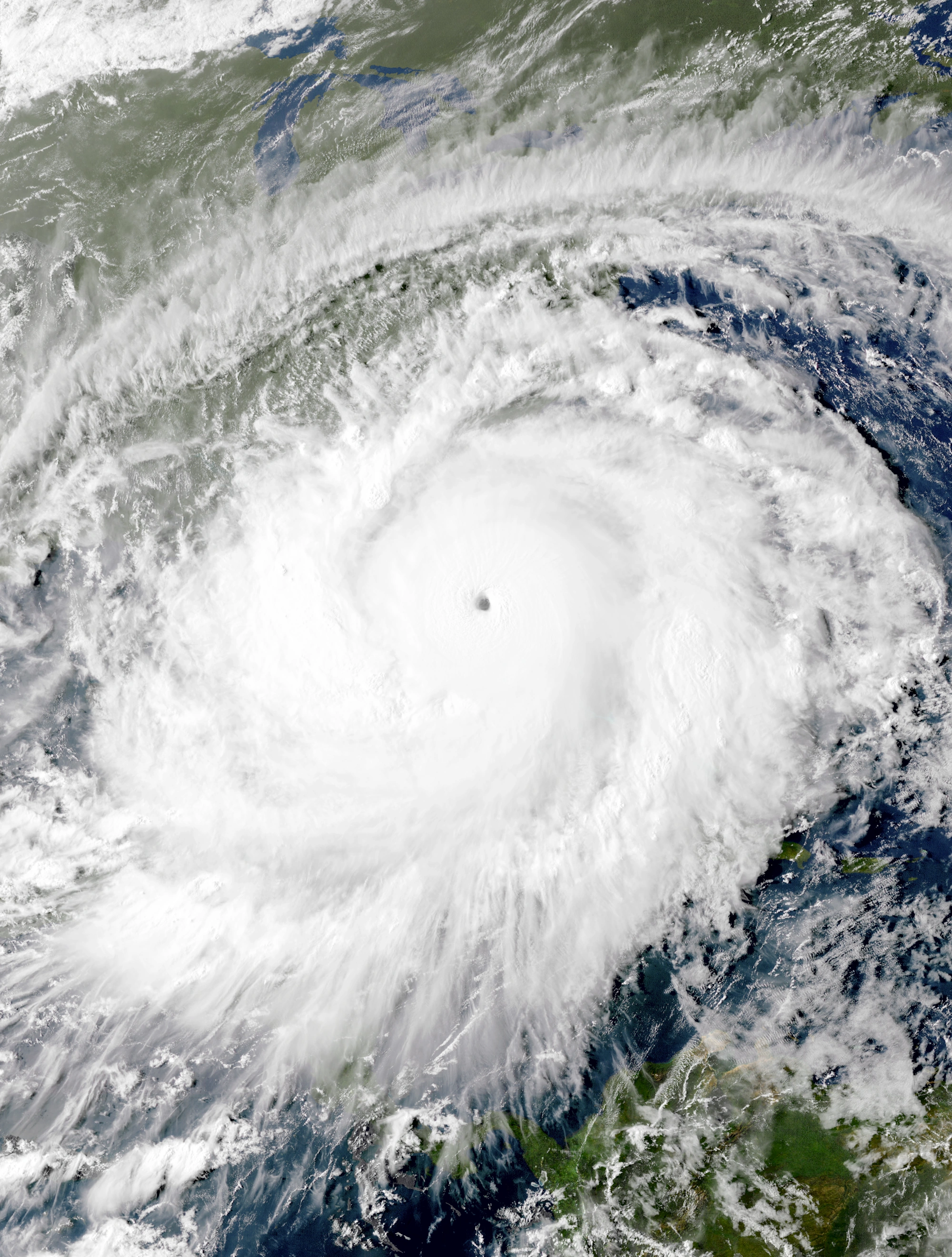
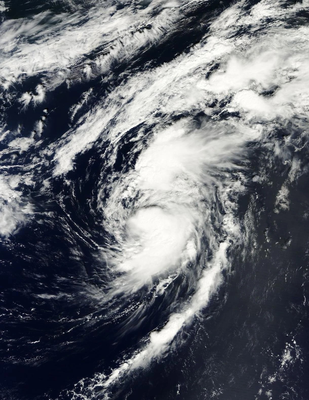
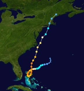
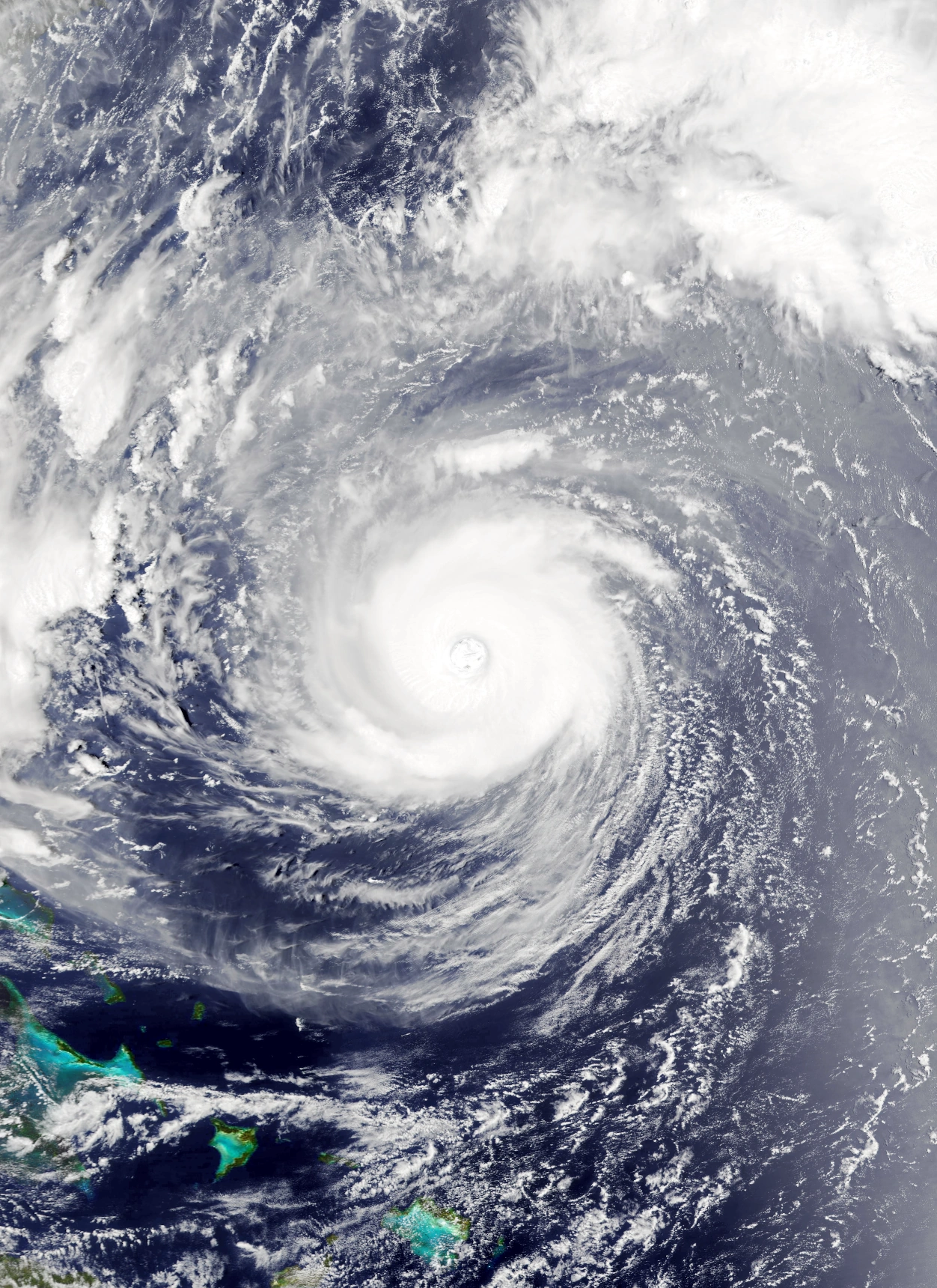
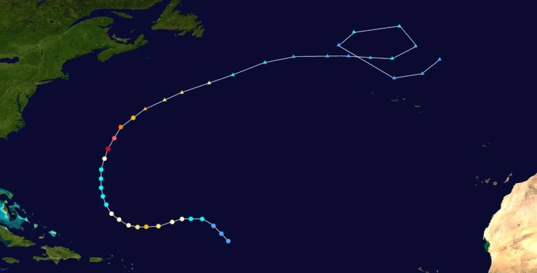
Hurricane Sam[]
| Category 10 hurricane (SSHWS) | |
|---|---|
 | |
| Duration | June 2 – June 12 |
| Peak intensity | 295 mph (475 km/h) (1-min) 792 mbar (hPa) |
On May 25, a tropical wave emerged off the coast of Africa. Cold waters left by other storms prevented the development of any convection as it moved across the open Atlantic. Eventually, thunderstorms began to form as the wave entered the Caribbean Sea. A central surface-level circulation topped by deep convection developed on June 2, leading to its designation as a depression at 16:00 UTC that day. The next day, at 11:00 UTC, the depression developed into Tropical Storm Sam and further strengthened into a hurricane at 21:00 UTC. Afterwards, the combined force of a trough to the northwest and a high-pressure area to the northeast steered Sam north towards Jamaica, where it began to rapidly intensify due to sufficiently warm water temps. By the end of June 4, Sam was already a Category 4 storm on the Saffir-Simpson Scale and had a clear, well-developed. At 08:00 UTC on June 5, Sam intensified into a Category 6, becoming the sixth extreme hurricane of the season. The storm reached its initial peak intensity of 235 mph (380 km/h) at 19:00 UTC that day before hitting Jamaica at 01:00 UTC the following day. Over land, Sam weakened down into a Category 6 and its eye contracted, indicating an eyewall replacement cycle. The hurricane further weakened below extreme hurricane status altogether after a landfall near Pilon, Cuba at 14:00 UTC on June 6. However, the warm waters of the Bahamas allowed Sam to re-intensify back into a Category 6 at 00:00 UTC on June 7, and it continued to intensify while also rapidly growing in size. At 15:00 UTC on June 8, Sam reached its true peak intensity of 295 mph (475 km/h) and 792 mbar, a Category 10 hurricane, while also being over 3,000 miles (4328 kilometers) in diameter. This made it the largest hurricane ever recorded, a record which would not be beaten until the formation of Collin at the end of the year. Sam also sported a very large eye nearly as wide as the Florida Peninsula. After peaking, Sam gradually weakened, but still maintained its enormous gale wind diameter. The storm weakened below extreme hurricane status at 06:00 UTC on June 11 while beginning to turn towards New York. Soon enough, Sam hit the state at 18:50 UTC on June 12 as a Category 3 hurricane. A few hours later, Sam transitioned into a post-tropical cyclone and later an extratropical cyclone, causing advisories to end.
Sam was responsible for one of the worst flooding catastrophes ever recorded due to its extremely large size and slow forward motion. Rainfall and storm surge affected many areas including the Eastern United States several days before landfall, with 40 inches of rain and hurricane-force winds being recorded in parts of North Carolina, Virginia, Delaware, and other nearby states even though they were several hundreds of miles away from anywhere Sam hit. Thousands of mudslides and flash floods were reported in the U.S, with flooding being so widespread that on June 12, half of all states in the continental United States had flood alerts issued by the National Weather Service in some form. Nearly a billion structures were inundated in some form while 68 million people lost power. Furthermore, Sam hindered recovery efforts after previous storms even more, with re-flooded rivers and streams forcing recovery personnel to evacuate and injured people to relocate to other hospitals. Sam also caused heavy rain in northern Venezuela, northern Colombia, Jamaica, Cuba, and the Bahamas while inflicting powerful 200+ mph sustained winds in Jamaica, Cuba, and the Bahamas, leading to the destruction of several thousand more structures. Overall, Sam's flooding led to a dramatic loss of life and property, with economic losses totaling $950 billion and fatalities numbering 276,300, making the extremely large tropical cyclone one of the costliest and deadliest hurricanes ever recorded.
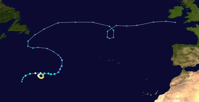
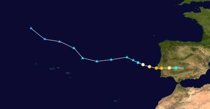
Hurricane Teresa[]
| Category 5 hurricane (SSHWS) | |
|---|---|
  | |
| Duration | June 4 – June 14 |
| Peak intensity | 160 mph (255 km/h) (1-min) 927 mbar (hPa) |
On June 2, the NHC first noted the possibility of the development of a subtropical cyclone out of a gale-force extratropical cyclone situated over the Azores. Over the next few days, the cyclone moved south, where dry air from the Sahara Desert lowered the chance of any development. However, late on June 3, the system unexpectedly began developing central convections, a low-level circulation reminiscent of that of a tropical cyclone, and began shedding its weather fronts. At 04:00 UTC the next day, the system was formally designated as Subtropical Storm Teresa. Despite the continual presence of dry air, Teresa managed to become a fully tropical storm at 15:00 UTC and a hurricane at 20:00 UTC. At 12:00 UTC on June 5, the small storm became a major hurricane and later reached an initial peak of 120 mph as it began moving north. Afterwards, dry air finally began affecting the storm, with Teresa losing major hurricane status early on June 6 as its convection quickly dissipated. Teresa further weakened into a Category 1 at 11:00 UTC on the 7th while turning southwest, though it soon re-strengthened back into a Category 2 and started to regain its convection at 07:00 UTC the next as it began executing a small cyclonic loop. At 14:00 UTC on June 9, Teresa became a major hurricane again before exiting the loop and beginning to move along the jet stream towards western Europe. Though intensification continued to be slow due to aforementioned dry air, the storm attained Category 4 strength at 09:00 UTC on June 11 and Category 5 status at 00:00 UTC on June 12. That day, at 13:00 UTC, Teresa rapidly intensified into a peak of 160 mph (255 km/h) and 927 millibars while a few dozen miles north of Madeira, breaking Hurricane Lorenzo of 2019's record of the easternmost Category 5 on record (though Teresa's record would itself be broken later in the year). Due to an eyewall replacement cycle and another onset of dry air, Teresa weakened back into a Category 4 later that day. However, the storm did not weaken further and made landfall on Doñana National Park in Southern Spain at 22:00 UTC on June 13 as a high-end Category 4 storm, breaking Kate and Nicholas' records for strongest hurricane to hit Iberia. After landfall, Teresa explosively weakened over land. By June 14, the storm had lost all convection and its leftover low merged with a large extratropical cyclone.
Teresa brought heavy rain to the Canary Islands and Madeira, leading to isolated flooding and high winds which caused moderate property damage. However, the worst damage occurred in the Iberian Peninsula. With Teresa's landfall in southern Spain, 2027 became the only recorded year with three tropical cyclones making landfall on Europe and the strongest to do so at the time, though later storms would break its record. On account of its unusual landfall location as well as the fact that the area was still recovering from Nicholas and Kate, Teresa caused immense devastation in Portugal and Spain, with economic losses amounting to $105 billion (2027 USD) and 1,670 total fatalities. More than 90,000 structures were damaged and 120,000 people were left without power, with over 12,000 Europeans being left homeless by the storm. In addition to recovery efforts post-Kate and post-Nicholas being disrupted, fresh destruction occurred in southern Spain, which was largely left unaffected by the two previous Europe hurricanes. Furthermore, the storm's landfall on a nature reserve caused the destruction of many habitats including that of the endangered Iberian Lynx.
Hurricane Ulli[]
| Category 4 hurricane (SSHWS) | |
|---|---|
  | |
| Duration | June 9 – June 10 |
| Peak intensity | 130 mph (210 km/h) (1-min) 960 mbar (hPa) |
The NHC first noted the chance for an area of low pressure to form over the open Atlantic on June 8. Surely enough, a trough soon developed in the predicted location later that day and began to show features of a tropical cyclone. By early on June 9, the once upper-level low had become a surface level circulation and convection had become abundant in the center of the system. It was designated Tropical Depression Twenty-Three at 04:00 UTC that day. Curving north, the presence of almost no wind shear and water temperatures in excess of 90 degrees F (32 degrees C) caused the depression to explosively intensify. Less than an hour after formation, Twenty-Three developed into Tropical Storm Ulli while large bursts of convection formed in and around the system. By the storm's next advisory at 11:00 UTC, Ulli had already become a Category 2 hurricane with a developing eye. Eventually, Ulli peaked at 16:00 UTC on the 9th as a potent Category 4 hurricane with 1-minute sustained winds of 130 mph (210 km/h) and a central surface atmosphere pressure of 960 millibars. After its explosive deepening, an increase in upper-level wind shear, an eyewall replacement cycle, and cooler waters caused the cyclone to weaken just as quickly as it intensified. By just 07:00 UTC the day after, Ulli had already degenerated into a remnant low. The remnants merged with a cold front later that day.
Hurricane Victor[]
| Category 2 hurricane (SSHWS) | |
|---|---|
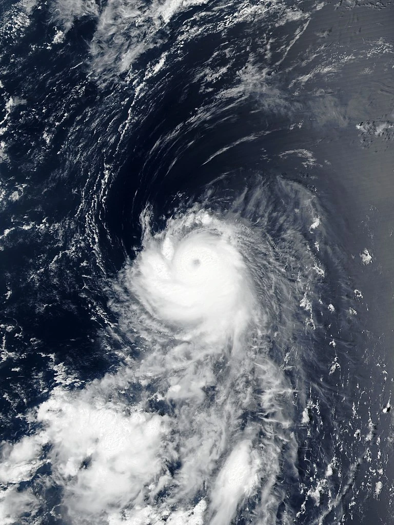 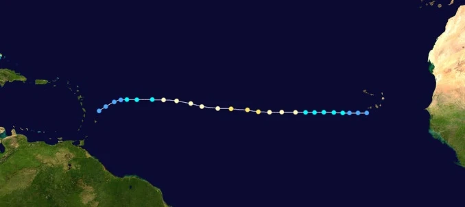 | |
| Duration | June 13 – June 19 |
| Peak intensity | 110 mph (175 km/h) (1-min) 963 mbar (hPa) |
On June 10, the NHC first noted the possibility of a tropical wave emerging off the coast of Africa and developing into a tropical cyclone. Eventually, a wave did move off Cabo Verde the next day. Due to rather low sea surface temperatures, it struggled to develop thunderstorms and repeatedly tried to form a central low pressure circulation but failed. However, the system eventually gained enough organization to be upgraded into Tropical Depression Twenty-Four at 08:00 UTC on June 13. Moving west, the continuing presence of cold ocean waters kept intensification slow. At 04:00 UTC on June 14, Twenty-Four gained gale-force winds and was designated Tropical Storm Victor, but its central dense overcast was still disorganized and its spiral bands were virtually nonexistent. However, they steadily improved in appearance over the course of the day. On June 15 at 10:00 UTC, Victor became a hurricane, with its overall structure now well-developed. At 13:00 UTC the next day, Victor reached peak winds of 175 km/h/110 mph, with a small eye becoming apparent on satellite. After its peak, the storm entered a gradual weakening trend as it entered even colder waters. Early on June 18, Victor, now with most of its outer thunderstorms gone, weakened back to a tropical storm. By 23:00 UTC the same day, it had been downgraded into a mere tropical depression, with only a tiny and disorganized CDO and an exposed circulation. Victor degenerated into a remnant low at 19:00 UTC on June 19.
Victor triggered several tropical storm warnings for the Windward Islands and caused the cancellation of around 32 flights. However, it only brought moderate rainfall in the end. Precipitation was also recorded in the Cabo Verde Islands.
Tropical Storm Wanda[]
| Tropical storm (SSHWS) | |
|---|---|
  | |
| Duration | June 17 – June 20 |
| Peak intensity | 65 mph (105 km/h) (1-min) 997 mbar (hPa) |
A tropical wave emerged from Cabo Verde and situated itself a few hundred miles west-northwest on June 16. Cold waters leftover from Hurricane Victor inhibited development for several hours. However, an anticyclone to the north shifted the wave's motion northward, moving it away from the cold waters. Eventually, the wave developed enough organization to be designated Tropical Depression Twenty-Five at 13:00 UTC on June 17. As convection rapidly wrapped around the system's tight core, its winds increased in speed and its atmospheric pressure dropped. At 07:00 UTC on June 18, TD 25 was upgraded into a tropical storm and was assigned the name Wanda. Later that day, Wanda achieved winds of 105 km/h and a central surface pressure of 997 mbar. Afterwards, an increase in wind shear began degrading Wanda's structure, leading to a gradual weakening trend. At 15:00 UTC on the 19th, the storm weakened into a depression as its bands and CDO began dissipating. However, despite the unfavorable conditions, Wanda's circulation persisted and maintained at least minimal convection. These eventually collapsed and fizzled out into the surrounding environment at 23:00 UTC on June 20 without affecting land besides light rain in Cabo Verde.
Hurricane Xander[]
| Category 3 hurricane (SSHWS) | |
|---|---|
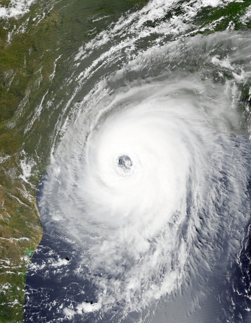 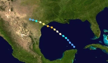 | |
| Duration | June 18 – June 22 |
| Peak intensity | 120 mph (195 km/h) (1-min) 956 mbar (hPa) |
The NHC tracked the possibility of a tropical cyclone developing in the Caribbean for several days. Eventually, a clump of thunderstorms formed south of Cuba on June 16, but it failed to form a sufficiently defined circulation to be considered a depression. Late on June 17, the system passed over the northeastern tip of the Yucatan, which was also when the area of convection began to organize more rapidly. Not long after emerging into the Gulf of Mexico, it coalesced into Tropical Depression Twenty-Six at 06:00 UTC on June 18. Twenty-Six remained a depression for nearly a day before further intensifying into Tropical Storm Xander at 10:00 UTC the next day. While doing so, an area of high pressure over the eastern United States caused Xander to move northwest towards the coast of Texas. Later on the 19th, Xander was upgraded into a hurricane as warm waters and low wind shear began inducing rapid intensification in the storm. At 14:00 UTC on June 20, Xander strengthened to a peak of 120 mph (195 km/h) and 956 mbar, a Category 3 hurricane; despite its rate of deepening, the storm maintained a rather large eye around 25 miles (40 kilometers) in diameter. Though conditions continued to be favorable for rapid deepening, the hurricane soon made landfall near Port O'Connor, Texas at 02:40 UTC on June 21, stopping any further intensification. Over Texas, the presence of a brown ocean effect made Xander's weakening relatively slow, with the storm maintaining hurricane strength for over twelve hours after its eye passed ashore. Eventually, however, Xander weakened into a tropical storm at 13:00 UTC on the 21st as its eye stopped being visible on satellite and its convection began to wane. Just hours later, it weakened into a mere tropical depression as its convection began being absorbed by a passing cold front. At 05:00 UTC on June 22, Xander's low pressure area merged with the aforementioned front, prompting the NHC to cease advisories that day.
Xander wrought severe devastation in Texas. Powerful hurricane-force wind gusts were reported in numerous major cities like Houston, Austin, and San Antonio, leading to numerous reports of wind damage. Roofs were torn from homes while trees were downed, damaging even more properties and blocking roads. Streets became littered with debris from plants and from damaged houses and businesses. Glass panes on skyscrapers in downtown areas were shattered by Xander and fell onto roads below. Along the coast, major hurricane-force sustained winds created dangerous waves along the Texan coast which damaged coastal infrastructure and buildings. Flooding was widespread and severe, with dozens of counties in the state issuing flash flood watches and warnings. At least twenty thousand structures were inundated by floodwaters, with thousands of people requiring rescue. 4.3 million Texans lost power due to Xander. Recovery efforts after Hypercane Nicholas were also disrupted, with recovery personnel and Nicholas victims being forced to evacuate, damaged buildings being affected even further, and many vital supplies and makeshift shelters and hospitals lost. In total, Xander claimed 33 lives and caused $4.2 billion in economic losses.
Hurricane Yesenia[]
| Category 6 hurricane (SSHWS) | |
|---|---|
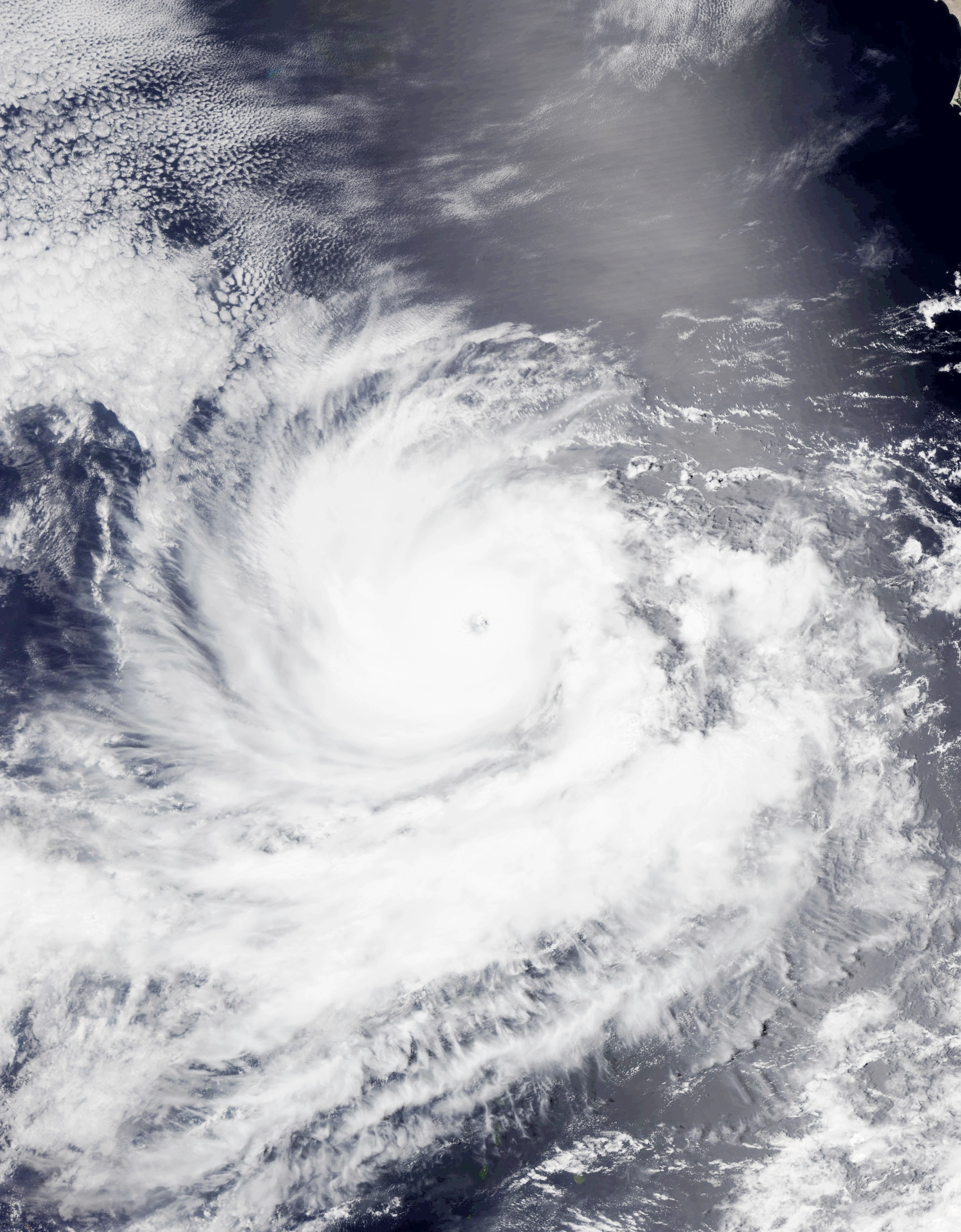 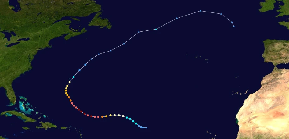 | |
| Duration | June 26 – July 4 |
| Peak intensity | 220 mph (355 km/h) (1-min) 857 mbar (hPa) |
On June 25, the NHC began to track a tropical wave in the middle of the tropical Atlantic for possible signs of development. Though convection was deep and widespread, the lack of a well-developed circulation prevented the wave from being designated as a tropical cyclone. However, one eventually formed very early the next day, causing the NHC to designate the system as a tropical depression at 03:00 UTC. Around noon that day, the depression was upgraded into a tropical storm and was named Yesenia, with its circulation and central dense overcast becoming increasingly well-defined. At 14:00 UTC on June 27, the storm attained hurricane status as it began moving west. An eye soon developed in the center of Yesenia. After becoming a hurricane, Yesenia moved into an area where conditions were ripe for rapid intensification. On June 28, Yesenia's sustained winds increased by 60 mph (95 km/h) over a 24-hour period and the day ended with Yesenia becoming a powerful Category 4 major hurricane. Rapid deepening continued into the 29th, with the storm achieving Category 5 status in the morning hours. At 17:00 UTC that day, hurricane hunter planes recorded sustained winds of 315 km/h/195 mph, constituting an upgrade to Category 6 strength. However, an eyewall replacement cycle took place shortly afterwards, with the system briefly weakening back into a Category 5 for a few hours, though Yesenia soon completed it later that day. On June 30, Yesenia regained Category 6 status and soon reached peak intensity at 11:00 UTC northeast of Puerto Rico, with recon flights detecting winds of 220 mph (355 km/h) and a minimum surface pressure of 857 mbar. Afterwards, as Yesenia began to curve north into waters with lower SSTs, it began to slowly weaken. By 21:00 UTC that day, the storm dropped below extreme hurricane status and became a Category 5 hurricane. Late on July 2, its eye collapsed, its convection became elongated to the northeast, and it was downgraded below major hurricane status to a Category 2. At 09:00 UTC the day after that, Yesenia lost hurricane status and also passed within a hundred kilometers of Bermuda. Several hours later, Yesenia weakened into a depression and began to show signs of an extratropical transition. Eventually, Yesenia was determined to have completed this transition at 06:00 UTC on the 4th of July.
Though Yesenia was a powerful storm, it mostly stayed away from land for its entire life. Light rain and swells were reported in Puerto Rico and the Leeward Islands, though only isolated property damage was reported. Swells were also recorded in Bermuda and the east coast of the United States as well. Yesenia passed closest to Bermuda, where hurricane-force winds, heavy rain, and strong waves occurred. However, since the area was already totally destroyed by Hurricane Peter a month prior, it did not cause much damage. The storm was responsible for a total of 15 drownings related to rip currents and rough surf as well as $1.2 million in economic losses.
Hurricane Zachary[]
| Category 8 hurricane (SSHWS) | |
|---|---|
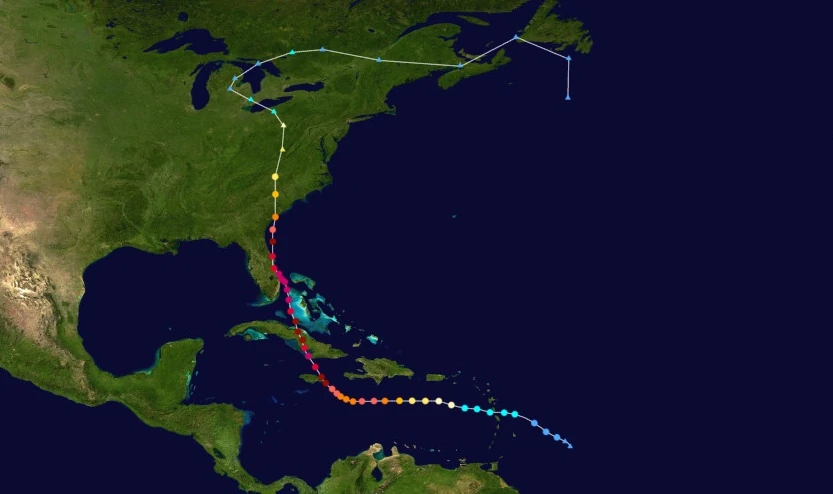 | |
| Duration | June 29 – July 10 |
| Peak intensity | 255 mph (410 km/h) (1-min) 823 mbar (hPa) |
On June 29, the NHC began tracking a tropical wave several miles east of the Lesser Antilles. Wind shear from the nearby Hurricane Yesenia inhibited development, with convection constantly being stripped away and exposing the system's forming center of circulation. However, the disturbance managed to gain enough organization to be upgraded to tropical depression status at 21:00 UTC that day, though wind shear from Yesenia continued to keep strengthening slowly. At 17:00 UTC on June 30, the depression deepened further into a tropical storm and was assigned the name Zachary. Afterwards, the storm was expected to dissipate due to the shear from Yesenia still persisting. However, as the two began moving further and further away from each other, wind shear began to lessen, allowing Zachary to strengthen more. As its circulation became fully encased by a now well-developed CDO, the storm became a hurricane at 18:00 UTC on July 1 while on a westward track south of Puerto Rico. On July 2, even more favorable conditions including high sea surface temperatures and low wind shear caused Hurricane Zachary to begin rapid intensification; by the end of the day, the storm had reached Category 3 major hurricane strength. At around 14:00 UTC on July 3, Zachary reached an initial peak intensity of 170 mph (275 km/h) south of Haiti before undergoing an eyewall replacement cycle and weakening to a Category 4. At this point, an approaching trough caused the storm to begin moving north towards Jamaica and Cuba. During the afternoon hours of July 4, Zachary completed the replacement of its eyewall and re-strengthened into a Category 5 storm. At 02:00 UTC on July 5, Zachary began rapidly intensifying again and became a Category 6 hurricane before making landfall on Morant Point, Jamaica a few hours later. However, this landfall did not hinder Zachary's intensification, with the storm further strengthening into a Category 7 extreme hurricane at 15:00 UTC that day. At 22:40 UTC, Zachary made landfall on Cuba near the city of Pilon while carrying Category 8-strength sustained winds of 245 mph (395 km/h). This was followed by another landfall east of Santa Cruz del Sur early on July 6 at C7 strength. Over land, the storm weakened down into a Category 6 hurricane and maintained that strength as it emerged into the waters near the Bahamas later that day. Warm waters and low wind shear near the islands caused Zachary to begin yet another round of rapid deepening. Growing to a large size of over 800 mi (1287 km), the storm regained Category 8 strength and soon peaked at 23:00 UTC on July 7 with winds of 255 mph and 823 mbar off the coast of West Palm Beach, FL. A well-defined pinhole eye developed alongside very well-developed outflow, but an eyewall replacement cycle also became apparent as a ring-shaped gap in convection appeared surrounding the eye. However, this did not affect the strength of the storm as it made landfall on Florida early on July 8 while still at Category 8 strength. Shortly after landfall, Zachary began to quickly weaken due to a combination of its ERC and land interaction. It made a turn towards Georgia and South Carolina and by the time of its landfall near their border at 17:00 UTC on July 9, it had dwindled down to Category 4 strength and its eye had become highly ragged and disorganized. Early on July 10, while at Category 2 strength, Zachary underwent a transition into an extratropical cyclone and completed that transition at approximately 10:00 UTC. They brought heavy rain over the eastern continental U.S. before dissipating south of Newfoundland on the 13th.
As a developing tropical storm, Zachary brought heavy rain and gale-force winds to the Lesser Antilles, particularly in Dominica and Martinique. Winds gusted to up to 72 mph (120 km/h), near hurricane-force while a total of 9 inches (228 millimeters) of rain fell. These conditions caused moderate damage, with a few dozen structures experiencing interior flooding and minor wind damage to roofs. Swells and stormy conditions were produced in the Lesser Antilles as well as along the southern coasts of Puerto Rico and Hispaniola as Zachary passed through the area. Torrential rain caused some rockslides and landslides along the Hispaniolan coast which blocked a few highways. The most major damage occurred in Jamaica, Cuba, the Bahamas, and the southeastern United States, which all experienced extreme hurricane conditions which included winds of over 200 mph and exceptional flooding. Jamaica reported economic losses of $1.3 billion in the island alone, with over half of all structures being damaged or destroyed. The entire island suffered a power outage, leaving all of its ~3 million residents in the dark. In Cuba, the provinces of Granma, Las Tunas, Camaguey, and Ciego de Avila all had at least half of their structures destroyed by extreme high winds and a 34-foot storm surge while 3.67 million Cubans lost power. Dozens of mudslides were reported in the area where Zachary hit, burying countless villages and towns while leading to the deaths of nearly 2,700 people. Nearly 100% of all structures in Andros Island and Grand Bahamas were destroyed by Zachary. In Florida, over a million structures were damaged or destroyed by flooding and strong winds while 1.4 million households lost power. The powerful winds were reported to quite literally tear chunks of concrete and pavement off the ground. A State of Emergency was declared by the state's governor due to the storm and thousands of rescue personnel were sent from other states and countries to assist with recovery efforts following Zachary. As for Georgia and South Carolina, severe storm surge and high winds destroyed several homes and businesses while causing approximately $29 billion in economic losses, though damage was not as severe as in the areas where Zachary hit as a Category 6 or higher. Severe humanitarian crises occurred in all of the areas severely affected, with even places in the first-world United States experiencing water, shelter, and food shortages on a scale never seen before. Out of Zachary's total fatality count of 4,561, 883 of them died from starvation, thirst, disease, or some other health-related issue, and many of them were young children or elderly people. In all, the storm was responsible for $467 billion in economic losses due to the widespread scope of its effects.
Hurricane Adria[]
| Category 6 hurricane (SSHWS) | |
|---|---|
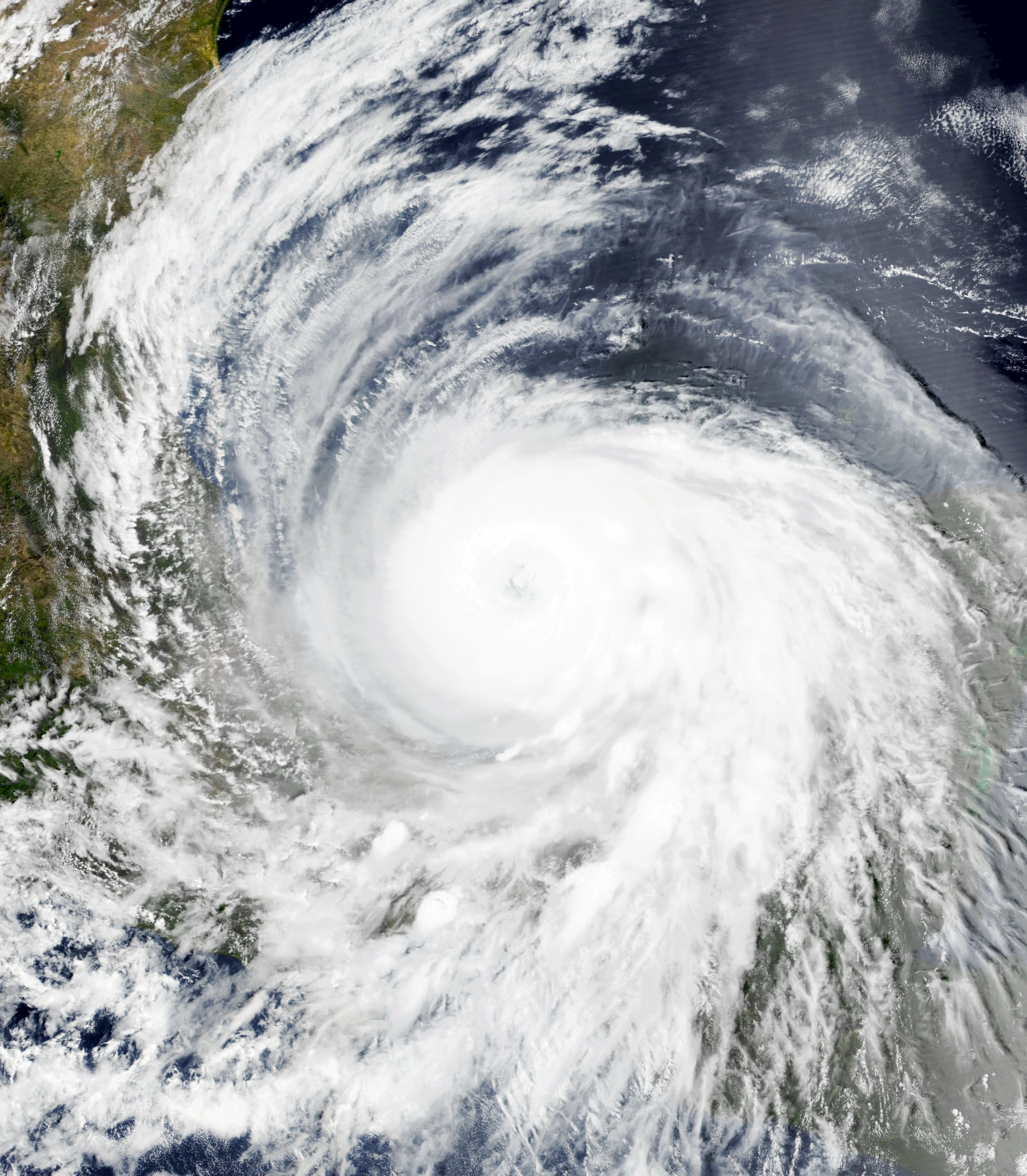 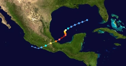 | |
| Duration | July 2 – July 7 |
| Peak intensity | 195 mph (315 km/h) (1-min) 890 mbar (hPa) |
On July 2, a non-tropical low was spotted approximately 90 miles west of Florida. It eventually organized into a tropical depression at 20:00 UTC that day and was given the designation Twenty-Nine. TD 29 continued its southwest motion as it slowly intensified, becoming a tropical storm and being named Adria at 03:00 UTC on July 4. At this point, Adria began to stall over an area of very warm waters and low wind shear near the Bay of Campeche, leading to rapid intensification as convection began to flare all around the system. Just a few hours after being designated a tropical storm, Adria intensified into a hurricane. An eye began developing at the center of the system's rapidly developing CDO as Adria reached major hurricane status at 23:00 UTC on the 4th. At 16:00 UTC on July 5, after beginning to accelerate southwestward again, Adria achieved its peak intensity, with recon flights recording Category 6-strength sustained winds of 195 mph (315 km/h) and a central atmospheric pressure of 890 mbar. The next day, while approaching the province of Veracruz, Adria began to weaken due to an eyewall replacement cycle and less favorable conditions. Its convection began to wane and its eye ceased to be visible on visual satellites. However, Adria was still a powerful 140 mph (225 km/h) Category 4 hurricane by the time of its landfall on Heroica Veracruz at 11:15 UTC on July 6. Over land, Mexico's mountainous terrain caused Adria's structure to quickly degrade and its pressure to rapidly rise. Having lost almost all of its remaining convection, Adria degenerated into a remnant low at 06:00 UTC on July 7. Its leftover circulation continued into the Eastern Pacific basin intact, but it failed to regenerate and soon dissipated later that day.
Adria caused considerable damage in southern Mexico, particularly in the Mexican states of Veracruz, Oaxaca, and Guerrero. All of these provinces received heavy rain and gusty winds of at least gale force. Though the storm's weakening and quick passage prevented damage from being extreme, there were still numerous reports of damage. Hundreds of landslides were reported along mountainsides, blocking roadways and burying homes. Strong winds damaged many rooftops while flooding caused damage on structures' lower levels, with around four thousand homes being impacted by floodwaters. A storm surge of around 12 feet caused coastal flooding in Veracruz, inundating boardwalks, piers, and coastal buildings. Adria was also responsible for 3.5 million reports of lost power and for delaying recovery efforts after Nicholas, with rescue personnel halting operations ahead of the storm to evacuate and many temporary tents and supplies being destroyed. Overall, Adria caused $7.3 billion in damages and 1,820 deaths.
Subtropical Storm Braylen[]
| Subtropical storm (SSHWS) | |
|---|---|
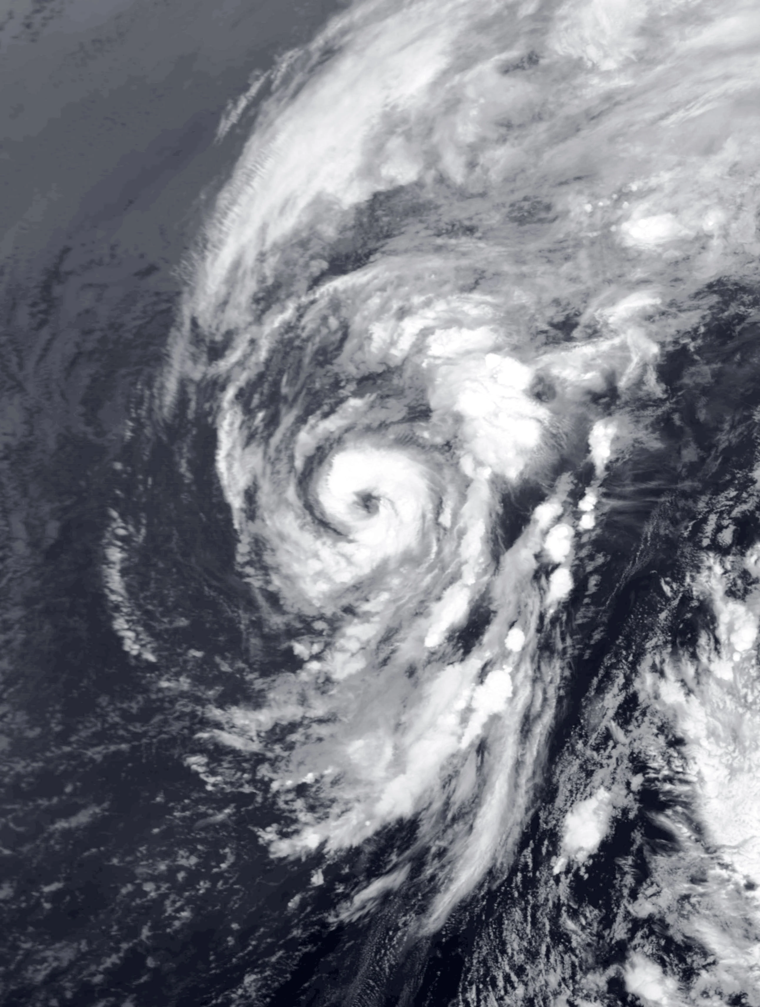 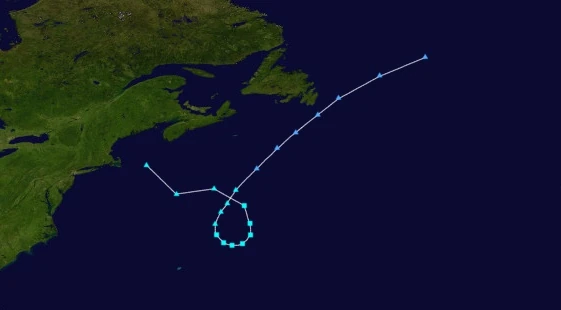 | |
| Duration | July 3 – July 5 |
| Peak intensity | 65 mph (105 km/h) (1-min) 993 mbar (hPa) |
On July 3, the NHC began tracking an extratropical low off the coast of Cape Cod for possible development. Its central low eventually began to shed off its weather fronts, develop a surface level circulation, and accumulate central convection. At 18:00 UTC that day, the system was officially designated Subtropical Storm Braylen - because its precursor low already carried gale-force winds by the time it became subtropical, Braylen skipped subtropical depression status and was named immediately. As the storm made a clockwise loop, Braylen reached its peak intensity of 105 km/h at 04:00 UTC on July 5, but failed to become fully tropical due to high wind shear. Eventually, said wind shear led to the storm transitioning back into an extratropical cyclone at 12:00 UTC that day. Besides rain in the New England states and eastern Canada, no damage occurred. An indirect death occurred in Newfoundland when a patient in a hospital died due to heavy rain preventing medical supplies from being delivered on time.
Hurricane Caridad[]
| Category 3 hurricane (SSHWS) | |
|---|---|
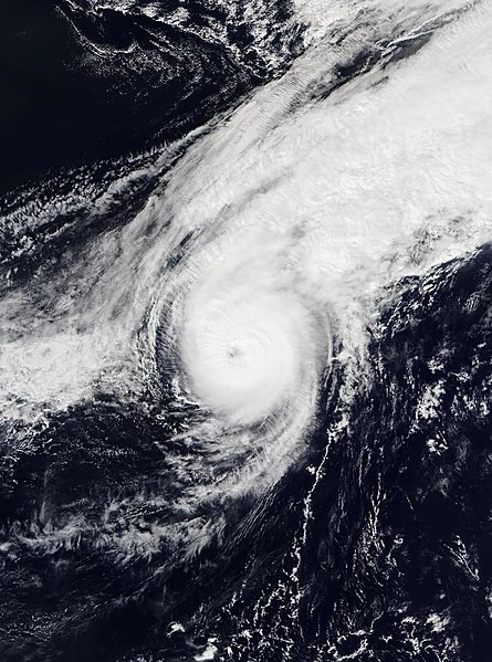 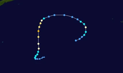 | |
| Duration | July 4 – July 11 |
| Peak intensity | 120 mph (195 km/h) (1-min) 962 mbar (hPa) |
The NHC first began tracking the possibility of a non-tropical low forming in the open Atlantic on July 2. A low soon formed along the cold front of an extratropical cyclone early on July 4 before beginning to undergo a subtropical transition. After shedding its fronts and developing some tropical characteristics, the NHC designated the low Subtropical Depression Thirty-One. At 09:00 UTC the next day, Thirty-One became fully tropical and stalled as the Azores High started to steer the storm north. At 14:00 UTC on the 5th, the depression intensified into a tropical storm and was named Caridad before speeding up north. Caridad continued to steadily intensify due to favorable conditions, becoming a Category 1 at 16:00 UTC on July 6 while developing an eye and well-defined rainbands. Soon, high sea surface temperatures and little to no wind shear caused Caridad to rapidly intensify to its Category 3 peak of 195 km/h (120 mph) and 962 mbar at 11:00 UTC on July 7. However, the storm began weakening shortly after due to cooler ocean waters and high wind shear. Eventually, while turning east, Caridad lost hurricane strength altogether early on July 8 and lost tropical storm status at 10:00 UTC the same day as its convection fell apart. However, Caridad's circulation persisted and maintained minimal convection; the storm held on to depression status for several hours despite unfavorable conditions.
Late on July 9, the system regained tropical storm status after curving south back into more favorable conditions for intensification. At noon on the 10th, Caridad achieved a secondary peak intensity of 80 mph (130 km/h) as a Category 1 hurricane, with its eye briefly resurfacing. However, the return of high wind shear led to more weakening soon after, and Caridad lost hurricane status just a few hours after peaking. At the beginning of July 11, with most of its convection stripped away and displaced, Caridad weakened into a depression. At 17:00 UTC that day, the storm became nothing more than an ill-defined and fully exposed circulation and the NHC ceased advisories, having downgraded Caridad into a remnant low.
Hurricane Deshawn[]
| Category 4 hurricane (SSHWS) | |
|---|---|
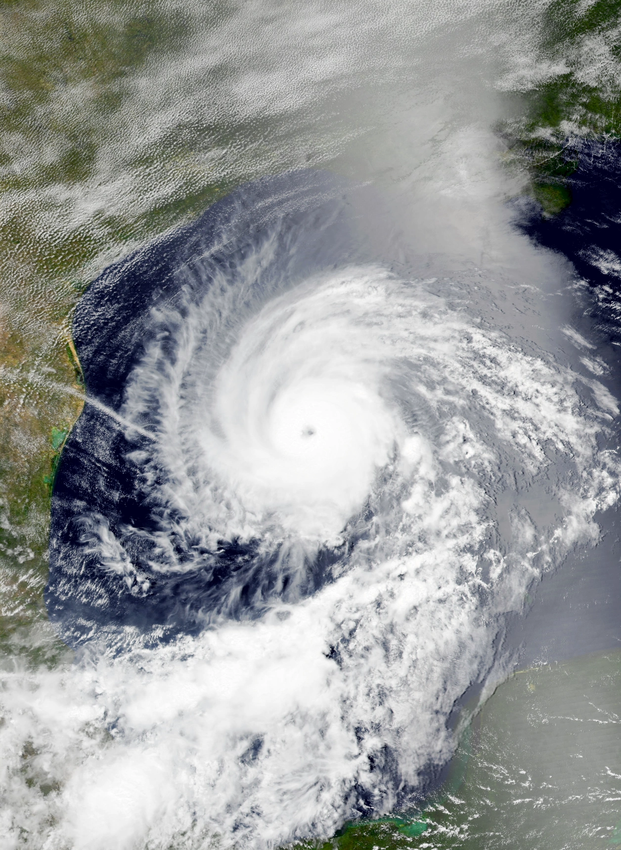 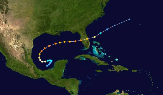 | |
| Duration | July 9 – July 15 |
| Peak intensity | 150 mph (240 km/h) (1-min) 937 mbar (hPa) |
On July 7, an area of convection leftover from one of Hurricane Adria's spiral rainbands was noted in the Bay of Campeche. Due to cold waters caused by the aforementioned hurricane, the disturbance was given a very slim chance for development. However, sea surface temperatures quickly rose over time, and the system's chance of development increased steadily. Eventually, radars confirmed the formation of a central low-level circulation at 15:00 UTC on July 9, leading to the designation of Tropical Depression Thirty-Two by the National Hurricane Center shortly after. Meandering within the Bay of Campeche due to weak steering currents, the newly-formed tropical cyclone strengthened very slowly, as waters were still relatively cool. It eventually became a tropical storm at 14:00 UTC on July 10, receiving the name Deshawn as it made a slow, sharp turn west. After being upgraded to a hurricane at 07:00 UTC on the 11th, Deshawn entered warmer waters untouched by Adria and began to rapidly intensify. Near the beginning of July 12, Deshawn intensified into a Category 2 while hurricane hunter planes noted a cloud-filled eye beginning to form in the center of the storm. Just hours later, Deshawn was upgraded into a Category 3 major hurricane. Well-developed convection tightly wrapping around a compact central dense overcast, the system reached its peak intensity at 01:00 UTC the following day as a high-end 150 mph (240 km/h) Category 4 hurricane over the Gulf of Mexico while accelerating east due to a northerly trough. Deshawn maintained Category 4 status for roughly a day before weakening back into a Category 3 on July 13 due to an eyewall replacement cycle, however it soon re-strengthened back into a Category 4 before making landfall on the Tampa Bay in Florida at 17:00 UTC the next day. After landfall, Deshawn emerged into the open Atlantic as a low-end Category 3 and began to explosively weaken due to wind shear from the nearby Hurricane Emery. By 13:00 UTC on July 15, all of the storm's convection had been absorbed by Emery. Its leftover circulation collapsed several hours later.
Though Deshawn never made landfall on Mexico, it did come close enough to the coast to generate heavy rainfall and flooding. The effects of this were mostly limited to hampering recovery efforts after Adria, but some new damage occurred especially in the more easterly areas like the Yucatan. Many mudslides and landslides occurred, and these along with widespread flooding damaged 4,325 structures, mostly low-lying homes in remote areas. 5 fatalities were attributed to Deshawn as a developing storm. Along the west-facing coast of the Yucatan Peninsula, a surfer drowned due to rough surf generated by the storm. In Tabasco, one woman drowned in floodwaters while in Campeche, three people in the same car were killed while traveling along a mountainside when a landslide crushed their vehicle. Deshawn's most significant impact was in Florida, where Deshawn made landfall as a Category 4 storm. There, economic losses totaled $3.41 billion and fatalities totaled 17. Most structures in the state were already destroyed by previous storms, but Deshawn still caused considerable impacts including interference with recovery efforts, severe flooding, and most of all extreme winds which knocked several dozen buildings to the ground. In total, the storm was responsible for $3.44 billion in damages and 22 deaths.
Hurricane Emery[]
| Category 10 hurricane (SSHWS) | |
|---|---|
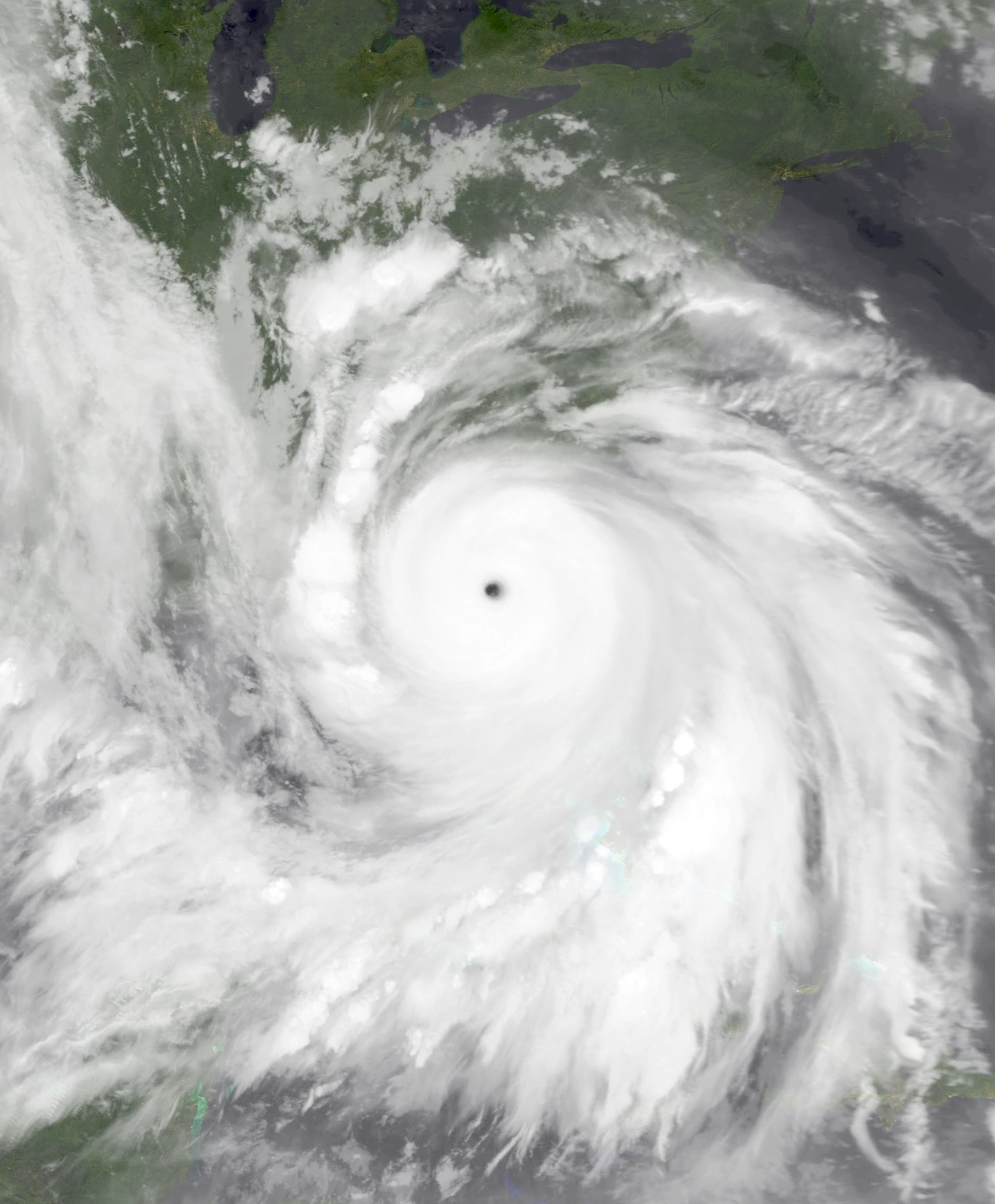 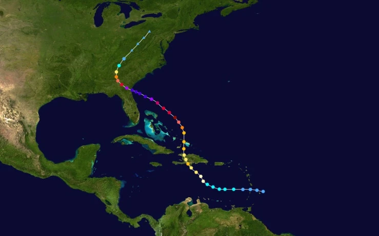 | |
| Duration | July 10 – July 19 |
| Peak intensity | 290 mph (465 km/h) (1-min) 817 mbar (hPa) |
On July 3, a tropical wave emerged from the African Coast and moved westward. Due to a layer of dry air over much of the open Atlantic, the wave struggled to strengthen for several days. The system repeatedly attempted to form a surface- or low-level circulation, but dry air kept intruding into its core and destroying any organization. Eventually, as the wave was nearing the Lesser Antilles on July 9, the dry air layer lifted and was quickly replaced by a mass of more moisture, causing the developing tropical cyclone to intensify more quickly. By 09:00 UTC on July 10, the system had become Tropical Depression Thirty-Three just a few miles northeast of Barbados. Continuing its westward motion, the depression reached tropical storm status at 11:00 UTC the next day and was named Emery; soon after, an anticyclone over the open Atlantic began to steer Emery north towards Hispaniola. On July 12, hurricane hunter planes found winds of 75 mph in the storm's developing eyewall, leading to an upgrade to hurricane status at 15:00 UTC. Emery soon intensified into a minimal Category 3 hurricane at 12:00 UTC on July 13 before hitting the southern tip of the Dominican Republic shortly after. At 18:50 UTC the same day, Emery made another landfall near Belle-Anse, Haiti while still a Category 3. Over Hispaniola, Emery weakened into a Category 2 due to the island's mountainous terrain, however it quickly regained major hurricane status at 10:00 UTC on the 14th, a few hours after re-entering open waters. The storm maintained Category 3 status for several hours while passing within a few dozen miles of the Inagua Islands and the Turks and Caicos Islands. As the hurricane's motion began to shift gradually to the northwest, however, warm water fueled a period of explosive intensification. Near the beginning of July 15, Emery intensified into a Category 4 and further became a Category 5 a few hours later. By 15:00 UTC, the storm had become a Category 6 on the SSHWS and was still intensifying as it absorbed the remnants of Hurricane Deshawn. At 14:30 UTC on July 17, Emery, having grown to a size of nearly 1000 miles (1609 kilometers) in diameter, reached its Category 10 peak intensity of 290 mph (465 km/h) and 817 millibars a few miles off the coast of the Florida-Georgia border. At 17:55 UTC the same day, Emery hit said area as a Category 10. Afterwards, the storm explosively weakened due to land interaction while an approaching upper-level low steered it northeast. At 07:00 UTC on July 18, Emery lost extreme hurricane status and became a Category 5 as its convection quickly collapsed and its eye ceased to be visible on visual radar. By the end of that day, Emery had already weakened into a Category 2. After weakening further into a tropical storm at 01:00 UTC on the 19th and a depression at 08:00 UTC the same day, Emery became extratropical at 14:00 UTC before merging with another system over Pennsylvania the next day.
Emery was one of the most catastrophic hurricanes to affect Florida, Georgia and South Carolina, bringing wind gusts comparable to that of the strongest tornadoes and a catastrophic storm surge over 20 meters tall. Due to the storm's large size, a total of 3.3 million structures were affected in some form by Emery, with 1.8 million of them sustaining major damage and 967,000 being totally destroyed. In Jacksonville, Large objects such as ships, trucks, and even homes were reported to be sent airborne by the storm's winds, an effect which likely extended to other locations near the eyewall. Trees, chunks of sidewalks, and high-rise buildings were also damaged by the storm, with even the strongest structures near the eyewall being completely demolished in some cases. 14.62 million households lost power during the storm including the entire population of Georgia due to the aforementioned high winds as well as an extremely powerful storm surge and over 20 inches of rainfall which led to widespread flooding. Many coastlines were permanently reshaped due to erosion related to the storm surge while numerous piers, boardwalks, and aquatic vehicles were damaged or lost altogether. Ahead of the storm, the governments of the states projected to be in Emery's path ordered the evacuation of over 6 million people - more than twice the number of people evacuated due to Hurricane Floyd in 1999. However, this did not stop Emery from claiming the lives of 31,567 people and causing $765 billion in damages in the United States alone.
In the Lesser Antilles, Emery brought rainfall and occasional gusty winds as a tropical depression. However, property damage was only minimal and no deaths were reported. Damage was more significant in Hispaniola and the Turks and Caicos, where major hurricane-force sustained winds of 7 inches of rain caused significant property damage. Around 41 mudslides were reported along the slopes of mountains on Hispaniola, affecting numerous towns. 98 Hispaniolans required rescue due to the landslides, with 38 losing their lives. The storm was responsible for $1 billion in damages in these areas.
Hurricane Foster[]
| Category 9 hurricane (SSHWS) | |
|---|---|
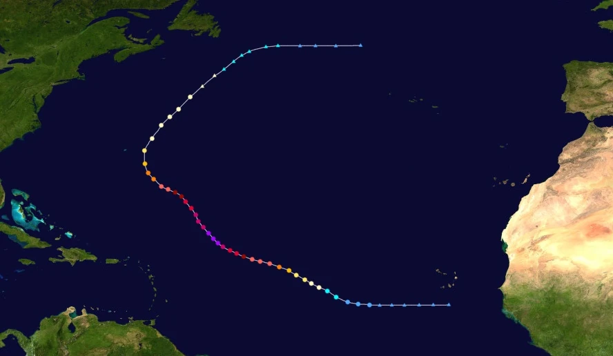 | |
| Duration | July 11 – July 20 |
| Peak intensity | 275 mph (440 km/h) (1-min) 828 mbar (hPa) |
A tropical wave a few miles south of Cabo Verde was first monitored on July 9 as it moved west. Despite sufficiently high water temps, low wind shear, and moist air aloft, the disturbance did not develop for several days. Eventually, at 02:00 UTC on July 11, it developed enough convection to be upgraded into a tropical depression. By the end of that day, it had strengthened into Tropical Storm Foster as its convection organized into neatly curved rain bands. Shifting its motion slightly more northward, very warm ocean waters enabled Foster to begin to strengthen more quickly, becoming a hurricane at 09:00 UTC on the 12th and a major hurricane at 07:00 UTC on the 13th. By the end of July 13, Foster had developed a well-defined eye, a large, symmetrical central dense overcast, well-developed rain bands, and sustained winds of 265 km/h - a Category 5 on the Saffir-Simpson Scale. Continuing its northwestern motion, Foster's intensification continued into July 14, with the storm becoming a Category 6 at 15:00 UTC. Late on July 15, with extremely powerful thunderstorms surrounding a somewhat cloud-filled but very well-developed eye, Foster gained maximum sustained winds of 440 km/h and a minimum central surface atmospheric pressure of 828 millibars. After peaking, weakening took place at a moderate pace due to upwelling and increasing wind shear. Late on July 17, Foster lost extreme hurricane status and weakened into a Category 5. At 10:00 UTC on July 19, the storm dipped below Category 3 status while being steered northeast by the Azores High. Around that time, the storm also began exhibiting signs of an extratropical transition, with a tail of intense convection developing to the south. At 22:00 UTC the next day, Foster completed said transition, causing advisories to end.
As a disturbance, Foster brought moderate rain to the Cabo Verde Islands. Property damage was very minimal and no fatalities were reported. Later on, hurricane watches and warnings were issued for the Lesser and Greater Antilles, the Bahamas, and the southeastern United States due to Foster being forecast to affect the aforementioned areas just a few days ahead of the even more powerful Hurricane Emery. These alerts were all lifted when Foster began moving away from the alerted areas and towards the north. Its only effects in said areas were rip currents and storm surge which claimed a total of 8 lives. The remains of Bermuda were also affected.
Hurricane Gemma[]
| Category 9 hurricane (SSHWS) | |
|---|---|
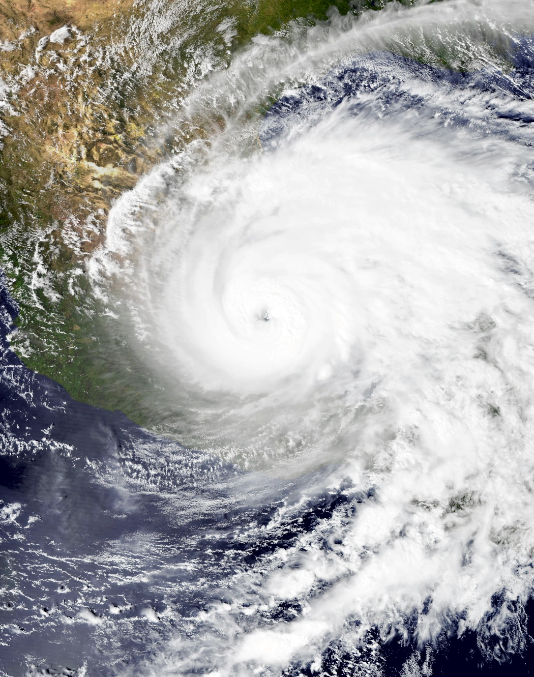 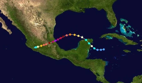 | |
| Duration | July 12 – July 17 |
| Peak intensity | 265 mph (425 km/h) (1-min) 829 mbar (hPa) |
On July 11, the NHC began to monitor an area of intense convection in the western Caribbean. Though it was well-organized, the lack of a closed center of circulation prevented it from being upgraded into a tropical depression. Eventually, one developed early the next day, resulting in the formation of Tropical Depression Thirty-Five at 05:00 UTC. Moving west towards the Yucatan Peninsula, Thirty-Five strengthened slowly at first before eventually becoming Tropical Storm Gemma at 19:00 UTC that day while beginning to turn northwest. Early on July 13, Gemma rapidly developed an eye-like feature and became a hurricane before making landfall a few miles south of Tulum, Mexico at 08:00 UTC. A few hours after making landfall, Gemma lost its eye and some of its central convection and weakened into a tropical storm, but it soon regained hurricane strength later that day when it emerged into the Gulf of Mexico. As the storm slowly began to curve south due to a large area of high pressure over the continental United States, exceptionally warm waters up to 45 °C (113 °F) caused it to begin rapidly intensifying. Over the course of July 14, Gemma's 1-minute sustained winds increased 80 mph (128 km/h) and grew into a powerful Category 5 hurricane. Explosive deepening continued into July 15 and culminated into a peak intensity of 265 mph (425 km/h) and 829 mbar at 23:00 UTC that day. Less than an hour later, the storm made landfall on Tamiahua, Veracruz near peak intensity. Over inland Mexico, Gemma rapidly weakened just as, if not even faster than it intensified. At 20:00 UTC on July 17, Gemma was downgraded into a remnant low over southwestern Michoacan.
The Yucatan Peninsula received moderate impacts from Gemma. Tulum, the municipality hardest hit by the storm's first landfall, recorded a wind gust of 99 mph (159 km/h), equivalent to a Category 2 hurricane. Due to high winds, many homes and businesses sustained structural damage, though it was mostly limited to broken windows and damaged roofs. Flooding and storm surge also produced significant damage in the area, with around 143 acres of farmland being damaged by floodwaters. Economic losses in the area totaled $72 million USD. Gemma's second landfall was far more destructive, with extreme winds and a devastating storm surge destroying much of central Mexico. In numerous areas across Veracruz and Puebla, winds of at least 200 mph were recorded which sent entire homes, buildings, and large vehicles into the air. A truck originating from Tamiahua was found over 30 km away in Naranjos. Both towns also reported chunks of sidewalk littered on the streets, having been pulled from the ground by the extreme winds. Along the coast, waves up to 100 feet high caused noticeable beach erosion and the destruction of most piers and coastal structures in northern Veracruz. Further inland, high moisture from the storm triggered around 716 reported landslides and mudslides along the central mountains. An estimated 5,674 structures along with hundreds of acres of farmland were damaged or destroyed by these landslides. Overall, Gemma was responsible for $120 billion in damages and 34,899 deaths.
Hypercane Heath[]
| Hypercane (SSHWS) | |
|---|---|
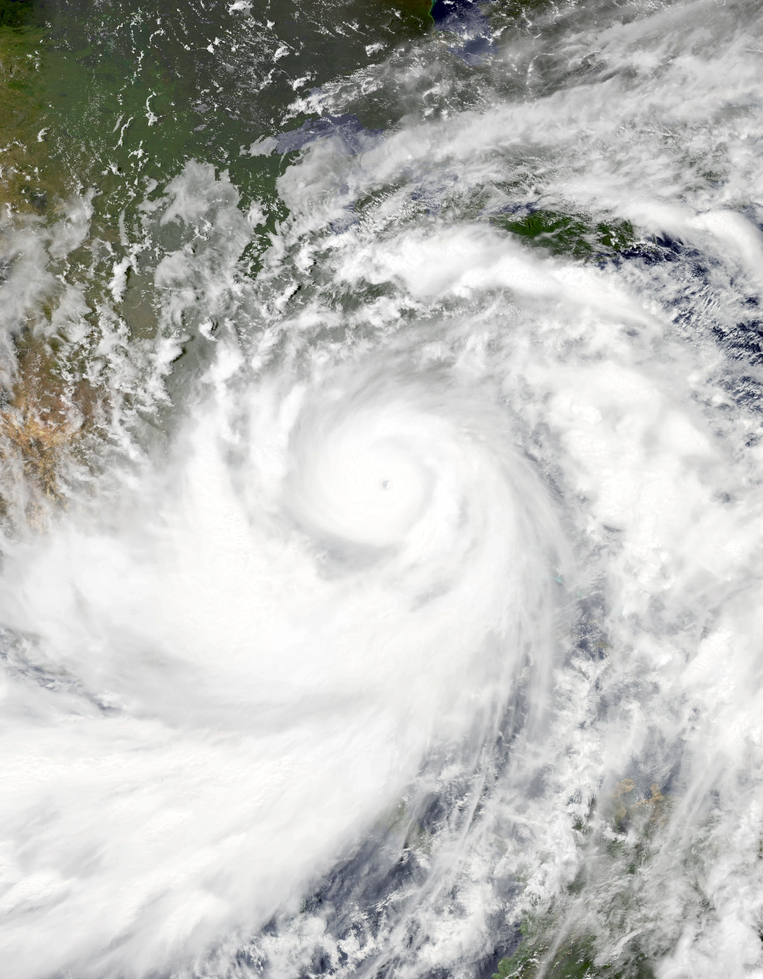 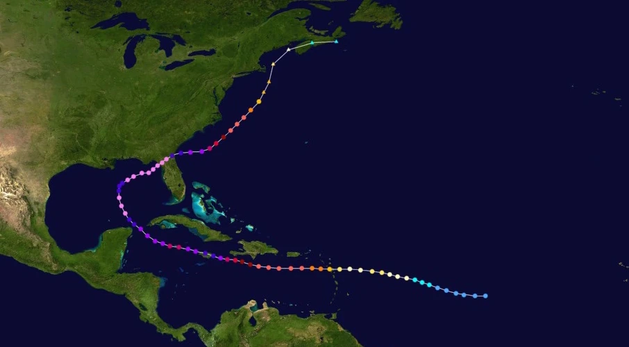 | |
| Duration | July 16 – August 2 |
| Peak intensity | 355 mph (570 km/h) (1-min) 735 mbar (hPa) |
On July 13, a tropical wave was spotted near Cabo Verde moving west. Due to waters across the entire north Atlantic being after hurricanes Emery, Foster, and Gemma, the NHC gave the system low chances of further development. However, around three days later, the wave passed over a patch of higher sea surface temperatures, leading to an increase in convection and organization. It eventually coalesced into Tropical Depression Thirty-Six at 14:00 UTC on the 16th. As it continued to move west, the newly-formed depression moved back into waters warm enough to prevent dissipation but nevertheless too cold to support intensification. No significant strengthening occurred until July 18, when it strengthened into a tropical storm and was assigned the name Heath. Entering warmer waters and developing well-defined rainbands which spiraled tightly around a small but organized core, Heath became a hurricane at 22:00 UTC that day. Heath eventually became a Category 2 at 16:00 UTC on July 19 and reached an initial peak intensity of 170 km/h before passing over another area of cold ocean waters and weakening back into a Category 1. However, this weakening was short-lived, and Heath re-strengthened into a Category 2 and began to develop an eye at 12:00 UTC on July 20. Just after striking the island of Guadeloupe, Heath entered the Caribbean Sea, began a period of rapid deepening due to favorable conditions, and intensified into a Category 3 hurricane at 23:00 UTC. The next day, the storm reached Category 5 strength at 12:00 UTC before levelling out in strength, having passed over yet another area of low sea surface temperatures. This trend, however, was also short-lived and was followed by another period of rapid deepening where Heath intensified into a Category 6 hurricane at 19:00 UTC on the 22nd. Heath reached its second peak intensity of 285 mph, a Category 10, early on July 24 before making landfall on eastern Jamaica at 06:10 UTC. This landfall combined with an eyewall replacement cycle caused the system to weaken down to a Category 9 at 15:00 UTC that day and to a Category 8 at 03:00 UTC on July 25. Afterwards, Heath began to strengthen again as it began to curve north due to an approaching trough. Later that same day, Heath regained Category 9 strength. The storm became a Category 10 again at 17:00 UTC on the 26th and passed within a few kilometers of Cancun. At 01:00 UTC on July 27, the NHC detected sustained winds in excess of 300 mph/482 km/h in Heath's eyewall, marking the second time an Atlantic hurricane intensified into a hypercane. As it turned east towards Florida, Heath weakened down into a Category 10 at 18:00 UTC that day due to an eyewall replacement cycle, but it quickly regained hypercane status at noon the next day and began rapidly intensifying yet again. At 10:00 UTC on July 29, Heath reached its true peak intensity of 570 km/h (355 mph) and 735 mbar, all while gigantic blobs of convection burst all over the Caribbean and wrapped around an exceptionally well-defined CDO larger than the state of Florida. This made Heath the strongest tropical cyclone at the time, but like the previous record holder (Nicholas), Heath would be beaten by other hypercanes later in the season. At 00:00 UTC on July 30, Heath made landfall on Horseshoe Beach, FL carrying winds of 515 km/h (320 mph) before emerging back into the Atlantic as a Category 10 later that day. Afterwards, the storm travelled parallel to the East Coast of the U.S. while steadily weakening due to increasing northerly wind shear. It retained its large size, but its convection became shallow and ill-defined. At 08:00 UTC on August 1, Heath weakened below extreme hurricane status and began to show signs of becoming an extratropical cyclone. At 15:00 UTC on August 2, it became fully extratropical while a Category 3 storm. The storm's remnant hit Nova Scotia before being absorbed into a stronger extratropical system late the next day.
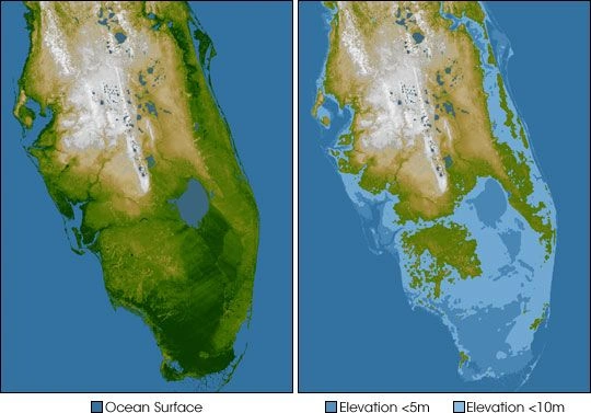

The Florida Peninsula before (left) and after Heath (right).
Though Heath did not affect as many areas as the hypercane before it, Nicholas, the storm was still very severe and wrought havoc across the entire Atlantic. It became the worst storm to ever hit Florida, with flooding and storm surge being so severe that extensive areas of the low-lying parts of the state became permanently submerged. Lake Okeechobee became a bay connected to the Atlantic while many landmarks including the Everglades, home to numerous rare species, were put underwater. Millions of homes and businesses went underwater as well, leaving an estimated 9.5 million Floridians homeless and jobless. Sustained winds of at least 200 mph were recorded all over the state, destroying virtually every structure in the entire state - both man-made and natural - not already destroyed by the cataclysmic flooding. Millions of structures were flattened and flung into the air by Heath indiscriminately, including many high-rise offices and other types of large buildings. Famous resorts like Walt Disney World Resort and Universal Studios Orlando were lost. Huge chunks of the ground were hurled into the air as well, transforming the already radically-altered landscape of the state. The NHC's headquarters in Miami was also destroyed by the storm, forcing the organization to move its primary center to a station further inland. By the time Heath had left Florida, the state was completely transformed geographically and over 99% of its population was forced into cramped evacuation centers where disease and famine were rampant. Extreme damage was also reported in the Lesser Antilles, Puerto Rico, Hispaniola, Cuba, Jamaica, the Yucatan, and the east coast of the United States, where powerful wind gusts and severe flooding led to the loss of hundreds of thousands of structures and thousands of deaths. Like Nicholas, Heath's damage prompted aid from wealthy countries across the globe, with over a trillion dollars in USD being offered as well as millions of rescue and recovery personnel. However, these were still paled by the disastrous hypercane's final effect totals - 1.32 trillion USD in damages, over 4.8 million direct fatalities, and over 2.98 million indirect fatalities caused by UV radiation following ozone layer damage from Heath.
Hurricane Isla[]
| Category 2 hurricane (SSHWS) | |
|---|---|
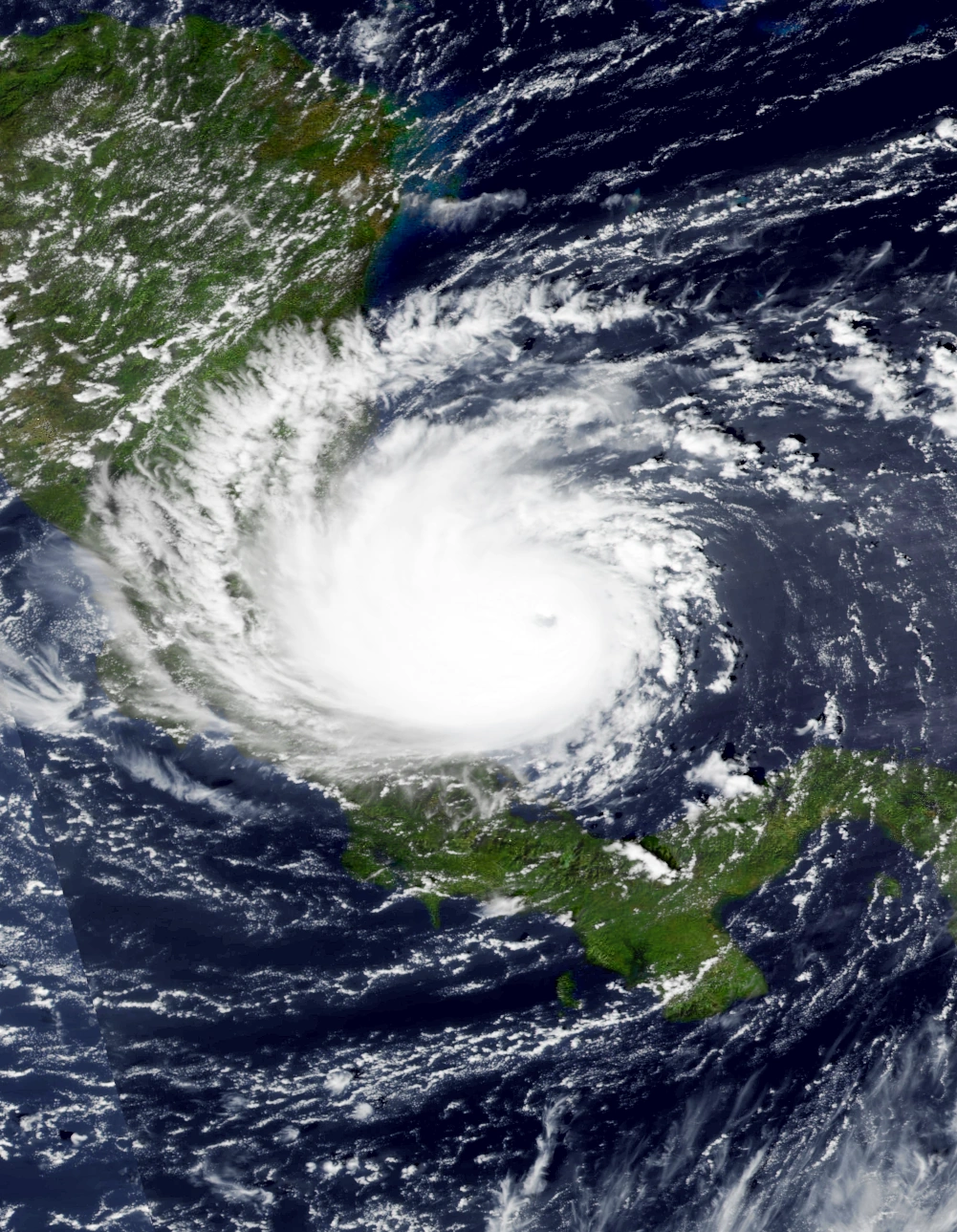 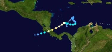 | |
| Duration | July 16 – July 21 |
| Peak intensity | 105 mph (170 km/h) (1-min) 974 mbar (hPa) |
On July 15, a tropical disturbance formed a little less than a hundred miles north of Panama. Due to little to no steering currents, the disturbance simply meandered aimlessly near the location it formed as it slowly gathered strength. The disturbance eventually developed a closed circulation the next day and was designated Tropical Depression Thirty-Seven at 16:00 UTC, just a few hours after the formation of what would become Hypercane Heath. As the storm looped down southwards, it slowly developed well-organized convection in its rainbands and its pressure gradually dropped. At 05:00 UTC on July 18, Thirty-Seven turned east and hurricane hunter planes found winds of over 40 mph in the storm's core, prompting the NHC to upgrade it into a tropical storm and assign it the name Isla. A compact tropical cyclone, Isla continued its trend of slow intensification but was now being steered west towards Central America. At 10:00 UTC on July 19, the tropical storm was upgraded to hurricane status following the detection of hurricane-force winds in Isla's developing eyewall. It became a Category 2 early on July 20 and reached its peak of 105 mph (170 km/h) and 974 mbar at 08:00 UTC that day, all while sporting a gale-force wind diameter of less than 300 kilometers across. The storm made landfall on Costa Rica while still a small Category 2 hurricane at 11:45 UTC, after which it began weakening due to wind shear and land interaction. At 19:00 UTC, Isla managed to cross into the Eastern Pacific Basin, but had lost much of its convection and was only a tropical storm. Overall hostile conditions in said basin caused Isla to eventually degenerate into a remnant low at 13:00 UTC on July 21. Its leftover circulation soon dissipated completely and its leftover convection ended up becoming a part of Hypercane Heath a few days later.
Isla was only the second tropical cyclone to hit Costa Rica since reliable records began (with 2016's Hurricane Otto being the first). Isla caused a large amount of destruction in Costa Rica and Nicaragua due to said areas not being fully prepared to withstand hurricane conditions. A large amount of landslides and mudslides occurred alongside strong wind gusts and river flooding, all of which caused a total of $16 million in damages and 72 direct fatalities. An estimated total of 1,250 homes were left damaged or destroyed during the hurricane. The storm also caused rain and rough surf along the coasts of Panama and Colombia, but virtually no property damage occurred. Isla's rather small size for a tropical cyclone largely mitigated its damage, but the storm still ranks as one of the most severe natural disasters in Costa Rican history.
Hurricane Jacobus[]
| Category 6 hurricane (SSHWS) | |
|---|---|
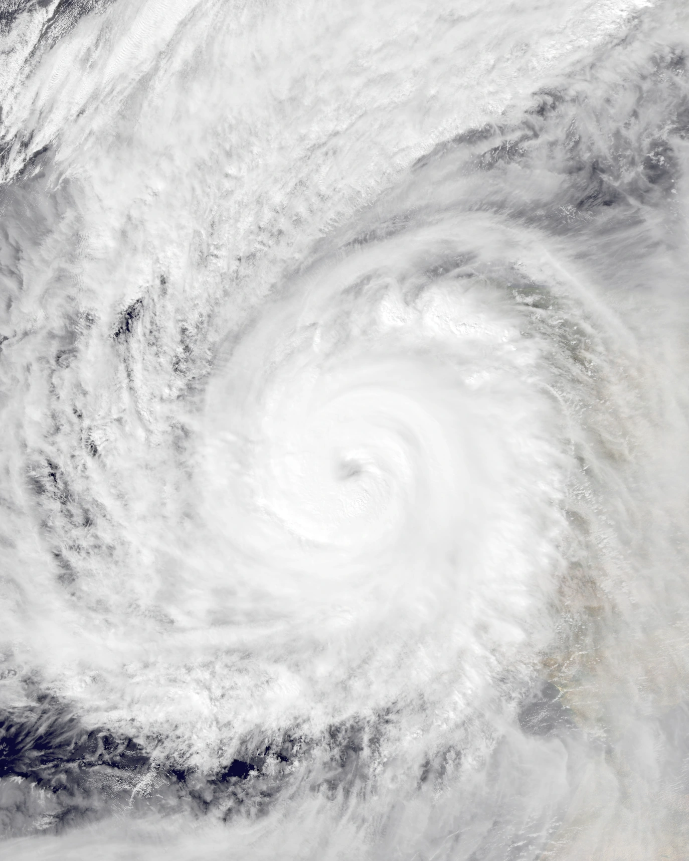 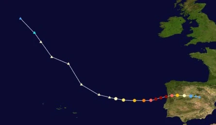 | |
| Duration | July 19 – July 22 |
| Peak intensity | 200 mph (320 km/h) (1-min) 882 mbar (hPa) |
An extratropical cyclone formed over the open Atlantic at 11:00 UTC on July 17 and moved southeast due to interaction with another extratropical system. Strong baroclinic instability led to explosive cyclogenesis in the storm despite the time of year, with a sensor out at sea reporting a wind gust of 156 km/h, or 97 mph. As it began to turn eastward, the system, still carrying winds equivalent to a Category 1 hurricane, began to quickly undergo a transition into a tropical cyclone on July 19. Unusually favorable conditions for tropical cyclone development for its location allowed the cyclone to become fully tropical at 09:00 UTC, receiving the name Jacobus. Due to the continual presence of abnormally warm sea surface temperatures in the waters off the coast of the Iberian Peninsula, Jacobus began to rapidly intensify. At 02:00 UTC on July 20, the storm was upgraded into a major Category 3 hurricane while developing a well-defined eye and intense convection. Jacobus became a Category 4 just a few hours later, eclipsing both Kate and Nicholas' strengths. Later that day, the storm became a Category 6 and became the northernmost extreme hurricane ever recorded as well as by far the strongest tropical cyclone to ever affect Europe on record. Both records would be broken by Collin later in the year. Jacobus reached peak sustained winds of 320 km/h at 05:00 UTC on July 21 before hitting a few kilometers south of Porto, Portugal at 12:55 UTC that day. Eventually, extremely dry air and land interaction caused Jacobus to explosively weaken over Iberia, and the storm eventually dissipated at 15:00 UTC the next day.
As mentioned before, Jacobus was by far the strongest hurricane to hit Europe at the time and one of the worst Portuguese and Spanish natural disasters on record, causing hundreds of times more destruction than Kate and Nicholas of the same year. EF5-force sustained winds tore through much of northern Portugal and a few parts of Spain, causing entire homes and businesses to be blown away. Only very large and sturdy high-rise buildings like office buildings, large apartments, hotels, and parking garages remained standing in areas affected by Jacobus' eyewall, and said buildings still retained severe damage to their walls, windows, and doors. Thousands of vehicles were thrown into the air and ended up landing up to a few kilometers away from their place of origin; there were numerous reports of boats being sent far inland, cars originally from dealerships being found up to 2.3 km away, and vehicles as large as trucks crashing into buildings. Trees were uprooted en masse and contributed to the extreme wind damage. Even worse was Jacobus' storm surge, which was 12 meters high at most and caused widespread flooding up to 4 kilometers inland. Buildings not destroyed by the hurricane's winds experienced inundation up to 8 feet high, trapping many on roofs and warranting an estimated 4,670 rescues. The storm damaged a total of 2.3 million structures and completely destroyed 1.1 million of them, with the fact that the area was not designed to withstand tropical cyclone conditions being to blame for the extreme property damage. Overall, Jacobus was responsible for $155 billion USD in damages and the deaths of 67,890 people.
Hurricane Kenzie[]
| Category 5 hurricane (SSHWS) | |
|---|---|
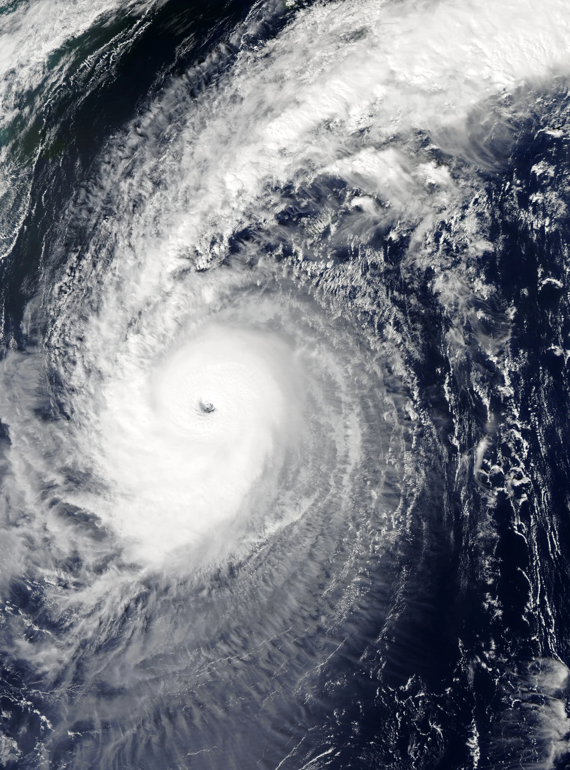 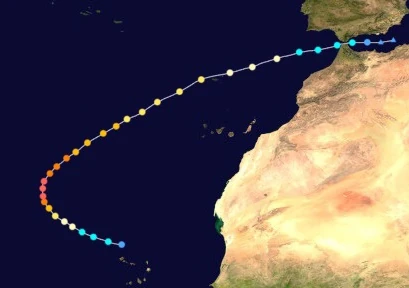 | |
| Duration | July 20 – July 28 |
| Peak intensity | 180 mph (290 km/h) (1-min) 908 mbar (hPa) |
On July 18, an area of disturbed weather emerged from the coast of Africa and moved northwest. Favorable conditions caused the disturbance to slowly gain convection and develop a small circulation in its center. It was eventually upgraded into Tropical Depression Thirty-Nine at 06:00 UTC two days later a few dozen kilometers north of Cabo Verde. Just seven hours later, the depression attained sustained winds above gale force and was upgraded into a tropical storm, getting the name Kenzie. Kenzie continued to strengthen as it began developing curved bands of deep convection. At 07:00 UTC on July 21, the NHC upgraded the storm into a Category 1 hurricane upon the formation of an eye-like feature. Thereafter, rapid intensification ensured due to very warm waters of 95 degrees Fahrenheit/35 degrees Celsius. At 01:00 UTC on July 22, Kenzie was upgraded to major hurricane status. This was followed by a 65 mph-increase in its one minute sustained winds and a whopping 154 mbar-drop in its central atmospheric pressure over a timeframe of less than 24 hours. By the end of the day, the storm had reached its peak strength of 180 mph and 908 mbar while beginning to be steered northeast by a combination of an approaching extratropical cyclone and the force of the Azores High. While moving northeast, dry air became entrapped within Kenzie's circulation while upwelling began occurring in the waters below. However, weakening was still rather slow. Early on July 25, the storm dropped below major hurricane status and became a Category 2 hurricane, though it still bore a well-defined eye at the center of its central dense overcast. While weakening into a Category 1, Kenzie passed within a dozen kilometers of Madeira at 07:00 UTC on July 26. At 03:00 UTC on July 27, the storm weakened further into a tropical storm. While a tropical storm, it made landfall on Tangier, Morocco at 18:30 UTC before entering the Mediterranean Sea, becoming both the first tropical cyclone to ever hit Morocco, the first to cross from the Atlantic into the Mediterranean, and one of the few tropical cyclones to simply exist in the Mediterranean altogether. However, hostile conditions in said sea caused Kenzie to weaken even more rapidly, dissipating at 08:00 UTC on July 28.
As the first tropical cyclone to affect Morocco while fully tropical, Kenzie caused considerable damage to both Morocco and areas of southern Spain. Though wind gusts never exceeded hurricane strength, numerous structures received moderate damage especially to roofs and windows. Residents of both countries reported 1892 incidents of roof shingles or even entire roof sections being blown away. Many tree branches, especially those of weaker trees, were snapped. Some of them blocked roadways, leading to traffic. Flooding also caused road closures and damage to homes and businesses; waters were up to 1.2 meters deep as most. 2,640 structures in Morocco and 1,922 structures in Spain were damaged by Kenzie in total. In Madeira, damage was even more severe; powerful wind gusts of up to 190 km/h ravaged the islands and tore off numerous rooftops and tree branches. Streets were littered with debris such as fragments of homes, shattered glass, branches, downed power lines, and more. Waves up to 13 meters high were recorded along the coast. In total, Hurricane Kenzie was responsible for $1.5 billion USD in damages and 180 deaths.
Hurricane Lucio[]
| Category 5 hurricane (SSHWS) | |
|---|---|
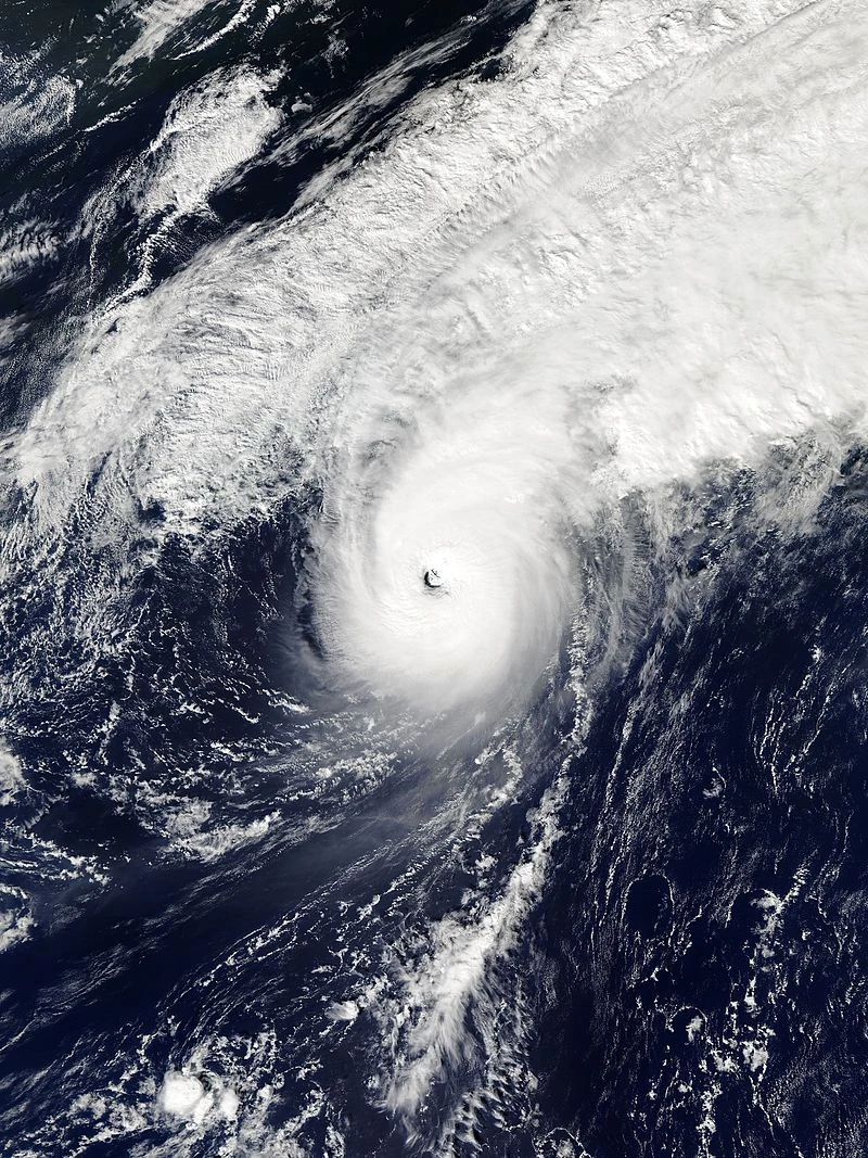  | |
| Duration | July 21 – July 27 |
| Peak intensity | 160 mph (255 km/h) (1-min) 929 mbar (hPa) |
The National Hurricane Center began to monitor an extratropical cyclone over the open Atlantic early on July 20. Over the next few days, the cyclone gradually gained tropical characteristics. It fully transitioned into a tropical depression at 19:00 UTC on July 21. The next day, despite its northerly location, the depression strengthened into a tropical storm and was named Lucio at 11:00 UTC. While strengthening, Lucio began to turn west towards the Azores due to the interference of another low pressure area to the south. At 01:00 UTC on July 23, Lucio was upgraded to hurricane status as an eye became apparent in the center of the storm's central dense overcast, though it was ragged and cloud-filled at the time. This changed around 13 hours later, when the storm became a Category 2 and the appearance of its eye became more well-defined. While a Category 2, Lucio passed within less than a mile of the island of Sao Miguel. At 06:00 UTC on July 24, as Lucio kept strengthening, it made landfall on the island of Terceira while carrying sustained winds of 175 km/h. Shortly after landfall, the storm strengthened into a Category 3 before passing within a few kilometers of Graciosa Island. Lucio strengthened into a Category 4 later that day. At 04:00 UTC on July 25, Lucio reached peak strength as a 255 km/h Category 5 hurricane while making a tight cyclonic loop. Due to increasing wind shear and cooler waters, the hurricane began to weaken after peaking, but was still a powerful 150 mph Category 4 when it struck the islands of Pico and Sao Jorge at 23:00 UTC and 01:00 UTC on July 26 respectively. After making one last landfall on Terceira at around 05:00 UTC on the 26th, Lucio exited the loop and began moving north out of the Azores, where it weakened even more quickly due to colder waters and stronger wind shear. At noon, the storm dropped below hurricane status as its eye disappeared from view and by 02:00 UTC on July 27, it had lost most of its convection and weakened to a tropical storm. Approximately 15 hours later at 17:00 UTC that day, Lucio dissipated after being absorbed by an extratropical cyclone.
Lucio was both the strongest and the worst tropical cyclone to ever hit the Azores while tropical; major hurricane-force sustained winds, record amounts of rainfall, and large 10 m waves battered the islands for days as the storm slowly meandered over the archipelago. 100% of structures were damaged or destroyed in every island except Sao Pedro, Flores, and Corvo. In Sao Miguel, Category 2-strength 1-minute sustained winds damaged hundreds of structures, with roofs being blown away and chunks of walls being chipped off. Windows were blasted off and building interiors were ruined. The debris from these homes and businesses accompanied large tree branches in blocking roadways and interfering with transportation. Wind damage was worse in Faial, Pico, Sao Jorge, and Terceira, where most structures were demolished completely. Terceira in particular was hit twice by Lucio and both were at major hurricane strength. Every structure in the aforementioned island was completely destroyed. In all islands of the Azores, flooding and storm surge caused large amounts of devastation to add to the already-severe wind damage. Up to 2430 mm (96 in) of rain fell across the islands in total; more rainfall fell on the Azores over the span of a few days than the average annual rainfall totals of the islands. This led to extensive flooding and landslides, burying towns in water or mud from hillsides. Along the coast, waves over 30 feet high led to the destruction of boats, coastal structures, and the erosion of numerous beaches. Overall, Lucio was responsible for $2 billion in damages and 1,287 deaths. Following the storm, living conditions became poor enough that over 99% of the remaining population evacuated, leaving the Azores on the border of becoming deserted. They later sank completely due to the powerful extratropical remnant of Hypercane Theta and the aftermath of Armageddon Storm Collin later in the year, making them permanently uninhabitable.
Hurricane Makayla[]
- Main article: Hurricane Makayla 2027 (Landon53 and Litia Von Lucerna)
| Category 8 hurricane (SSHWS) | |
|---|---|
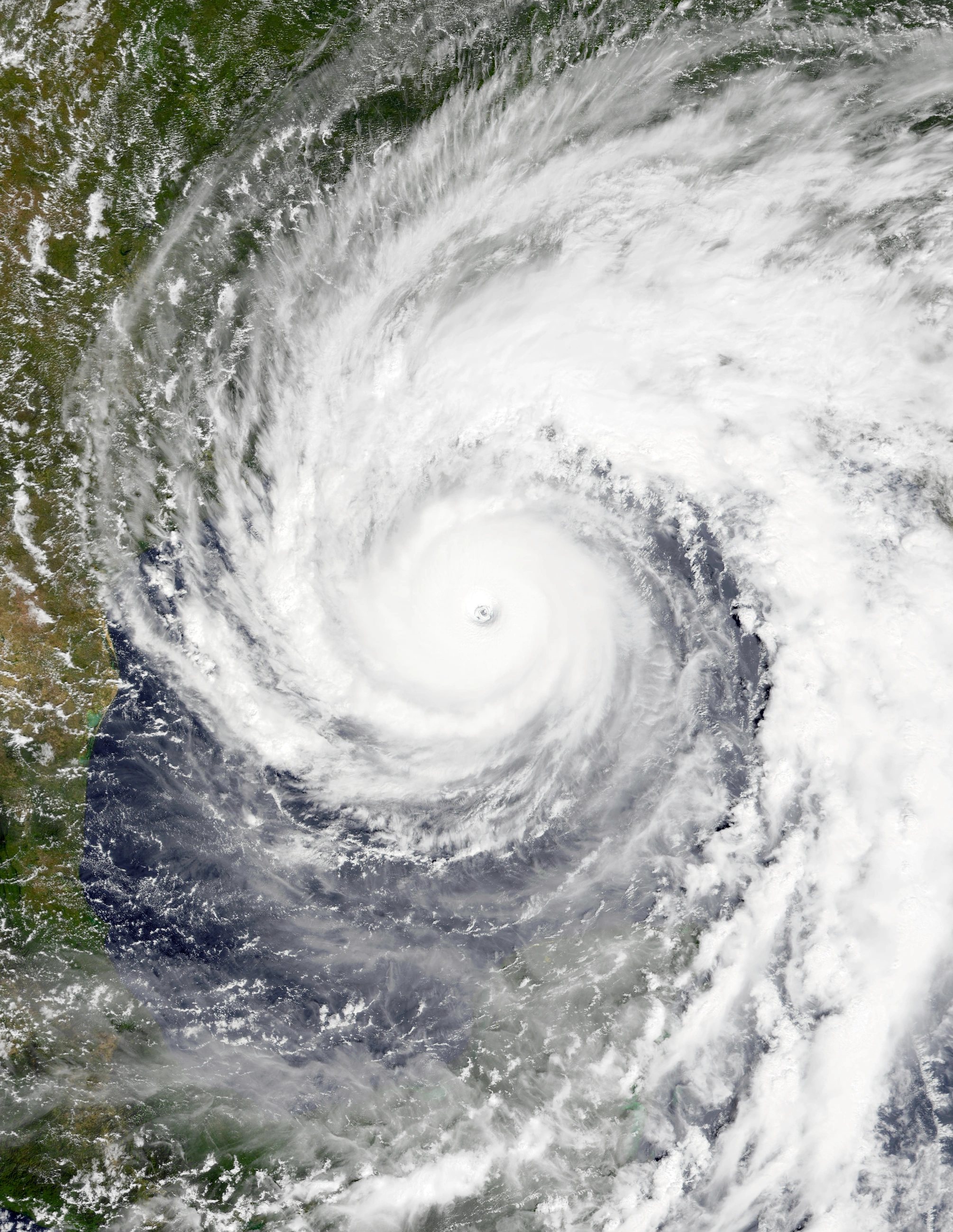 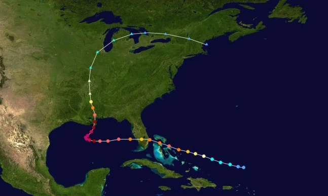 | |
| Duration | August 1 – August 8 |
| Peak intensity | 250 mph (400 km/h) (1-min) 831 mbar (hPa) |
On July 30, a tropical disturbance developed over the open Atlantic. Wind shear from the nearby weakening Hurricane Heath prevented any significant development for several days. However, on August 1, conditions became more favorable for tropical cyclone development and the disturbance's organization began to improve drastically. At 12:00 UTC that day, the NHC designated the disturbance as Tropical Depression Forty-One following the formation of a defined low-level circulation capped by intense convection. Intensification continued into the following day as the system moved west; Forty-One became Tropical Storm Makayla at 01:00 UTC on August 2 and a hurricane at 21:00 UTC the same day. Approaching the Bahamas, Makayla soon intensified further into a Category 3 major hurricane at 09:00 UTC on August 3. The storm went on to reach an initial peak intensity of 160 mph, a minimal Category 5, at 23:00 UTC that day while passing over Eleuthera. An eyewall replacement cycle then caused the hurricane to weaken into a Category 4 before hitting what was West Palm Beach, Florida at 13:10 UTC on August 4. It weakened further into a Category 3 over land, but quickly regained its strength after emerging into the Gulf of Mexico later that day. Near the beginning of August 5, Makayla regained Category 5 strength and began to slow down due to a trough approaching from the northwest. As it did so, rapid intensification began to occur due to extremely high sea surface temperatures and almost no wind shear. Following Makayla's upgrade to Category 6 status at 22:00 UTC that day, Makayla exploded to its peak intensity of 250 mph and 831 mbar, a Category 8 on the SSHWS, at 14:00 UTC on August 6 as the same trough mentioned before began shifting the hurricane's motion northeast towards eastern Louisiana. Despite its rapid deepening, Makayla retained a relatively large but well-defined eye. A steady decrease in unfavorable conditions led to a weakening trend in the storm thereafter. By the time it made landfall on Louisiana at 15:00 UTC on August 7, it had weakened to Category 6 strength. Weakening then quickened due to land interaction, with the storm losing extreme hurricane status at 20:00 UTC that day, major hurricane status at 13:00 UTC on August 8, and tropical status altogether at 16:00 UTC. Its remnants went on to bring rain and occasional gusty winds across the central United States and some isolated parts of southern Canada before merging with another frontal low on August 10.
As it passed over the Bahamas as a powerful major hurricane from August 3 to 4, Makayla caused significant destruction comparable to that of Dorian in 2019. Eleuthera was the hardest-hit, with wind gusts up to 179 mph destroying most buildings in the towns of Freetown and Dunmore. Up to 50% of the island became submerged by a powerful storm surge. New Providence, Andros, and Grand Bahama also received severe damage. The three islands had 6,000, 9,000 and 3,500 structures damaged or destroyed respectively while over 300,000 Bahamians reported losing power. In Florida, wind gusts of up to 162 mph and flooding up to 7 feet high were recorded, but due to the area hit being submerged by Hypercane Heath a few weeks prior, not much new damage was recorded in the state. Makayla's effects were catastrophic in Louisiana and Mississippi, with the storm becoming the worst storm to hit the states since Katrina in 2005. In addition to levees being overtopped by a storm surge up to 46 feet high, powerful sustained winds of 215 mph tore through numerous populated areas such as New Orleans and Gulfport. In advance of the storm, Gulf Coast mayors and governors ordered the evacuations of 2.4 million residents, with another 925,000 being forced to relocate temporarily due to their homes being damaged or destroyed by the powerful cyclone. 560,000 buildings and 620,000 vehicles were damaged or destroyed by Makayla, including important power plants and electrical stations whose destruction led to the loss of power for approximately 8 million people. FEMA and other aid organizations managed the aftermath of the storm, but due to numerous other locations in the United States and the overall Atlantic basin also requiring assistance in recovering from other damaging hurricanes, their help was limited and rather ineffective. 6.7 million United States residents were left without basic needs such as food, clean drinking water, and shelter and were forced to take refuge in cramped shelters such as stadiums, where disease was rampant. Across other parts of the central and eastern United States, Makayla's remnants spawned 47 tornadoes, though most of them were weak and did little damage. In total, Makayla caused $225 billion in damages and 9,834 fatalities.
Hurricane Nolan[]
| Category 8 hurricane (SSHWS) | |
|---|---|
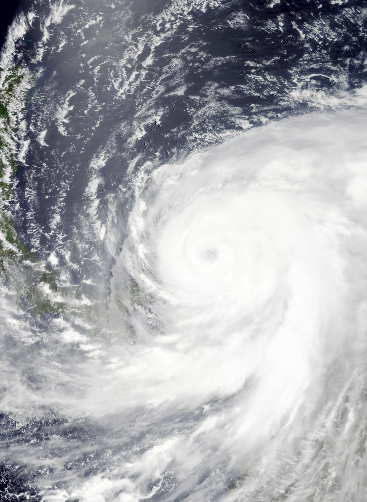 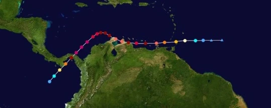 | |
| Duration | August 1 – August 7 |
| Peak intensity | 245 mph (395 km/h) (1-min) 848 mbar (hPa) |
Early on August 1, the NHC began monitoring an area of thunderstorms southeast of the Lesser Antilles. Though it showed signs of forming a well-defined circulation, the circulation's state of incompletion as well as the lack of any deep convection in the system prevented it from being upgraded into a true tropical cyclone. However, very favorable conditions ahead of the storm's westward path made intensification very likely. As predicted, the disturbance soon gained enough organization to be designated Tropical Depression Forty-Two at 15:00 UTC that day, just three hours after the formation of what would become Hurricane Makayla. As favorable conditions continued to be present, the depression began to rapidly strengthen, becoming Tropical Storm Nolan at 19:00 UTC the same day. Explosive deepening continued into August 2, when Nolan intensified further into a hurricane at 03:00 UTC with a developing eye already being apparent on radar and into a major hurricane just four hours later at around 07:00 UTC while passing just a few dozen kilometers north of Tobago. By the end of the day, Nolan had become a powerful Category 5 hurricane just a few dozen kilometers north of Isla Margarita, breaking Matthew of 2016's record for southernmost Category 5 hurricane on record. However, the storm continued to intensify, and Nolan became the southernmost Category 6 or higher storm on record at 04:00 UTC on August 3. At 10:00 UTC, Nolan reached an initial peak as a low-end Category 7 hurricane before making landfall on San Juan de los Cayos, Venezuela at 15:30 UTC at that intensity and becoming one of the only storms to hit Venezuela. Weakening over land as the storm passed through other parts of Venezuela and neighboring Colombia, Nolan lost extreme hurricane status at 18:00 UTC that day and began curving northwestward. It eventually emerged from the Guajira Peninsula into open waters once more at 09:00 UTC on August 4. Around that time, another round of intensification occurred and Nolan regained Category 6 status at 11:00 UTC that day. Early on August 5, Nolan became a Category 7 again after beginning to make an unusual turn southwest, having ceased its northwestward movement. At 20:00 UTC that day, Nolan reached its second peak of 245 mph and 848 mbar, a Category 8 hurricane, and broke its own records for southernmost Category 5 (or higher) and southernmost Category 6+ storm. At 06:20 UTC on August 6, Nolan made landfall on Tupile, Panama, breaking Hurricane Otto of 2016 and Hurricane Isla earlier in the season's record for southernmost Central America landfall on record. Very high wind shear, land interaction, insufficient Coriolis forces, and other unfavorable factors caused Nolan to rapidly weaken and dissipate following its landfall, but not before it made one last landfall as a Category 4 on the eastern tip of the Azuero Peninsula at 17:15 UTC that day. Nolan dissipated at 13:00 UTC on August 7, with radar and satellite showing that the storm had lost its circulation alongside all convection.
Over half of the population of Tobago evacuated from August 1–2 in anticipation of Nolan's arrival, as forecast models predicted rapid intensification to occur and Nolan to hit Tobago as a strong major hurricane. These predictions indeed came true, with damages being more severe than predicted due to the little time the island's residents had to prepare for the fast-moving storm. Though Nolan only remained close enough to the island to cause stormy conditions for just over a day, storm surge and strong winds were able to damage almost all of the island's structures, with a little less than a third being completely destroyed. Damage included torn roofs, visible wall damage, and the destruction of most windows and doors. Many trees were also uprooted. Isla Margarita was also evacuated in preparation for the storm. Like in Tobago, most structures sustained damage, with almost all structures being totally destroyed this time due to Nolan's stronger winds. Northeastern Venezuela was one of the hardest hit areas, with winds near or at 300 km/h ripping through the land. Approximately 7,890 structures in the area were affected by the winds and severe flooding in some form, with another 3,299 being completely destroyed. Damage was described as catastrophic, with even large buildings such as offices and apartments maintaining severe structural damage. Elsewhere along the coast of the country, storm surge presented a significant hazard, with waves of up to 5 m high forcing road closures and even inundating buildings along the shoreline in some cases. These effects were also seen in Colombia. Around 5.5 million Venezuelans and 700,000 Colombians lost power, with the islands of Isla Margarita and Tobago both completely losing access to electricity. Panama received some of the worst damage alongside northeastern Venezuela. Category 8-strength sustained winds and intense rainfall caused the damaging of over a quarter of all structures in the entire country. In addition to buildings being lifted into the air and torn apart, roads themselves received significant damage from Nolan's winds and chunks of pavement were sent flying into the air. Flooding was widespread, inundating countless towns and destroying acres upon acres of farmland, but the moisture's chief effect was in the form of mudslides. Nolan was responsible for a total of 47 reported landslides and mudslides which travelled down hillsides and buried thousands of homes and businesses. Rescue personnel both from the country itself and from abroad spent days clearing the muddy debris and recovering buried bodies, including those of young children. In total, Nolan was responsible for $13.4 billion in economic losses and 87,454 fatalities, a number that is still rising as more and more bodies are being found at mudslide sites.
Hypercane Orlanda[]
| Hypercane (SSHWS) | |
|---|---|
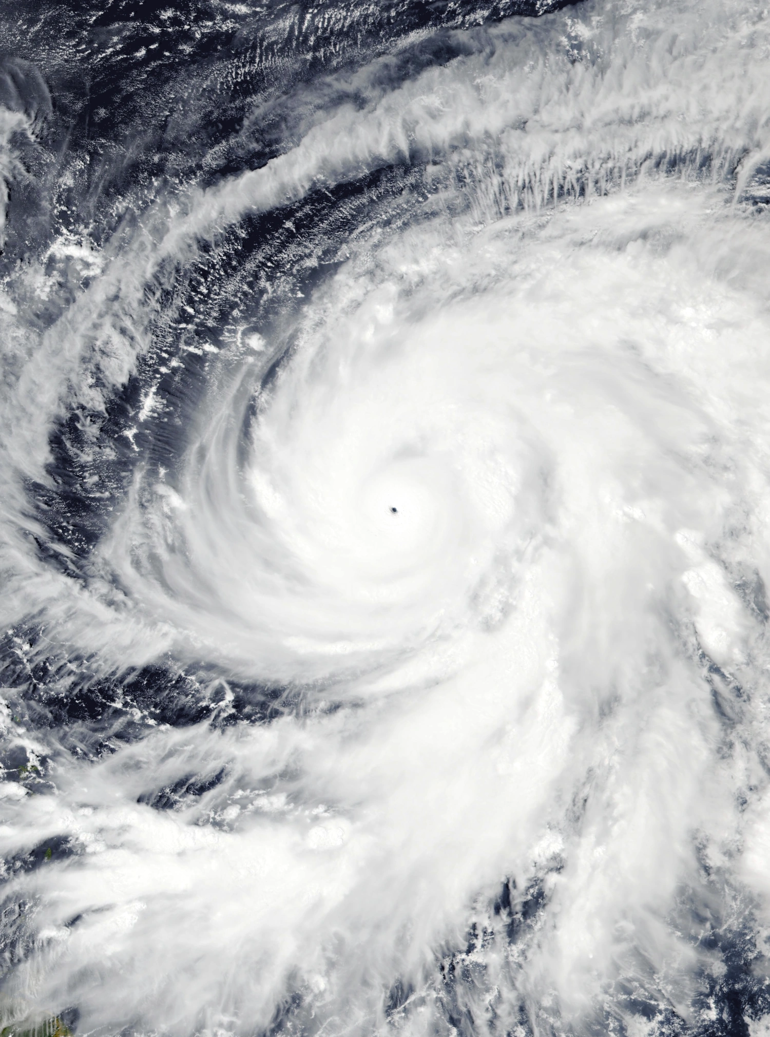 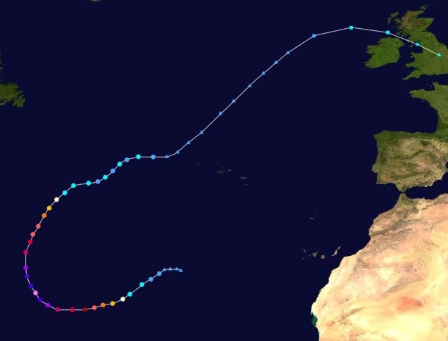 | |
| Duration | August 2 – August 14 |
| Peak intensity | 300 mph (480 km/h) (1-min) 796 mbar (hPa) |
An area of low pressure formed over the eastern Atlantic ocean at 11:00 UTC on August 1. Moving southwest along an adjacent high pressure area to its north, the low steadily gained tropical characteristics and developed central convection and a circulation. Its circulation became well-defined enough on August 2 that it was designated Tropical Depression Forty-Three at 08:00 UTC that day. At 18:00 UTC, the depression further strengthened into a tropical storm and was named Orlanda. Following the storm's upgrade to a hurricane at 07:00 UTC the following day, Orlanda began to rapidly intensify due to very warm waters of over 50 °C (122 °F) in temperature being spewed nearby from the Atlantic Mid-Ocean Ridge. Just six hours later, Orlanda intensified into a major hurricane and developed a clear pinhole eye. By the beginning of August 4, the storm had become a Category 5 hurricane on the Saffir-Simpson Scale. Orlanda intensified further into a Category 6 at 10:00 UTC, with intensification and the development of even more deep convection showing no signs of stopping as it began to curve north. Orlanda's rapid intensification culminated with its intensification into a hypercane at 17:00 UTC on August 5 and hurricane hunter planes recording maximum 1-minute sustained winds of 480 km/h. Shortly after its peak, Orlanda's eyewall began to contract, signaling an eyewall replacement cycle. The ERC along with cooler waters caused by upwelling marked the end of the storm's rapid intensification and the beginning of a steady weakening trend. The system held on to hypercane status for only two hours before weakening back into a Category 10 at 19:00 UTC. The storm dipped below extreme hurricane status at 05:00 UTC on August 7, but then completed its eyewall replacement cycle and developed a large eye, halting weakening. However, Orlanda soon turned northeast into even cooler waters, where it weakened further below major hurricane status at 01:00 UTC on August 8. At 10:00 UTC on the 8th, Orlanda weakened into a tropical storm and its eye, now ragged, quickly became cloud filled. This was followed by a period from August 9 to 10 where the storm fluctuated between tropical storm and tropical depression strength. At 22:00 UTC on the 10th, Orlanda transitioned into an extratropical cyclone a few hundred kilometers west of the Azores and stabilized at tropical depression-equivalent strength.
The storm continued northwest as an extratropical cyclone for over two days. On August 13, however, Orlanda began to show signs of a tropical transition despite being located off the coast of Ireland, an area normally far too hostile for tropical cyclone development. Unusually warm waters and low wind shear enabled Orlanda to regenerate as a subtropical depression at 09:00 UTC that day. At 14:00 UTC, Orlanda surprised meteorologists even further when it became a subtropical storm, becoming the second northernmost (sub)tropical cyclone ever recorded behind Faith in 1966. Four hours later, Orlanda reached peak winds of 80 km/h (50 mph) before becoming extratropical again at 02:00 UTC on August 14 just a few kilometers northeast of Ballycastle in Northern Ireland.
Being one of the only tropical cyclones to affect the British Isles while subtropical, Orlanda caused moderate damage. Wind gusts of up to 102 km/h caused roof damage and broke branches off of trees, some of which led to road closures. Waves up to three meters in height were recorded along the coasts of northern Ireland and western England which flooded roads along the coast and prompted beach closures. Light rain was also reported in the Azores from Orlanda while it was extratropical. 9 deaths were recorded from the storm. Ironically enough, most of them were not caused by stormy conditions in the British Islands, but rather by rip currents along the east coast of the United States caused by the storm. 6 swimmers were caught in rough surf and drowned in the U.S while another drowned in Canada. The 3 other deaths all occurred in England and Ireland, with 2 deaths from a car accident near London caused by slippery roads and 1 death from a person in Belfast being struck by a fallen tree. Orlanda caused $74 million in damages.
Hurricane Pax[]
| Category 9 hurricane (SSHWS) | |
|---|---|
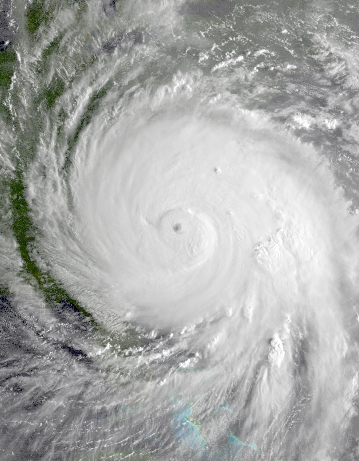 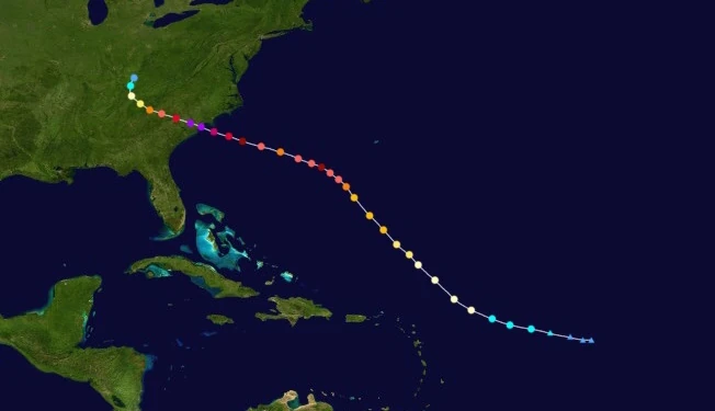 | |
| Duration | August 3 – August 10 |
| Peak intensity | 270 mph (435 km/h) (1-min) 815 mbar (hPa) |
Early on August 2, a developing tropical disturbance was spotted by radar several hundred miles east of the Lesser Antilles moving northwest due to the Bermuda High. The storm quickly gained convection and its sustained winds surpassed gale force at 20:00 UTC that day, but radars only detected an elongated, ill-defined circulation at the system's center which was too disorganized for the NHC to consider the overall system a true tropical cyclone. It eventually was upgraded to Tropical Storm Pax at 01:00 UTC on August 3 following a vast improvement in the center circulation's appearance. Shifting its path slightly north, Pax gradually strengthened and became a hurricane at 19:00 UTC. At 06:00 UTC on August 5, the storm strengthened further into a Category 3 and developed a well-defined eye, making it a Category 3 on the SSHWS. Gradual strengthening continued up until August 6, when Pax entered an area of conditions ripe for rapid intensification. The hurricane, a Category 4 at the time, quickly strengthened into a Category 5 at 08:00 UTC that day and ended the 6th as a 195 mph Category 6 extreme hurricane. Afterwards, the Bermuda High's influence on Pax's movement across the Atlantic began to lessen, causing Pax to begin moving more west than north. At the same time, an eyewall replacement cycle caused the system to weaken, going as far down as a Category 4 on the SSHWS at 17:00 UTC on August 7. Later that day as well as during the next, however, Pax completed its eyewall replacement and began re-gathering its strength even more rapidly than before. At 05:00 UTC on August 8, Pax regained Category 6 status as it inched closer and closer to the Carolinas. Shortly before its landfall south of Myrtle Beach at 23:50 UTC that day, weather instruments recorded a peak intensity of 270 mph and 815 mbar within the storm, which displayed concentric eyewalls indicative of a second eyewall replacement cycle and unusually shallow and widespread convection for its strength. Over land, Pax quickly weakened, but held on to tropical status for an impressive amount of time, dissipating at 21:00 UTC on August 10 over Tennessee almost two days after landfall.
Pax left cataclysmic damage near the border of North and South Carolina. Powerful winds of 270 mph demolished every building in the path of Pax's eyewall, with even large offices and apartments being completely destroyed. Houses, apartments, trains, trucks, cars, and even concrete slabs from sidewalks and roads were reportedly hurled into the air, causing even more damage. Myrtle Beach recorded a hypercane-force wind gust of 301 mph (484 km/h); in the same area, a camera was recovered in the wreckage that showed raw footage of a loose boat being lifted by the winds and slamming into the SkyWheel, a famous ferris wheel in the city. The owner of the camera was assumed dead and the footage was leaked online, where it went viral. Large waves over 150 feet (50 meters) tall were also recorded along the coast which caused devastation comparable to tsunamis and washed the remains of ships and boardwalks onshore. Further inland, over 12 inches of rain in some areas caused severe flooding which inundated an estimated total of 157,000 homes in South Carolina alone. The flooding also caused numerous road closures which combined with even more road closures caused by debris caused what was essentially a complete standstill in terms of transportation in numerous cities including major population centers such as Charleston and Florence. Even further inland, Pax spawned a total of 17 tornadoes across Atlanta, Alabama, and Tennessee including a damaging EF2 in Sevierville, TN. Pax also caused rough surf in the Bahamas, the remains of Bermuda, and the Lesser and Greater Antilles. In total, Pax was blamed for $369 billion in economic losses and 4,873 deaths.
Hurricane Ronin[]
| Category 1 hurricane (SSHWS) | |
|---|---|
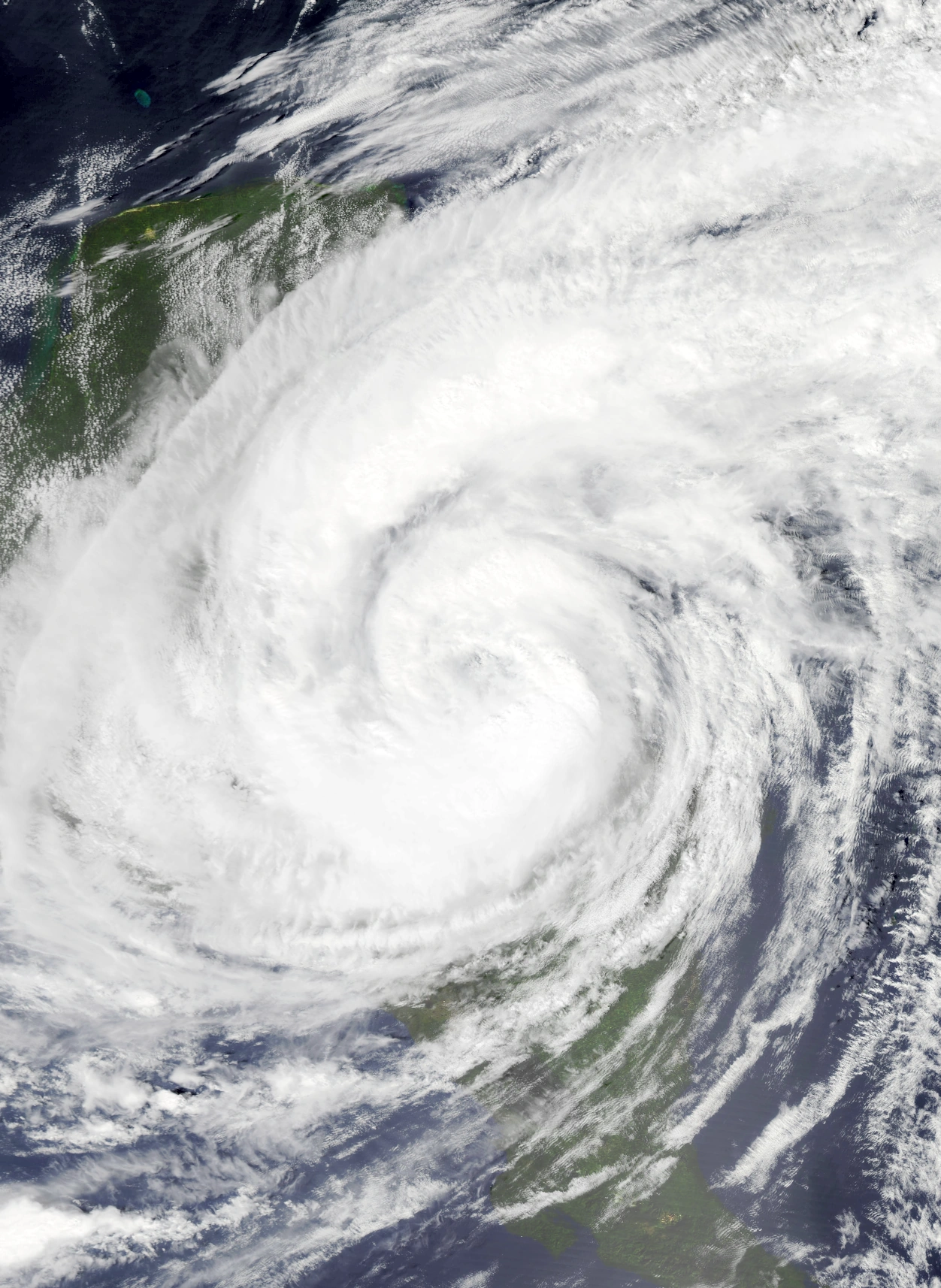 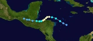 | |
| Duration | August 5 – August 9 |
| Peak intensity | 90 mph (145 km/h) (1-min) 979 mbar (hPa) |
On August 5, an area of intense convection spontaneously formed in the southwestern Caribbean Sea off the coast of Nicaragua. Despite wind shear from the nearby powerful Hurricane Nolan, the system quickly developed a well-defined surface-level circulation and was upgraded into Tropical Depression Forty-Five at 23:00 UTC that day. However, Nolan's shear still had its toll on TD 45 and caused its circulation to become exposed, though convection quickly re-developed and covered the center as the stronger Nolan quickly moved away. By 11:00 UTC on August 6, Forty-Five had gained tropical storm status and was named Ronin while moving west-northwest into more favorable conditions. At 01:00 UTC on August 7, Ronin had grown into a large hurricane in contrast to its origins as a compact area of thunderstorms and began to move southwest towards Honduras. Developing a large, ragged eye, Ronin reached a peak of 145 km/h and 979 mbar at 15:00 UTC on the 7th before making landfall near La Ceiba city at 23:00 UTC that day. Over land, the storm began to turn back west and accelerate while weakening. At 07:00 UTC on August 8, Ronin lost hurricane status and became a tropical storm as its eye collapsed and its convection became disorganized and displaced. By August 9, it had weakened into a mere depression, with only very small bursts of convection covering its mostly exposed core circulation. The circulation and all convection dissipated fully just before midnight that day.
Ronin caused high wind gusts of up to 162 km/h in Honduras, especially La Ceiba. These winds knocked down trees and caused damage to rooftops and windows. Around 180 road closures caused by debris blocking streets were reported while many of La Ceiba's tourist attractions were forced to close and board up in anticipation of the storm. However, flooding was the biggest culprit of damage in Honduras owing to Ronin's slow movement across the country and neighboring Guatemala and Belize. La Ceiba received 355.6 mm (14 in) of rain alone, with a total of 635 mm (25 in) of rain falling across Central America overall. This led to waist-deep flooding both along rivers and the coast which damaged about 75,000 homes and businesses. Residents in cities projected to be hit prepared sandbags to mitigate property damage, which thankfully was successful in lowering the damage. In all, the storm caused $121 million USD in damage. Only one death, a 51-year-old woman who drowned off the coast of Puerto Barrios, was reported during the storm despite the intensity of the flooding.
Hurricane Sophie[]
| Category 4 hurricane (SSHWS) | |
|---|---|
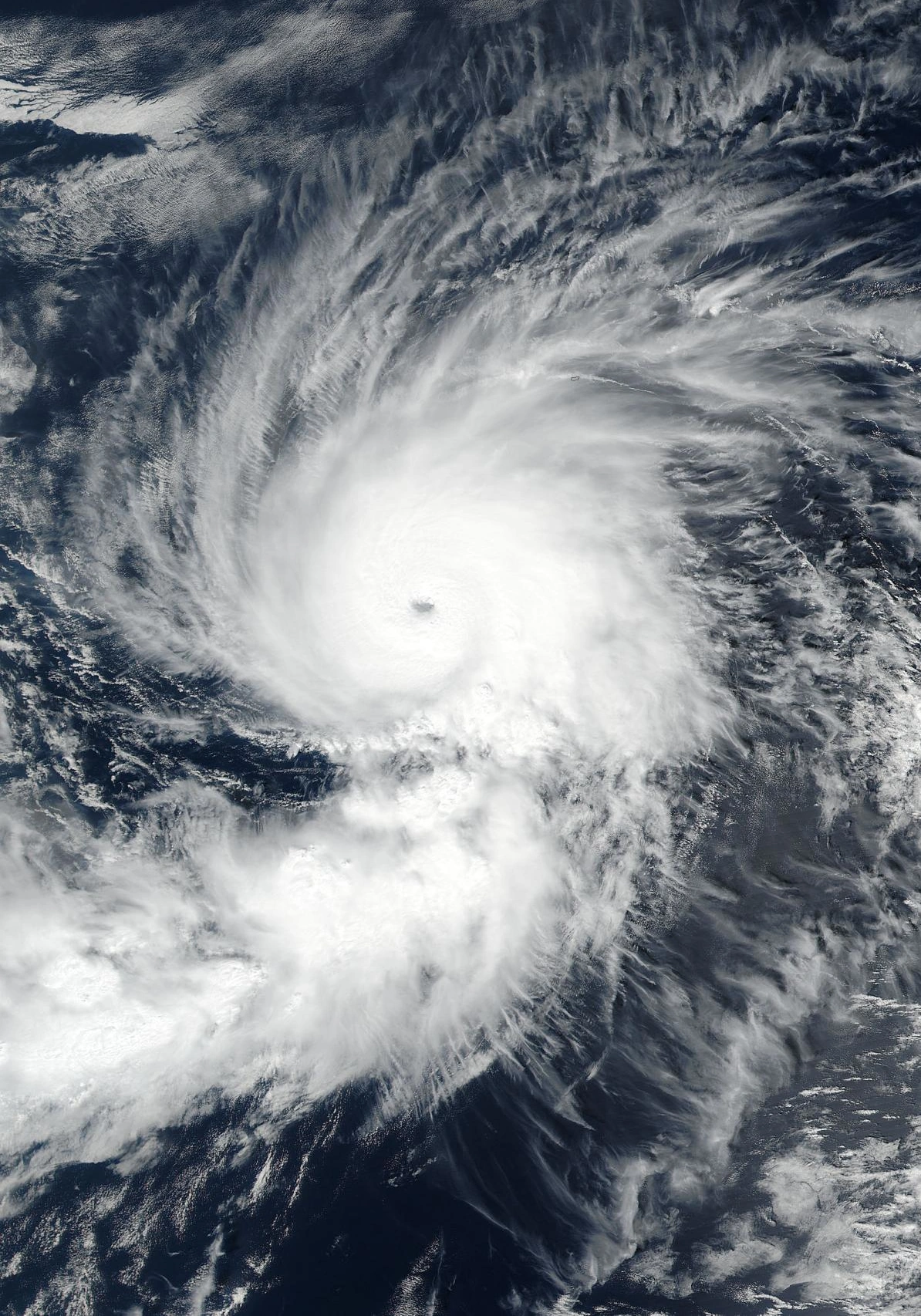 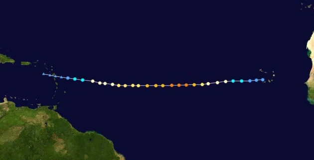 | |
| Duration | August 6 – August 12 |
| Peak intensity | 155 mph (250 km/h) (1-min) 930 mbar (hPa) |
Sophie's origins were from a tropical wave moving west that had emerged from the coast of Africa sometime on August 4. Though wind shear was low, cold waters initially inhibited the organization of the storm, with only small, shallow bursts of convection forming around its well-defined but almost completely exposed circulation. While passing over Cabo Verde late the next day, however, sea surface temperatures quickly rose and the tropical wave's structure began to improve. By 05:00 UTC on August 6, enough deep convection had developed near the circulation for the NHC to designate the system Tropical Depression Forty-Six. As the depression continued to move in a straight line west, it slowly intensified, becoming a tropical storm at 22:00 UTC the same day and receiving the name Sophie and a hurricane at 06:00 UTC on August 7. By then, Sophie had begun to develop an eyewall near the center of the storm. Afterwards, the storm entered an area of conditions favorable for rapid intensification, and huge bursts of deep convection began to form. Sophie became a Category 2 at 01:00 UTC on August 8, a Category 3 major hurricane at 08:00 UTC (developing a well-defined eye by then), and a Category 4 at 14:00 UTC. By 18:00 UTC that day, the storm had reached its peak intensity on the cusp of Category 5 strength while exhibiting well-organized outflow at its northern quadrant. Convection was also deep and well-developed especially within a strong rainband to the south. Following peak, the waters beneath the storm began to decrease in temperature and Sophie experienced a slow weakening trend. At 03:00 UTC on August 10, Sophie lost major hurricane status and became a Category 2 on the SSHWS. The storm's eye and outer rain bands also began to become less well-defined. The storm further weakened into a tropical storm at 04:00 UTC on August 12, having completely lost its eye and deep convection. After weakening into a depression at 12:00 UTC, Sophie degenerated into a post-tropical cyclone at 16:00 UTC.
Approximately 59 mm of rain fell over Cabo Verde while 40 mm fell across the Leeward Islands. No property damage or deaths were reported.
Hurricane Tayshaun[]
| Category 10 hurricane (SSHWS) | |
|---|---|
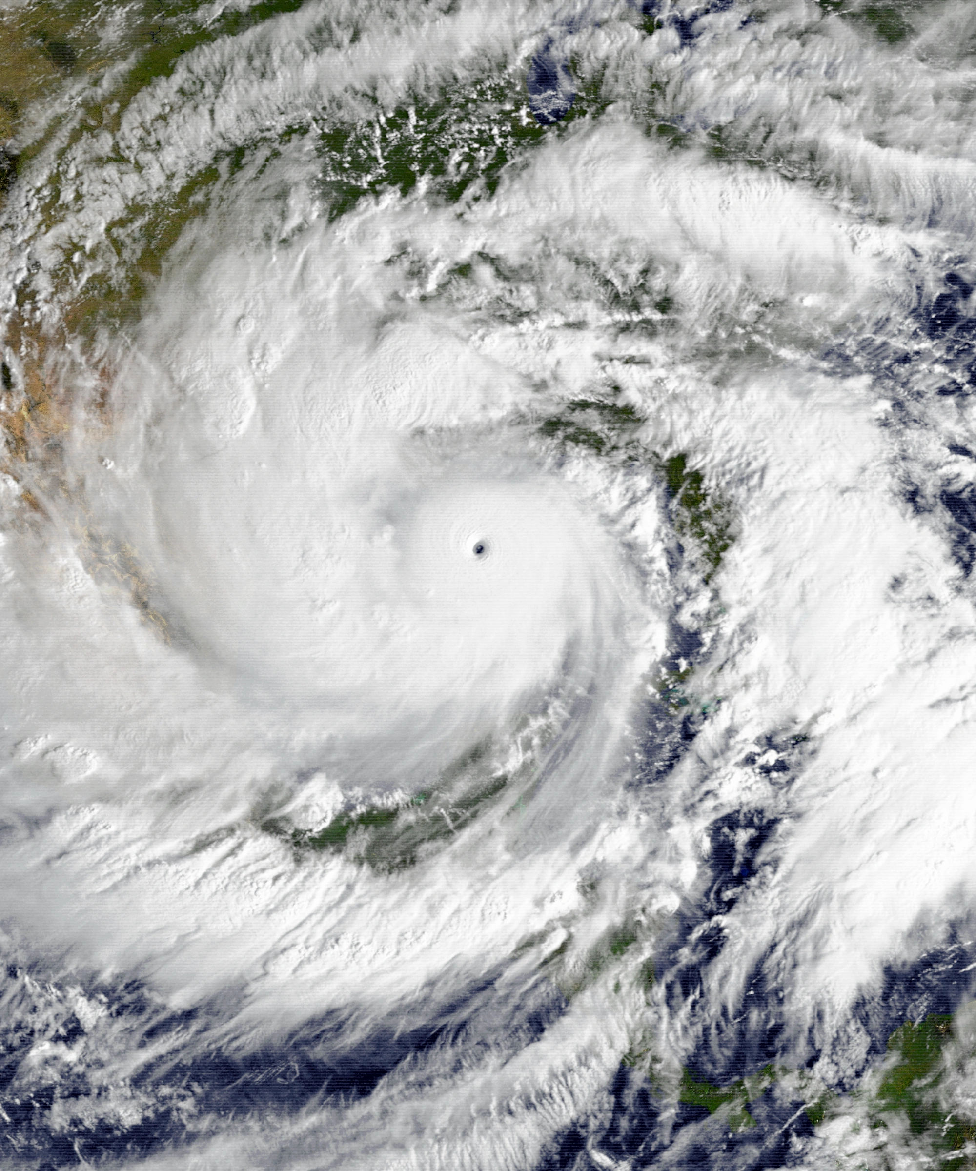 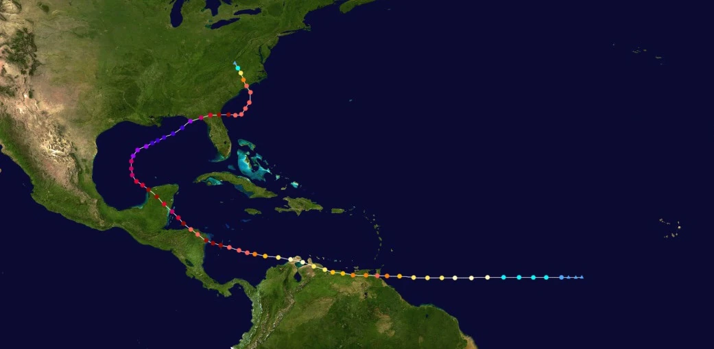 | |
| Duration | August 6 – August 23 |
| Peak intensity | 295 mph (475 km/h) (1-min) 795 mbar (hPa) |
Tayshaun began as an area of disturbed weather moving west over the open Atlantic on August 6. Though convection was deep, it was displaced to the northeast of its center and its central circulation was very ill-defined due to its rather southerly location lacking a large amount of Coriolis force. However, its appearance quickly improved over the course of the day due to the rise of more favorable conditions. Eventually, the disturbance was upgraded by the NHC to tropical depression status at 22:00 UTC. At approximately 02:00 UTC on the 7th, the newly-formed depression quickly gained tropical storm status and was given the name Tayshaun. Intensification was slow thereafter, with the storm becoming a Category 1 hurricane at 04:00 UTC on August 7 and a Category 2 at 23:00 UTC that day. However, an area of unusually warm waters and low wind shear off the coasts of Guyana and Venezuela led to a period of rapid intensification in the storm. Temperatures within Tayshaun's rapidly developing eye dropped dramatically while convection began to quickly fire up both near and far from the center, and the storm reached an initial peak intensity as a minimal Category 5 hurricane at 03:00 UTC on August 10 less than two hours before making landfall on Venezuela's Orinoco Delta. Following Tayshaun's landfall, the hurricane passed through other parts of the country while steadily weakening. By the time the storm emerged back into open waters early on August 12, it had weakened to a mere Category 1 and had lost much of its intense convection. However, warm waters in the Caribbean Sea allowed the system to quickly re-intensify, becoming a major hurricane again at 17:00 UTC that day and regaining its eye and deep convection. Tayshaun rapidly intensified into a Category 6 hurricane at 19:00 UTC on August 13 despite cold wakes from hurricanes Nolan and Ronin and soon struck Puerto Cabezas in Nicaragua at 09:00 UTC on the 14th while carrying sustained winds of 320 km/h. Beginning to shift its motion north due to the Azores High's influence, Tayshaun weakened back into a Category 5 over land, but soon regained extreme hurricane status at 01:00 UTC on August 15. Another period of rapid intensification occurred and the storm reached a third peak of 395 km/h, equivalent to a Category 8 hurricane, at 18:00 UTC that day before hitting near the village of Xcalak, Quintana Roo a few hours later. The storm weakened down to a Category 6 over the Yucatan, but then underwent yet another period of strengthening upon entering the Gulf of Mexico on August 16. Eventually, on August 18 at 21:00 UTC, Tayshaun reached its strongest peak intensity of 295 mph and 795 mbar, a Category 10 right on the verge of hypercane status, while exhibiting a very well-defined eye at the center of a storm 1,100 miles across and being pushed by an approaching upper-level low northeast. The storm maintained C10 strength for an impressive five advisories before hitting Cape San Blas as a Category 9 just after midnight on August 20. Later that day, Tayshaun entered the waters off the coast of the eastern United States having weakened into a Category 6. After weakening into a Category 5 at 02:00 UTC on the 21st due to increasing wind shear, Tayshaun made an unexpected turn northwest and hit Southport, North Carolina at 10:00 UTC on the 22nd with winds of 165 mph, after which it explosively weakened over land. It dissipated fully at 09:00 UTC on August 23 upon the NHC's radars finding that the storm had lost all signs of a circulation.
In Venezuela, Guyana, and Colombia, Tayshaun's impacts were mainly in the form of interfering with post-Nolan recovery efforts. Wind gusts up to 280 km/h tore through the northern regions and added on to the large amount of wind debris generated by Hurricane Nolan. Makeshift tents used as temporary shelters and hospitals were forced to be abandoned and were in most cases blown away by the storm while many buildings already damaged by previous storms finally collapsed. Rivers across northern South America overtopped their banks once more and reflooded affected areas, unfortunately trapping many Nolan victims. Due to the storm, evacuees from islands like Tobago and Isla Margarita were ordered to continue staying away. In Nicaragua and neighboring Honduras, powerful winds toppled entire neighborhoods and left only the largest and strongest structures intact. A wind gust of 355 km/h was reported in Puerto Cabezas, which was considered the ground zero of Tayshaun's Nicaragua landfall. Flooding from a total of 178 mm of rainfall affected roughly 130,000 structures in Nicaragua and 115,000 in Honduras. Over half of the populations of both countries reported losing power during Tayshaun. Strong wind gusts and extremely rough surf were also reported in Guatemala. Damage was even more catastrophic in the Yucatan Peninsula; a storm surge nearly 15 meters high and sustained winds of at least 320 km/h dealt severe damage to even sturdy high-rise buildings in Belize and Quintana Roo. 2.1 million people, nearly the entire population of the peninsula, lost power during the storm. As Tayshaun moved around in the Gulf of Mexico, it generated hurricane-force wind gusts and waves up to 20 feet in height along the coasts of other parts of Mexico as well as the U.S. states of Texas and Louisiana. Florida and Alabama received extremely powerful wind gusts as fast as 295 mph and a storm surge 58 feet high as reported in Panama. Since Florida was almost completely destroyed and still recovering from Heath, Tayshaun's effects there were minimal, but the panhandle as well as numerous parts of southern Alabama were severely affected. In addition to 4.2 million losing power across the states affected, an estimated 452,000 structures were damaged and 178,283 were destroyed completely. Catastrophic damage also occurred in the Carolinas where Tayshaun hit as a Category 5, but due to rapid weakening, the storm's damage was relatively light compared to other areas. Its effects there were similar to in South America and mainly consisted of delaying recovery efforts after Pax. Due to the large scope of its effects, Hurricane Tayshaun caused a total of $888 billion (2027 USD) in economic losses and 78,213 deaths.
Hurricane Viviana[]
| Category 3 hurricane (SSHWS) | |
|---|---|
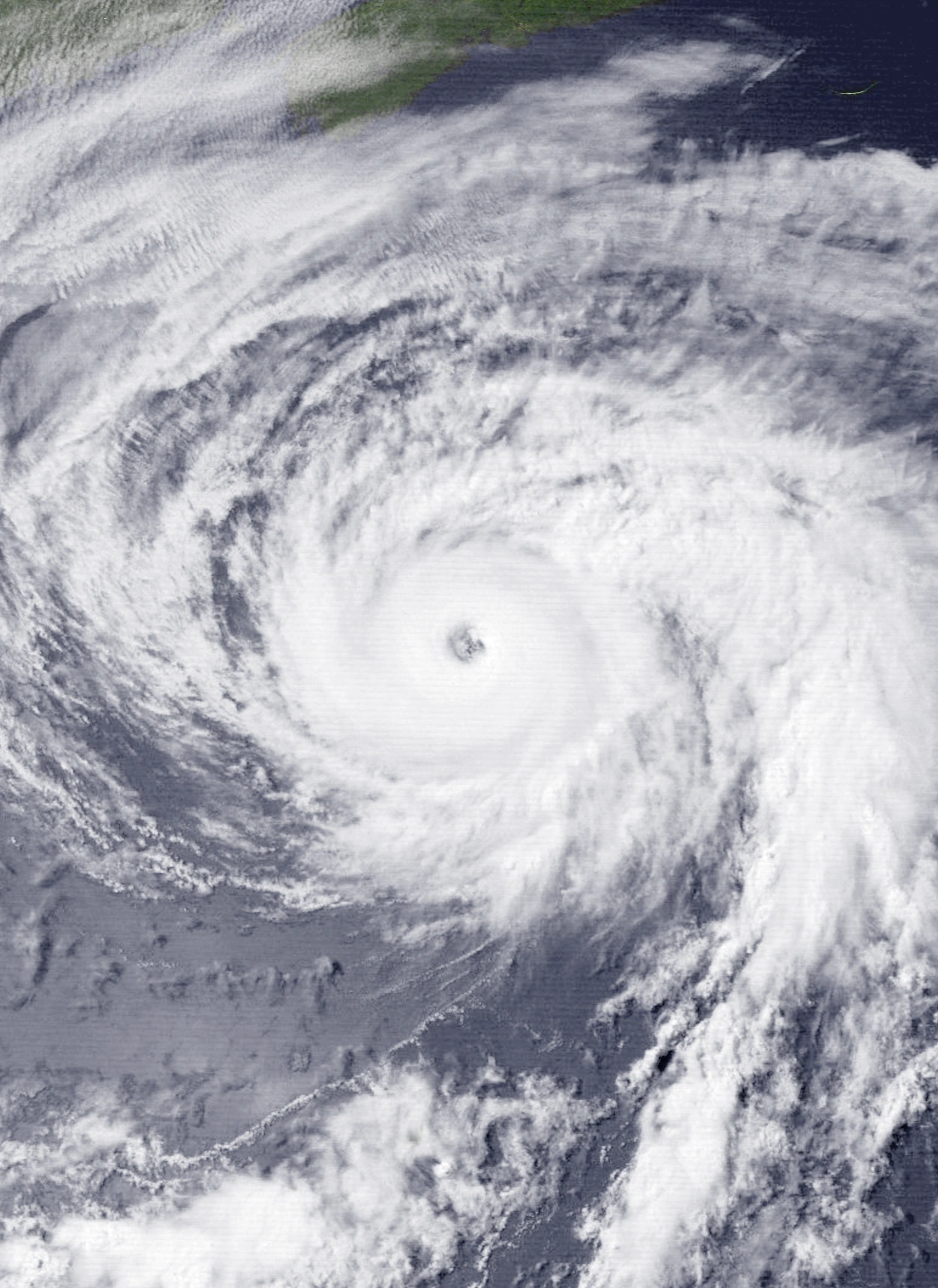 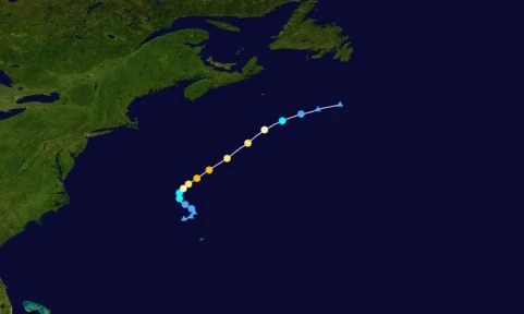 | |
| Duration | August 8 – August 11 |
| Peak intensity | 120 mph (195 km/h) (1-min) 968 mbar (hPa) |
Around noon on August 7, a relatively stationary frontal low formed a few hundred kilometers northwest of Bermuda. Despite it being non-tropical, the NHC closely monitored it due to its high chance of becoming tropical or subtropical. As per their predictions, the system began to quickly undergo a tropical transition the next day, with bursts of central convection forming and its weather fronts separating from the low. At 07:00 UTC on the 8th, it was officially designated Tropical Depression Forty-Eight. Afterwards, as it slowly strengthened, the newly-formed depression began to turn northwest. However, it continued to do so very slowly much like it did before formation. Around 21:00 UTC that day, hurricane hunter planes flew into Forty-Eight and found sustained winds of tropical storm force, leading to the system's upgrade to Tropical Storm Viviana shortly after. An incoming trough then caused Viviana to begin to accelerate northeast into more favorable conditions, where the storm strengthened more quickly. At 08:00 UTC on August 9, the system was upgraded into a hurricane and an eye appeared on radar. By the end of the day at 23:00 UTC, Viviana had already become a Category 3 major hurricane, with its banding features and eye all being distinct and well-defined. The storm reached its peak at 04:00 UTC on the 10th with winds of 120 mph and a central barometric pressure of 968 mbar. Afterwards, colder waters and higher wind shear further north caused Viviana to weaken almost as quickly as it strengthened. Just five hours after peaking, Viviana weakened below major hurricane strength and its convection began to become concentrated to the northeast. At 01:00 UTC on August 11, the storm lost hurricane status altogether and became a tropical storm, with its eye disappearing completely and its thunderstorms being pushed far enough northeast for the center circulation to become exposed. After weakening to a depression at 11:00 UTC, Viviana transitioned into an extratropical cyclone at 13:00 UTC. The system's remnant was last identifiable at 23:00 UTC that day before being absorbed into another system.
Rough surf conditions were recorded in the remains of Bermuda and along the Atlantic coasts of the United States and Canada, with a Tropical Storm Watch being hoisted for Bermuda. Both the U.S. and Canada received large swells up to 12 feet (4 meters) in height which claimed the lives of a person in Atlantic City, NJ on August 9 and a couple in Nantucket on August 10. No known property damage occurred in relation to the storm.
Hurricane Will[]
| Category 3 hurricane (SSHWS) | |
|---|---|
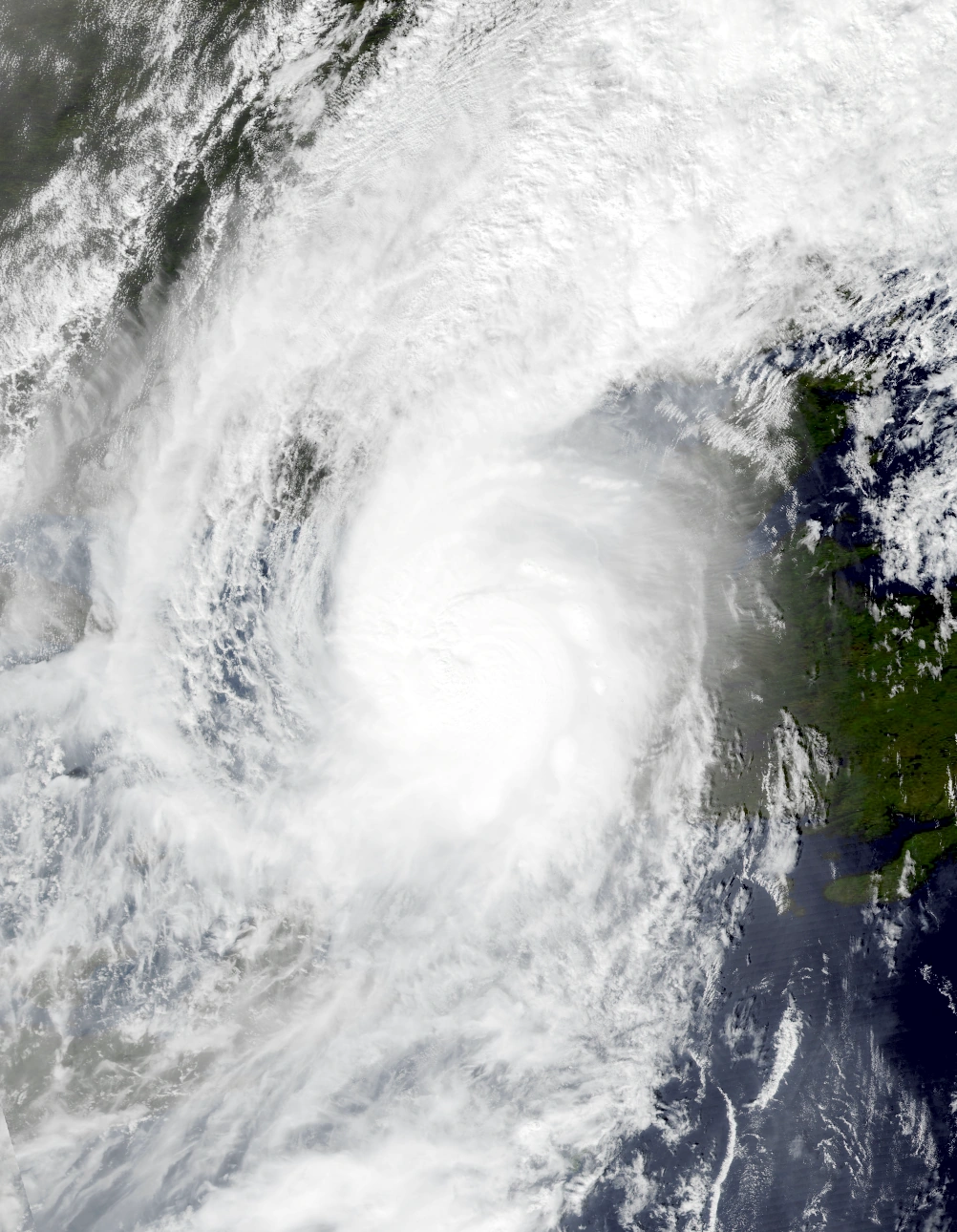 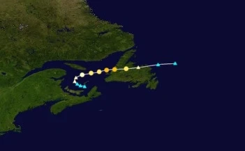 | |
| Duration | August 9 – August 11 |
| Peak intensity | 115 mph (185 km/h) (1-min) 976 mbar (hPa) |
The Meteorological Service of Canada began monitoring the Gulf of St. Lawrence on August 7 due to the possibility of an area of low pressure forming in the area within the next 48 hours. Eventually, at 17:00 UTC the next day, an extratropical storm formed in the waters between Prince Edward Island and the Magdalen Islands and began to slowly move west. The system gained hurricane-equivalent winds at 07:00 UTC on August 9 while beginning a rather sharp turn to the east. Around that time, it anomalously began to undergo a subtropical transition despite cool waters and relatively high wind shear. Central convection began developing and persisting in spite of repeated attempts to displace it northeastward by wind shear. The extratropical low soon officially became Hurricane Will at 23:00 UTC that day, fully detaching from its fronts and becoming the first hurricane ever recorded in the Gulf of St. Lawrence. Continuing east, Will made yet another erratic move when it began a period of rapid intensification fueled by a sudden increase in sea surface temperatures and an unusual lack of wind shear in the gulf. Developing a ragged eye, Will reached its peak intensity of 185 km/h, equivalent to a Category 3 hurricane, at 19:00 UTC on August 10. Around three hours later at 22:00 UTC, Will made landfall near Lark Harbour, Newfoundland, after which it rapidly succumbed to land interaction, wind shear, and cold temperatures and began extratropical again at 06:00 UTC on August 11 while still carrying hurricane-force winds.
Will's extremely unusual location led to a large amount of destruction in Newfoundland. Record breaking wind gusts swept through much of the island as well as neighboring areas in St. Lawrence, including one wind gust of 249 km/h in York Harbour. A total of 20,000 homes were damaged or destroyed, which was likely due to how buildings in the areas affected were not designed to withstand hurricane conditions, let alone major hurricane conditions. Damage ranged from minor damage to roof shingles and to small trees to the destruction of entire walls and roofs. Flooding also presented a serious threat during the storm. Will's quick formation left many Canadians little time to prepare sandbags and boards, leading to the inundation of numerous homes and buildings. Dozens of streets became completely flooded in waters up to 1.3 meters deep. Power went out for over 75% of Newfoundland's population. Economic losses totaled $6.1 billion while 72 people died, making it one of the most destructive Canada hurricanes in recorded history.
Subtropical Storm Alpha[]
| Subtropical storm (SSHWS) | |
|---|---|
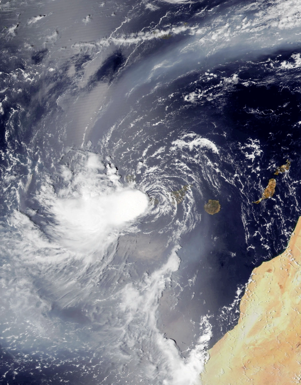 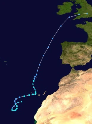 | |
| Duration | August 9 – August 14 |
| Peak intensity | 50 mph (80 km/h) (1-min) 995 mbar (hPa) |
A non-tropical area of low pressure carrying gale-force winds began being tracked at 10:00 UTC on August 7. Sufficient sea surface temperatures of over 30 °C and low wind shear created favorable conditions for the development of a tropical or subtropical cyclone from the system. However, large amounts of dry air owing to the low's location just a few hundred miles east of the Sahara kept its chances of formation low. Despite these hostile conditions, the system managed to form a small but well-defined circulation and intermittent convection to the west at roughly 11:00 UTC on August 9, resulting in it being designated Subtropical Storm Alpha. Dry air entrapped in Alpha's convection and circulation, however, severely limited strengthening, kept its core partially exposed, and prevented it from transitioning into a fully tropical storm. Weakening only sped up as Alpha was steered north by a small trough into an area of higher wind shear which eventually led to the storm being downgraded into a depression at 03:00 UTC on August 10. Afterwards, the cyclone began turning east towards the Canary Islands. At 05:00 UTC the next day, Alpha regained gale-force sustained winds and was upgraded back into a subtropical storm due to a slight decrease in wind shear and dry air, though said factors were still prominent and were actively inhibiting significant strengthening. The storm reached its peak intensity at 16:00 UTC that day with 1-minute sustained winds of 80 km/h just a few miles offshore the island of La Gomera. Just a few hours later at 23:00 UTC the same day, Alpha made landfall on Tenerife while carrying winds of 70 km/h. Shortly after landfall, Alpha made a sharp turn north where large amounts of dry air and wind shear caused the storm to become post-tropical at 07:00 UTC on August 12.
The storm remained post-tropical for around 18 hours before beginning to once again show subtropical characteristics early on August 13. By just 01:00 UTC that day, Alpha regenerated as a 65 km/h subtropical storm and had vastly improved its appearance on radar due to a large decrease in dry air. However, wind shear from the north quickly moved in and began tearing apart Alpha's structure, causing it to weaken 8 hours later at 09:00 UTC that day. By 12:00 UTC, Alpha had made landfall on Madeira, though this had little effect on its strength. By 04:00 UTC on the 14th, the storm had become extratropical again. Its remnants went on to affect the British Isles and northwestern Europe.
Alpha is so far the only tropical cyclone in modern history to hit the Canary Islands directly, making landfall on Tenerife on August 11. The storm was the worst weather-related disaster in the Canaries' history since the 1826 Canary Islands storm. Hurricane-force wind gusts and severe flooding caused large amounts of property damage. Numerous landslides occurred along the slopes of the Teide and Pico Viejo volcanoes as well as along numerous other mountains and hills across the archipelago. Though most of them did not hit populated areas, they still managed to account for nearly half of all property damage in the Canaries related to Alpha. A total of 1,220 homes and businesses were affected in Tenerife alone by the storm, over twice as many structures compared to the 1826 storm (though this is likely only due to the fact that more structures existed in the island in 2027 than in 1826). Madeira was also affected by Alpha and experienced a rare direct landfall, though the storm was only a depression at the time and caused rather minimal damage and only 1 fatality caused by a car accident. Minor rainfall was recorded across northeastern Europe and the British Isles. Alpha was blamed for a total of $2.1 million in damages and 58 deaths.
Hypercane Beta[]
| Hypercane (SSHWS) | |
|---|---|
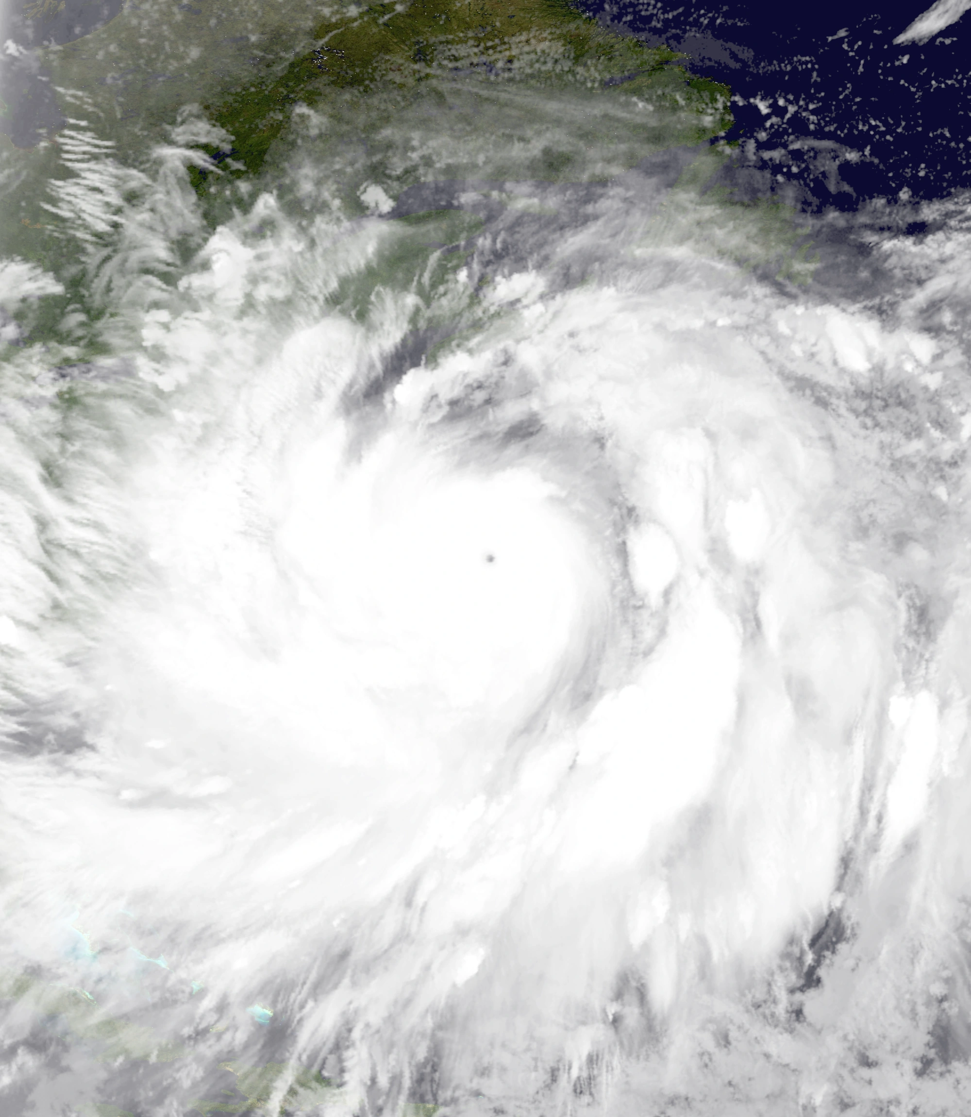 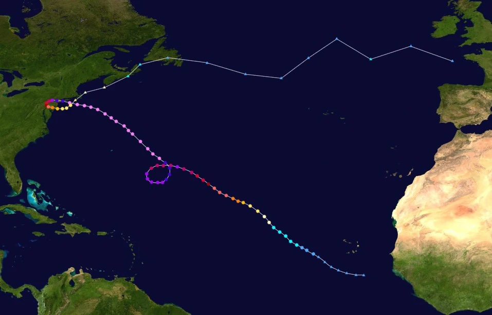 | |
| Duration | August 11 – August 27 |
| Peak intensity | 375 mph (605 km/h) (1-min) 716 mbar (hPa) |
At 16:00 UTC on August 9, a tropical wave was spotted a few hundred kilometers south-southeast of the Cabo Verde Islands. Though water temperatures were warm, high wind shear and dry air prevented the disturbance from developing a well-defined central circulation and widespread deep convection. However, conditions gradually improved over the next few days while the wave moved northwest; eventually, with the departure of wind shear and dry air from the area and the introduction of more moist air, the system developed the aforementioned characteristics on August 11 and was officially designated Tropical Depression Fifty-One at 08:00 UTC that day. Afterwards, the newly-formed depression continued its gradual intensification and slowly developed larger and more organized areas of convection. At 02:00 UTC on August 12, the NHC found sustained winds of 65 km/h (40 mph) in the system, causing Fifty-One to be upgraded into a tropical storm shortly after and to be named Beta. A prominent, symmetrical central dense overcast soon formed while Beta's outer convection organized into curved rainbands. By 09:00 UTC on the 13th, Beta had become a hurricane and was beginning to intensify more rapidly due to a sharp increase in the temperatures of the surrounding waters. After developing a well-defined eye with a pronounced stadium effect, becoming a major hurricane at 11:00 UTC on August 14, and becoming a Category 5 at 01:00 UTC on August 15, Beta began undergoing even more rapid intensification. The storm quickly strengthened into a Category 6 extreme hurricane at 22:00 UTC that day, a C7 at 04:00 UTC on August 16, and a C8 at 13:00 UTC all while its convection grew to span 700 miles (1126 kilometers) in diameter and its outflow became extremely well-defined. Beta reached its initial peak intensity of 265 mph (425 km/h) and 824 mbar, a minimal Category 9 on the Saffir-Simpson scale, at 05:00 UTC on August 17. Shortly after, however, an eyewall replacement cycle took place which caused the powerful hurricane to weaken back into a Category 8 storm a few hours later. The system also began executing a cyclonic loop caused by the combined influence of an incoming upper-level low and the Azores High. Beta stayed as a Category 8 for roughly a day while its old eyewall contracted and dissipated to make way for a new, larger, and more stable eyewall. The cyclone had reportedly completed its ERC at 09:00 UTC on August 18 when it re-strengthened into a Category 9 hurricane before settling into another round of gradual strengthening. At 14:00 UTC on August 19, Beta strengthened further into a Category 10 hurricane, now over 1000 mi/1610 km in diameter and still growing like most storms of its strength do. At 17:00 UTC on the 20th, Beta became the fourth hypercane of the season when the NHC reported sustained winds in excess of 300 mph. Fueled by another area of extremely warm waters sufficient for hypercanes, Beta rapidly intensified and soon reached its maximum strength of 375 mph (605 km/h) and 718 mbar at 12:00 UTC on August 22, beating Heath and becoming the most powerful tropical cyclone ever recorded at the time (though like Heath, Beta would lose its record later on). The storm then steadily weakened due to wind shear and cooler waters, but remained a powerful storm. At 10:00 UTC on August 24, Beta weakened back into a Category 10 hurricane before making landfall on Long Island, NY less than an hour later. This was followed by Beta making a tight cyclonic loop over the northeastern U.S. which kept it over land for roughly two whole days. A strong brown ocean effect kept weakening relatively slow, and by the time Beta emerged back into open waters at 09:00 UTC on August 26, it was still a relatively powerful Category 3 hurricane, though it had lost most of its outer convection due to radically shrinking in size and displayed a structure stretched out to the northeast by wind shear. After weakening into a Category 2 a few hours later, however, the storm began to transition into an extratropical cyclone. This transition was completed at around 10:00 UTC on August 27. Beta's remnants continued to trek across the northern Atlantic, affecting the northeastern United States and eastern Canada, before dissipating off the coast of Europe.

Satellite views of the New York area before (left) and after (right) Hypercane Beta.
Beta was one of the most catastrophic hurricanes to hit New York (and the northeastern U.S. as a whole), with its Category 10 landfall causing exceptional destruction across the whole state. Wind gusts of up to 310 mph, equivalent to the sustained winds of the most powerful EF5 tornadoes, lifted entire high-rises off the ground, tore large chunks of earth and concrete into the air, and created waves up to 200 feet high as reported in areas across the coast of Long Island. New York City in particular, which was already hard-hit by hurricanes Nicholas and Sam, was completely eradicated. Every single building on Manhattan Island being torn to pieces and their debris littering miles of the surrounding waters which ruined local marine ecosystems. An immense storm surge up to 88 feet tall broke the record at the time for highest storm surge and flooded up to 34 miles inland, inundating millions of homes and businesses and triggering numerous road closures - several dozen counties experienced total transportation standstills due to severe flooding. By the time Beta passed, Long Island, Manhattan Island, and many areas of coastal mainland New York were permanently submerged much like what happened to Florida during Hypercane Heath. Due to the storm's immense size and slow movement, extreme rainfall occurred hundreds of miles inland with around a third of all U.S. states issuing flood warnings and a total of 192.48 inches of rain falling across the affected areas. Moisture from the storm fell as far south as the Bahamas and as far north as Nova Scotia while swells associated with Hypercane Beta were felt all the way in the Greater Antilles. A total of 10.9 million structures were damaged due to this, and Beta's flooding was considered the worst since Sam earlier in the year. Hundreds of mudslides also occurred along the slopes of the Appalachian Mountains which buried even more towns and blocked roads and freeways. Less severe, but still significant damage occurred in Eastern Canada, where Beta's remnants generated hurricane-force wind gusts and heavy rain. In all, Beta caused a shocking $1.33 trillion USD in damages. Thankfully, the near-total evacuation of New York and nearby states before storm kept the death toll less than that of Hypercane Nicholas, but was still extremely high at 2.26 million not counting the 3.01 million other deaths caused by UV radiation from ozone damage triggered by Beta's cloud tops reaching into the stratosphere. Beta's large wind field and subsequent cold wake also caused a stark decrease in storm activity that lasted until the end of August.
Hurricane Gamma[]
| Category 1 hurricane (SSHWS) | |
|---|---|
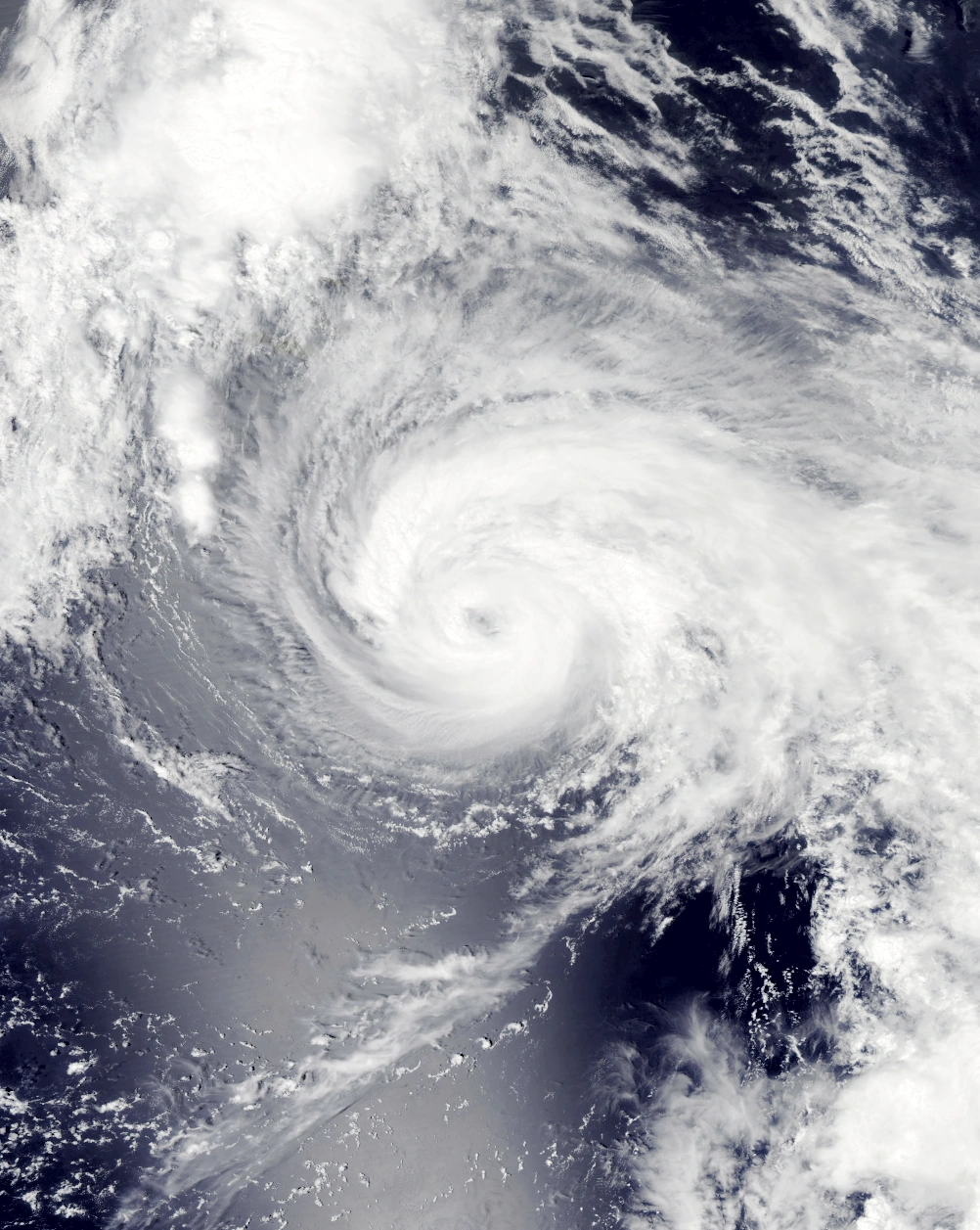  | |
| Duration | August 17 – August 19 |
| Peak intensity | 80 mph (130 km/h) (1-min) 964 mbar (hPa) |
On August 16, the NHC began tracking an extratropical low over the open Atlantic that had a moderate chance of developing into a tropical cyclone. Not long after, the system began undergoing a subtropical transition, with its cold front becoming increasingly detached from the central circulation which was now developing central convection similar to that of tropical cyclones. The cyclone was designated Subtropical Depression Fifty-Two at 17:00 UTC the next day while it was quickly moving northeast. Continuing to organize despite its relatively high latitude, the subtropical depression soon gained gale-force winds at 05:00 UTC on August 18 and was assigned the name Gamma, though it still displayed enough extratropical characteristics to prevent it from being marked as a true tropical cyclone. This changed later that day at 20:00 UTC when it was upgraded into a fully tropical cyclone on account of its impressive organization. Gamma soon reached a peak intensity of 130 km/h, a Category 1, at 04:00 UTC on August 19 a few hundred kilometers south of the Azores. Despite only being a low-end Category 1 at peak, Gamma displayed a relatively well-defined eye and a rather low pressure of 964 mbar. Only a few hours after its peak, wind shear increased and Gamma weakened back into a strong tropical storm, losing its eye and displaying an elongated circulation. After weakening into a depression at 18:00 UTC on the 19th, Gamma transitioned back into an extratropical low around four hours later before going on to hit Ireland.
Large swells and gusty winds were produced in the Azores, especially in Sao Miguel and Santa Maria. Rebuilding and recovery following Hurricane Lucio had to be stopped in some places due to the storm while $2.2 million worth of fresh damage was produced. One person died off the coast of Ponta Delgada due to strong waves while another in Vila Do Porto succumbed to their injuries in the hospital after Gamma caused their house to collapse.
Hurricane Delta[]
| Category 4 hurricane (SSHWS) | |
|---|---|
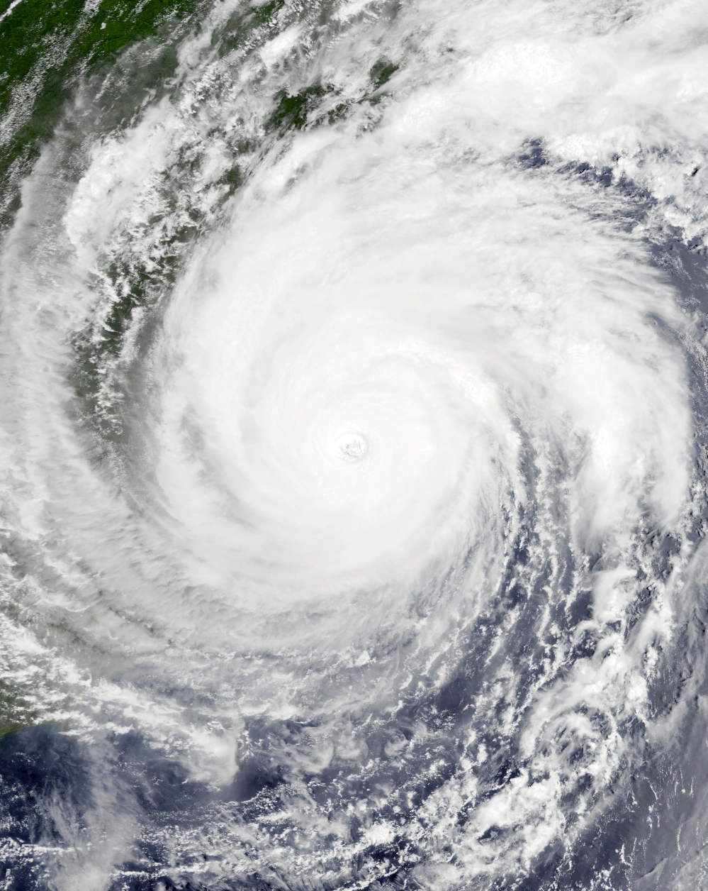 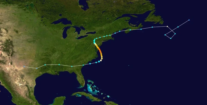 | |
| Duration | August 26 – August 30 |
| Peak intensity | 155 mph (250 km/h) (1-min) 938 mbar (hPa) |
A frontal low quickly moving east across the southeastern United States began being monitored by the NHC at 11:00 UTC on August 24 due to the possibility of it moving into the open Atlantic and developing into a tropical or subtropical cyclone. Almost immediately after entering the Atlantic At around 23:00 UTC on August 25, the system began undergoing a subtropical transition. After separating from its associated front and developing some central convection, the storm was designated Subtropical Storm Delta at 03:00 UTC on August 26; having carried sustained winds of 60 mph upon transitioning, Delta was immediately named. After becoming fully tropical at 13:00 UTC that day, Delta was steered northwestward by a trough to the west. There, warm ocean waters and low wind shear allowed the storm to intensify. The storm became a hurricane at 19:00 UTC as it quickly developed strong convection, especially to the north where a rainband was located. Intensification became even faster over the following days due to the system dramatically slowing down over the aforementioned patch of favorable conditions, with Delta achieving major hurricane status at 17:00 UTC on August 27 and developing an eye. Delta peaked at around noon on August 28 as a high-end Category 4 hurricane with impressively curved bands, excellent outflow, and a large but prominent eye. Less than an hour before midnight that day, the hurricane made landfall near Ocean City, Maryland while carrying winds of 140 mph (225 km/h), after which it weakened slowly due to leftover flooding from Hypercane Beta creating a brown ocean effect. Though Delta weakened back into a Category 3 at 01:00 UTC on August 29 and below major hurricane status at 14:00 UTC that same day, it continued to display a visible eye and at least some deep convection. It was only when it was downgraded into a tropical storm at 04:00 UTC on August 30 when its eye disappeared and its convection became shallow and sprawling. Strong convection became concentrated in a comma-like tail to the south, indicative of an extratropical transition. The NHC ceased advisories on Delta at 13:00 UTC that day when it became apparent that an attached front had developed and that the storm was no longer tropical.
As a precursor low, Delta was responsible for generating gusty winds and moderate flooding across the U.S. states bordering the Gulf of Mexico. Among the damage were numerous snapped branches, road flooding, and occasional structural damage to roofs and windows from debris and hail. A tornado was also reported around 7 miles northeast of Monroeville, Alabama, though it was only an EF0 that caused minimal damage. More significant damage occurred in and around Delta's landfall site. The storm's landfall added on to the already-severe devastation left by Hypercane Beta, with even more flooding occurring and hundreds of surviving structures being destroyed. Efforts to begin recovery following said storm were delayed in Maryland due to the storm's passage, though they were not as hindered as with other similar storms due to Delta's landfall being forecasted. Damage was difficult to estimate due to an inability to distinguish damage from Delta from damage from Beta, but it is estimated at around $7.8 billion. 14 people were reported to be killed during the storm. Delta also generated gusty winds and precipitation in parts of Atlantic Canada, though damage was minimal.
Hurricane Epsilon[]
| Category 3 hurricane (SSHWS) | |
|---|---|
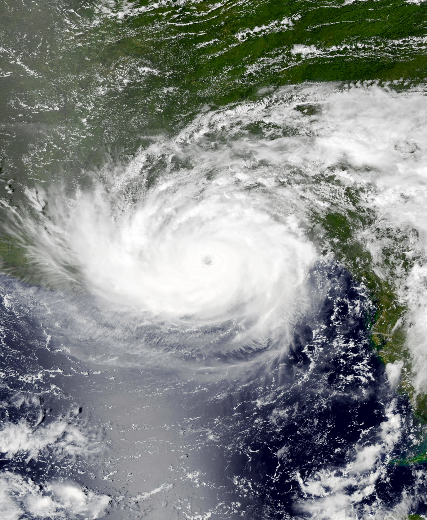 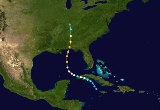 | |
| Duration | August 28 – September 2 |
| Peak intensity | 125 mph (200 km/h) (1-min) 954 mbar (hPa) |
An area of showers resembling a circulation was first noted for possible development on August 26 south of Jamaica. Cold waters left from numerous previous storms made its chances of forming into a tropical cyclone low, which was supported by the fact that deep convection struggled to form throughout the system. Nonetheless, the disturbance soon entered a patch of warmer waters a few dozen kilometers off the western coast of Jamaica, causing it to soon develop more thunderstorms. It was eventually designated a depression by the NHC at 23:00 UTC on August 28. After moving north for almost its entire life up to that moment, the depression began turning west due to the Azores High, where it continued to strengthen in favorable conditions. At 15:00 UTC the following day, it was upgraded into a tropical storm and was named Epsilon due to sensory data picking up gale-force winds at the core of the storm. A relatively compact storm, Epsilon soon reached its initial peak as a low-end Category 1 hurricane at 03:00 UTC on August 30 before making landfall on the northern part of Isla de la Juventud, Cuba at around 05:00 UTC. This was followed by a second hurricane-strength landfall on the village of Playa El Guanal at around 11:00 UTC. Due to these two landfalls, Epsilon weakened into a tropical storm a few hours later and began to lose its convection, but the storm was quick to reintensify and regained hurricane strength near the end of August 30. Afterwards, the storm began to curve back north towards the Gulf Coast of the United States. Soon, an eye developed at the center of Epsilon when it became a Category 2 at 13:00 UTC on August 31. This eye only increased in definition as the hurricane became a Category 3 at 18:00 UTC that day, though the storm itself remained relatively small like when it first formed due to cold waters limiting the scope of its convection. Hurricane hunter aircraft eventually recorded a peak of 954 mbars and 125 mph in Epsilon at 12:00 UTC on September 1 prior to its landfall on Pensacola, FL at 15:20 UTC that day. After its landfall, Epsilon quickly weakened due to land interaction, dropping below hurricane status at 21:00 UTC on September 1 and losing its eye. By 09:00 UTC on September 2, the system had become a tropical storm and its circulation was now exposed. Epsilon weakened further into a depression at 14:00 UTC that day, after which it dissipated due to combining with an incoming extratropical cyclone two hours later over northern Tennessee.
In Jamaica, Epsilon's precursor low brought minor rain that caused little to no damage. Rain was heavier in Cuba, where up to 180 mm (~1 in) or rain fell which led to some flooding. Damage there was mainly in the form of agricultural losses, with numerous acres of farmland being inundated and thousands of plants and livestock lost. High winds gusting up to 140 km/h also caused considerable effects to structures, with poorly-constructed huts and homes being the most damaged with their entire roofs blown away and their walls and windows sustaining visible damage. Many trees were also downed by Epsilon, blocking roads. In the United States, which was still reeling from dozens of powerful storm landfalls including the disastrous Tayshaun and Beta, States of Emergency were put into effect for Mississippi, Alabama, Florida, Georgia, and other states projected to be in Epsilon's path. Many victims of Hurricane Tayshaun who had been sheltering in makeshift tents were forced to evacuate alongside hundreds of personnel sent to assist victims of said storm. A total of 34 inches of rain fell in the continental U.S. due to Epsilon, leading to numerous reports of flooding. Powerful winds also tore roofs off well-constructed homes and created visible cracks on walls. Overall, the storm caused an estimated $4.5 billion in damages. 3 deaths occurred, two in Cuba and one in Florida. All of them were attributed to drowning.
Hurricane Zeta[]
| Category 1 hurricane (SSHWS) | |
|---|---|
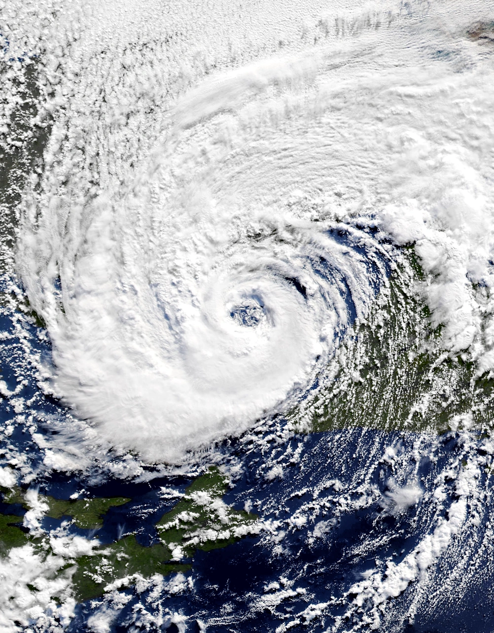 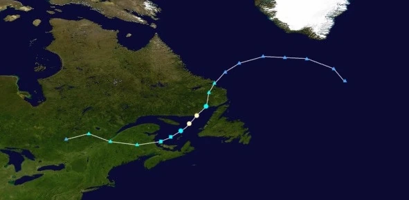 | |
| Duration | August 30 – August 31 |
| Peak intensity | 75 mph (120 km/h) (1-min) 982 mbar (hPa) |
At 07:00 UTC on August 29, a strong extratropical cyclone formed over eastern Canada and trekked eastward along the jet stream. Though its chances of forming into a tropical or subtropical cyclone upon emerging into open waters were exceedingly low due to high wind shear and cold waters, the possibility of a St. Lawrence gulf storm similar to Will earlier in the month merited monitoring by weather centers. Eventually, almost immediately after turning slightly north and entering the Gulf of Saint Lawrence the next day, the extratropical cyclone began to undergo a transition into a subtropical cyclone and detach from its fronts. Enough central convection developed within the now-independent central low for the storm to be classified as Subtropical Storm Zeta at 10:00 UTC on August 30 just a few kilometers north of Prince Edward Island. Quickly moving across the gulf, Zeta quickly strengthened due to unusually warm waters and became fully tropical at 20:00 UTC that day. The system swiftly reached its peak intensity at 07:00 UTC on August 31 as a 120 km/h Category 1 hurricane with large, sprawling convection and a visible eye feature before making landfall on Wolf Bay, Canada at 11:10 UTC that day. After its landfall, Zeta quickly weakened back into a tropical storm at 13:00 UTC due to a combination of land interaction, cold temperatures, and high wind shear, with its eye disappearing and its convection becoming displaced to the east exposing its core. By 21:00 UTC, Zeta had transitioned back into an extratropical low.
Across Quebec and parts of the New England region of the U.S., Zeta produced gusty winds and heavy rain both as a precursor extratropical low and while tropical. Hurricane conditions ravaged eastern Quebec and southern Newfoundland and Labrador, both of which were still reeling from Hurricane Will earlier in the month. Wind gusts up to 155 km/h as reported in Chevery as well as a total of 167 mm of rain caused flooding and wind damage across the area. Homes were reported to sustain visible damage to roofs while their insides were heavily affected by floodwaters. Doors and windows were also blown out in some cases. Numerous trees were downed by Zeta which blocked roads and contributed to the damage. The storm caused a total of $678 million in damages and 12 deaths.
Hypercane Eta[]
| Hypercane (SSHWS) | |
|---|---|
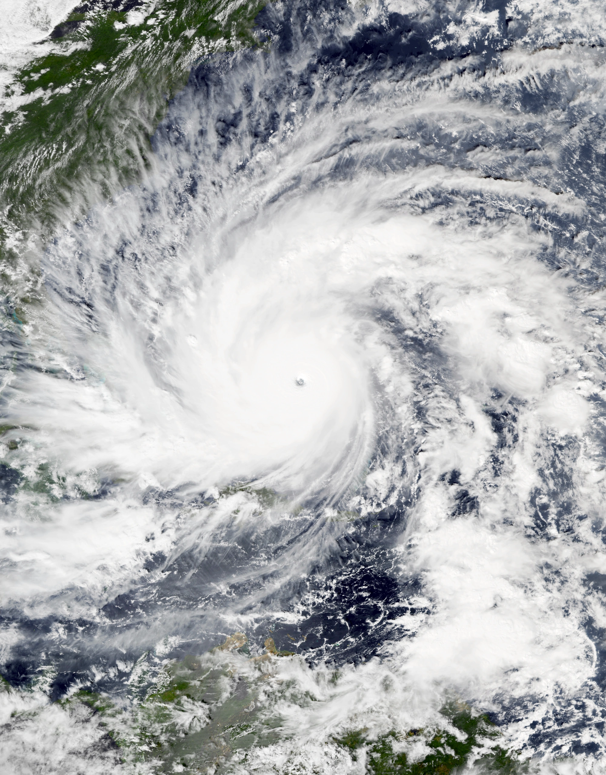 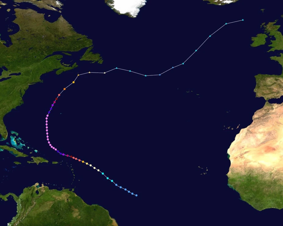 | |
| Duration | September 1 – September 11 |
| Peak intensity | 360 mph (580 km/h) (1-min) 722 mbar (hPa) |
On August 31, the NHC began tracking an area of disturbed weather at an unusually southerly latitude over the open Atlantic Ocean. Though the system had impressive convection, the lack of adequate Coriolis forces prevented a central circulation from forming quickly. By September 1 at 02:00 UTC, a circulation had formed and the storm was designated Tropical Depression Fifty-Six, but its intensification continued to be relatively slow due to the aforementioned reasons. At 14:00 UTC on September 2, 56 became Tropical Storm Eta and its outer bands began to become more curved now that the storm had reached a latitude more favorable for tropical cyclones. Continuing its northwestward movement, Eta soon became a Category 1 At 08:00 UTC on September 3 and began to develop an eye alongside a large, symmetrical CDO. Eta finally broke its trend of gradual strengthening and began to rapidly deepen early on September 4 due to passing over waters up to 44 °C (112 °F). After just 24 hours, the storm had intensified into a powerful 290 km/h (180 mph), 907 mbar Category 5 hurricane off the coast of the Leeward Islands. However, rapid intensification did not stop and went on to the next day, when it became a Category 6 at 07:00 UTC on September 5, a Category 7 at 12:00 UTC, a Category 8 at 15:00 UTC, and a Category 9 at 20:00 UTC all while rapidly growing in size and developing a miniscule pinhole eye only 8 km (5 mi) across. Just a few minutes after the start of September 6, Eta was reported to have intensified into a Category 10 hurricane and was on the cusp of hypercane strength. By 13:00 UTC that day, the hurricane's 1-minute sustained winds had exceeded 300 mph (480 km/h) and Eta had officially become a hypercane. Turning north due to being steered by the Azores High, Eta continued to rapidly strengthen as waters all across the Atlantic showed no signs of cooling aside from the cold wakes left behind by Eta and adjacent storms Theta and Iota. The powerful storm reached its peak intensity of 580 km/h/360 mph and 722 millibars at 22:00 UTC on September 7 while displaying very well-defined outflow and large, far-reaching bands of deep convection. Afterwards, Eta underwent an eyewall replacement cycle and its intensification halted, but the storm never went below hypercane status during the process and was still a hypercane by the ERC's estimated completion late on September 8. Eta did not lose hypercane status until 01:00 UTC on September 10 when the hurricane began to steadily weaken over significant cooler waters in the north. While weakening, Eta passed within a few hundred kilometers of what was left of Bermuda. Afterwards, the storm lost extreme hurricane status and weakened into a Category 5 at 04:00 UTC on September 11 while its eye disappeared from view and its convection became shallow and sprawling. At 21:00 UTC that day, Eta, while a Category 3 hurricane, transitioned into an extratropical cyclone off the coast of Nova Scotia.
Though Eta never made landfall, its large size and strength caused very stormy conditions across the Leeward Islands and Puerto Rico, where wind gusts up to 410 km/h (as recorded in Fajardo, Puerto Rico) and large waves up to 30 meters tall ravaged towns and cities in the aforementioned areas. Conditions in said areas were equivalent to a hurricane making landfall at high-end Category 5 strength, with sustained winds reaching 175 mph (280 km/h) in the British Virgin Islands. These conditions resulted in the destruction of an estimated 19,000 homes and businesses while another 50,000 were not destroyed outright, but still affected in some way by the storm. In the rest of the Greater Antilles, the Bahamas, and the east coasts of the United States and Canada, impacts were limited to large swells, rip currents, and surf which in some places were high enough to cause some coastal flooding. Bermuda in particular was very hard hit by the aforementioned effects as well as high winds, and the already-battered islands reportedly sank completely due to Eta. In total, the storm was responsible for $64 billion USD in economic losses. Eta was responsible for 478 fatalities: 468 in the primarily affected areas such as the Leewards and Puerto Rico and 10 from sea-related factors such as rip currents elsewhere.
Hypercane Theta[]
| Hypercane (SSHWS) | |
|---|---|
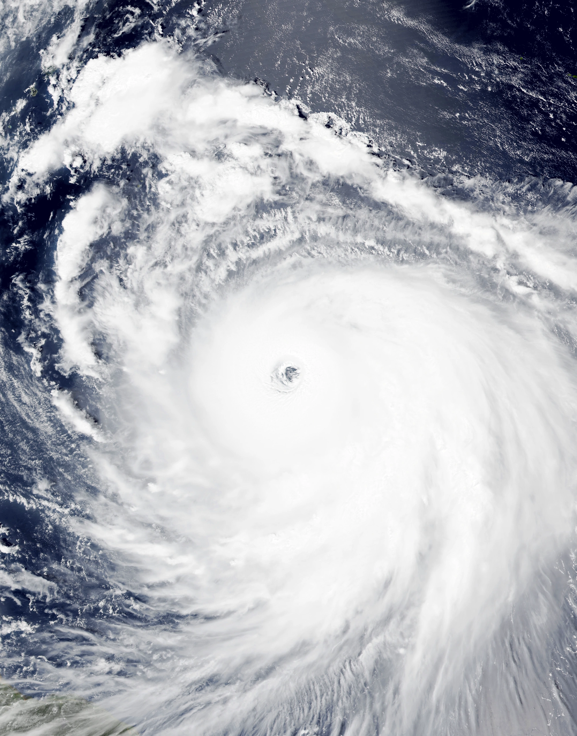 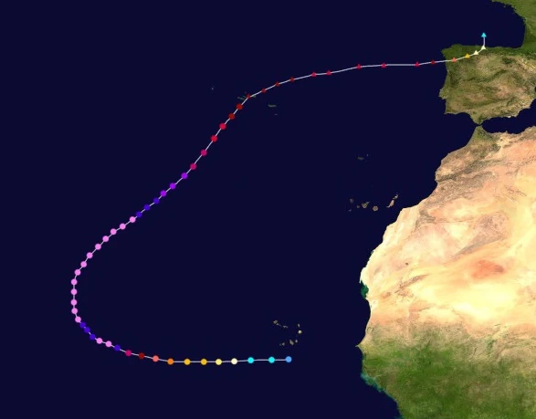 | |
| Duration | September 1 – September 11 |
| Peak intensity | 325 mph (525 km/h) (1-min) 765 mbar (hPa) |
A tropical wave emerged from western Africa moving westward sometime on August 31. Due to favorable conditions, the system quickly acquired enough organization for it to be designated Tropical Depression Fifty-Seven at 10:00 UTC on September 1 south of Cabo Verde. Its formation came just 8 hours after the formation of Hypercane Eta. Continually favorable conditions ahead of its westward path allowed the depression to quickly intensify into Tropical Storm Theta 3 hours later at 15:00 UTC that day as deep convection quickly formed all over the system, organizing into clear rain bands. By 02:00 UTC on September 2, Theta had become a hurricane and began to rapidly intensify due to very warm water temps, sufficiently moist air aloft, and almost nonexistent wind shear. At 18:00 UTC that day, the storm intensified into a Category 3 while a ragged eye formed in the center of its well-developed and symmetrical central dense overcast. This eye became clearer and more defined the next day when Theta was upgraded into a Category 4. At 09:00 UTC on September 3, Theta was upgraded further into a Category 5 and soon strengthened further into a Category 6 at 13:00 UTC. Afterwards, a large swath of extremely warm ocean waters around 51 °C (124 °F) caused Theta's strengthening to hasten; by the end of the day, the storm was already an extremely powerful Category 8 hurricane on the Saffir-Simpson Scale and was ballooning in size as most hurricanes of its strength do. By 06:00 UTC on September 4, Theta had intensified into a hypercane, but soon underwent an eyewall replacement cycle due to its breakneck rate of strengthening and weakened into a Category 10 at 19:00 UTC. The storm's original eyewall contracted and dissipated as a new outer eyewall formed and moved in to take the inner's place, resulting in the formation of a roughly 80 km/50 mi wide eye. As the storm curved northeastward, Theta regained hypercane status at 17:00 UTC on September 5, after which slow intensification resumed and Theta peaked as a 525 km/h storm at roughly 08:00 UTC on September 7. Following its peak, the negative effects of high wind shear began to take its toll on the hypercane, though warm waters kept weakening slowly. Theta lost hypercane status at 23:00 UTC on September 8 as its eye's appearance took on a ragged appearance once more and its convection shallowed. The storm further weakened into a Category 9 at 12:00 UTC on September 9 and into a Category 8 at 10:00 UTC on the 10th. Later that day, Theta weakened into a Category 7 while beginning to show signs of an extratropical transition. After weakening into a Category 6 at 06:00 UTC on September 11, Theta fully transitioned into an extratropical cyclone at 18:00 UTC, but still carried Category 6-force winds and even strengthened into a Category 7-equivalent extratropical cyclone due to extreme baroclinic instability caused by the extremely warm waters of the tropical regions and the extremely cold waters of the near-polar areas. The powerful remnant hit northern Spain on September 14 before dissipating the next day.
Theta and another storm, Eta, were both at hypercane strength from September 6 to September 8, marking the first recorded occurrence of simultaneous hypercanes - the next occurrence would not occur until 2028 with the occurrence of simultaneous hypercanes Alex (known as the infamous Storm Finn in Europe) and Caleb. Furthermore, a third storm named Iota was also a hypercane on September 7 while in the Pacific, marking the exceptionally rare occurence of three simultaneous hypercanes. Theta and Eta also formed and dissipated on the same dates, a rare occurrence. Theta brought light rain to the Cabo Verde archipelago which caused no known property damage. Meanwhile, swells associated with the storm were recorded along the eastern coast of the United States despite the storm being thousands of miles offshore; these swells killed a fisherman who along with four other people were swept out to sea by a large wave in North Carolina, three swimmers in New Jersey, and a couple in New York. In the Azores, where Theta passed over with Category 6 winds, conditions were very severe with waves up to 100 meters in height. The entire island group was ordered to evacuate ahead of the storm. Flooding was severe enough that over half of the land area of most islands was flooded, with some islands sinking completely like what happened with Bermuda following Peter. In the northern part of the Iberian Peninsula, wind warnings and evacuation orders were issued all over the area as the record-breaking Storm Theta, which was the strongest recorded European windstorm cyclone by far, neared. During the powerful system, 320+ km/h winds ravaged hundreds of cities and destroyed up to 1.9 million structures across much of western Europe, which was still recovering from the similarly powerful Hurricane Jacobus. Overall, Theta caused 74,827 deaths and $170 billion in damages, the vast majority coming from Europe.
Hypercane Iota[]
| Hypercane (SSHWS) | |
|---|---|
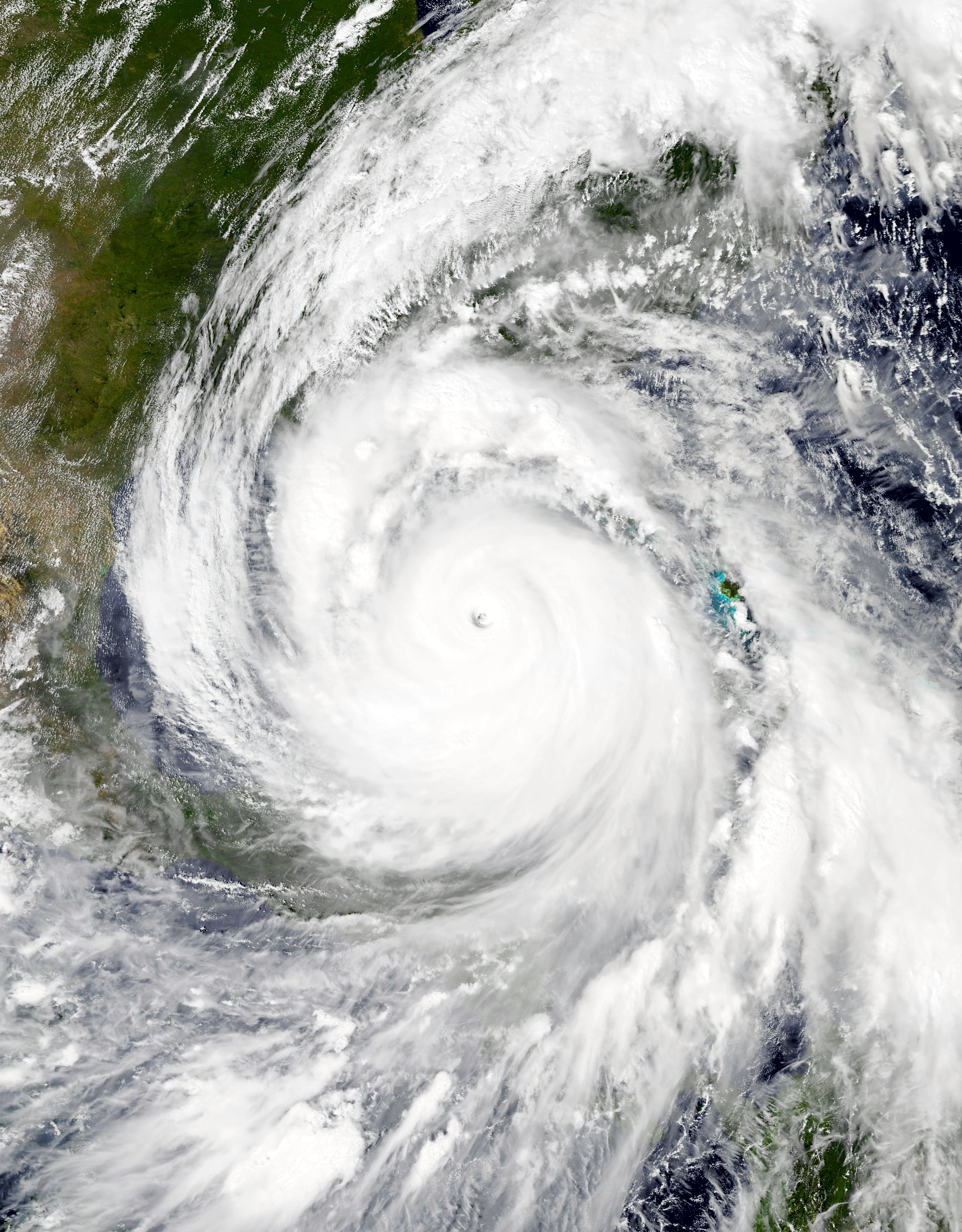 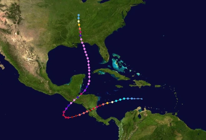 | |
| Duration | September 1 – September 14 |
| Peak intensity | 380 mph (610 km/h) (1-min) 700 mbar (hPa) |
Iota originated from a tropical wave detected in the middle of the Caribbean Sea late on August 31. It slowly gathered convection and a circulation before being designated a tropical depression at 15:00 UTC on September 1, just five hours after the formation of Hypercane Theta. Due to very favorable conditions, the depression quickly intensified, becoming a tropical storm early the next day and receiving the name Iota as its circulation became fully obscured from view by a well-developed CDO. By the end of the day at 23:00 UTC, Iota had intensified into a hurricane and was showing signs of developing a pinhole eye. Amid an environment favorable for rapid deepening, the storm began to explosively intensify on September 3, with the storm already becoming a Category 3 major hurricane upon the start of the day. Over a 24-hour period, Iota's winds increased by 210 km/h (130 mph) as the storm went from a low-end Category 3 to a powerful Category 8 hurricane with winds of 395 km/h (245 mph). Just a few minutes before midnight, Iota made landfall near Pearl Lagoon, Nicaragua while a Category 8 hurricane. Due to land interaction, the storm weakened and lost convection, but was still a powerful Category 5 hurricane by the time it crossed into the Pacific Ocean at 15:00 UTC on September 4. By September 5, Iota was already regaining its strength due to a patch of very warm waters along the Pacific-facing coast of Central America, becoming a Category 6 again at 10:00 UTC and a Category 7 at 22:00 UTC. Afterwards, an incoming upper-level low caused Iota to make an unusually sharp turn northeast into even warmer waters. These waters caused the hurricane to rapidly intensify a second time; by 01:00 UTC on September 7, it had reached Category 10 status. A few hours later, it became a full-fledged hypercane. Iota later made landfall on Monterrico, Guatemala at 14:00 UTC while a hypercane. Over land, Iota quickly weakened due to mountainous terrain, but nevertheless survived the crossover due to its fast movement and re-entered the Atlantic as a Category 8 at 04:00 UTC on September 8 before continuing to strengthen. This made Iota the very first storm in the Atlantic on record to cross into the Pacific before crossing back into the Atlantic. At 18:00 UTC, Iota became a hypercane again while beginning to move north due to the influence of an extratropical storm over the central United States. Intensification continued, and the storm eventually reached its peak as a powerful 380 mph and 700 mbar hypercane at 07:00 UTC on September 10 all while displaying a very well-rounded eye, a diameter of roughly 900 miles, and pronounced outflow at the fringes of the cyclone. This intensity was enough to temporarily break Beta's record for strongest tropical cyclone before the formation of stronger storms Mu, Zayin, and Collin. After a few days of continuing north, Iota made landfall on Gulf Shores, Alabama at 03:00 UTC on September 12 while carrying winds of 320 mph and a central pressure of 766 mbar. Over land, the system swiftly weakened and was eventually declared dissipated at 08:00 UTC on September 14.
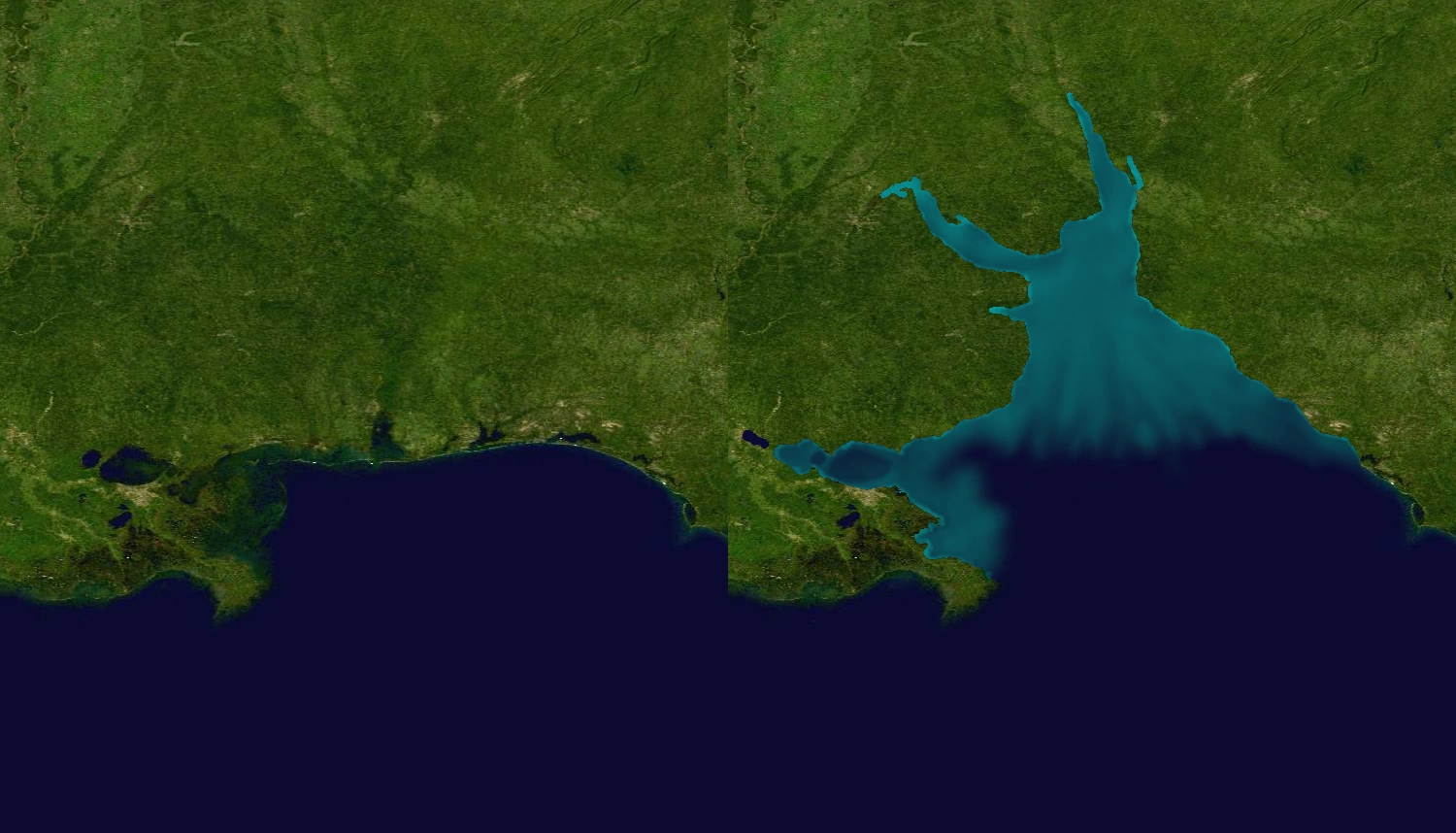

The Southeastern United States before and after Iota. Left is before and right is after.
Across Central America, Iota's first landfall on Nicaragua as a Category 8 caused significant damage. Powerful winds up to 390 km/h tore thousands of buildings off their foundations and into the air while creating waves up to 60 meters high which caused extensive damage to coastal communities. Shanty homes were reportedly swept away miles from their original location. The storm surge travelled dozens of kilometers inland and drowned entire towns in 15 meters of water. Approximately 875,000 structures were affected by Iota's first landfall while 2.4 million customers reported losing power. Numerous landslides also occurred, burying homes and businesses. In the parts of Central America closer to Mexico, where Iota hit as a hypercane, damage was cataclysmic with even large, well-built structures like offices and apartments being blown away. Even the foundations of buildings received large cracks from the winds and debris. Flooding reached 30 m deep in places and travelled over 20 kilometers inland, washing away numerous structures. Along mountains, the storm was strong enough to not only cause landslides, but send large chunks of the mountainside into the air before crashing them down on the ground. Some people were reportedly crushed on camera by chunks like these. In total, another 1.08 million structures were affected while 3.8 million experienced power outages. Furthermore, a visible part of the Guatemalan coast was permanently put underwater by the storm. Stormy conditions also occurred along the Yucatan Peninsula and Cuba including winds of near hypercane strength; damage was similar to what was seen in Guatemala.
In the Southeastern United States, Iota's flooding was powerful enough to send significant portions of Alabama and Louisiana underwater. Flooding up to 75 feet deep and waves over 200 feet high caused some of the worst flooding calamities since Sam earlier in the year. Entire cities were put underwater due to the storm easily overturning flood barriers including those of New Orleans, which experienced inundation that made the flooding produced by Hurricane Katrina of 2005 pale in comparison. Following the storm, a body of water known as the Bay of Alabama had formed. Severe flooding also occurred further inland, though not on the scale seen in Louisiana and Alabama. Still, numerous homes and businesses were submerged while many roads were closed due to water. Approximately 4.3 million structures were affected by flooding alone. Wind also caused significant damage. Wind gusts up to 341 mph toppled even the largest and strongest buildings like in Guatemala. High-rises that survived the extreme flooding were often torn to pieces by Iota's winds and airborne debris. Like in Guatemala, large chunks of land were torn from the ground and hurled into the air while structural foundations themselves sustained visible markings from winds. Overall, Iota destroyed 7.79 million structures in the United States and cut power for 12.7 million households. $1.23 trillion in economic losses, 1,625,700 direct deaths, and 2,190,000 indirect deaths were blamed on Iota.
Hurricane Kappa[]
| Category 2 hurricane (SSHWS) | |
|---|---|
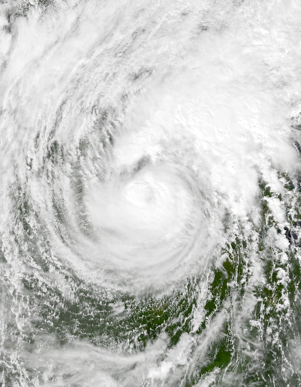 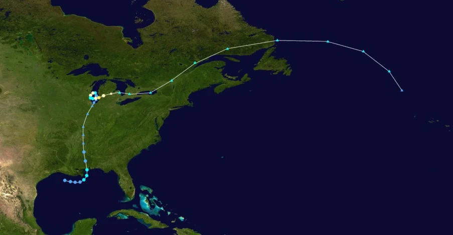 | |
| Duration | September 13 – September 19 |
| Peak intensity | 100 mph (160 km/h) (1-min) 977 mbar (hPa) |
On September 13, an area of low pressure formed just south of Louisiana. Initially, it struggled to organize due to cold waters and wind shear from Hypercane Iota. Eventually, wind shear lessened enough to allow some small areas of deep convection to form and allow the system to become Tropical Depression Fifty-Nine at 23:00 UTC that day. As it moved east, the depression intensified albeit very slowly due to Iota's cold wake. The depression had become a tropical storm by 19:00 UTC on September 14 but still displayed a partially exposed core and minimal convection. Afterwards, the storm turned north before making landfall on what was once coastal Alabama at around noon on September 15, eventually being downgraded into a depression at 14:00 UTC and degenerating into a post-tropical cyclone at 23:45 UTC that day upon the loss of its warm core.
Continuing its northward path, Kappa's remnants eventually entered Lake Michigan during the late morning hours of September 17. There, the storm began to redevelop tropical characteristics due to unusually warm waters and low wind shear in the Great Lakes area. At 11:00 UTC on the 17th, Kappa became a subtropical depression having regained a warm core devoid of attached fronts and a circulation center; this made it the first tropical-like cyclone in the Great Lakes since the 1996 Lake Huron cyclone. The storm also began to slow down significantly and enter a tight counterclockwise loop due to a lack of significant steering factors. Eventually, Kappa became a fully tropical depression and the very first true tropical cyclone in the Great Lakes by 22:00 UTC. Kappa strengthened further into a tropical storm at 03:00 UTC on September 18 and a full-fledged hurricane at 06:00 UTC, though no visible eye formed at the center of its small central dense overcast. At around 17:00, the storm made its first landfall on Milwaukee, Wisconsin, where sustained winds of 75 mph and a central pressure of 988 mbar were measured. This meant that Kappa surpassed the 1996 Huron cyclone for strongest Great Lakes tropical cyclone. Due to land interaction, Kappa weakened into a tropical storm at 21:00 UTC and remained a tropical storm by the time it re-entered open waters early the next day. No change in strength occurred for a few hours before the storm suddenly began to rapidly intensify. After becoming a hurricane again at 09:00 UTC on September 19, Kappa peaked as a 100 mph Category 2 hurricane at 16:00 UTC with an eye-like formation and deep convection. Just a few hours later, Kappa made landfall near Holland, Michigan. Over land, the storm was steered east by the jet stream and quickly transitioned into an extratropical cyclone a few minutes before midnight on the 19th.
In Alabama, Kappa was responsible for bringing gale-force wind gusts and heavy rain, though it did not contribute too much damage since the areas affected were already levelled by Hypercane Iota just a day prior. Light rain was felt across the inland U.S. as Kappa's remnants moved north, causing minor, isolated flooding. In the Great Lakes area, Kappa caused record wind gusts and damage due to the historic nature of the storm. Winds of over 100 mph and severe flooding were recorded across Wisconsin and Michigan along with large waves close to the coast. In Wisconsin, heavy downpours caused flooding in numerous parts of Milwaukee, causing road closures and traffic delays while the hurricane's winds tore away at roofs and windows. Numerous trees were downed as well. Meanwhile, Michigan received stronger winds which were enough to blow away some roofs entirely and cause minor but visible wall damage including the total collapse of a few mobile homes. In addition, downed trees and tree branches caused additional structural damage. Like in Wisconsin, flooding was felt across the state and triggered road closures. Agricultural losses were substantial, with an estimated $140 million in crop damage. 45 thousand structures were damaged in the Great Lakes region alone while 3.7 million residents reported losing power due to Kappa's stormy conditions. Outside of the Great Lakes, Kappa's remnant extratropical cyclone caused squally conditions across the rest of the northeastern United States and parts of eastern Canada. In total, the storm was responsible for $8.2 billion in 2027 USD and 12 deaths.
Hurricane Lambda[]
| Category 10 hurricane (SSHWS) | |
|---|---|
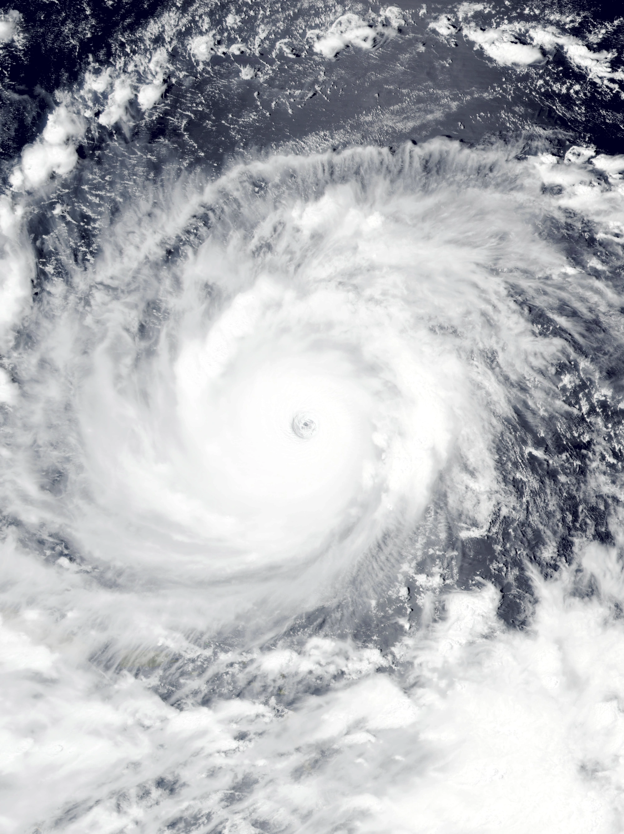 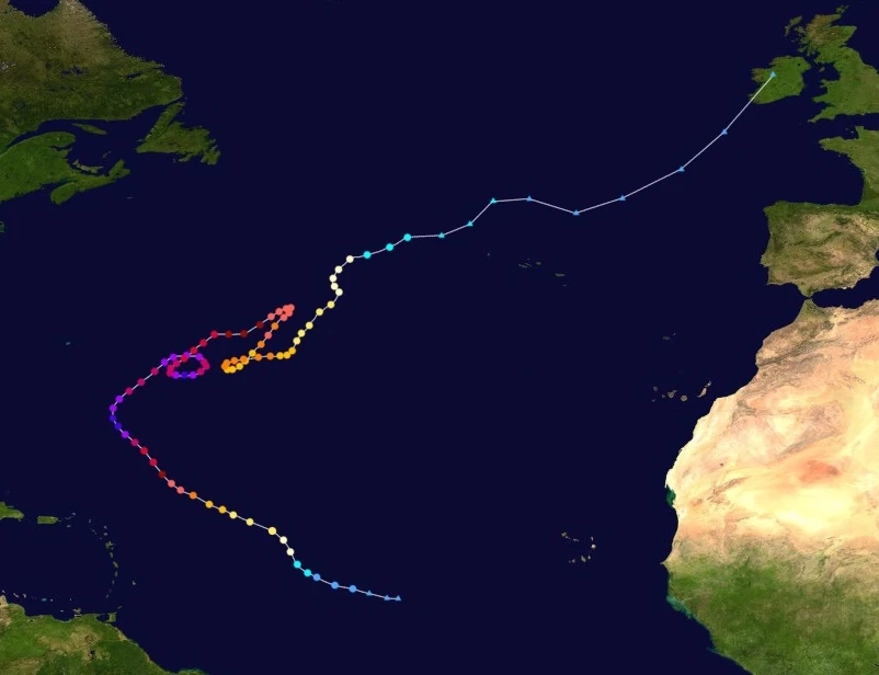 | |
| Duration | September 15 – October 6 |
| Peak intensity | 285 mph (460 km/h) (1-min) 808 mbar (hPa) |
On September 10, a tropical wave formed east of Africa and moved west. Due to outflow, shear, and cold waters generated by nearby storms Eta and Theta, the system was not expected to develop. However, with the dissipations of the two aforementioned hurricanes on September 11, conditions gradually became more favorable to the point that the NHC began to track the wave on September 14. By September 15, it had gained a well-developed circulation and was designated TD 60 at 10:00 UTC on September 15. Continuing its convective development, Tropical Depression Sixty eventually became Tropical Storm Lambda at 02:00 UTC on the 16th as a dip southward in the Azores High caused the tropical cyclone to turn northwest. By 16:00 UTC that day, Lambda had intensified into a hurricane and was displaying well-defined rain bands of deep convection, a symmetrical CDO, and the beginning stages of an eye. After intensifying into a Category 3 major hurricane at 18:00 UTC on September 17, Lambda began to rapidly intensify due to very warm waters and low wind shear. By the end of September 18, Lambda had intensified into a 295 km/h (185 mph) Category 5 hurricane with a much more well-defined eye than before surrounded by large amounts of extremely intense convection. The storm's pressure continued to drop, and Lambda eventually became a Category 6 at 04:00 UTC on September 19. Eventually, just as Lambda began to curve northeast due to an approaching upper-level low, it reached its peak of 460 km/h (285 mph) at 13:00 UTC on September 20, after which it weakened back into a Category 9 at 23:00 UTC due to an eyewall replacement cycle. At 07:00 UTC on September 21, the system weakened further into a Category 8, but it re-intensified into a Category 9 at 05:00 UTC the next day due to the storm finishing replacing its eyewall. After the ERC, Lambda began to make a tight anticyclonic loop due to a lack of major steering factors while fluctuating in strength due to variable conditions and a second eyewall replacement cycle that caused Lambda to weaken back into a C8 for most of September 23. At 04:00 UTC on September 24, Lambda briefly regained Category 10 status before weakening back to a Category 9 and beginning a gradual weakening trend a few hours later. By the time Lambda exited its loop on September 25, it had weakened into a Category 7. Early on September 27, Lambda weakened below extreme hurricane status and became a Category 5; at this point, the storm's convection began to become shallow and widespread while its eye slowly disappeared from view on both visual satellite images and radar. The hurricane made two more erratic moves, a sharp turn southwest and another small anticyclonic loop, before weakening below major hurricane status at 22:00 UTC on October 2. After weakening into a tropical storm at 09:00 UTC on October 5, Lambda transitioned into an extratropical cyclone at 03:00 UTC on October 6.
Though Lambda was a very potent, erratic, and long-lasting storm, it caused surprisingly little damage due to staying away from land for most of its life. Its main effects were rip currents felt across the east coast of the U.S.A. which led to 10 deaths. Light rain from Lambda's extratropical remnants was also felt in the British Isles and the Iberian Peninsula.
Megacane Mu[]
| Megacane (SSHWS) | |
|---|---|
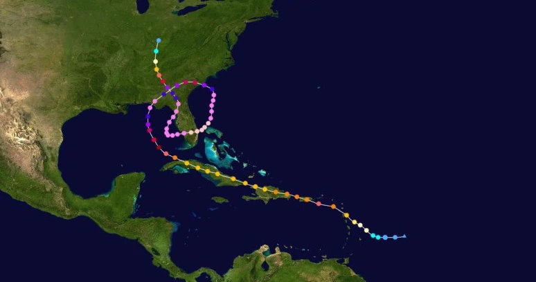 | |
| Duration | September 16 – October 2 |
| Peak intensity | 440 mph (710 km/h) (1-min) 633 mbar (hPa) |
A convective area of low pressure was spotted east of the Lesser Antilles early on September 16 which eventually became a tropical depression at 11:00 UTC that day. After forming, the depression began to quickly intensify due to high ocean temperatures, little wind shear, and moist air and became Tropical Storm Mu at 21:00 UTC that day. Acquiring more organized convection, Mu became a hurricane at 09:00 UTC on September 17 while moving northwest. Rapid deepening followed thereafter as conditions continued to become more favorable for tropical cyclone development. Developing a well-defined eye, Mu became a major hurricane at 05:00 UTC on September 18 less than an hour before hitting Guadeloupe Island and soon was a powerful Category 5 hurricane by 16:00 UTC that day. Afterwards, it made landfall near Guayama, Puerto Rico as a high-end Category 4 storm at 21:00 UTC. Mu continued to pass over the Greater Antilles over the next several days as land interaction caused the storm to weaken, with the system making landfalls on the city of Punta Cana in the Dominican Republic as a 210 km/h/130 mph Category 4 at 09:30 UTC on September 19 and on the eastern tip of Cuba as a 195 km/h/120 mph Category 3 at 11:15 UTC on September 20. Eventually, Mu emerged into the waters near the Gulf of Mexico late on September 21 as a low-end Category 3 before immediately beginning to re-intensify due to extremely warm waters and almost no wind shear. By 23:00 UTC that day, the storm had regained Category 4 strength. The following day, Mu began to rapidly intensify a second time and exceeded Category 5 strength at 07:00 UTC as it began to be steered north-northeast by a low to the west. The powerful cyclone became a hypercane at 17:00 UTC on September 23 just hours before its landfall on Panama City, FL. Over land, the storm quickly weakened due to land interaction and lost hypercane status early on the 24th along with some of its deep convection and the organization of its eye, and it eventually emerged as a disorganized Category 8 on September 25. After, Mu began to re-strengthen again due to the continuing presence of favorable conditions, intensifying back into a hypercane within the day. As it did so, a small anticyclone to the west caused Mu to make a highly unusual turn to the south, where even warmer waters existed. By 16:00 UTC on September 26, Mu's winds had exceeded Iota's 380 mph winds, making it the strongest tropical cyclone on record at the time. By 20:00 UTC, the storm had become the first to have sustained winds over 400 mph; its strength caused the NHC to unexpectedly assign it a new category: megacane. The so-touted Megacane Mu soon reached its peak intensity of 440 mph and 633 mbar at noon on September 27 before passing over what was once the east coast of the Florida Peninsula at 16:50 UTC. At peak, Mu's tropical storm-force winds extended out 700 miles (1127 km) out from the center of its 50 mile-wide eye. An influx of stronger wind shear as well as the effects of upwelling caused Mu to begin to steadily weaken as it passed over Florida's remains, becoming a regular hypercane at 01:00 UTC on September 28 and not regaining megacane strength by the time it emerged back into the Gulf of Mexico a few hours later. After turning back northward due to an incoming trough, Mu made its final landfall on Cedar Key at 03:00 UTC on September 30, after which it rapidly weakened over the mainland United States and dissipated at 14:00 UTC on October 2 upon the loss of all convection.
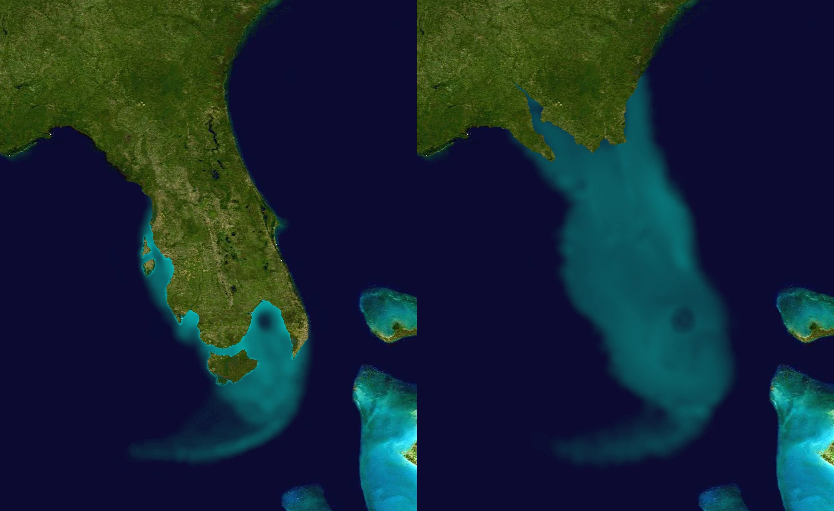

Florida before (left) and after (right) Megacane Mu. Note that the state's geography had already been altered prior to Mu by Hypercane Heath.
Hurricane watches and warnings were posted throughout both the Lesser and Greater Antilles in anticipation of Mu. The Lesser Antilles, especially the Leeward Islands, received strong wind gusts and extremely strong surf due to the storm passing very close to the archipelago as a strong major hurricane. Guadeloupe Island in particular received waves of up to 12 meters high and recorded wind gusts of 230 km/h, both of which led to the destruction of around 400 homes and businesses as well as the destruction of banana crops and other plants. Across the Greater Antilles, damage was also severe. Puerto Rico received catastrophic damage on a scale similar to that of Hurricane Maria in 2017, with an estimated 193,834 structures being affected in some fashion and 2,217 being completely destroyed. Extensive flooding left many homes underwater and forced families onto rooftops while roads became strewn with debris from trees and structures affected by the winds. 95% of the island lost power due to Mu damaging infrastructural facilities and left many in the dark without access to food or water. Hispaniola received severe damage as well - wind damage was not as bad as in Puerto Rico due to Mu being weaker by the time of its landfall, but flooding and storm surge levelled thousands of businesses and homes. Heavy rain caused numerous mudslides along the islands' many mountains and was one of the biggest damage culprits, with entire towns being buried under up to 3 meters of debris. Cuba saw 65% of all households lose power while 287,313 buildings were affected. Like in Hispaniola, flooding caused much of the damage with homes being inundated all across the island, though high winds up to 210 km/h also caused significant roof and wall damage. In the southeastern United States, damage was not as high as would be for such a powerful storm since the areas it affected were already almost entirely levelled by previous storms. Still, however, Mu was responsible for completely blowing away buildings as large as high-rises and for extensive flooding caused by up to 40 inches of rain and a storm surge 89 feet tall. Up to 5.7 million structures were damaged in some fashion. Mu also was able to completely sink the rest of the Florida Peninsula still above water after Heath, forcing the rest of Florida's population to move elsewhere. Overall, the megacane caused $2.01 trillion in damages and 68,298 direct fatalities along with 1.4 million indirect deaths.
Hurricane Nu[]
| Category 10 hurricane (SSHWS) | |
|---|---|
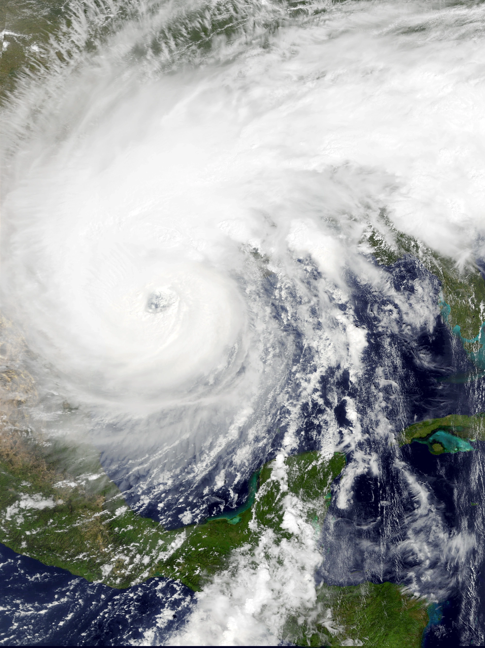 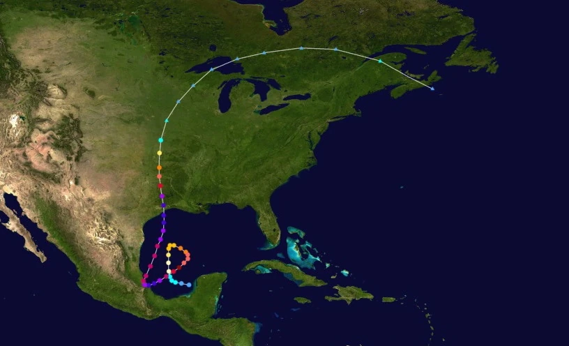 | |
| Duration | September 16 – September 26 |
| Peak intensity | 290 mph (465 km/h) (1-min) 794 mbar (hPa) |
On September 10, an area of thunderstorms in the Eastern Pacific formed and eventually made landfall in Chiapas, Mexico a few days later. Afterwards, it meandered in the Gulf of Mexico for another few days before beginning to exhibit more development on September 16. Quickly gaining more convection and a circulation center, the disturbance became Tropical Depression Sixty-Two at 23:00 UTC that day. At 08:00 UTC the next day, the depression intensified into Tropical Storm Nu and began to develop more curved rainbands. Very weak steering currents caused Nu to continue to meander in the Gulf of Mexico, and the storm then began to execute a clockwise loop as it steadily intensified. Nu was upgraded into a Category 1 hurricane at 01:00 UTC on September 18 upon a hurricane hunter flight discovering sustained winds of 117 km/h (73 mph) at the center of the storm; Nu also began to show signs of a developing eyewall and eye. By the time Nu rapidly intensified into a major hurricane at 20:00 UTC that day, its eye had cleared. Rapid deepening continued over the next few days, with Nu becoming a Category 4 at 13:00 UTC on September 19, a Category 5 at 02:00 UTC on September 20, and an extreme hurricane at 19:00 UTC that same day. Developing a prominent stadium effect as well as several hot towers, Nu eventually reached its initial peak intensity of 285 mph (460 km/h), a Category 10 hurricane, at 01:00 UTC on September 22 just four hours before its landfall near the resort town of Tecolutla, Mexico. After that, Nu weakened into a Category 8 due to land interaction while making a sharp turn to the north caused by the arrival of a trough to the system's west, eventually moving back into the open waters of the Gulf of Mexico later on the 22nd. The storm remained a Category 8 for nearly another day due to an eyewall replacement cycle and outflow from Megacane Mu but soon regained Category 9 status at 22:00 UTC on September 23. Nu continued to strengthen until reaching its final peak of 290 mph (465 km/h) and 794 mbar at 16:00 UTC on September 24, after which it made landfall on an area of Texas near Galveston. The cyclone quickly lost convection and became disorganized due to land interaction and more outflow from Mu, losing extreme hurricane status at 14:00 UTC on September 25, major hurricane status at 02:00 UTC on September 26, and hurricane status at 09:00 UTC that day. By 14:00 UTC, Nu had transitioned into an extratropical cyclone.
Mexico and the Yucatan Peninsula received several days of rain from the developing Nu. The resultant 812 mm of moisture caused significant flooding across the region, flooding numerous towns and cities while trapping many people. Road closures were widespread due to water blocking streets while crop losses were high after farms flooded from the rain. Damage was, however, much more catastrophic in northern Veracruz due to Nu's C10 landfall. Wind gusts of nearly 480 km/h threw entire buildings into the air, with some small villages being destroyed without any trace. Cars as well as even the hardiest trees were blown away along with the buildings. These aforementioned objects were all transformed into airborne projectiles which caused significant damage on larger, sturdier buildings that managed to stay standing. Flooding was extensive, with flood damage being similar to that seen in other areas of Mexico. In addition, landslides along the Mexican mountains dealt even more damage when they buried towns and villages under rock and debris. A total of 1.7 million structures were affected in some way while 484,372 were destroyed completely. 10.5 million Mexicans reported losing power during Nu. In Texas as well as neighboring Louisiana, damage was also extreme and was very similar to what was seen in Veracruz, with extensive flooding and storm surge across the two states, powerful winds that sent many homes, vehicles, and trees into the air and into other buildings, and more. Another 2 million structures were damaged and 492,843 were destroyed while 12.1 million people in the U.S. lost power. Overall, Nu caused $767 billion in economic losses and 12,213 fatalities.
Hurricane Xi[]
| Category 5 hurricane (SSHWS) | |
|---|---|
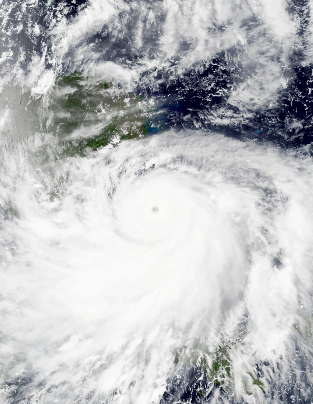 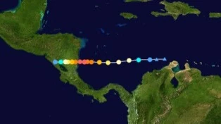 | |
| Duration | September 17 – September 21 |
| Peak intensity | 165 mph (265 km/h) (1-min) 921 mbar (hPa) |
A few hours before noon on September 17, the NHC began monitoring a well-developed tropical disturbance situated just a few dozen kilometers northeast of the Guajira Peninsula. Thanks to high sea surface temps, low wind shear, and moist air aloft, the system developed into a tropical depression at 20:00 UTC that day and received the designation Sixty-Three. By 04:00 UTC the next day, the depression had already strengthened into a tropical storm and was quickly developing powerful rain bands and a defined CDO; the system was named Xi at this point. Xi became a hurricane at 10:00 UTC before beginning to rapidly intensify, becoming a Category 2 at 18:00 UTC, a Category 3 at 02:00 UTC on September 19, a Category 4 at 07:00 UTC that day, and finally a Category 5 at 21:00 UTC all while a well-defined eye developed at the center of its CDO. The storm reached its peak at 01:00 UTC on September 20 as a 265 km/h Category 5, with deep convection being concentrated at a large group of rain bands to the south. The hurricane made landfall on Nicaragua at 09:00 UTC that day while a low-end C5. Afterwards, Xi quickly weakened over land. As the storm rapidly lost its convection and eye, at 19:00 UTC on the 20th, Xi weakened below major hurricane status and at 11:00 UTC on September 21, Xi weakened into a tropical storm. Five hours later, the storm weakened into a depression. Xi was declared dissipated at 22:00 UTC on the 21st after both recon flights and radar analyses confirmed the dissipation of the system's center of circulation.
Xi hindered recovery efforts post-Hypercane Iota and triggered re-flooding of rivers, strong waves along the coast, and very strong winds that dealt further damage to already-damaged buildings. Temporary tents and shelters housing storm victims were forced to relocate along with rescue personnel. Repaired power equipment was damaged again, destroying efforts to bring back electricity to the country. People who had just been given permission to go back into the disaster zone following Iota were forced out once again. Since the area was already severely affected prior to Xi's landfall, the storm did not cause much fresh damage or deaths, with $1.3 billion in damages and 20 confirmed deaths.
Hurricane Omicron[]
| Category 8 hurricane (SSHWS) | |
|---|---|
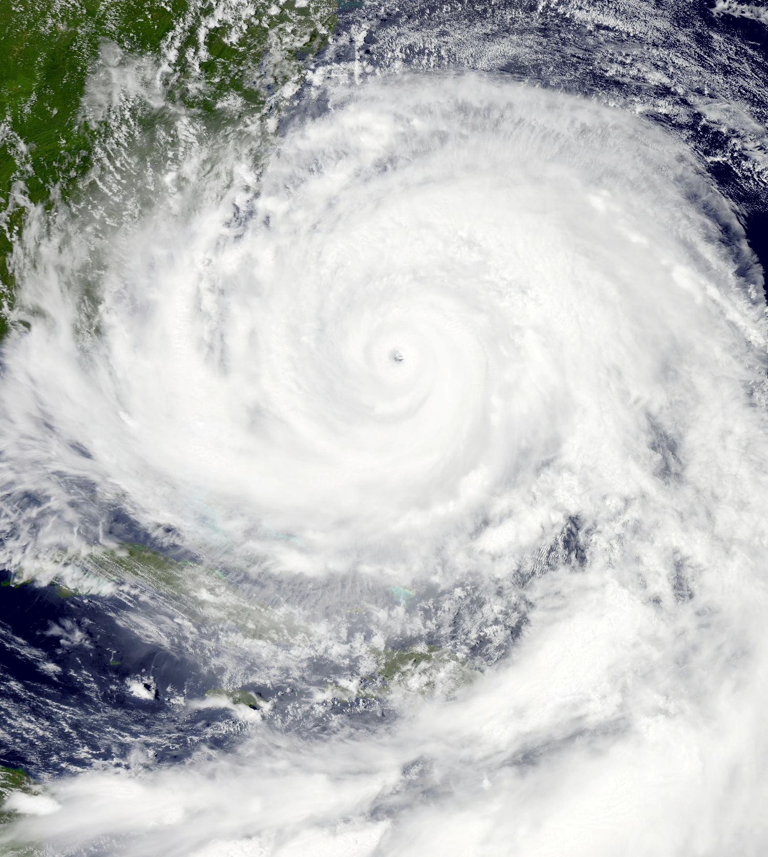 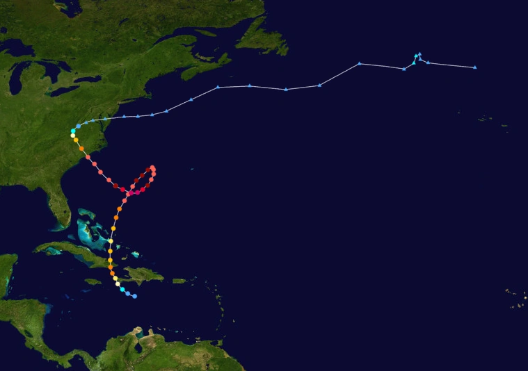 | |
| Duration | September 30 – October 10 |
| Peak intensity | 250 mph (405 km/h) (1-min) 846 mbar (hPa) |
A tropical area of low pressure was discovered less than a hundred miles south of Hispaniola on September 29. Intensifying quickly due to favorable conditions, the system intensified into a tropical depression at 18:00 UTC on September 30. Moving north due to being steered by the Azores High, the depression quickly intensified into a tropical storm at 06:00 UTC on October 1. After intensifying into a hurricane at 16:00 UTC that day and beginning to develop an eye, Omicron struck the western tip of the Tiburon Peninsula. Afterwards, due to extremely warm waters in the vicinity of Cuba and Hispaniola and almost nonexistent wind shear, Omicron began to explosively intensify. The storm reached its initial peak of 235 km/h (145 mph) and 949 mbar, a Category 4 hurricane, at 09:00 UTC on October 2 as thunderstorm activity flared up all over the system. Its intensification constituted a 95 mph increase in its winds over a period of 36 hours. After its first peak, Omicron made landfall on Guantanamo, Cuba at noon that day before weakening into a Category 3 due to land interaction as well as an eyewall replacement cycle at 15:00 UTC. Though the storm re-entered open waters a few hours later, it did not re-strengthen and in fact weakened further into a Category 2 near the beginning of October 2 due to its eyewall replacement cycle. However, its ERC was soon completed and the storm began to strengthen again, becoming a Category 3 at 10:00 UTC and a Category 4 at 17:00 UTC. Eventually, Omicron exceeded Category 5 status and became a Category 6 at 19:00 UTC on October 4. On October 5 at 06:00 UTC, Hurricane Hunter aircraft recorded Omicron's second peak of 345 km/h (215 mph) and 879 mbar in the system's very well-developed eyewall. As the cyclone began to stall and make a turn southwest, Omicron weakened back into a Category 5 11 hours later due to a second eyewall replacement cycle which it soon completed at 13:00 UTC the next day. Strengthening resumed then, and the storm became an extreme hurricane again at 16:00 UTC on the 6th. At 03:00 UTC on October 7, the storm reached its third and strongest peak intensity of 405 km/h (250 mph) and 846 mbar, which is equivalent to a strong Category 8 hurricane. Afterwards, Omicron turned northwest and developed multiple concentric eyewalls, signalling a third eyewall replacement cycle. It weakened back into a Category 5 hurricane at 01:00 UTC on October 8 while convection began to wane due to upwelling and a slight increase in wind shear. A few hours later, Omicron completed its eyewall replacement cycle and acquired annular characteristics. The storm made its final landfall as a 165 mph Category 5 on Caswell Beach, NC, after which it rapidly succumbed to land interaction and increased wind shear while recurving out east due to an oncoming extratropical cyclone. Omicron lost hurricane status at 21:00 UTC on October 9 and eventually became extratropical at 09:00 UTC on October 10.
In western Haiti, Omicron added on to the damage caused by Hurricane Mu weeks prior. The storm brought major hurricane-force wind gusts as well as moderate flooding that affected some populated areas. Landslides were also reported on mountainsides, though they were mostly in isolated areas away from populated areas. Around 300 homes were destroyed by Omicron in the country. Similar damage was recorded in eastern Cuba, which experienced even stronger winds of Category 4 strength which sent trees into the air and destroyed the roofs and walls of homes. Guantanamo and Santiago de Cuba were the hardest-hit provinces, with over a thousand buildings destroyed in each, while Granma, Las Tunas, and Holguin were also severely affected by flooding which destroyed crops and led to mudslides in several villages. Heavy downpours occurred in the Bahamas when Omicron passed over the eastern portion of the islands while undergoing an eyewall replacement cycle. In the Southeastern United States, severe wind and water damage occurred due to Omicron and was especially catastrophic in the Carolinas. Winds of up to 167 mph tore through homes and businesses, collapsing walls and rooftops. Significant flooding isolated several towns and closed down multiple highways including Interstate 95. A total of 23,473 homes were inundated while 932 people were rescued. There were likely many other individuals who required rescue but never received it due to FEMA being short on personnel as recovery following other storms like Iota and Mu continued. Damages in the Carolinas combined was $21 billion alone while 7,681 structures sustained some form of damage. Across other parts of the United States, Omicron's remnants spawned tornadoes including one that touched down within 10 miles of Washington D.C. A total of $75 billion in damages and 140 fatalities were blamed on Omicron.
Hurricane Pi[]
| Category Pi x 2.86478897565 hurricane (SSHWS) | |
|---|---|
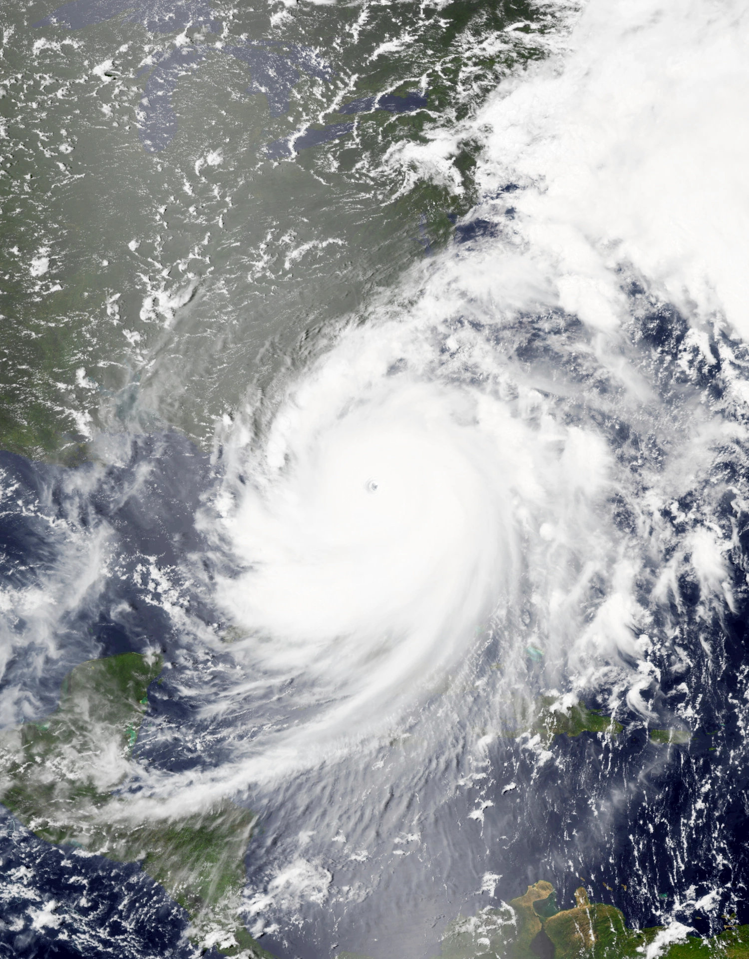 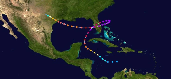 | |
| Duration | October 5 – October 16 |
| Peak intensity | 280 mph (450 km/h) (1-min) 814 mbar (hPa) |
On October 5, an area of dense thunderstorm activity was detected southeast of Jamaica and was moving west. Though convection was well-developed, a central low pressure area did not form until 22:00 UTC that day, when it was designated Tropical Depression Sixty-Five. Intensification thereafter was steady, with the system's upgrade to Tropical Storm Pi at 16:00 UTC on October 6 being accompanied by a gradual increase of the definition of its central dense overcast and rain bands. The next day, however, very favorable conditions allowed Pi to begin a period of rapid intensification; over 24 hours, the storm's winds went from 65 mph (105 km/h) to 120 mph (195 km/h), constituting a 55 mph (90 km/h)-increase in Pi's sustained winds, while its pressure dropped to 959 mbar. The now-major hurricane soon became a powerful Category 6 at 20:00 UTC on October 8 as it began to curve northeast towards the remains of Florida, with its appearance on satellite now displaying a very prominent eye and large rain bands spanning a sizable portion of the Caribbean and Gulf of Mexico. The storm soon reached winds of 265 mph (425 km/h), a Category 9, at 21:00 UTC on October 9 before hitting the remains of Florida's west coast a few minutes before midnight. Despite the peninsula being fully underwater, Pi weakened into a Category 8 over land due to the relative shallowness of the water as well as an eyewall replacement cycle, but eventually re-strengthened back into a Category 9 over the waters east of Florida at 14:00 UTC on October 10. Afterwards, an area of high pressure to the north of Pi caused it to stall while north of the Bahamas and eventually turn west. Early on October 12, Pi reached true peak winds of 280 mph (450 km/h) while growing to a diameter of 700 mi (1125 km). Pi then hit Florida again a few hours later and then began to weaken due to re-entering the Gulf of Mexico and passing over its own cold wake. At 15:00 UTC on October 13, the storm weakened below Category 6 status and became a Category 5. It weakened further into a Category 4 a few hours later, but then ceased weakening due to passing over warmer waters. Pi soon became a Category 5 again at 13:00 UTC on October 14 and reached a final peak of 175 mph (280 km/h) by the end of that day before making landfall a few miles away from Galveston, Texas at 05:40 UTC on October 5. Pi then quickly succumbed to the effects of land interaction and was designated a remnant low at 10:00 UTC on the 16th after the NHC failed to detect any convection associated with the storm.
In the Yucatan Peninsula and western Cuba, Pi did not make landfall but was still close enough to cause significant flooding and wind damage, with wind gusts exceeding Category 3 strength in the Cuban town of Mantua and flooding reaching a little more than 22,000 homes. Small trees were knocked down to the ground and destroyed businesses, blocked roadways, or both. Floodwaters and storm surge also caused road closures. Florida received minimal damage since the state was already completely drowned by Mu and Heath prior to Pi. The Bahamas, however, did receive rather major damage from Pi's close passage while a Category 9. Grand Bahama and Abaco received the worst of the damage, with wind gusts exceeding 300 km/h in Freeport and waves reaching 25 meters in height. Over half of both islands were flooded while 95% and 80% of all structures were blown down in Grand Bahama and Abaco respectively. Pi's Texas landfall did not contribute much new damage like in Florida, but interfered with recovery efforts after Hurricane Nu. Overall, the storm was responsible for $15 billion in property damage and 277 deaths.
Hurricane Rho[]
| Category 1 hurricane (SSHWS) | |
|---|---|
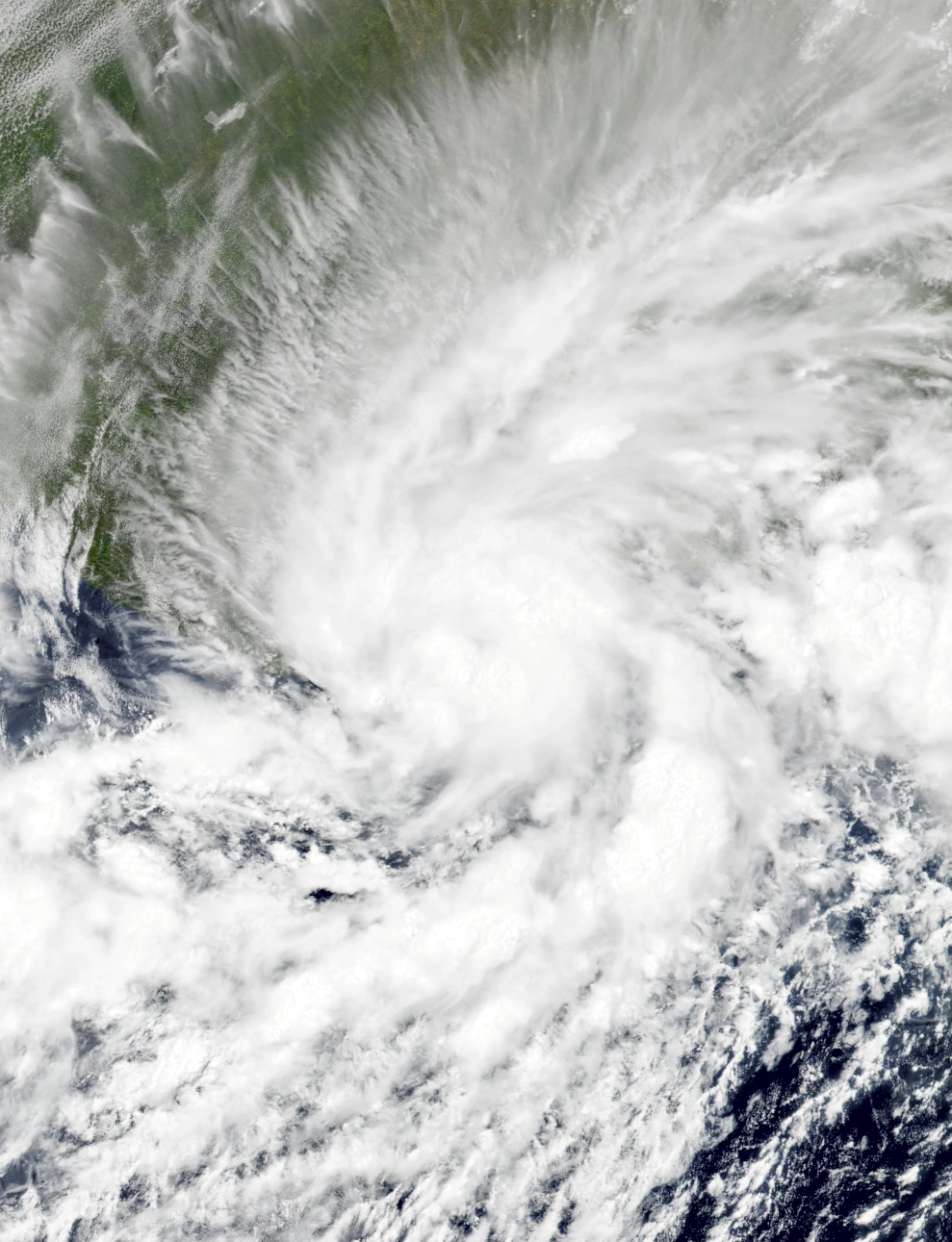  | |
| Duration | October 6 – October 7 |
| Peak intensity | 75 mph (120 km/h) (1-min) 990 mbar (hPa) |
On October 5, an area of low pressure unexpectedly formed south of Ghana despite its proximity to the equator. Moving west, it quickly gained large amounts of intense convection but struggled to develop a central circulation due to a lack of the Coriolis Effect. The next day, however, its circulation center dramatically improved in appearance, leading to the designation of Tropical Depression Sixty-Six at 08:00 UTC on October 6 at less than 5 degrees latitude, making the system the southernmost Atlantic tropical cyclone on record. At 20:00 UTC that day, the depression surprisingly further intensified into a tropical storm and was named Rho, and the storm soon began to develop banding features mostly concentrated to the north where the Coriolis Force was more powerful. Eventually, Rho reached its peak intensity of 120 km/h, a weak Category 1 on the SSHWS, at 12:00 UTC on October 7 as it began to turn north. A small eye-like feature formed at the center of an asymmetrical central dense overcast, with strong rainbands forming both north and south of the CDO. The storm made landfall on Côte d'Ivoire at 15:50 UTC that day before quickly weakening due to land interaction, dry air, and wind shear. Less than an hour after landfall, Rho was downgraded into a tropical storm and large amounts of its convection were getting entrapped with dry air and dissipating while its remaining convection became displaced to the northeast. The storm soon dissipated just before midnight on the 7th after its low-level circulation became devoid of convective activity and became a remnant low.
Despite being a weak tropical cyclone, Rho caused significant damage due to its unusual location. Record-breaking wind gusts of up to 153 km/h were able to destroy many buildings in the Ivory Coast, completely blowing away shanty-like homes in rural areas while tearing away at the roofs and walls of larger buildings. Numerous tree uprootings were recorded which caused further property damage. Flooding also impacted the nation significantly, with rising rivers destroying acres of coffee and cocoa fields. Power outages were widespread and reported in 2.3 million households. Waves of up to five meters in height along with storm surge were reported in both Côte d'Ivoire and the coast of nearby Ghana, prompting beach closures and causing minor coastal flooding. Overall, Rho killed 11 people and was responsible for $125 million in damages.
Hurricane Sigma[]
| Category 6 hurricane (SSHWS) | |
|---|---|
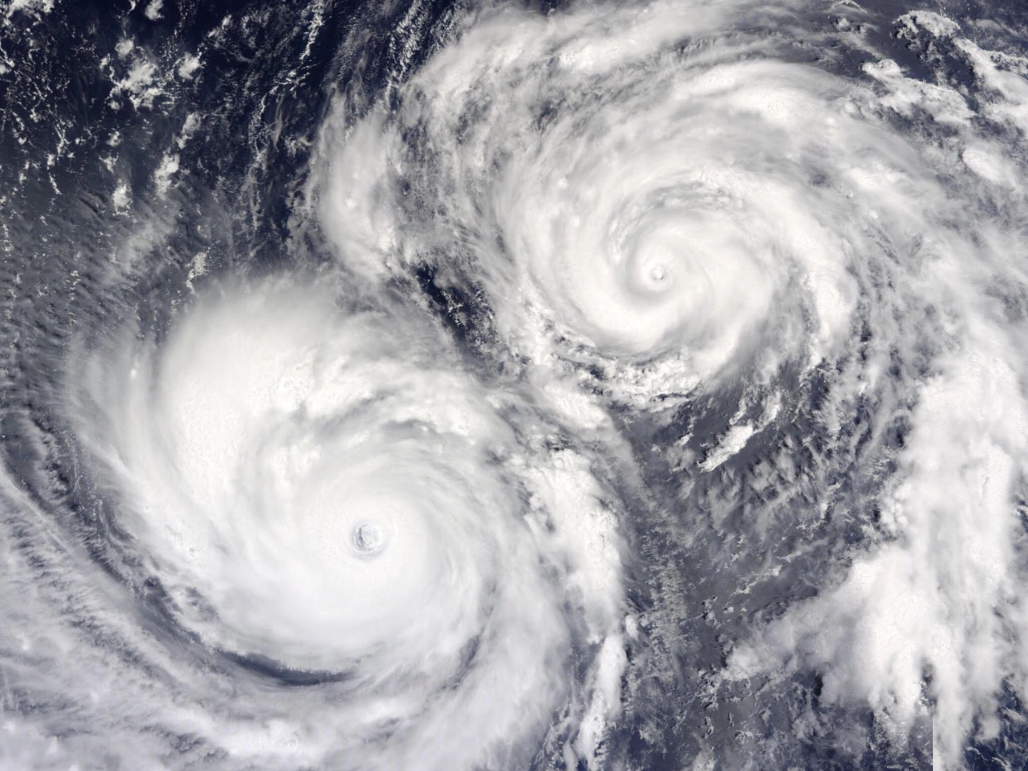 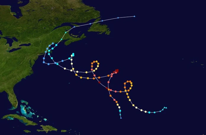 | |
| Duration | October 6 – October 16 |
| Peak intensity | 215 mph (345 km/h) (1-min) 864 mbar (hPa) |
Two extratropical cyclones over the open Atlantic were noted sometime on October 5. Due to favorable conditions, the one to the north eventually developed subtropical characteristics and was named Sigma at 17:00 UTC on October 6. Three hours later, Sigma became fully tropical as its central convection and low-level circulation became better defined. Wind shear initially displaced Sigma's deeper convection to the northeast, but the storm's central dense overcast became symmetrical by the time it intensified into a hurricane at 02:00 UTC on October 7. Steady intensification continued, and Sigma became a major hurricane at 08:00 UTC on October 8. The following day, Sigma became a Category 4 just as it began to enter a fujiwhara interaction with another storm named Tau which caused it to execute a small loop. Interaction with the rapidly intensifying Tau caused Sigma's appearance to become slightly sheared and it to weaken into a Category 3 at 01:00 UTC on October 10, but it soon regained Category 4 status at 22:00 UTC that day. Afterwards, with Sigma and Tau almost equal in strength, they stopped weakening each other and began an unusually long-lived fujiwhara interaction. Sigma peaked at 02:00 UTC on October 12 with winds of 215 mph, making it a Category 6 on the Saffir-Simpson Hurricane Wind Scale, while exhibiting a relatively large eye. Afterwards, the effects of wind shear, cooler waters, and the storms' outflow began to weaken both Sigma and its neighbor, with Sigma losing extreme hurricane status at 07:00 UTC on October 12, major hurricane status at 03:00 UTC on October 13, and hurricane status at 19:00 UTC on October 14 as its convection became more sprawled-out and shallow. As the two storms began approaching the northeastern United States, Sigma began to absorb the slightly weaker Tau into its circulation. After hitting Cape Cod at 15:00 UTC on October 15, Sigma transitioned into an extratropical cyclone at 06:00 UTC on October 16 and its remnants absorbed Tau on the 18th.
Sigma caused moderate effects in Massachusetts and neighboring states, with gale-force wind gusts and some flooding occurring. Flooding was mostly isolated and its effects were limited to road closures and the occasional partially flooded home in rural areas. Wind downed some tree branches, tore shingles off roofs, and littered roads with debris. Though Sigma did not cause a significant amount of damage due to peaking offshore, it and Tau were notable for being part of the longest-lasting Fujiwhara interaction ever recorded, with the two storms rotating around each other for nearly their entire lives, a feat which was considered nearly impossible by meteorologists. Many scientists described the occurrence of the storms as a once-in-a-lifetime event that will likely not occur again for many decades. Sigma caused a total of $1.8 million in economic losses and only 1 fatality.
Hurricane Tau[]
| Category 6 hurricane (SSHWS) | |
|---|---|
| | |
| Duration | October 9 – October 18 |
| Peak intensity | 220 mph (355 km/h) (1-min) 859 mbar (hPa) |
Two extratropical cyclones over the open Atlantic were noted sometime on October 5. While the northerly cyclone quickly developed into Sigma at 17:00 UTC on October 6, the one to the south remained extratropical until 04:00 UTC on October 9, when it rapidly transitioned into a tropical cyclone and became Tropical Storm Tau. Initially, outflow from the nearby and much more powerful Sigma prevented Tau from intensifying much. However, extremely warm waters ahead of its path caused the storm to explosively intensify, with its winds increasing by 100 mph over just 20 hours. By the end of October 9, Tau had become a 150 mph Category 4 hurricane and was still strengthening and gaining convection. At this point, Tau entered a long-term fujiwhara interaction with Sigma. At 05:00 UTC on October 10, Tau had intensified into a Category 5 hurricane, but soon weakened into a Category 4 at 10:00 UTC due to a brief eyewall replacement cycle. After Tau's eyewall replacement cycle was completed, the storm continued to intensify, with the storm becoming a Category 6 at 07:00 UTC on October 11. Hurricane Tau reached its peak at 20:00 UTC that day carrying winds of 220 mph; while doing so, it exhibited an unusually small central dense overcast and eye but large and powerful rainbands housing deep, intense convection. Gradual weakening then took place over the next few days as it and Sigma began to experience the effects of wind shear and colder waters, with Tau weakening below Category 6 status at 06:00 UTC on October 12, below major hurricane status at 11:00 UTC on October 14, and below hurricane status and into a tropical storm at 08:00 UTC on October 15. Soon after, Tau's convection became displaced in the direction of Sigma as Sigma began absorbing it, which caused Tau to become a depression at 03:00 UTC on October 16. After hitting Weekapaug, Rhode Island at 10:50 UTC on October 17, Tau dissipated inland at 06:00 UTC on October 18 due to being absorbed into Sigma's remnants.
Tau caused negligible effects in Connecticut, Rhode Island, and Massachusetts, with a few inches of rainfall falling which led to isolated flooding. Though Tau did not cause a significant amount of damage due to peaking offshore, it and Sigma were notable for being part of the longest-lasting Fujiwhara interaction ever recorded, with the two storms rotating around each other for nearly their entire lives, a feat which was considered nearly impossible by meteorologists. Many scientists described the occurrence of the storms as a once-in-a-lifetime event that will likely not occur again for many decades. Tau's damage was minimal, but one person was killed along the coast of Delaware due to rip currents generated by Tau.
Hurricane Upsilon[]
| Category 5 hurricane (SSHWS) | |
|---|---|
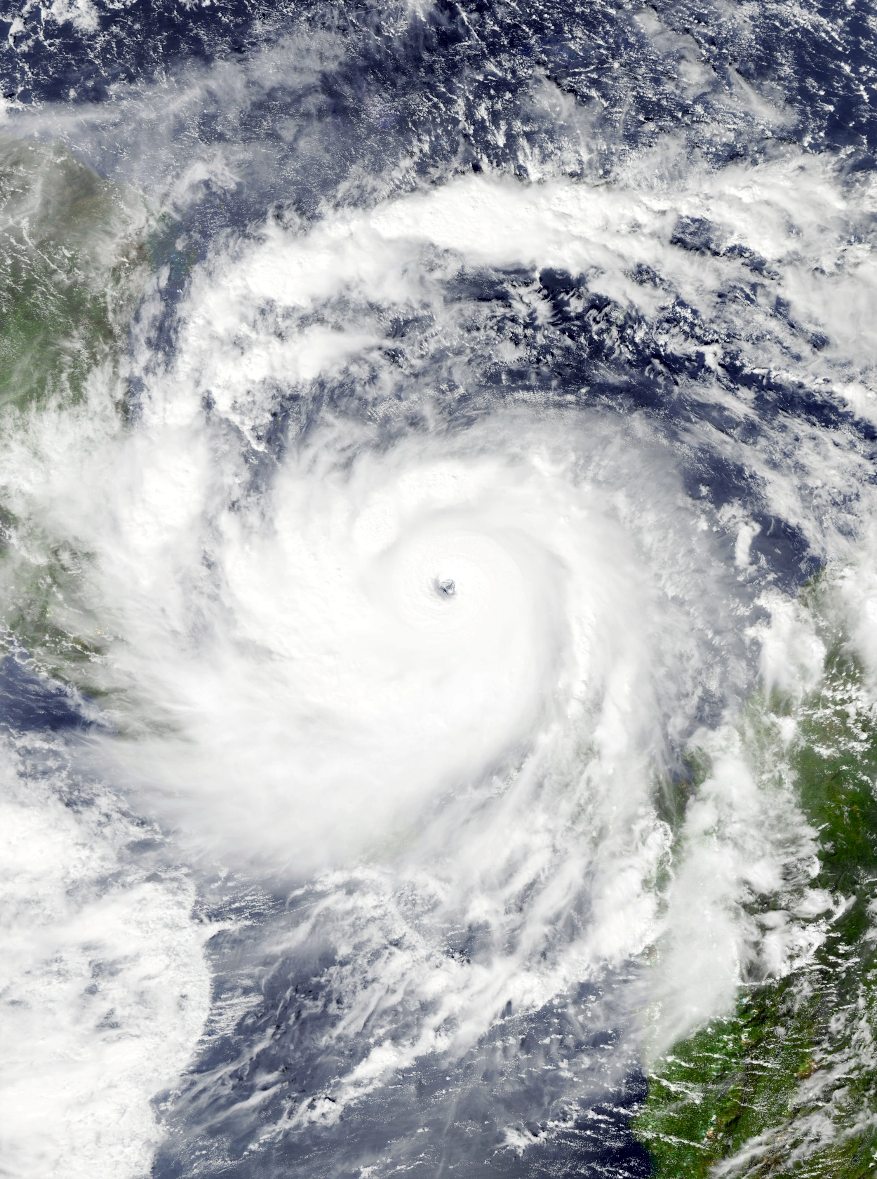 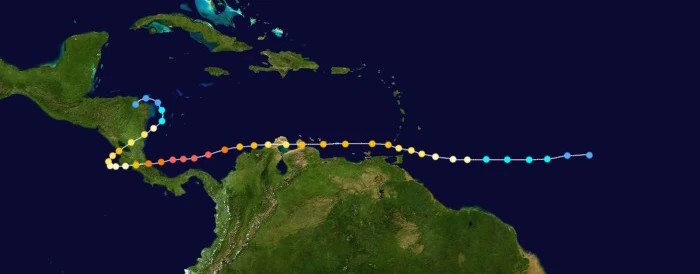 | |
| Duration | October 10 – October 20 |
| Peak intensity | 190 mph (305 km/h) (1-min) 893 mbar (hPa) |
A disturbance in the open Atlantic was detected sometime on October 8 as it began to develop intense convection. It continued to develop until it finally gained a well-developed circulation at 04:00 UTC on October 10, earning the designation Tropical Depression Sixty-Nine (n i c e) a few minutes after. As more convection developed and its appearance improved on radar and satellite due to favorable conditions, the depression strengthened into Tropical Storm Upsilon at 12:00 UTC that day. Upsilon was deemed a hurricane at 16:00 UTC on October 11 due to hurricane hunter aircraft detecting hurricane-force sustained winds near the center of the storm and due to an eye beginning to form at the center. Passing just a few dozen kilometers north of South America, the storm soon became a major hurricane at 01:00 UTC on October 13. Its eye cleared a few hours later as deep convection continued to increase significantly across its neatly curved outer bands. Upsilon, however, did not rapidly intensify further into a Category 4 or 5 at the time due to a slight increase in wind shear from other storms. The storm made its first landfall on the Paraguana Peninsula of Venezuela at 05:00 UTC the next day while a Category 3 and soon weakened into a Category 2 not long before its second landfall on the Guajira Peninsula at noon that day. Upon re-entering open waters a few hours later, Upsilon immediately began to re-strengthen, regaining Category 3 strength by the end of the 14th. Not long afterwards, the hurricane began to rapidly intensify due to favorable environmental conditions including a lessening of the aforementioned wind shear; near the beginning of October 16, Upsilon had reached its peak intensity of 305 km/h, right on the cusp of Category 6 strength, while exhibiting a clear, circular eye and very well-defined outflow. However, this peak was short-lived, and Upsilon soon weakened into a Category 4 at 17:00 UTC on the 16th as an eyewall replacement cycle began to take place. By 22:50 UTC, Upsilon had made landfall near Tortuguero, Costa Rica as a 235 km/h Category 4 hurricane. After landfall, the mountainous terrain of Central America caused the storm to quickly weaken into a Category 1 at 10:00 UTC on the 17th as it entered the Pacific Ocean. Just then, an incoming trough caused Upsilon to abruptly turn northeast, where it re-strengthened into a Category 3 before hitting San Juan del Sur, Nicaragua at 17:00 UTC on October 18. It eventually emerged back into the Atlantic early on October 19, becoming the second known storm to cross between the Atlantic and Pacific twice after Iota of the same year, but not without having weakened into a Category 2 at 19:00 UTC the previous day due to land interaction. In the Atlantic, Upsilon did not strengthen due to encountering cold waters and soon weakened into a tropical storm at 16:00 UTC on October 19. After weakening into a depression early on October 20, Upsilon made one last landfall on Patlaya, Honduras at 15:00 UTC on the same day before dissipating at 18:00 UTC over land.
In Venezuela and Colombia, moderate damage occurred after Upsilon's Category 3 landfall. Flooding was rather widespread, but not catastrophic in nature. Flood damage was mostly in the form of agricultural losses, with waters inundating multiple acres of crop fields across both countries, but a few populated areas were affected. A total of 10,732 homes experienced flooding in some form. Winds tore roofs off homes and businesses, dealt visible damage to walls, and sent trees to the ground which led to further property damage. In Costa Rica and other parts of Central America, which were still dealing with the aftermath of Hurricane Xi, Upsilon caused heavy damage. Powerful winds tore down the roofs and walls of 20,436 buildings and downed even more trees, including several large ones. However, Upsilon's most severe effects came from flooding caused by the combined intense rainfall of the storm's three total landfalls in the region. A total of 1,804 mm of precipitation fell across Central America, causing not only flooding but numerous mudslides across the mountainous terrain of the region. Flooding entered a total of 63,274 homes and businesses, causing severe damage to their interiors and forcing thousands of residents to take refuge on rooftops to await rescues, of which up to 4,531 were reported to occur. Mudslides and landslides buried dozens of villages and acres of farmland. One particular landslide occurred along the slopes of the Madera volcano around 21:00 UTC on October 18; this landslide managed to reach the coast of Lake Nicaragua and generate a tsunami in the lake which claimed 678 lives. In total, $10.5 billion in economic losses and 734 deaths were blamed on Upsilon.
Hurricane Phi[]
| Category 3 hurricane (SSHWS) | |
|---|---|
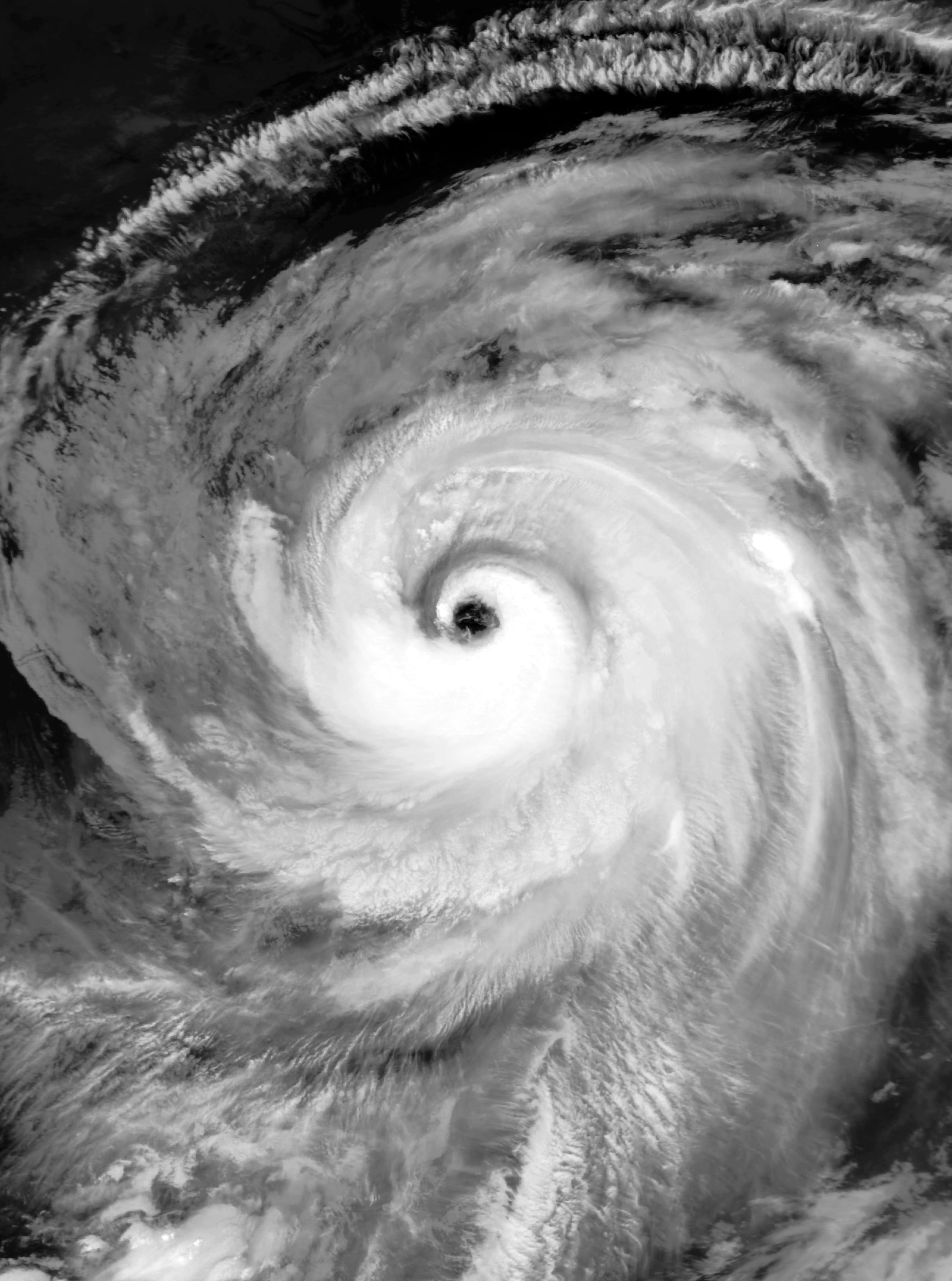 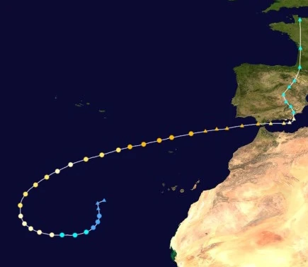 | |
| Duration | October 10 – October 16 |
| Peak intensity | 125 mph (200 km/h) (1-min) 957 mbar (hPa) |
Late on October 9, an area of low pressure formed over the eastern Atlantic and turned south. It had a well-developed circulation, but it was completely exposed with no obscuring convection. The following day, however, convection gradually developed until the NHC finally designated the system as a tropical depression at 17:00 UTC on October 10. Slow strengthening occurred over the next few days as the depression curved west into favorable conditions. At 11:00 UTC on October 11, it strengthened into Tropical Storm Phi as banding features formed and became more and more apparent. By the time Phi was upgraded into a hurricane at 02:00 UTC on October 12, its rain bands were curved and well-defined. Phi soon reached an initial peak of 175 km/h, equivalent to a Category 2 hurricane on the Saffir-Simpson Scale, at 15:00 UTC on October 13 while exhibiting the beginnings of an eye-like feature and curving northeast. At 10:00 UTC on the 14th, however, Phi weakened into a Category 1 due to an increase in easterly wind shear displacing convection to the east, but the storm soon entered an area of more favorable conditions and re-organized into a Category 2 hurricane at 18:00 UTC that day. After reaching Category 3 major hurricane strength at 13:00 UTC on October 15 and developing a clear, well-defined eye, Phi reached its true peak intensity of 200 km/h and 957 millibars at 06:00 UTC on October 16. Approaching the Gibraltar Strait, Phi continued to exhibit Category 3-force winds and was projected to make landfall just north of the strait, but ended up transitioning into a post-tropical cyclone while still a Category 3 at 20:00 UTC on the 16th. However, Phi still hit Europe while a strong post-tropical cyclone and eventually was absorbed by another extratropical cyclone over northern Europe early on October 21.
In Madeira, Phi generated gale-force wind gusts and torrential rain as well as rough surf along the coast. Though property damage was mostly minimal, some roads were flooded or became littered with debris from trees. Phi's post-tropical remnants caused immense devastation in Europe, becoming one of the strongest European windstorms on record besides the disastrous Theta and the record sixth tropical cyclone to significantly affect Europe during the season. Phi brought destructive winds reaching over 115 mph in some areas as well as heavy rainfall. A combination of these destructive winds, record-breaking flooding, the fact that the region was still reeling from Kate, Nicholas, Jacobus, Kenzie, and Theta, and a lack of adequate preparation for tropical cyclone-like conditions led to damages which cost over $29 billion USD and the loss of 354 lives. Phi also destroyed an estimated 11,989 structures.
Hurricane Chi[]
| Category 2 hurricane (SSHWS) | |
|---|---|
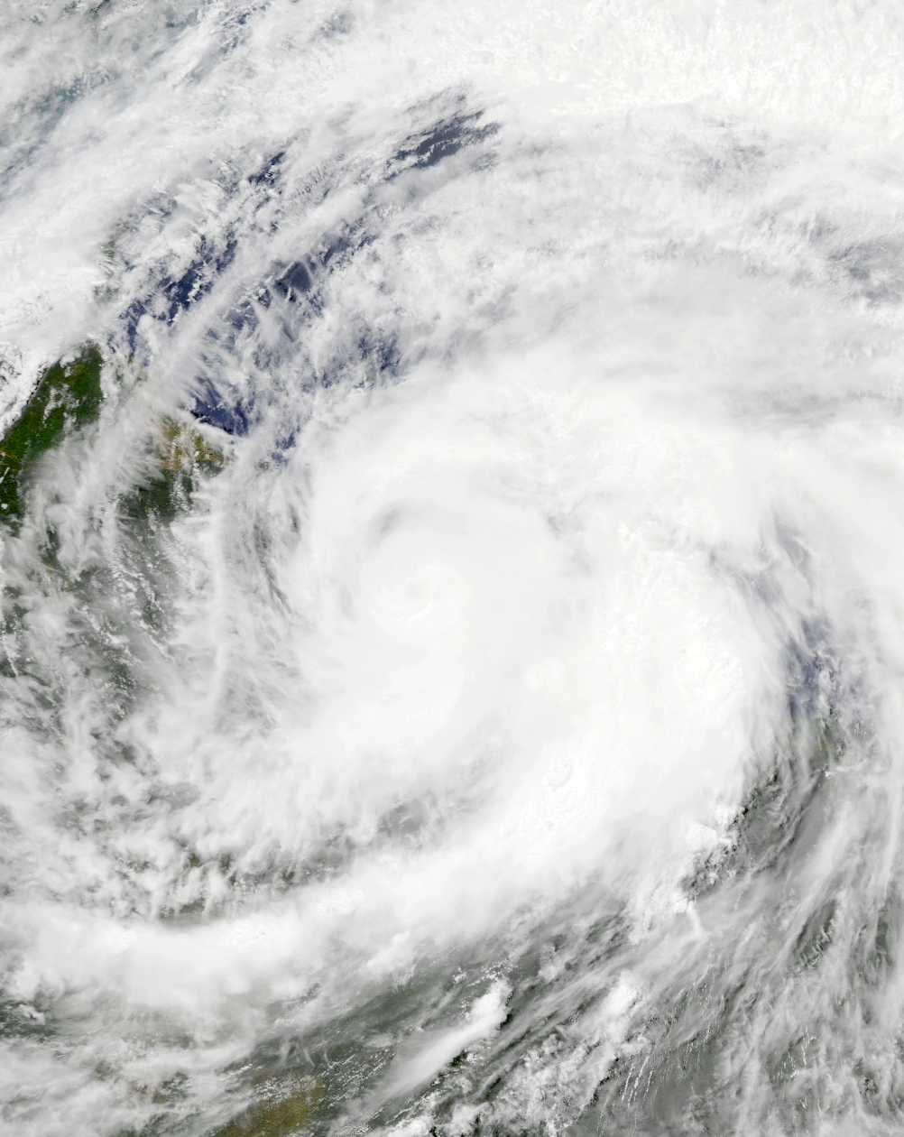 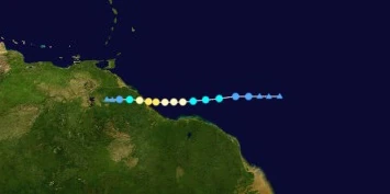 | |
| Duration | October 11 – October 14 |
| Peak intensity | 105 mph (170 km/h) (1-min) 975 mbar (hPa) |
Late on October 10, an area of low pressure formed at a rather southerly location in the open Atlantic and moved west. Because of its location, its circulation was ill-defined, though deep convection was present and abundant. Despite relatively weak Coriolis forces, the system eventually organized into a tropical depression at 07:00 UTC on October 11 as its circulation improved in appearance. At 23:00 UTC that day, the depression intensified into a tropical storm and was named Chi. Thanks to warm waters and low wind shear, convection continued to deepen across the storm and organize into bands, and by 13:00 UTC on October 12, Chi had intensified into a hurricane. Peak intensity occurred at around 12:00 UTC on October 13, when Chi achieved peak winds of 170 km/h (105 mph) equivalent to that of a Category 2 hurricane. At peak, Chi's central dense overcast was rather small, but the storm contained an eye feature as well as rain bands of very deep convection. At 19:00 UTC on the 13th, the storm made landfall on the town of Sucuriju in Charity, Guyana at peak intensity, becoming the first recorded North Atlantic hurricane to make a direct landfall on the country. Over land, rapid weakening ensued, with Chi losing hurricane status at 01:00 UTC on October 14 and tropical storm status at 09:00 UTC that day as convection quickly dissipated. The system became devoid of convection by 12:00 UTC, and advisories on the storm ended soon after as the NHC marked Chi as a remnant low.
Due to its unusual location, Chi caused relatively significant damage in Guyana. Many residents were initially skeptical of Chi's approach and failed to heed warnings. Due to poor building preparation, hurricane-force winds were able to completely destroy several structures and damage even more - up to 357,000 structures were affected by Chi's winds. The winds also downed numerous trees and power lines, leading to more property damage and the loss of power for 549,000 customers. Heavy rain of up to 7 inches also fell across the area, leading to large amounts of river flooding. This flooding destroyed several roads and bridges as well as triggered street closures. In Venezuela, Chi brought minor rainfall as a weakening depression/remnant low, and damage was overall minimal with flooding only being reported in isolated areas. The hurricane was responsible for 14 deaths and $147 million in economic losses.
Hurricane Psi[]
| Category 7 hurricane (SSHWS) | |
|---|---|
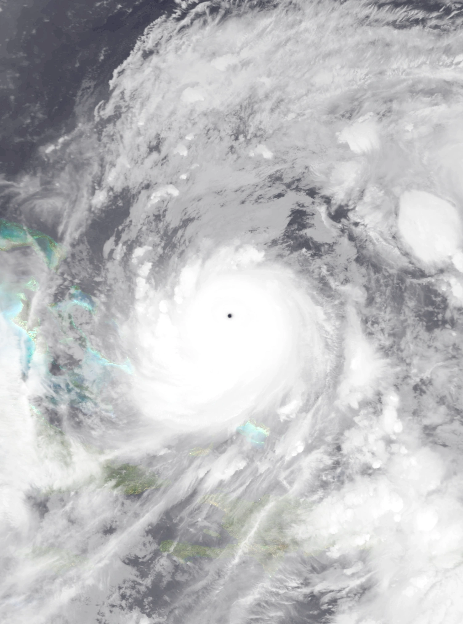 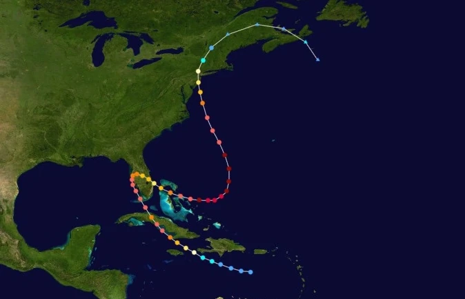 | |
| Duration | October 13 – October 23 |
| Peak intensity | 235 mph (380 km/h) (1-min) 849 mbar (hPa) |
On October 6, a tropical wave emerged off the coast of western Africa. No deep convection or well-developed circulation developed for some time due to hostile conditions, but it eventually began to organize more as it entered the Caribbean late on October 11. A defined low-level center was identified by hurricane hunter planes on October 13, resulting in the wave's upgrade to a tropical depression shortly after at 02:00 UTC. It continued on a generally westward track thereafter, but began to be steered north as it became Tropical Storm Psi at 05:00 UTC on October 14. Despite its proximity to land, Psi proceeded to rapidly intensify as it began developing large amounts of organized convection, with the storm becoming a hurricane at 16:00 UTC on the 14th and a major hurricane at 04:00 UTC on October 15. As it did so, its thunderstorms organized into prominent banding features and an eye developed and cleared at the center of its symmetrical central dense overcast while the storm passed within just a few kilometers of Cabo Cruz, Cuba. By 20:00 UTC on October 15, Psi had reached its first peak of 265 km/h (165 mph) and 924 millibars. Three hours later, Psi made landfall on El Megano, Cuba with peak winds and a slightly higher atmospheric pressure of 927 mbar. Over Cuba, Psi weakened into a Category 4 at 03:00 UTC on October 16, but quickly re-strengthened into a Category 5 and regained its lost convection. Approaching Florida now, the storm began another phase of intensification and reached a second, stronger peak of 190 mph (305 km/h) shortly before its landfall on the remains of Florida at 12:00 UTC on October 17. Less than an hour later, Psi was downgraded into a Category 4 and began a weakening trend due to unfavorable conditions and an eyewall replacement cycle as the system began to make an erratic curve southeastward due to being steered by a trough to its north. Eventually, it emerged into open waters as a Category 2 hurricane with a disheveled appearance at 16:00 UTC on October 18, but the storm began to re-strengthen just a few hours later. Entering another phase of rapid deepening, Psi soon became a Category 6 extreme hurricane at 20:00 UTC on October 19 and reached a final Category 7 peak intensity of 235 mph (380 km/h) at 13:00 UTC on October 20 as a pinhole eye became visible on radar. Following peak intensity, Hurricane Psi was steered northward towards cooler waters and higher wind shear, causing it to gradually weaken. At 18:00 UTC the next day, Psi weakened below extreme hurricane strength and became a Category 5. By 04:00 UTC on October 23, the storm had weakened below major hurricane status and had lost its eye and banding features. Less than an hour later, it made landfall near Cape May, New Jersey. Over land, the storm weakened even faster while undergoing an extratropical transition which Psi completed just before midnight on that day.
Psi generated large waves, rip currents, high winds, and significant rainfall along the coasts of Jamaica and Haiti. In Jamaica, around 102 mm (4 in) of precipitation fell in some areas, causing isolated and minimal flooding. Wind gusts of near-hurricane force downed some tree branches and triggered road closures due to debris. Large waves capsized a few small craft, forced the closure of beaches and coastal structures like docks or wharfs, and caused the death of one person. Because of the storm, a total of 14 flights were cancelled in the region. Haiti received almost identical effects, though winds were slightly stronger and were enough to cause minor but visible damage to rooftop shingles. A tree reportedly fell on a home in Les Cayes, injuring its 4 occupants, while 2 people died due to rip currents. In Cuba, damage was very severe. Very high winds gusting up to 285 km/h destroyed numerous homes and businesses and uprooted trees across the central part of the island while a large storm surge left 3,237 structures flooded, isolated communities, and forced thousands of Cubans onto roofs. Humanitarian aid was sent to the country to help assist in recoveries, but their ability to do so was limited due to numerous other areas requiring aid after several other power and damaging hurricanes. Very stormy conditions occurred in Florida, but damage was minimal due to the peninsula already being destroyed by previous storms, but some flooding in isolated areas was reported in the still-intact regions of the Florida Panhandle and in Georgia. The Bahamas received major damage from Psi. Andros Island received winds of up to 210 km/h (130 mph) in some areas which caused poorly-constructed homes to be destroyed without a trace and larger buildings to sustain significant damage. Approximately 50% of all structures on the island were damaged to some degree while infrastructure was affected in 60%. Across other parts of the islands, Psi severely damaged or destroyed 4,300 homes and businesses and displaced 25,000 people. In the New Jersey area, the storm caused gusty winds of up to 116 mph in Sea Isle City. Winds damaged a total of 182,000 structures in the United States, with damage ranging from minimal damage to roof shingles to the total destruction of roofs and significant damage to walls. Flooding inundated many communities, caused beach erosion, and cut power for 2.4 million residents. Due to the range of areas affected, Psi caused $22.1 billion in property damage and 163 fatalities.
Hypercane Omega[]
| Hypercane (SSHWS) | |
|---|---|
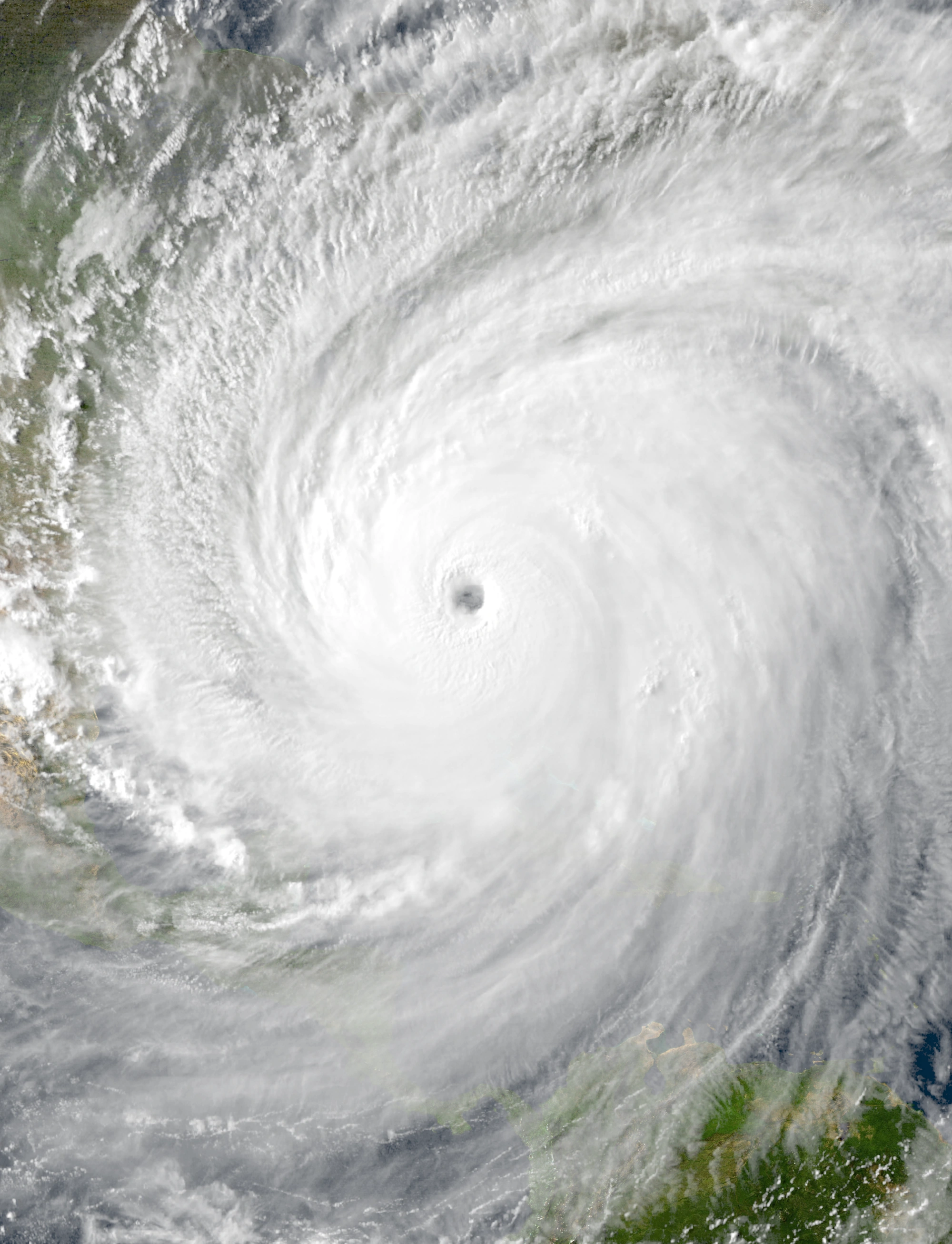 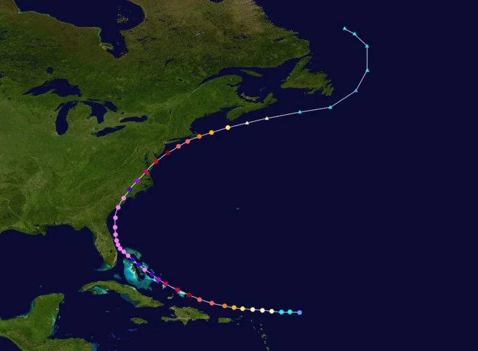 | |
| Duration | October 19 – October 28 |
| Peak intensity | 345 mph (555 km/h) (1-min) 749 mbar (hPa) |
On October 18, an area of convection was spotted northwest of the Lesser Antilles. As its thunderstorms became stronger and more organized, a central circulation formed and gradually improved in appearance until it was well-defined enough for the overall system to be classified as Tropical Depression Seventy-Three at 04:00 UTC on October 19. Moving west, the tropical depression continued to gather its strength under favorable conditions, becoming a tropical storm at 09:00 UTC and obtaining the name Omega. As banding features began developing at the fringes of the cyclone, Omega's strengthening continued. By the end of the day, the storm had become a Category 1 hurricane. In the following hours, however, Omega's intensification slowed due to outflow from nearby Hurricane Psi, but conditions became favorable again by the next day. After becoming a major hurricane at 22:00 UTC on October 20, the system began to undergo explosive intensification due to very warm water temperatures, low wind shear, and moisture in the atmosphere. Over the course of October 21, Omega strengthened from a 125 mph Category 3 hurricane to a 205 mph Category 6 hurricane, constituting an increase of 80 mph in the storm's 1-minute sustained winds. A few hours later, the storm made landfall on the Turks and Caicos Islands, but this did nothing to hinder its intensification. Eventually, Omega became a hypercane at 03:00 UTC on October 23 while over the Bahamas, but quickly weakened back into a Category 10 four hours later due to an eyewall replacement cycle. This eyewall replacement cycle was short-lived, however, as Omega soon completed its ERC and re-strengthened into a hypercane at 18:00 UTC the same day, now with a large but very well-defined eye nearly 100 miles across. The storm was then steered north, passing within a few dozen miles of what used to be the Florida coast, before peaking at 14:00 UTC on October 25 carrying winds of 345 mph and a central surface pressure of 749 mb as recorded by hurricane hunter planes. Also noted was a large gale-force wind diameter of roughly 1,540 miles and excellent outflow and convection in all parts of the storm. Not long after midnight on October 26, Omega made landfall near Beaufort, South Carolina near peak intensity. Over land, Omega quickly weakened, with convection collapsing and its eye becoming increasingly ragged and cloud-filled. 6 hours after landfall, the storm weakened below hypercane status and became a Category 10. By the time the system re-entered open waters at 05:00 UTC on October 27, it had weakened into a Category 7 hurricane with deep convection being concentrated in its northeastern quadrant. Despite being over the open ocean, Omega continued to weaken because of high wind shear, losing extreme hurricane status at 15:00 UTC that day and major hurricane status at 12:00 UTC on October 28; while weakening, Omega made landfall on Nantucket at 04:45 UTC on the 28th as a Category 4. By 20:00 UTC, Omega had transitioned into an extratropical low.
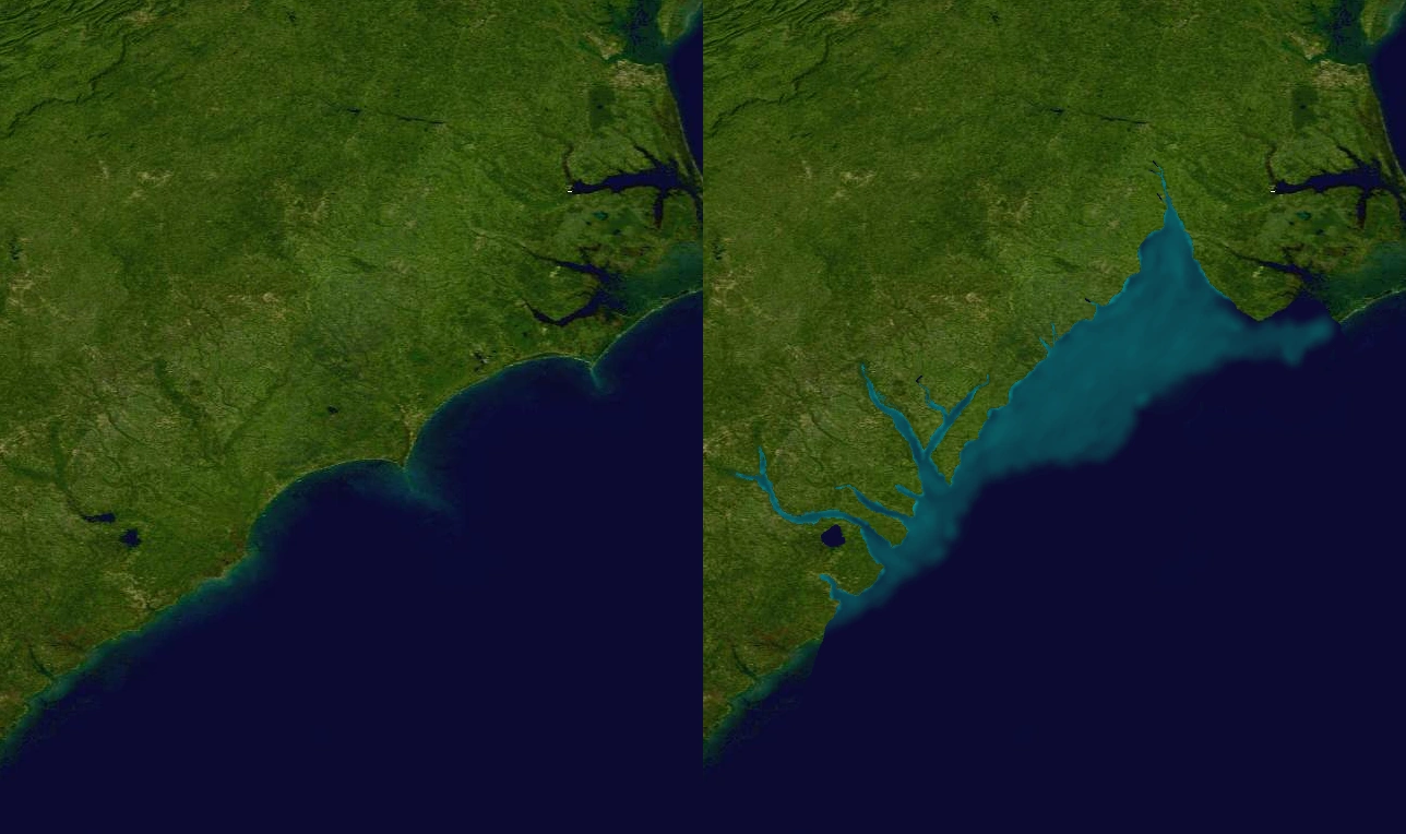
Views of the Carolinas prior to (left) and following (right) Hypercane Omega's passage.
As a strengthening storm, Omega brought squally weather to the coasts of the Lesser and Greater Antilles. Impacts included rough surf, abundant rip currents, wind gusts of up to major hurricane-force, and heavy rain. The large waves and torrential rainfall led to numerous reports of coastal flooding and damage to boardwalks, wharfs, docks, and other similar structures. Around 14,237 structures sustained damage across the Caribbean, with damages estimated at 4.5 million USD. Very catastrophic damage was reported in Cuba and the Bahamas as Omega passed near the islands as a powerful hypercane. Storm surge and flooding were so severe that many of the smaller islands of the Bahamas sank permanently similar to what happened with Florida. New Providence, the island housing the Bahamas' capital of Nassau, was one of the islands erased. Damages in the archipelago amounted to over $10 billion alone. Impacts were also apocalyptic in the Carolinas and other parts of the Southeastern United States. Like with other hypercane-affected areas, a visible portion of the states went underwater permanently due to Omega's flooding and storm surge. Outside of the sunken areas, however, damage was also incredibly severe. Entire cities such as Charleston were completely wiped from the map, with 300+ mph winds tearing entre high-rise buildings off of their foundations and ripping them to shreds. Large chunks of the ground were also uplifted, causing an altered landscape. Up to 20.7 million Americans lost power in the area. As Omega weakened a few dozen miles off the East Coast, more rough surf and stormy conditions were reported. Massachusetts received Category 4 hurricane conditions which caused the damaging or destruction of up to 290,000 homes and businesses as well as a loss of power for an additional 5.3 million residents. In all, Omega was responsible for $1.5 trillion in economic losses and an estimated 1,238,000 direct fatalities. Another 1.83 million indirect fatalities occurred due to cancer and other diseases brought about by ozone layer damage caused by the hypercane.
Hurricane Alef[]
| Category 4 hurricane (SSHWS) | |
|---|---|
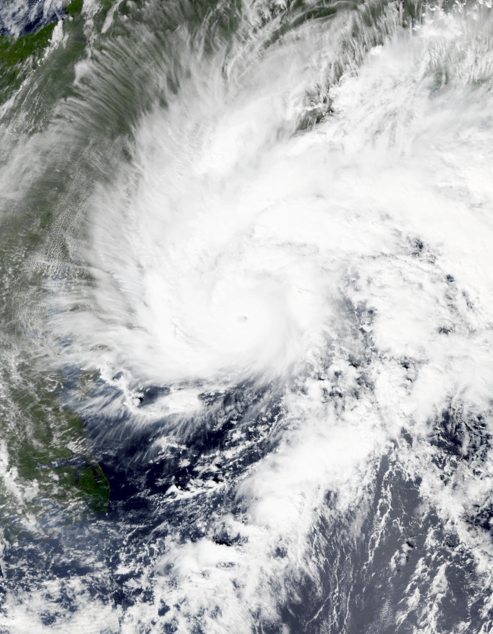 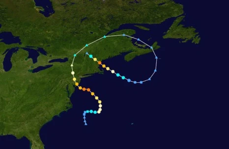 | |
| Duration | October 27 – November 6 |
| Peak intensity | 140 mph (225 km/h) (1-min) 946 mbar (hPa) |
Alef originated from a frontal low that formed off the coast of the Carolinas early on October 27. Wind shear and cold waters from Hypercane Omega initially prevented much development, but the system eventually began to show tropical characteristics and became a subtropical depression at 22:00 UTC later that day. Nonetheless, the subtropical depression had a sheared appearance on radar, with most convection being displaced to the west. The next day, the system was steered east into more favorable conditions, allowing its convection to align with the circulation center and the cyclone itself to become Subtropical Storm Alef at 6:00 UTC on October 28. This marked the first time in recorded history the Greek Alphabet was exhausted, prompting the NHC to use the Hebrew alphabet to name storms. By 16:00 UTC that day, Alef had transitioned into a fully tropical cyclone. A continuously favorable environment allowed the storm to continue strengthening while turning northwest. As tight spiral rainbands began to develop, Alef intensified into a hurricane at 02:00 UTC on October 29. By 09:00 UTC on October 30, Alef had intensified into a major hurricane according to reports from NHC recon flights into the intensifying system and began to develop a small eye at the center of its small but well-defined CDO. Peak intensity occurred on October 30 at 20:00 UTC, when the hurricane's winds reached 140 mph (225 km/h) and its pressure deepened to 946 millibars. Alef weakened into a Category 3 near the beginning of October 31, but its clearly defined central eye and its large rainbands' intense convection continued to persist as the storm made landfall on Ocean City, New Jersey at 09:30 UTC that day. Over the inland United States, Alef weakened quickly, losing major hurricane status at 15:00 UTC as its convection became wide and sprawling, signifying the beginning of an extratropical cyclone. Alef completed this transition at 03:00 UTC on November 1.
Alef's remnant continued to circle over the northeastern United States and southeastern Canada before emerging back into open waters on November 2. Over the Atlantic, the extratropical Alef began to redevelop into a subtropical cyclone thanks to warm water temperatures and unusually low wind shear. Eventually, it regenerated into a subtropical depression at 14:00 UTC on November 3 as central deep convection began redeveloping en masse. By 01:00 UTC on November 4, Alef had completely detached from its front and gained anticyclonic upper-level outflow, making it a fully tropical depression. Moving east, Alef steadily intensified, becoming a tropical storm again at 07:00 UTC and a hurricane at 21:00 UTC while spawning more and more thunderstorm activity. After becoming a hurricane, unusually favorable conditions off the coast of New England caused the hurricane to rapidly intensify into a Category 4 once more. Peaking with winds of 130 mph (210 km/h), Alef soon made landfall near the New Hampshire-Maine border at 17:00 UTC on November 5, after which it explosively weakened over land. The storm became a remnant low at 07:00 UTC, just 13 hours after its landfall.
Alef caused significant damage across the Northeastern United States. In New Jersey, Alef generated wind gusts of up to 149 mph (240 km/h) in Ocean City and hurricane-force wind gusts across almost the entire state. Small, poorly-constructed buildings such as mobile homes were blown away while other homes and businesses sustained severe damages to their walls and roofs. Numerous power lines and trees were downed, causing even more property damage as well as causing power outages for an estimated 1.23 million residents. Flooding affected New Jersey as well as Delaware, Pennsylvania, and New York, with floodwaters entering ~78,000 homes in New Jersey alone. In Delaware, damage was similar to that seen in New Jersey, with hurricane-force winds damaging the roofs of many homes and businesses and downing power poles and trees. A combination of flooding and winds caused around 98,000 to lose power. Across Pennsylvania and New York, Alef generated multiple incidences of flooding along rivers and streams, inundating farms and causing $4.1 million in agricultural losses. Hurricane-force winds were also reported, but they mostly occurred in isolated areas; wind-related effects in more urban areas was limited to torn-off roof shingles, downed tree branches, and debris cluttering streets. Rain and gusty winds were reported across much of the northeastern U.S. and in parts of Canada as Alef circled over the region as an extratropical cyclone. In New England, Alef brought wind gusts of up to Category 5-strength, blowing away many homes and businesses to the ground completely. At least 523,012 structures were damaged or destroyed in the region by the storm. Thankfully, since the hurricane weakened quickly over land, flooding was relatively minimal and was concentrated near major bodies of waters such as rivers or oceans. Some farms were partially flooded, destroying dozens of acres of crops, while several coastlines along the coast of New England were closed down in anticipation of Alef's rough surf. Overall, $17 billion in economic losses and 138 fatalities were blamed on Alef, with a State of Emergency being declared in the states of New Jersey, Massachusetts, New Hampshire, and Maine. Alef was also known for spawning multiple tornadoes while extratropical, with 23 reported twisters including a damaging EF3 in Allentown, Pennsylvania.
Hurricane Bet[]
| Category 2 hurricane (SSHWS) | |
|---|---|
 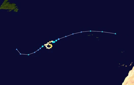 | |
| Duration | October 28 – November 2 |
| Peak intensity | 110 mph (175 km/h) (1-min) 962 mbar (hPa) |
On October 26, the NHC began monitoring an area over the open Atlantic due to the possibility of an extratropical cyclone forming in the area and transitioning into a tropical or subtropical storm. By 08:00 UTC the next day, a non-tropical area of low pressure had formed as predicted. Moving east, the system gradually acquired tropical characteristics until it was designated Subtropical Depression Seventy-Five at 17:00 UTC on October 28. Though the depression exhibited strong central convection, its location within a larger upper-level low prevented the formation of anticyclonic outflow and the transition of the system into a fully tropical cyclone. However, conditions quickly improved in the area of the storm, and the depression became both fully tropical and a tropical storm at 22:00 UTC on the 28th. Receiving the name Bet, the storm quickly strengthened into a hurricane at 05:00 UTC on October 29. As it strengthened, the storm began to slow down and execute a tight anticyclonic loop due to collapsing steering currents. At 16:00 UTC on the 29th, Bet strengthened into a Category 2 hurricane before peaking at 01:00 UTC on October 30 with winds of 175 km/h (110 mph) and a central surface pressure of 962 mbar. A small but well-defined eye-like feature soon developed, but quickly faded away as Bet weakened into a Category 1 at 12:00 UTC on the 30th due to an increase in vertical wind shear. Bet managed to re-strengthen into a Category 2 at 19:00 UTC on October 31 as hostile conditions lessened, but only held that strength for a few hours before resuming weakening in the face of heightened wind shear. After weakening into a tropical storm at 13:00 UTC on November 1 and into a tropical depression at 06:00 UTC on November 2, Bet transitioned back into an extratropical low at 15:00 UTC.
Besides light rain and gusty winds in the Azores, Bet had no effect on land. Damage was minimal in the Azores with no known storm-related fatalities.
Tropical Storm Gimel[]
| Tropical storm (SSHWS) | |
|---|---|
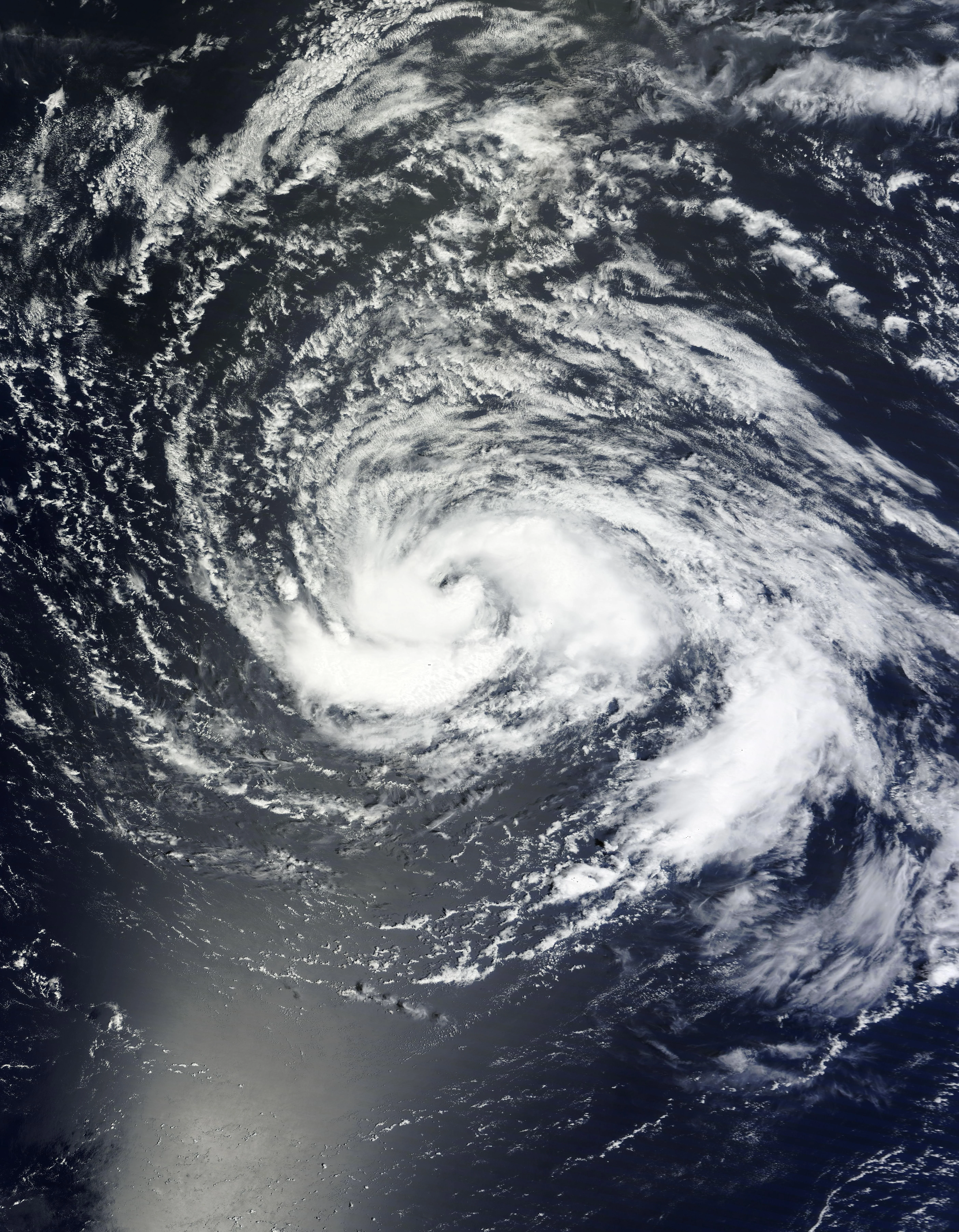 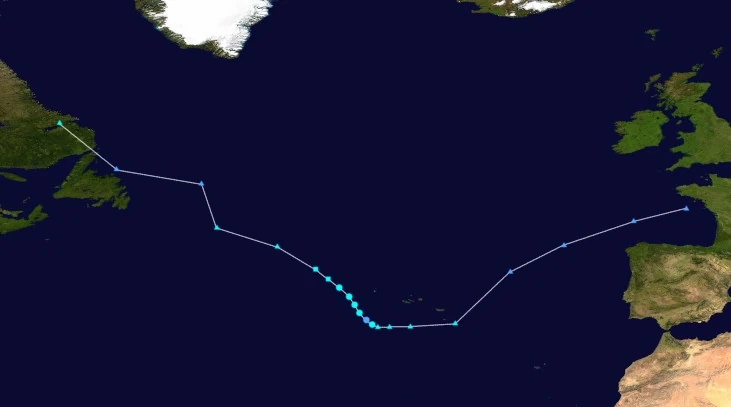 | |
| Duration | October 30 – November 1 |
| Peak intensity | 65 mph (105 km/h) (1-min) 998 mbar (hPa) |
The National Hurricane Center began tracking an extratropical cyclone over Labrador for the possibility of transitioning into a (sub)tropical cyclone upon moving into the open Atlantic on October 29. Entering the open ocean a few hours later, the cyclone's central low gradually separated from its associated fronts and developed central convection. Eventually, it became subtropical at 20:00 UTC on October 30 and received the name Gimel due to the precursor low already containing gale-force sustained winds. Moving southeast along the jet stream, Gimel became fully tropical at 08:00 UTC on October 31 while displaying well-developed banding features and a nearly symmetrical central dense overcast in spite of moderate wind shear. The storm eventually reached a peak intensity of 105 km/h (65 mph) at 19:00 UTC on the 31st before an increase in easterly wind shear caused Gimel to weaken. As its circulation became exposed in the west and convection became shallow and degraded, Gimel weakened into a depression at 06:00 UTC on November 1. However, it managed to regain tropical storm-force winds and complete cover of its center at 14:00 UTC, but this was followed by Gimel's transition into an extratropical cyclone at 22:00 UTC.
Gimel brought light rain and gusty winds to the Azores which caused only minimal damage and one indirect death when a person in an ambulance died due to traffic caused by a mudslide delaying proper treatment in a hospital.
Tropical Storm Dalet[]
| Tropical storm (SSHWS) | |
|---|---|
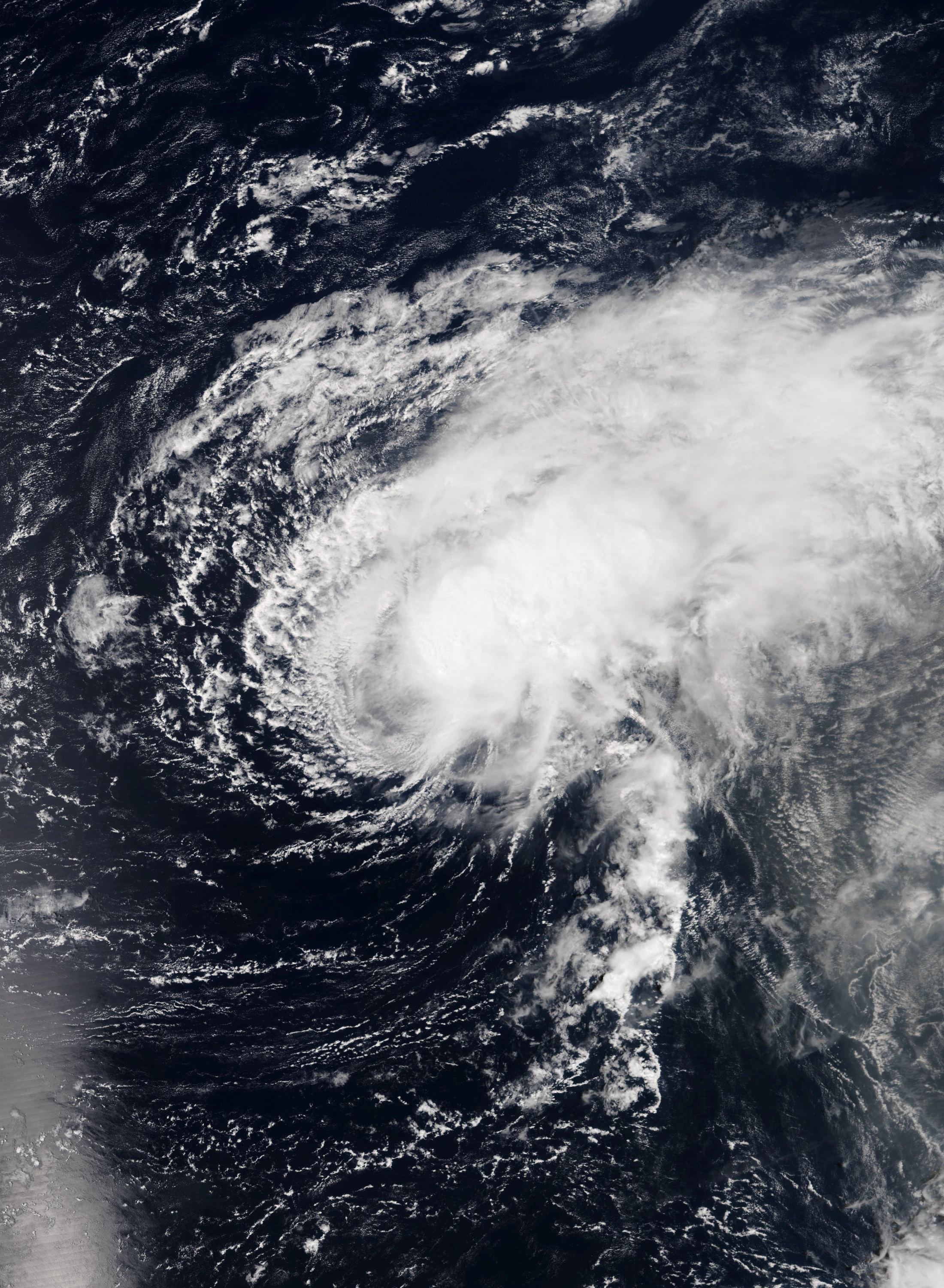 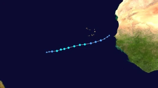 | |
| Duration | October 31 – November 3 |
| Peak intensity | 60 mph (95 km/h) (1-min) 996 mbar (hPa) |
On October 30, an area of low pressure formed and emerged off the coast of western Africa, near Cabo Verde. Favorable conditions allowed the low to steadily gain thunderstorm activity until it was classified as a tropical depression at 07:00 UTC the next day. Moving westward, the continual presence of warm waters and low wind shear allowed the cyclone to continue strengthening. Eventually, hurricane hunter planes found winds in excess of 65 km/h (40 mph) on November 1 along with a well-developed CDO and the beginnings of spiral rain bands, leading to an upgrade to Tropical Storm Dalet at 04:00 UTC. Intensification continued, with rainbands and outflow becoming more pronounced, though Dalet's convection was beginning to be displaced to the northeast due to wind shear. Peak intensity eventually occurred at 17:00 UTC on the 1st when Dalet acquired winds of 95 km/h (60 mph), after which the storm began to gradually weaken thanks to wind shear. Convection began parting from the circulation center over the next few hours, and the storm was soon downgraded into a depression at 18:00 UTC on November 2. By 02:00 UTC on November 3, the aforementioned wind shear had effectively stripped the system of all convection, resulting in Dalet being downgraded into a remnant low by the NHC. Around 18 hours later, Dalet's remnant circulation became indistinguishable from the surrounding environment. No damage was reported from the storm besides light rain in Cabo Verde.
Hurricane He[]
| Category 4 hurricane (SSHWS) | |
|---|---|
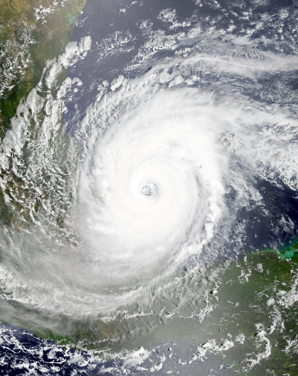 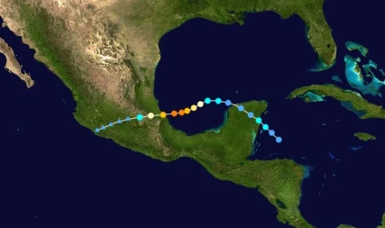 | |
| Duration | October 31 – November 5 |
| Peak intensity | 130 mph (210 km/h) (1-min) 945 mbar (hPa) |
An area of convection was spotted heading northwest off the coast of the Yucatan Peninsula on October 30. Though its thunderstorms were strong and well-developed, the system's lack of a central circulation prevented it from being upgraded into a tropical cyclone. By 21:00 UTC on October 31, recon planes flew into the storm and detected a low-level circulation at the center of the storm, resulting in it being designated Tropical Depression Seventy-Eight. After its formation, the depression continued to strengthen under favorable environmental conditions, becoming a tropical storm at 07:00 UTC on November 1 and receiving the name He. At 15:20 UTC that day, the storm made landfall near Punta Allen in the Yucatan Peninsula, halting further strengthening. He lost convection and became disorganized over land, weakening into a depression at 19:00 UTC on the 1st, but nonetheless emerged into the Gulf of Mexico the next day while still maintaining tropical characteristics. Not long after re-entering open waters, He regained tropical storm status at 14:00 UTC on November 2 as convection in the northwest began organizing into rain bands. The next day, very favorable conditions allowed He's structure to quickly improve, with the storm becoming a hurricane at 01:00 UTC on November 3 and a major hurricane at 12:00 UTC that day. He was subsequently upgraded into Category 4 status by the end of the day, having undergone rapid deepening and having developed a large, well-defined eye. Around 03:00 UTC on November 4, He reached its peak intensity as a low-end Category 4 before making landfall on Lechuguillas, Veracruz as a strong Category 3 at 11:00 UTC. Over land, Hurricane He explosively weakened due to the mountainous terrain of Mexico, being downgraded into a remnant low less than 18 hours after landfall.
He caused considerable damage in coastal Mexico, though effects were minimized by the storm's rapid weakening. In the Yucatan Peninsula, He was responsible for large amounts of rainfall which caused flooding in low-lying neighborhoods. Numerous rivers overtopped their banks and flooded a total of 15,000 structures and dozens of acres of farmland, while gale-force winds tore shingles off roofs. Some poorly-constructed roofs were destroyed entirely. In other parts of Mexico, particularly Veracruz, residents boarded up homes and stores and set up sandbags in anticipation of the storm. He generated winds of up to 195 km/h (120 mph) in several communities. Entire rooftops, utility poles, and trees were reported to be blown away. Heavy rain also caused mudslides along mountainsides, burying several dozen more homes under debris. A total of 29 deaths were blamed on He while $3.6 billion in property damages occurred.
Hurricane Vav[]
| Category 6 hurricane (SSHWS) | |
|---|---|
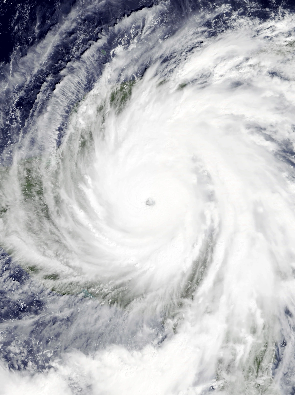 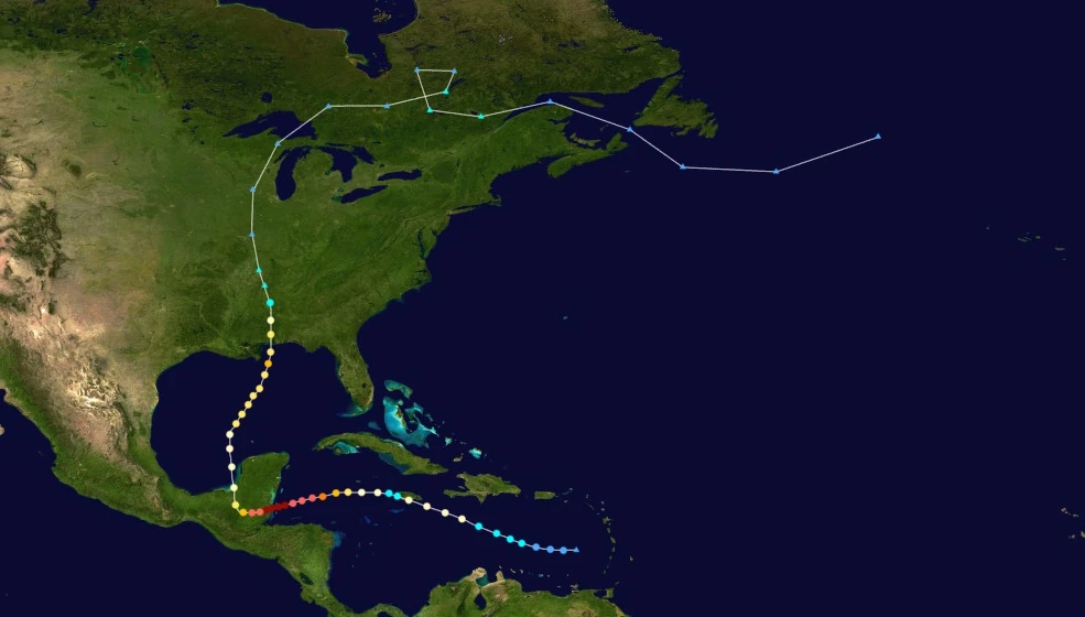 | |
| Duration | November 2 – November 13 |
| Peak intensity | 215 mph (345 km/h) (1-min) 875 mbar (hPa) |
Vav's origins can be traced back to a non-convective area of low pressure that formed early on November 2 in the eastern Caribbean Sea. Warm waters and low wind shear allowed the system to quickly develop thunderstorms until it was organized enough to be designated Tropical Depression Seventy-Nine at 13:00 UTC that day. Continuing its westward movement, Seventy-Nine eventually became Tropical Storm Vav at 09:00 UTC on November 3, with convection now covering its entire circulation. Favorable conditions allowed the storm to continue its gradual strengthening, eventually becoming a Category 1 hurricane at 11:00 UTC on November 4, before making landfall on Jamaica at around 06:30 UTC on the 5th. Land interaction caused the storm to weaken into a tropical storm a few hours later and lose some of its central convection, but it quickly regained hurricane status by the end of the day following its entrace back into open waters. Afterwards, very high sea surface temperatures of 43 °C (110 °F) caused Vav to undergo rapid intensification. As convection in and around the system's core exploded and an eye began forming, Vav reached major hurricane status at 14:00 UTC on November 6 and soon attained Category 5 status at 03:00 UTC the next day. Vav was upgraded into a Category 6 hurricane at 20:00 UTC on November 7 as robust outflow channels and a strong convective band to the east developed. A peak intensity of 345 km/h (215 mph) and 875 mbar occurred at around 12:00 UTC on November 8 before the storm's landfall near Placencia, Belize at 15:00 UTC that day. Over the Yucatan, Vav was steered north by an approaching trough while explosively weakening over land. Eventually, it emerged into the Bay of Campeche as a Category 1 hurricane at 22:45 UTC on November 9 and began moving towards the U.S. Gulf Coast. Though waters were warm and the atmosphere moist, strong outflow from the nearby Zayin prevented rapid intensification. Nonetheless, deep convection redeveloped and a ragged eye began to appear on radar as Vav re-intensified into a Category 2 at 22:00 UTC on November 10. At 10:00 UTC on November 12, Vav regained major hurricane status and held a brief secondary peak intensity of 185 km/h (115 mph) before hitting the Bay of Alabama as a Category 2 at 19:20 UTC that day. Over the bay, hostile conditions caused Vav to weaken into a tropical storm at 09:00 UTC on November 13 before the storm transitioned into a post-tropical cyclone a few hours later.
Vav caused gusty winds and rough surf in Jamaica, forcing beach closures and a few evacuations in particularly low-lying areas. Hurricane-force winds gusting up to 146 km/h tore shingles off roofs and branches off trees. Tree branches caused additional property damage, killing 2 people in a home crushed by a fallen branch and prompting road closures due to the branches blocking streets. Large waves along the coast and isolated flooding inland also caused road closures and inundated some homes. Around 30% of the island lost power. In Belize, the storm caused extraordinarily severe damage and was one of the worst natural disasters in the nation's history. Winds in excess of 200 mph upheaved entire homes and businesses, dealt severe damage to high-rise buildings, and blew down even the sturdiest trees. Severe flooding and storm surge flooded even more structures and caused the loss of multiple acres of farmland. Similar damage was recorded in Honduras, Gautemala, and the Yucatan, with a total of 2 million residents losing power in the region. In the United States, Vav's impacts were minimal since the area was still recovering from Hypercane Iota. In total, Vav caused $63 billion in damages and 2,349 fatalities.
Infinite Storm Zayin[]
| Infinite storm (SSHWS) | |
|---|---|
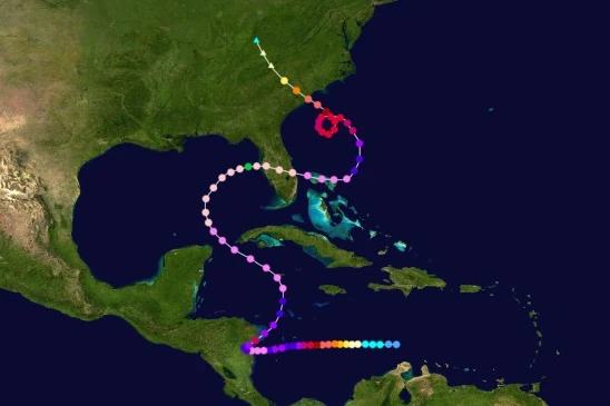 | |
| Duration | November 7 – November 26 |
| Peak intensity | 500 mph (805 km/h) (1-min) 578 mbar (hPa) |
On November 7, an area of convection was spotted around a hundred kilometers north of the Guajira Peninsula. Very favorable conditions allowed it to quickly develop deeper convection and a central circulation, resulting in its upgrade to tropical depression status at 19:00 UTC that day. Slowly moving westward, the depression continued strengthening and became Tropical Storm Zayin at 07:00 UTC on November 8 as banding features began to appear on radar and satellite. Zayin was upgraded into a Category 1 storm at 02:00 UTC on November 9 and was a major hurricane by the end of the day. Afterwards, very favorable conditions caused Zayin to undergo rapid intensification. With convection exploding in its center and a pinhole eye developing alongside it, the storm quickly became a Category 6 at 21:00 UTC on November 10. Hurricane Zayin eventually reached an initial Category 10-equivalent peak of 465 km/h (290 mph) at 23:00 UTC on November 11 before it underwent an eyewall replacement cycle that caused it to weaken back into a Category 9. However, on November 12, Zayin regained Category 10 status at 18:00 UTC following the completion of its ERC and proceeded to resume rapid intensification. On November 13 at 03:00 UTC, the NHC upgraded Zayin into a hypercane as recon planes detected winds over 300 mph (480 km/h) in the storm's well-defined eyewall. The powerful cyclone soon made landfall on Nicaragua at 15:45 UTC that day while carrying winds of 330 mph (530 km/h). Land interaction then caused Zayin's structure to rapidly deteriorate as the storm was steered northeast by an approaching low pressure area; by the time it re-entered the open waters of the Caribbean at around 17:00 UTC on November 14, it had weakened into a Category 8 hurricane with a ragged eye and shallow convection. However, Zayin re-intensified under favorable conditions and had strengthened into a hypercane again by 21:00 UTC on November 15 while it was beginning to turn northwest. After attaining hypercane status, the powerful storm continued to strengthen and grow in size as already-favorable environmental conditions only improved even more. At 14:00 UTC on November 17, Zayin's winds exceeded 645 km/h (400 mph), officially making it the second megacane in recorded history after Mu. Nonetheless, Zayin continued to explosively intensify while curving east. Eventually, at 09:00 UTC on November 19, Zayin's winds reached 500 mph (805 km/h), and the NHC upgraded the storm to a new category known as Infinite Storm. Peak intensity occurred a few hours later, with the cyclone's pressure deepening to 578 millibars before weakening back into a high-end megacane, though the system continued to retain its very well-developed eye and large, sprawling spiral bands. Later that day, Zayin passed over the remains of Florida and began to quickly weaken due to land interaction, upwelling, and an increase in wind shear. At 12:00 UTC on November 20, Zayin weakened into a hypercane as it entered the Atlantic and passed over Grand Bahama and the Abaco Islands. By 13:00 UTC the next day, it had weakened further into a Category 10 hurricane while being steered northwest by a high pressure area to its northeast. The storm then executed a small cyclonic loop from November 23 to 24 while a borderline Category 7/Category 8 extreme hurricane due to collapsing steering currents. Shortly after this loop, Zayin lost extreme hurricane status and became a Category 5 at 06:00 UTC on November 25. This was followed by Zayin making its final landfall a few miles northeast of McClellanville, South Carolina at 15:50 UTC as a low-end Category 5 hurricane. After Zayin hit the area, it explosively weakened due to land interaction and degenerated into a post-tropical cyclone while a Category 1 hurricane at 11:00 UTC on November 26.

Satellite views of the Nicaraguan coastline before Zayin (left) and after (right).
Across Central America, Zayin wrought extensive damage as a slow-moving hypercane, blowing away entire cities and dumping record amounts of precipitation. In Nicaragua, the hypercane's effects were described as apocalyptic. The entire country was severely affected, with almost every structure in the nation sustaining some form of damage and 90% of its power supply being cut off. Close to the landfall site, sturdy high-rise buildings, large trees, heavy vehicles, and even chunks of the ground were uplifted and thrown into the air. Smaller structures vanished without a trace while large structures were damaged beyond repair. Up to 914 mm (36 in) of precipitation fell across the country, causing the flooding of entire cities and hundreds of large landslides and mudslides across its numerous mountainsides. Thankfully, no big swaths of land was altered unlike other hypercanes thanks to Zayin being a low-end hypercane at the time, but the threat and effects of the storm were enough to warrant the evacuation of almost all of Nicaragua's population prior to landfall. Other Central American countries such as Panama, Costa Rica, and Honduras were also affected by Zayin due to the storm's large size. Effects included hurricane-force wind gusts, turbulent seas, and heavy rain which caused moderate damage to structures and isolated flooding. Damages in these areas were overall not as severe as in Nicaragua. Western Cuba and the Yucatan Peninsula received wind gusts of up to Category 6 strength and large 10-meter waves from the storm as it passed close to the islands. Poorly-constructed homes in both areas were severe damaged by winds and falling debris while storm surge capsized small boats and damaged piers, wharfs, and similar structures. Across the southeastern United States, Zayin also brought stormy conditions. Florida, where the storm made landfall near peak intensity, received little damage due to already being affected by other storms, though residents of neighboring states such as Alabama and Georgia reported major hurricane-force sustained winds and street flooding. An estimated total of 17,000 structures were damaged in said areas. In the Bahamas, Zayin wrought apocalyptic damage like in Nicaragua. Grand Bahama and the Abaco Islands were wiped completed off the map like what happened to Florida. Damage in other islands was remarkably catastrophic as well, with over half of all structures being destroyed on most islands and the entire power grid being compromised by flooding. Powerful winds and a strong storm surge were recorded in South Carolina, where Zayin made landfall as a Category 5, though damage was limited by its rapid weakening. Wind gusts of up to 175 mph severely damaged homes and businesses along the coast while flooding occurred along some rivers and washed out roads and bridges. Overall, Zayin was responsible for $809 billion in economic losses, a total of 1.1 million direct fatalities, and 1.5 indirect fatalities caused by radiation following the storm damaging the ozone layer.
The NHC received particularly harsh backlash for its unexpected addition of the Infinite Storm category. Many professional meteorologists and journalists criticized the rating for being unnecessary and even dangerous for public safety. CNN journalist Collin Murray called the rating "a tool of fear-mongering that will downplay the equal dangers of hypercanes and megacanes," citing that an Infinite Storm rating would cause the public to see hypercanes and megacanes as less dangerous, a belief Murray sees as false. In addition, the general public has criticized the name of the category for sounding unusually fantastical and unprofessional. Backlash was particularly severe in the meteorology-related online community known as Hypothetical Hurricanes Wiki; a group of several users on the site's Discord server were discovered to have planned a violent attack on local NHC offices in protest of the category and have sent death threats to prominent NHC officials. Though these users were later arrested by local police officials, criticism of the NHC remained high throughout the year.
Side note: Collin Murray is not a real CNN journalist and was made up for the purposes of this article. He is also not meant to be associated with any real people with the name or the armageddon storm named Collin that occurs at the end of the season.
Hurricane Chet[]
| Category 4 hurricane (SSHWS) | |
|---|---|
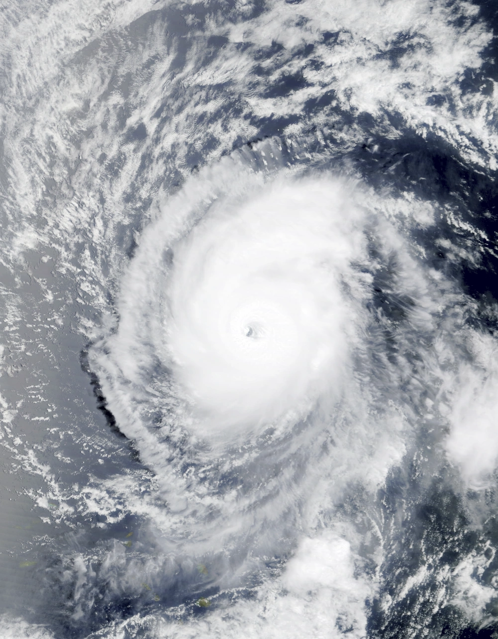  | |
| Duration | November 8 – November 15 |
| Peak intensity | 140 mph (225 km/h) (1-min) 934 mbar (hPa) |
On November 8, a tropical disturbance formed over the open Atlantic. Due to favorable conditions, the system rapidly organized into a tropical cyclone and eventually was upgraded into Tropical Depression Eighty-One by 07:00 UTC that day, with convection already covering most of its well-developed circulation center. Initially, the system moved west towards land, but stalled and made an unusual turn to the south due to a lack of significant steering factors as it strengthened into a tropical storm and received the name Chet from the NHC at 04:00 UTC on November 9. By the time Chet became a hurricane at 02:00 UTC on November 10, it had begun to move west again. Afterwards, high ocean temperatures and low wind shear caused the storm to continue intensifying, with an upgrade to Category 3 major hurricane status occurring at 23:00 UTC on the 10th as geostationary satellites indicated the formation of an eye, though the storm's convection remained confined to a compact ~100-mile (~160-kilometer) radius. Chet attained a peak intensity of 140 mph (225 km/h) as a Category 4 hurricane on the Saffir-Simpson Scale at 15:00 UTC on November 11 while its pressure deepened to a value of 934 millibars. Following peak intensity, convection began to dissipate and Chet's eye and eyewall lost organization as high wind shear from Hurricane Zayin's outflow began weakening Chet. At 17:00 UTC on November 12, the system lost major hurricane status and became a Category 2 and at 21:00 UTC the next day, it became a Category 1. Chet, now moving north and with no visible eyewall or banding features, weakened into a mere depression at 05:00 UTC on November 15. By 19:00 UTC that day, Chet's last areas of convection were stripped away from its now-exposed core, marking its dissipation into a remnant low. The storm caused heavy surf and light rain along the coasts of Anguilla, the British and U.S. Virgin Islands, Puerto Rico, the remains of Bermuda, and the U.S. East Coast. Three surfers died due to associated rip currents, but otherwise no damage or deaths were reported.
Hurricane Tet[]
| Category 1 hurricane (SSHWS) | |
|---|---|
  | |
| Duration | November 10 – November 12 |
| Peak intensity | 80 mph (130 km/h) (1-min) 989 mbar (hPa) |
On November 9, a non-tropical area of low pressure developed over the open Atlantic and gained organization until its eventual upgrade to a tropical depression at 03:00 UTC the next day. The depression quickly intensified thanks to favorable conditions, and by 08:00 UTC on November 10, hurricane hunter planes detected tropical storm-force winds at the center of the storm. This led to the NHC upgrading the system into Tropical Storm Tet. Continuing westward, Tet strengthened further into a Category 1 hurricane at 01:00 UTC on November 11 but struggled to organize its deep convection into well-defined rain bands due to intermittent wind shear. A few hours later, the storm reached peak sustained winds of 130 km/h (80 mph) and an unusually high pressure of 989 mbar while still exhibiting rather disorganized thunderstorms and a small central dense overcast. Tet's already-poor appearance degraded even further as increasing wind shear caused the storm to weaken below hurricane status at 13:00 UTC on the 11th. Soon, the storm's circulation became exposed as convection became displaced to the southwest. After being downgraded into a tropical depression at 07:00 UTC on November 12, Tet lost all convection six hours later and became a remnant low. Its remnants continued to move west for several days before becoming indistinguishable from the surrounding environment just a few dozen miles away from the Lesser Antilles. Tet did not affect land aside from light rain in the Leeward Islands which caused no known damages or deaths.
Hurricane Yod[]
| Category 2 hurricane (SSHWS) | |
|---|---|
  | |
| Duration | November 11 – November 20 |
| Peak intensity | 110 mph (175 km/h) (1-min) 975 mbar (hPa) |
A low pressure area formed over the eastern Atlantic early on November 10. Moving westward, the system began to acquire characteristics of a tropical cyclone including central convection, outflow channels, and a low-level circulation. Eventually, the storm had reportedly transitioned into a subtropical cyclone at 05:00 UTC on November 11, being assigned the name Yod due to gaining gale-force wind gusts a few hours prior. By 08:00 UTC that day, Yod had completed its transition and became a fully-tropical cyclone. However, easterly wind shear prevented Yod from strengthening further and caused it to weaken into a tropical depression at 01:00 UTC the next day as convection became displaced from its center. As the storm curved northeast, wind shear gradually lessened, allowed Yod to slowly reacquire convection to cover its partially exposed core. Yod regained tropical storm status at 04:00 UTC on November 3 while exhibiting a much health appearance on radar and satellite; once-disorganized convection now surrounded a small but symmetrical central dense overcast as defined rain bands. At 15:00 UTC on November 14, the cyclone strengthened further into a hurricane and began to develop a ragged eye-like feature. A slight increase in wind shear caused it to weaken back into a tropical storm at 10:00 UTC on November 15, but conditions quickly improved again and Yod promptly regained hurricane status a few hours later. After reaching Category 2 hurricane status at 03:00 UTC on November 16 and clearing out its eye, Yod reached its peak of 175 km/h (110 mph) and 975 mbar at noon that day before proceeding to execute a tight clockwise loop and entering a slow weakening trend. The hurricane weakened into a tropical storm at 17:00 UTC on November 17 and into a tropical depression at 11:00 UTC on November 18 before exiting the loop later that day. Yod then maintained tropical depression status and moved northeast for a little over a day before transitioning into an extratropical cyclone at 02:00 UTC on November 20. The storm brought moderate rain and hurricane-force wind gusts to the Iberian Peninsula, hampering efforts following other severe European storms such as Theta and causing $10 million in economic losses. No known fatalities were associated with Yod.
Tropical Storm Kaf[]
| Tropical storm (SSHWS) | |
|---|---|
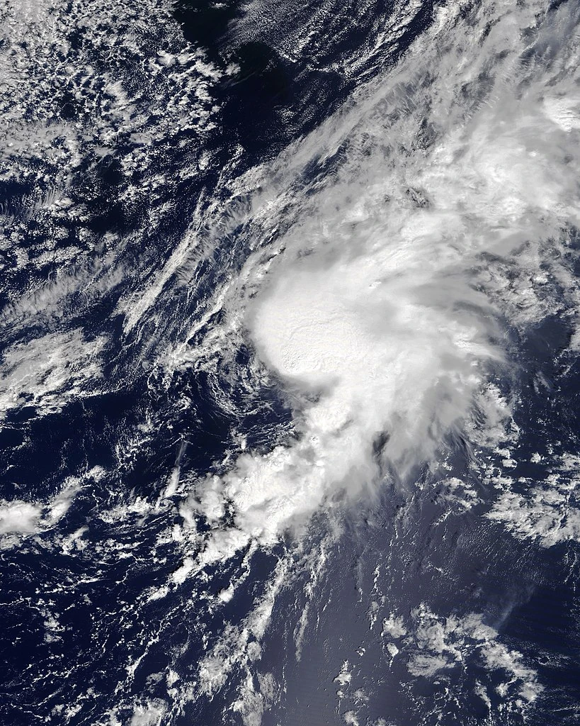 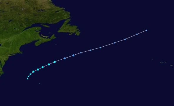 | |
| Duration | November 13 – November 15 |
| Peak intensity | 50 mph (80 km/h) (1-min) 1000 mbar (hPa) |
On November 12, the NHC began to monitor an area of open ocean near the former location of Bermuda due to the possibility of an area of low pressure forming there and transitioning into a tropical cyclone. Eventually, a gale-force low formed in the area at around 11:00 UTC on November 13. Central convection quickly developed while the low itself began detaching from its associated cold front, leading to the system's eventual upgrade to Subtropical Storm Kaf at 20:00 UTC that day. Following its formation, Kaf continued its northeastward motion while slowly strengthening. The storm transitioned into a fully tropical cyclone by 03:00 UTC on November 14 as banding features began to form along the system's outer fringes. Peak intensity occurred at 16:00 UTC on November 14 off the coast of New Jersey when NHC aircraft measured sustained winds of 50 mph (80 km/h). Afterwards, wind shear began displacing Kaf's central dense overcast to the northeast, causing Kaf to begin weakening. At 07:00 UTC on November 15, the NHC downgraded Kaf into a depression as the system started gaining characteristics of an extratropical cyclone. The storm had transitioned fully into a frontal low without affecting land by 23:00 UTC, causing advisories to end.
Subropical Depression Eighty-Five[]
| Subropical depression (SSHWS) | |
|---|---|
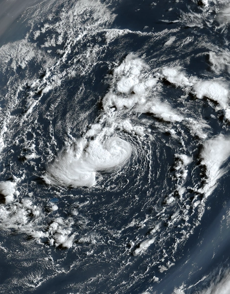 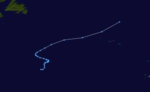 | |
| Duration | November 14 – November 15 |
| Peak intensity | 35 mph (55 km/h) (1-min) 1008 mbar (hPa) |
On November 13, an extratropical cyclone over the open Atlantic Ocean began to be monitored by the NHC for possible development into a tropical cyclone. Warm waters and moderate to low wind shear allowed the system to slowly organize. By 21:00 UTC, the NHC had designated the system as Subtropical Depression Eighty-Five. Though the storm displayed well-defined central convection, a warm core, and minimal banding features, it remained partially attached to its associated weather fronts which prevented it from becoming a true tropical cyclone. Due to an increase in wind shear, Eighty-Five neither intensified past depression status nor fully transitioned into a tropical cyclone. It transitioned back into an extratropical cyclone at 23:45 UTC on November 15 without affecting land.
Hurricane Lamed[]
| Category 6 hurricane (SSHWS) | |
|---|---|
  | |
| Duration | November 16 – November 19 |
| Peak intensity | 195 mph (315 km/h) (1-min) 897 mbar (hPa) |
On November 12, a tropical disturbance formed around 500 miles (800 kilometers) northeast of the Lesser Antilles. Wind shear from other tropical cyclones such as Infinite Storm Zayin prevented the system from developing much organization for several days as it moved westwards into the Caribbean. On November 15, conditions began to improve and the disturbance began developing a central surface circulation and large amounts of convection, eventually leading to its upgrade to Tropical Depression Eighty-Six at 08:00 UTC the next day. Afterwards, very warm water temperatures allowed the tropical depression to continue its fast intensification. At 12:00 UTC on November 16, NHC aircraft detected gale-force sustained winds at the center of the storm, causing the system to be upgraded into a tropical storm and receive the name Lamed. Gathering intense convection around its tight but well-defined central dense overcast, Lamed's strengthening continued under favorable conditions, with the storm becoming a hurricane at 20:00 UTC that day and a Category 2 at 10:00 UTC on November 17. Radar imagery began to indicate the presence of a complete eyewall and eye as Lamed intensified into a hurricane at 15:00 UTC on the 17th. By midnight that day, the storm had achieved Category 4 status and was exhibiting a well-defined eye formation on satellite. After becoming a Category 5 at 03:00 UTC on November 18, Lamed explosively intensified into a low-end Category 6 hurricane at 10:00 UTC. It reached its peak intensity a few hours later carrying winds of 195 mph (315 km/h) anda pressure of 897 mbar while displaying exceedingly well-defined outflow channels and spiral rainbands. Later that day, cold waters from Infinite Storm Zayin coupled with an increase in wind shear caused Lamed to weaken slightly into a Category 5 hurricane at 14:00 UTC that day before making landfall on southern Nicaragua as a high-end Category 4 at 22:00 UTC. Over land, Nicaragua's mountainous terrain drastically quickened the pace of the storm's weakening, but it nevertheless survived the crossover into the Pacific Basin as a Category 1 hurricane at 13:00 UTC on November 19. However, cold waters in the Pacific resulted in a quick dissipation into a remnant low six hours later.
Though Lamed was a powerful storm, Zayin's landfall near the same region in Nicaragua meant that the hurricane caused little additional damage to the nation. Economic losses were estimated at $7.7 billion while 79 fatalities were recorded. Lamed also brought light rain to the island of Dominica and islands neighboring it as a precursor tropical disturbance, causing minimal damage and no known fatalities.
Hurricane Mem[]
| Category 3 hurricane (SSHWS) | |
|---|---|
  | |
| Duration | November 16 – November 26 |
| Peak intensity | 120 mph (195 km/h) (1-min) 968 mbar (hPa) |
On November 15, an area of low pressure emerging from the coast of Africa was spotted and monitored by the National Hurricane Center for possible development. As it passed over the Cabo Verde Isles, the system slowly developed convection amid favorable conditions including high sea suface temperatures, low wind shear, and sufficiently moist air aloft. A warm core circulation was found at 12:00 UTC the next day, leading to the designation of Tropical Depression Eighty-Seven. Moving slowly northwest, the newly-formed depression continued its gradual intensification, becoming Tropical Storm Mem at 15:00 UTC on November 17 and a hurricane at 19:00 UTC on November 18. Convection was somewhat disorganized and shallow due to dry air, but very warm waters and low wind shear allowed the storm to continue strengthening and eventually reach an initial peak intensity of 100 mph (160 km/h) and 974 mbar at 01:00 UTC on November 20. After its first peak, Mem weakened back into a Category 1 hurricane at 13:00 UTC as wind shear and dry air increased. The hurricane experienced little change in its intensity until the beginning of November 22, when a turn northeast caused Mem to enter more favorable conditions, where it re-intensified into a Category 2 at 02:00 UTC that day. 15 hours later, Mem strengthened into a Category 3. Developing a large eye and deep, organized, and symmetrical convection, Mem reached peak intensity at 21:00 UTC carrying sustained winds of 120 mph (195 km/h) and 968 mbar. Following its peak, the hurricane entered a very gradual weakening trend while venturing into progressively cooler waters. At 06:00 UTC on November 23, Mem lost Category 3 hurricane status and at 16:00 UTC on November 24, Category 2 status as its eye became increasingly ragged and asymmetrical. The eye disappeared altogether when Mem weakened into a tropical storm on November 25 at 17:00 UTC. Early the following day, Mem transitioned into an extratropical cyclone. Aside from light rain and occasional gusty winds in Cabo Verde, the Azores, and the British Isles, the storm had no effect on land.
Tropical Storm Nun[]
| Tropical storm (SSHWS) | |
|---|---|
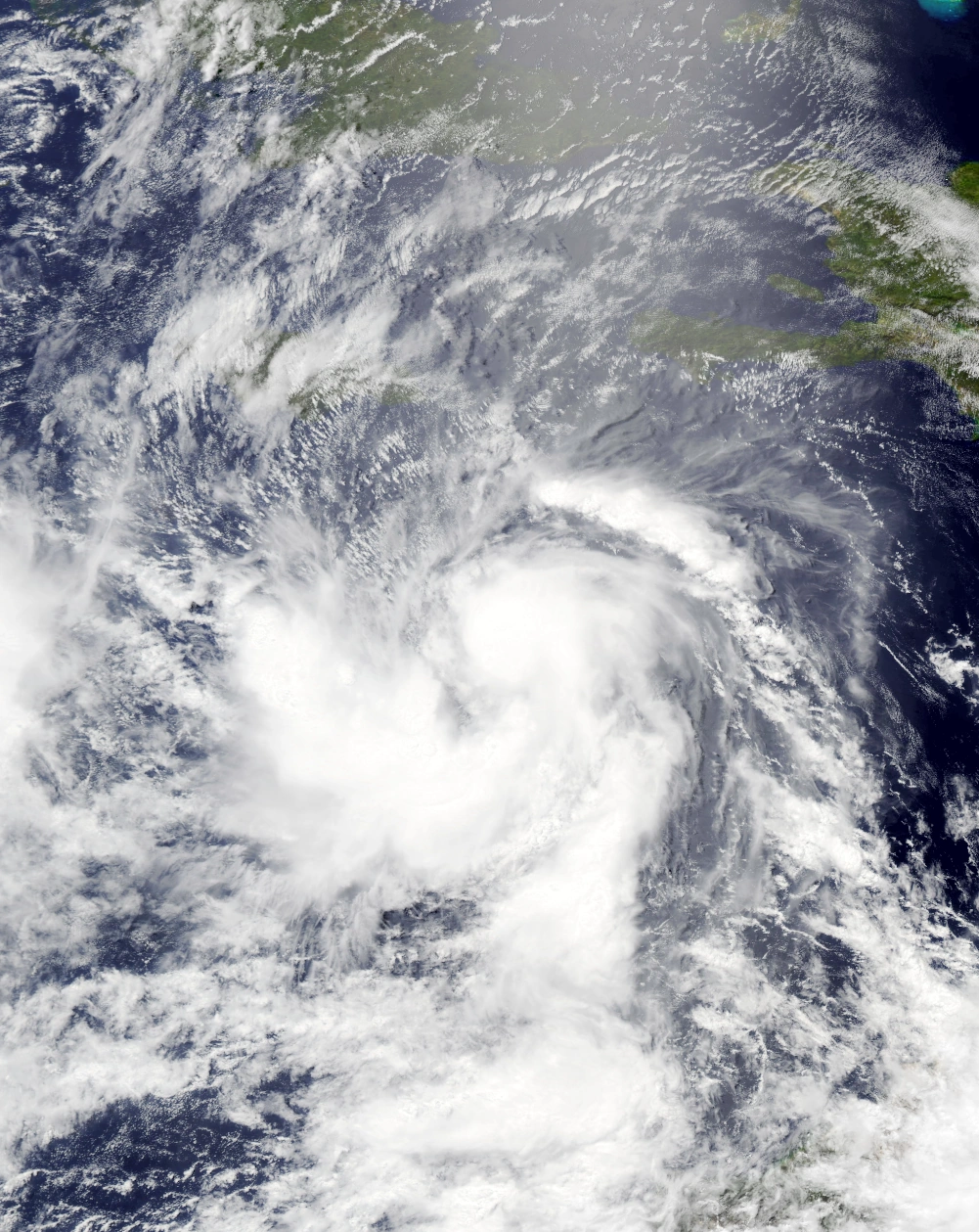 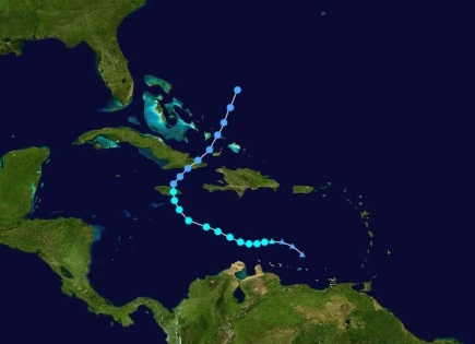 | |
| Duration | November 18 – November 22 |
| Peak intensity | 70 mph (115 km/h) (1-min) 991 mbar (hPa) |
Nun originated from an area of low pressure detected around 240 km (150 mi) north of the Venezuelan coastline at 23:00 UTC on November 17. Though large amounts of deep convection appeared on radar and satellite, the system's lack of a warm, closed core prevented it from achieving tropical cyclone status. The low gained gale-force sustained winds at 16:00 UTC on November 18 before finally developing a warm core at 23:00 UTC that day, resulting in its upgrade to a tropical storm. Receiving the name Nun, the storm continued northwest. Strong outflow from the nearby Infinite Storm Zayin prevented rapid intensification despite otherwise favorable conditions, but it slowly strengthened nonetheless. Developing deep but disorganized spiral bands of convection around its tight, symmetrical CDO, Nun reached its peak as a high-end tropical storm at 17:00 UTC on November 20. At 09:00 UTC the following day, Nun made landfall on Kingston, Jamaica as a slightly-weakened 105 km/h (65 mph) tropical storm. Following landfall, Nun weakened into a depression at 14:00 UTC on the 21st due to land interaction. Further weakening occurred as Nun entered a fujiwhara interaction with Zayin and became afflicted with wind shear from the aforementioned storm. At 05:10 UTC on November 22, Nun made landfall on eastern Cuba as a tropical depression as it rapidly lost convection and organization. Its central circulation, meanwhile, remained prominent on satellite until November 22 at 20:00 UTC, when it was absorbed by Zayin.
Moderate damage was reported in Jamaica following Nun's landfall on the island. In the capital of Kingston, Nun's approach prompted local businessmen to close down stores and local residents to board up their homes and prepare sandbags. Nun itself generated a storm surge which inundated coastal streets and structures and hurricane-force wind gusts which resulted in several downed tree branches. Some roofs were also affected by Nun, with shingles being displaced and windows not properly boarded up shattered by debris. Further inland, rain from Nun generated some isolated river flooding. A total of 240,000 Jamaicans reported losing power during the storm. In eastern Cuba, Nun's passage caused some light rain and gale-force wind gusts which overall caused little damage. In total, the tropical storm was responsible for $160 million USD in damages and 8 known deaths, all from flooding.
Tropical Storm Samech[]
| Tropical storm (SSHWS) | |
|---|---|
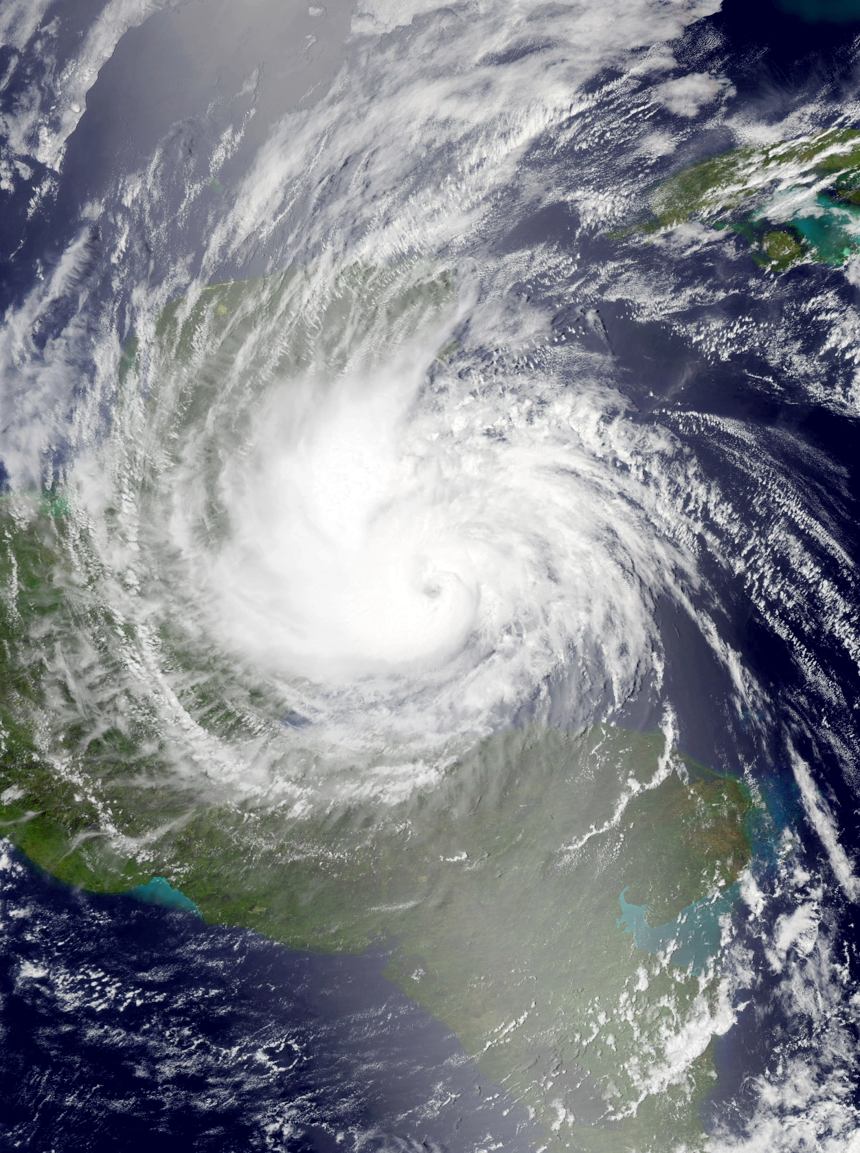 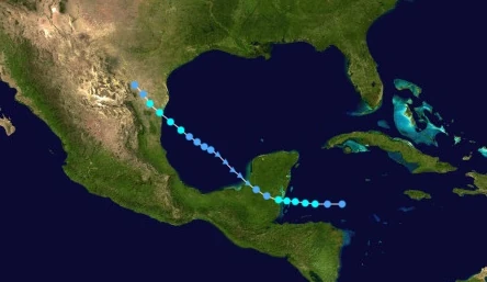 | |
| Duration | November 22 – November 27 |
| Peak intensity | 60 mph (95 km/h) (1-min) 990 mbar (hPa) |
An area of disturbed weather formed in the Caribbean sometime on November 21. Despite outflow from Hurricane Zayin, the system quickly organized as it moved west into warm waters. A central warm core and a well-defined circulation were detected early on November 22, leading to its upgrade to tropical depression status at 01:00 UTC that day. Afterwards, the depression steadily gathered its strength, becoming Tropical Storm Samech at 12:00 UTC that day as banding features began to form at the outer fringes of the cyclone. Samech eventually reached its peak intensity as a 60 mph (95 km/h), 990 mbar high-end tropical storm at 15:00 UTC on November 3; despite the storm's relatively weak strength, an eye-like feature formed at the center of its central dense overcast. A few hours later, the system made landfall on Belize City near peak intensity, after which its structure began to degrade due to land interaction. After weakening into a depression at 19:00 UTC that day, Samech lost all convection and degenerated into a remnant low at 07:00 UTC on November 24.
Samech's remnants continued northwest into the Bay of Campeche, where warm waters, moist air, and relatively low wind shear allowed the system to began to re-organize into a tropical cyclone. By midday on November 25, significant amounts of organized convection had developed in the vicinity of the system, leading to the NHC to upgrade Samech back into a tropical depression at 17:00 UTC that day. At 13:00 UTC on November 26, the depression intensified back into a tropical storm and began to undergo rapid intensification, however its subsequent landfall on Tamaulipas, Mexico at 04:00 UTC on November 27 prevented it from exceeding its initial peak intensity. Over land, land interaction as well as dry air quickly weakened Samech. Not long before midnight that day, Samech degenerated into a trough which soon merged with a larger frontal system. Significant flooding occurred in Belize as well as other parts of the Yucatan Peninsula, forcing several businesses in Belize City to close and causing the deaths of 7 of its residents. Gusty winds exceeding hurricane force ripped down tree branches and caused minor roof damage. In Northern Mexico and parts of southern Texas, the tropical storm's landfall resulted in similar damage and 5 addition fatalities. In total, the storm caused $126 million in economic losses and 12 deaths.
Hurricane Ayin[]
| Category 5 hurricane (SSHWS) | |
|---|---|
  | |
| Duration | November 26 – December 5 |
| Peak intensity | 185 mph (295 km/h) (1-min) 903 mbar (hPa) |
On November 26, an area of deep convection formed roughly 200 miles (322 kilometers) north of Puerto Rico. Due to overall favorable conditions for tropical cyclone development, the system began to form a central circulation while its convection only increased in organization. By 20:00 UTC that day, the NHC had initiated advisories on Tropical Depression Ninety. As the system turned northwest, warm waters and low wind shear allowed Ninety to intensify, becoming Tropical Storm Ayin at 19:00 UTC on November 27. Strengthening continued with Ayin's subsequent upgrade to hurricane status at 14:00 UTC the next day as it developed well-defined spiral rainbands and a symmetrical central dense overcast. On November 29, Ayin began to rapidly intensify and quickly gained major hurricane status at 08:00 UTC that day at the same time as the appearance of a clear eye on radar. After reaching Category 4 strength at 12:00 UTC, however, Ayin began to level out in intensity due to an eyewall replacement cycle. The storm resumed strengthening the next day, becoming a Category 5 at 13:00 UTC on November 30. Eventually, the hurricane made landfall on the sunken remains of Florida at around 13:30 UTC on December 1; despite most of the land being underwater, Ayin weakened nonetheless into a Category 3 as it emerged into the Gulf of Mexico roughly ten hours later. The storm began to re-intensify some hours later as it turned north towards the Bay of Alabama, where NHC instruments had recorded sea surface temperatures of over 90 degrees Fahrenheit (30 degrees Celsius). There, Ayin rapidly intensified to a peak of 180 mph (295 km/h) and 903 mbar at 16:00 UTC on December 3, making it a high-end Category 5 on the SSHWS. A few hours later, Ayin made landfall on the sunken remains of the Florida Panhandle. Over land, Ayin's satellite appearance rapidly deteriorated as it quickly weakened. By 07:00 UTC on December 5, the storm had become indistinguishable from the surrounding environment, causing the NHC to cease advisories shortly after. Due to the areas it affected already being severely damaged by other storms such as hypercanes Heath, Iota, and Mu, Ayin resulted in relatively minor damage with $9.3 billion in economic losses and 9 fatalities.
Hurricane Pe[]
| Category 5 hurricane (SSHWS) | |
|---|---|
  | |
| Duration | November 27 – December 5 |
| Peak intensity | 175 mph (280 km/h) (1-min) 919 mbar (hPa) |
Pe's origins can be traced back to a pair of tropical disturbances that formed in the Caribbean Sea early on November 27. Moving northwest, the two waves merged and began to rapidly organize amid favorable conditions. Eventually, the system coalesced into a tropical depression at 23:00 UTC that day. Following formation, the depression's intensification slowed due to a slight decrease in sea surface temperatures, but it nonetheless attained tropical storm status at 02:00 UTC on November 29 and received the name Pe. As more robust outflow and better-defined convection developed, Pe strenthened into a hurricane at 20:00 UTC on the 29th. At 13:00 UTC on November 30, Pe reached Category 2 status and at 01:00 UTC on December 1, the storm developed a clear eye and strengthened into a Category 3 major hurricane. At that point, Pe began to undergo rapid intensification due to very warm ocean temperatures coupled with low wind shear and moist air. A few hours after becoming a major hurricane, the system was upgraded to Category 4 status before eventually becoming a Category 5 hurricane at 05:00 UTC on December 2. Pe reached its peak intensity of 175 mph (280 km/h) and 919 mbar at 09:00 UTC that day while a small 100 mile-wide tropical cyclone before making landfall on Port O'Connor, TX at noon. As Pe stalled while making a turn east over Texas, a brown ocean effect allowed the storm to maintain major hurricane intensity and a well-defined structure up until its re-emergence into open waters late the next day. despite no longer being over land, cold waters and heightened wind shear prevented Pe from strengthening and in fact caused it to weaken more. The cyclone lost major hurricane status at 04:00 UTC on December 4 and hurricane status at 19:00 UTC that day. At 15:00 UTC on December 5, Pe dissipated.
Pe caused severe damage in Texas as a slow-moving Category 5. Dozens of counties across the coastal regions of the state experienced sustained winds of at least 100 mph (161 km/h), prompting the issuance of several Extreme Wind Warnings. The aforementioned winds tore roofs off well-constructed buildings, dealt severe damage to their walls, and toppled trees and power lines. Over 16,000 structures were damaged or destroyed in Calhoun County alone. Flooding was extensive throughout the state especially in the southeast, being considered the worst since Hurricane Harvey of 2017 according to some meteorologists. Up to 45 inches (1143 millimeters) of rain fell in Victoria, making Pe one of the wettest tropical cyclones in the state. Elsewhere, less but still significant amounts of rainfall left many streets flooded and an estimated total of 278,000 homes inaccessible due to inundation, prompting flash flood watches, warnings, and emergencies. Louisiana and the Yucatan Peninsula received stormy conditions and rough surfs from Pe's close passage, prompting beach closures. In total, the hurricane was responsible for $156 billion in damages and 97 fatalities.
Hurricane Tsadik[]
| Category 5 hurricane (SSHWS) | |
|---|---|
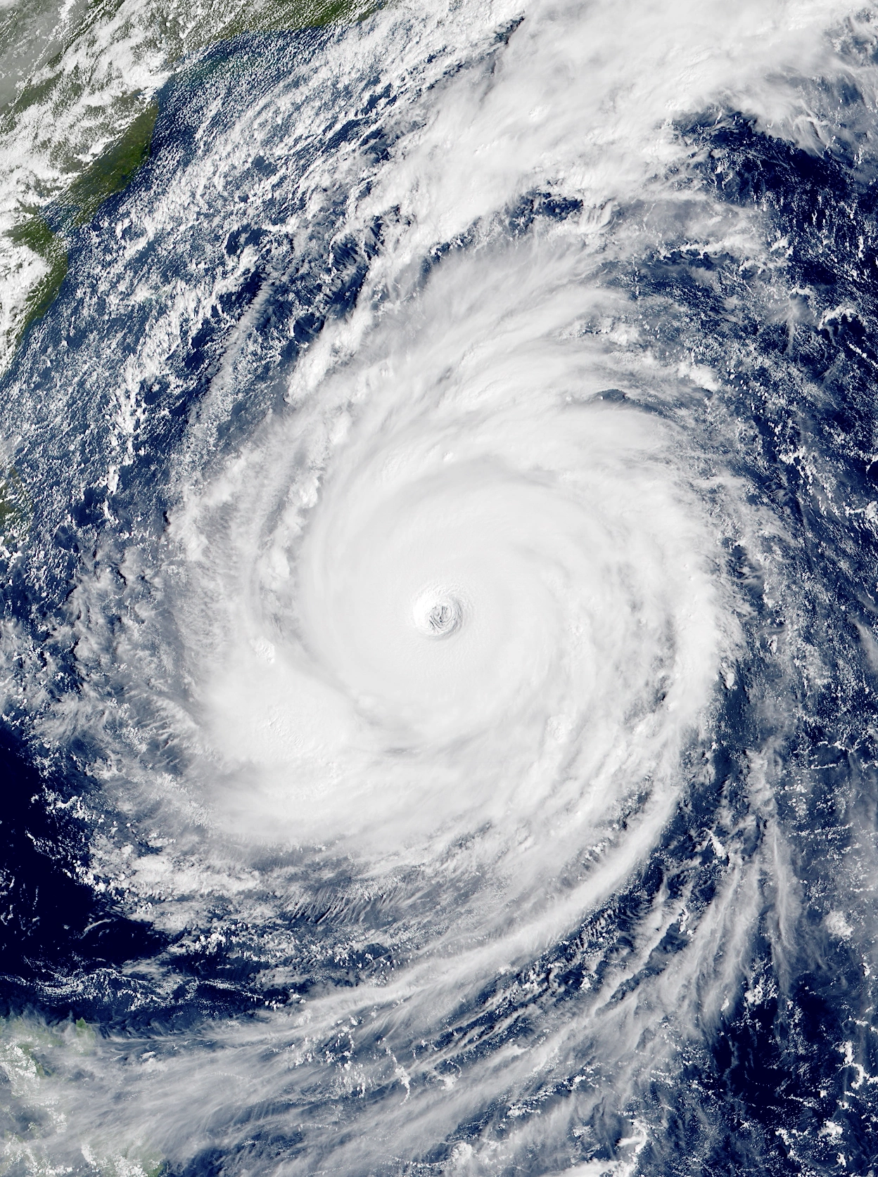  | |
| Duration | November 28 – December 3 |
| Peak intensity | 160 mph (260 km/h) (1-min) 923 mbar (hPa) |
Early on November 26, the NHC began tracking an area of the Atlantic off the coast of the Northeastern U.S. due to the possibility of a non-tropical low moving into the region and transitioning into a tropical cyclone. Eventually, a strong extratropical cyclone emerged from the coast of New Jersey and quickly began acquiring characteristics of a tropical storm. By 04:00 UTC on November 28, it was upgraded into Subropical Storm Tsadik after the system developed relatively well-defined central convection and detached from its associated fronts. Making a cyclonic loop, Tsadik soon achieved hurricane-force winds at 16:00 UTC that day, resulting in its upgrade to full tropical status as well as Category 1 status, though it weakened back into a tropical storm a little more than 12 hours later due to unfavorable conditions. As Tsadik turned south on November 30, it regained hurricane status at 03:00 UTC and began to steadily strengthen amid low wind shear and warm waters. At 20:00 UTC that day, the hurricane gained Category 2 status while an eye-like feature started to develop within its increasingly organized central dense overcast. The storm became a Category 3 major hurricane at 14:00 UTC on December 1 as it began to undergo rapid intensification. By the time Tsadik intensified into a Category 4 at 02:00 UTC on December 2, a large, circular eye had developed. After Tsadik strengthened into a Category 5 at 10:00 UTC that day, peak intensity occurred at 13:00 UTC as the storm's pressure deepened to 923 mbar. A few hours later, the system began gradually weakening as an eyewall replacement cycle took place and wind shear increased, with Tsadik being lowered to Category 4 status at 18:00 UTC that day and to Category 3 status at 07:00 UTC on December 3. Afterwards, Tsadik's strength stablized as it took on the form of a large annular hurricane. However, the storm ultimately transitioned into a post-tropical cyclone just before midnight that day. The remnants later hit New York while carrying Category 2-equivalent winds.
Despite the storm's strength, only relatively minor damage in New York due to the region still recovering from Hypercane Beta's disastrous landfall. However, Tsadik interfered with efforts to rebuild New York City following Beta and reflooded subway tunnels and streets. The hurricane also caused severe weather, thunderstorms, and a total of 27 tornadoes across the mideastern United States as a precursor extratropical cyclone, killing 5. Overall, the storm caused $5.6 billion in economic losses and 21 deaths.
Tropical Storm Qof[]
| Tropical storm (SSHWS) | |
|---|---|
  | |
| Duration | November 30 – December 4 |
| Peak intensity | 45 mph (70 km/h) (1-min) 1004 mbar (hPa) |
At around 04:00 UTC on November 30, a non-tropical area of low pressure formed several hundred kilometers southeast of Bermuda. Moving north, the system quickly strengthened; just ten hours later, it acquired enough tropical characteristics for it to be designated as Tropical Storm Qof. The storm had achieved gale-force winds a few hours prior to becoming tropical, meaning that it was immediately named. Despite its quick pace of intensification, a quick increase in wind shear caused Qof's convection to become displaced well to the southeast of its circulation. The aforementioned wind shear kept Qof from intensifying past its initial intensity of 45 mph (70 km/h) and 1004 mbar and caused it to weaken into a depression at 07:00 UTC on December 1. In spite of hostile conditions, however, Qof managed to maintain a well-defined circulation and at least some convection for nearly four days as it made a sharp turn to the southwest and later the southeast before eventually succumbing at 23:00 UTC on December 4.
Hurricane Resh[]
| Category 2 hurricane (SSHWS) | |
|---|---|
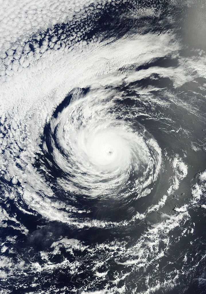 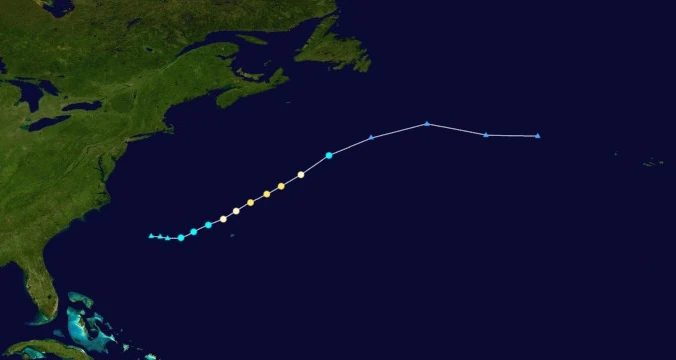 | |
| Duration | December 1 – December 3 |
| Peak intensity | 105 mph (170 km/h) (1-min) 976 mbar (hPa) |
An area of low pressure attached to a cold front emerged from the east coast of the U.S. and began being monitored by the NHC for development on November 30. Favorable conditions allowed the system to quickly gain gale-force winds and transition into a tropical storm at 06:00 UTC on December 1. Receiving the name Resh, the relatively large system strengthened at a fast pace while amassing deep convection and discrete spiral rainbands. By 00:00 UTC on December 2, Resh had achieved hurricane status and was beginning to develop a small eye. The storm eventually reached a peak intensity of 105 mph (170 km/h) and 976 mbar at 22:00 UTC that day, making it a Category 2 on the Saffir-Simpson Scale, as it cleared out its eye. Following peak intensity, an approaching cold front caused Resh to accelerate northeast, where it rapidly weakened due to cooler waters and wind shear. As convection became confined to the northeastern portions of the system and Resh began acquiring extratropical characteristics, it weakened into a tropical storm at 14:00 UTC on December 3. Just five hours later, the cyclone lost tropical characteristics and became a frontal low. Resh led to the death of 2 people in Carolina Beach, NC when they were swept away by rip currents associated with the storm.
Hurricane Shin[]
| Category 7 hurricane (SSHWS) | |
|---|---|
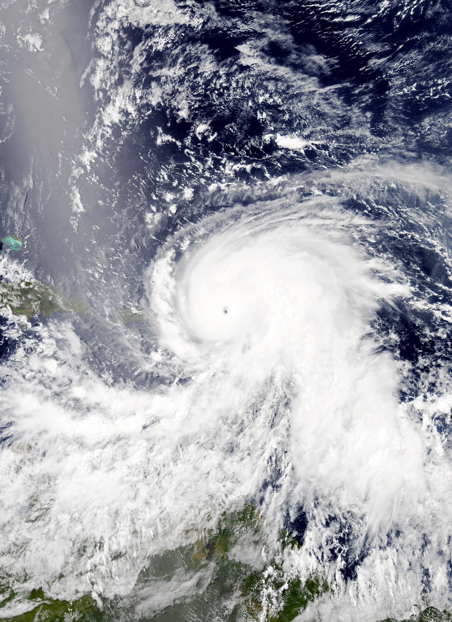 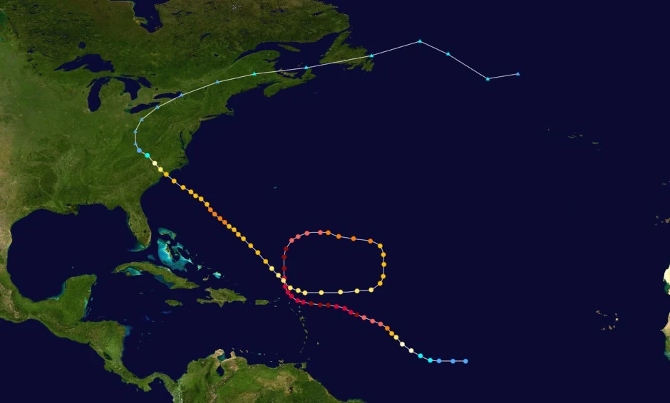 | |
| Duration | December 1 – December 20 |
| Peak intensity | 240 mph (385 km/h) (1-min) 825 mbar (hPa) |
Sometime in late November, a tropical wave emerged from the coast of western Africa and began tracking west. Initially, despite favorable conditions and high chances of development assigned by the NHC, the wave failed to exhibit characteristics of a tropical cyclone and remained an ill-defined mass of convection. On December 1, however, the disturbance began showing signs of developing a warm, closed core. Eventually, the NHC began issuing advisories on Tropical Depression Ninety-Five at 19:00 UTC that day. The newly-formed tropical cyclone soon intensified into Tropical Storm Shin at 13:00 UTC the next day as convection wrapped around a developing central dense overcast. Turning slightly northwest, Shin became a Category 1 hurricane at 02:00 UTC on December 3. Around that time, the presence of a developing pinhole eye and several hot towers as reported by Hurricane Hunter jets indicated the beginning of rapid intensification. Fueled by very warm waters and unusually low wind shear for the time of year, the storm explosively deepened into a major hurricane at 20:00 UTC on the 3rd, into a Category 5 at 11:00 UTC on the 4th, and into a Category 6 extreme hurricane at 05:00 UTC on the 5th. After receiving an upgrade to Category 7 status at 10:00 UTC that day, Shin reached its initial peak intensity as a powerful 230 mph (370 km/h), 852 mbar storm around five hours later while displaying very well-developed rain bands, a nearly perfectly circular central dense overcast, a clear pinhole eye, and exceptionally robust outflow channels. Early the next day, the hurricane executed an eyewall replacement cycle and weakened into a Category 6 as it approached the northern Leeward Islands, but soon regained Category 7 status at 23:00 UTC on December 6. Around noon on December 7, Shin, now exhibiting a slightly expanded but more stable eye, reached a second, stronger peak of 240 mph (385 km/h) and 825 mbar as its center situated itself roughly 30 miles (48 kilometers) north of Anguilla. Afterwards, a small stationary high-pressure area northeast of the storm caused it to perform a large clockwise loop it gradually weakened in the face of increasing wind shear. By the time the storm exited its loop at around 00:00 UTC on December 14, it had weakened down to a mere Category 2 on the Saffir-Simpson Scale. Afterwards, wind shear began to lessen in the vicinity of Shin, allowing it to slowly re-intensify as it began exhibiting annular characteristics. At 19:00 UTC on the 14th, Shin regained Category 3 status as the storm turned northwest and aimed itself at the Carolinas. The hurricane reached Category 4 strength at 16:00 UTC on December 16 before reaching a tertiary peak intensity of 145 mph (235 km/h) at 23:00 UTC that day. As it did so, Shin's eye expanded to a size of roughly 45 nautical miles in diameter. Following its final peak, Shin weakened into a Category 3 hurricane at 13:00 UTC the next day as its eye started to appear slightly more ragged on satellite and radar. The storm maintained a relatively constant intensity thereafter until its landfall on Southport, NC at 05:00 UTC on December 19, after which it weakened rapidly over land and degenerated into a post-tropical cyclone at 06:00 UTC the next day.
The Leeward Islands sustained very severe damage from Shin during its close passage to the islands. 100% of all structures were destroyed in Antigua and Barbuda, Montserrat, St. Kitts and Nevis, Anguilla, and both Virgin Islands due to 200+ mph winds blowing down homes, businesses, and trees and a powerful 10-meter storm surge inundating large parts of the islands' land area. Less extensive, but still severe damage occurred in the rest of the Leewards and Windwards as well as Puerto Rico. Most of the political leaders of the Leeward Islands ordered total evacuations of their populations, drastically lowering the death toll, but economic losses were still severe. Farms on most of the affected islands were completely destroyed by Shin while essential supplies such as water, power, and food were cut off by the storm's effects. It would take over a decade for the Leeward Islands to be fully restored financially. In the Carolinas, moderate damage occurred. Heavy rain caused localized river flooding which killed 5 people and destroyed around 2,600 homes; mudslides were also reported. Major hurricane-force wind gusts knocked down trees and tore roofs off of homes and businesses. Overall, Shin was responsible for $26 billion in economic losses and 96 deaths, most of which consisted of those in the Leeward Islands who failed to heed evacuation orders.
Hurricane Tav[]
| Category 4 hurricane (SSHWS) | |
|---|---|
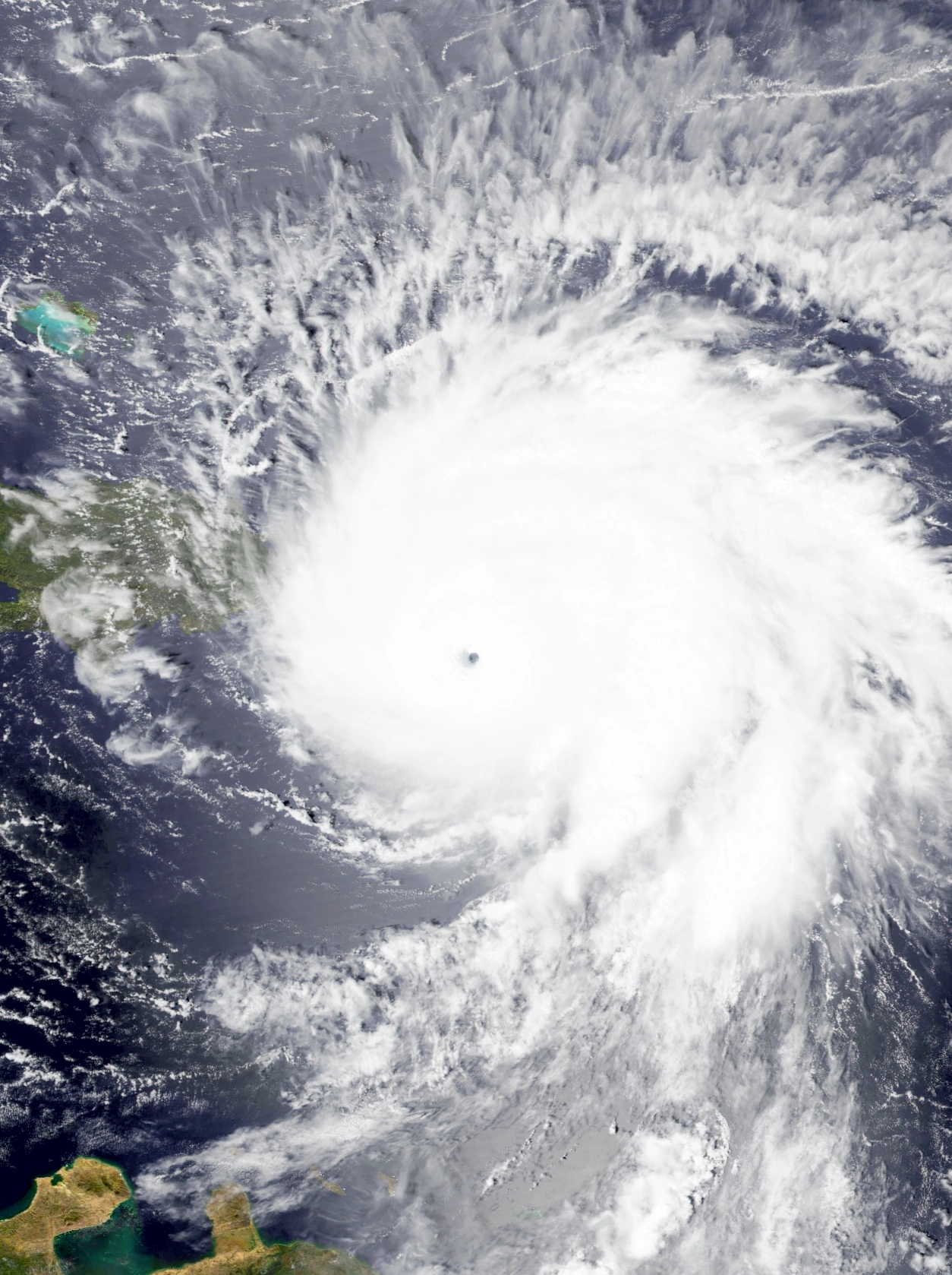 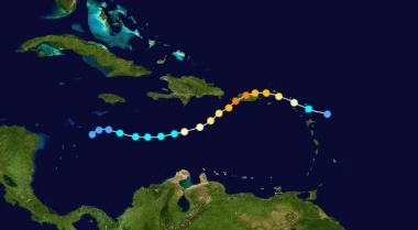 | |
| Duration | December 4 – December 9 |
| Peak intensity | 130 mph (215 km/h) (1-min) 953 mbar (hPa) |
On December 3, an area of low pressure was noted in the western Caribbean Sea moving in an unusual eastward direction. The system quickly developed large amounts of thunderstorms and organization; by 03:00 UTC on December 4, recon flights detected a well-developed central circulation, prompting the NHC to initiate advisories on the newly-formed depression shortly after. As the depression steadily strengthened due to warm waters, it continued its erratic eastward motion which it would continue for its entire life as a tropical cyclone. At 21:00 UTC on the 4th, the NHC upgraded the depression into a tropical storm, earning it the name Tav. Tav intensified into a Category 1 hurricane at 02:00 UTC on December 6, after which it began to undergo rapid intensification due to warm waters and low wind shear south of Hispaniola. As convection exploded around the storm's quickly-clearing eye, Tav strengthened into a Category 2 at 16:00 UTC that day and into a Category 3 major hurricane at 04:00 UTC on December 7. Following its upgrade to Category 4 status a few hours later, recon planes recorded peak winds 215 km/h (130 mph) at 11:00 UTC on the 7th while the storm's pressure deepened to 953 millibars. Around three hours after peaking, Tav made landfall on the southwestern portion of Puerto Rico while carrying the same sustained windspeeds as peak and a slightly higher pressure of 955 mbar. Over the island, land interaction as well as wind shear from nearby Hurricane Shin caused Tav to steadily weaken. At 22:00 UTC, the storm was downgraded from Category 4 status to Category 3 status, with its eye beginning to become asymmetrical and ragged. By the time Tav weakened into a Category 2 at 10:00 UTC on December 8, the eye became cloud-filled and its rainbands began to disorganize. The system's structure and convection continued to degrade as Tav weakened into a Category 1 at 17:00 UTC and a tropical storm at 23:00 UTC. After weakening into a depression at 03:00 UTC on December 9, Tav lost all semblance of a circulation at 08:00 UTC that day, marking its dissipation.
As Tav moved through the Caribbean as a developing tropical cyclone, rough surf produced by the storm was recorded in northern Colombia and Venezuela. Thankfully, no deaths occurred in association with these rip currents. In the Dominican Republic, Tav caused widespread flooding and gusty winds. Around 500 structures were destroyed in total, with economic losses totalling $677 million and deaths totalling 6. Damage from Tav in Puerto Rico was described as severe and devastating. Powerful major-hurricane force winds were felt in almost all parts of the island. These winds destroyed the walls of homes, toppled large trees, and threw small vehicles into the air. An estimated 2,439 structures were destroyed by Tav. Flooding and erosion were extensive; floodwaters and storm surge sent several villages underwater and destroyed hundreds of acres of crops, while moisture-related erosion led to severe landslides and mudflows inland and cliff collapses along the coast. The island's infrastructure was severely compromised by the hurricane. Flooding left over 90% of the island without power, with numerous utility poles being destroyed, preventing its residents from communicating with the outside world and vice versa. With the Puerto Rican water supply contaminated and most farms destroyed, residents who did not evacuate were forced to rely on external aid for basic needs. In the U.S. and British Virgin Islands, around 50% of all structures were destroyed by stormy conditions, with most of the citizens of both islands choosing to evacuate prior to the storm's passage. Many of the Leeward Islands were also affected, albeit less severely, with Tav's effects being limited to squally weather which caused minimal damage. $24.4 billion in damages and 151 deaths.
Tropical Storm Adam[]
| Tropical storm (SSHWS) | |
|---|---|
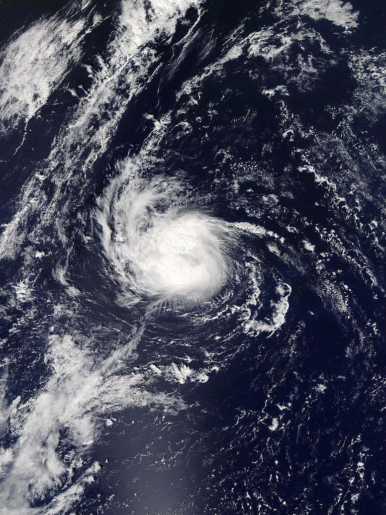 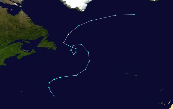 | |
| Duration | December 6 – December 7 |
| Peak intensity | 60 mph (95 km/h) (1-min) 998 mbar (hPa) |
Adam's origins were in an extratropical cyclone that had formed over the open Atlantic early on December 6. Moving north, unusually favorable conditions for tropical cyclone formation allowed the system to quickly gain tropical characteristics. At around 23:00 UTC that day, the low gained sufficient organization to be designated as a subtropical storm. Due to auxiliary, Greek, and Hebrew lists all being exhausted, the NHC was forced to create a new list of names. Assigning the name Adam to the newly-developed cyclone, the storm quickly became fully tropical at 02:00 UTC the next day, with convection being concentrated in a tight but well-organized ball-shaped region coving the system's circulation. A few hours later, however, a sharp increase in wind shear caused Adam's structure to rapidly grow elongated and disorganized. By 14:00 UTC on the 7th, Adam had lost tropical characteristics and degenerated into an extratropical cyclone without affecting land.
Tropical Storm Beatrice[]
| Tropical storm (SSHWS) | |
|---|---|
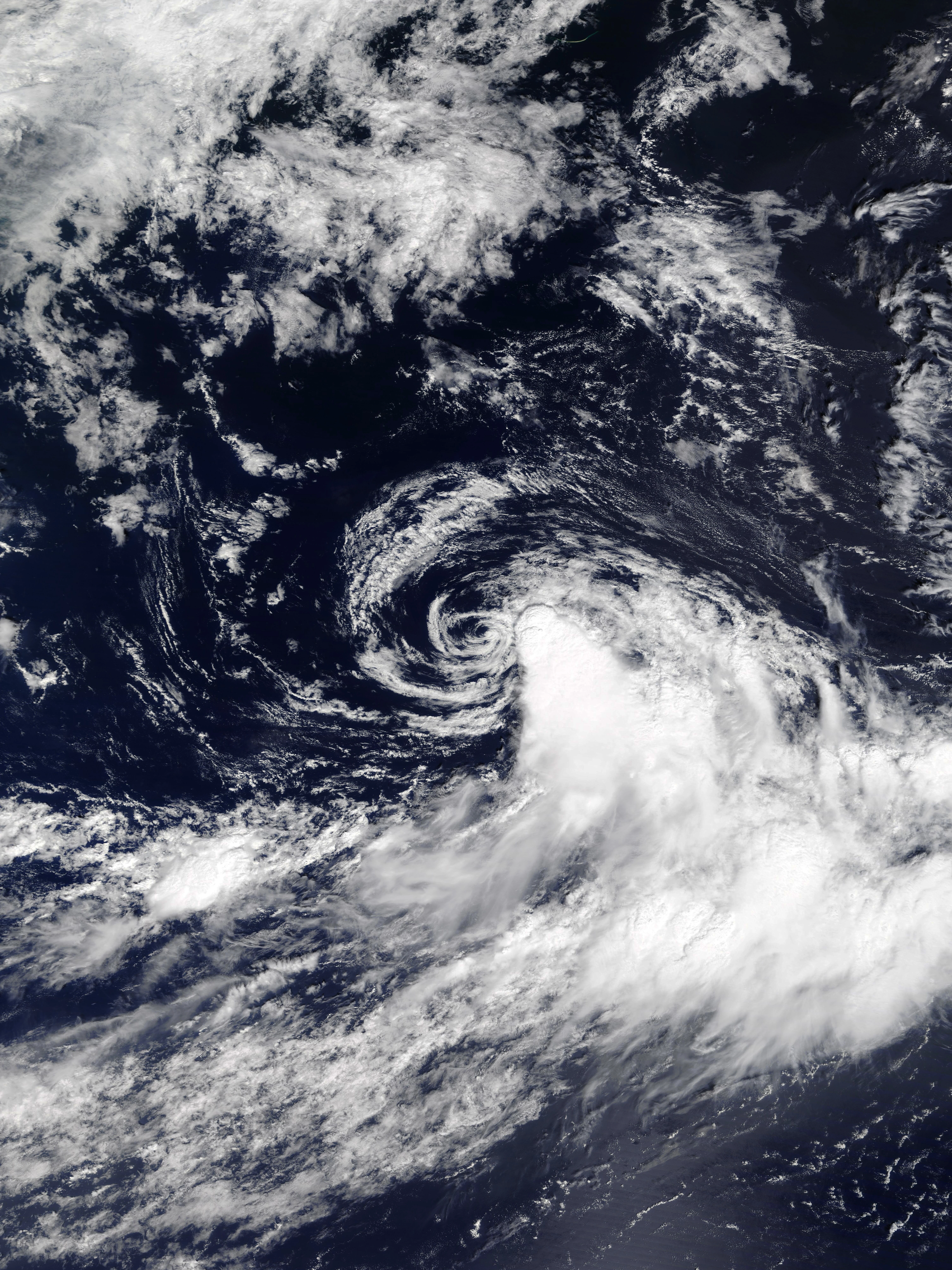  | |
| Duration | December 7 – December 9 |
| Peak intensity | 40 mph (65 km/h) (1-min) 1003 mbar (hPa) |
On December 5, several troughs over the open Atlantic merged into a single strong low pressure area. Amid favorable conditions, the low gradually gained central convection and banding features. Though the system gained gale-force winds at 12:00 UTC on December 6, the lack of a warm core and proper outflow channels prevented it from receiving an upgrade to tropical cyclone status. Eventually, the cyclone organized enough to be designated Tropical Storm Beatrice at 06:00 UTC on December 7. However, a sharp increase in wind shear caused most of Beatrice's convection to be displaced several dozen miles to the southeast and prevented the tropical storm from intensifying past its initial intensity of 40 mph and 1003 mbar. Turning northwest, the storm held on to tropical status despite wind shear exposing its circulation, though it soon weakened into a tropical depression at 13:00 UTC on December 8. At 07:00 UTC the next day, Beatrice succumbed to the effects of wind shear and degenerated into a remnant low which was eventually absorbed by a stationary front on December 10. Rough surf was reported along the coasts of North Carolina and Virginia, but no damage or deaths were reported.
Tropical Failure Ninety-Nine[]
| Tropical failure (SSHWS) | |
|---|---|
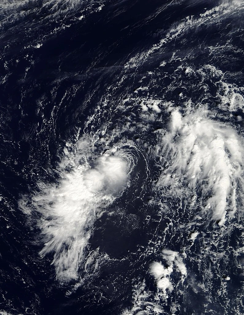  | |
| Duration | December 9 – December 9 |
| Peak intensity | 35 mph (55 km/h) (1-min) 1012 mbar (hPa) |
On December 9, a non-tropical low over the open Atlantic began to rapidly develop convection, strong outflow, and other characteristics of a tropical cyclone. Just two hours later at 05:00 UTC, the NHC designated the system as Tropical Depression Ninety-Nine. Due to its exceptionally fast rate of strengthening, the NHC noted the possibility of it intensifying into a hypercane, warning the east coast of the U.S. to prepare for a potentially cataclysmic tropical cyclone. However, four hours later at 09:00 UTC, Ninety-Nine encountered strong wind shear and abruptly dissipated after being absorbed by a frontal low. The NHC jokingly classified the system as a "tropical failure" due to the extremely low strength of the system as well as its very short one-advisory-long lifespan.
And now, the moment you have all been waiting for...
Armageddon Storm Collin[]
- Main article: Armageddon Storm Collin (2027 - Litia Von Lucerna)
| Armageddon storm (SSHWS) | |
|---|---|
 | |
| Duration | December 11 – April 11 (Exited basin) |
| Peak intensity | 1180 mph (1900 km/h) (1-min) 0 mbar (hPa) |
Armageddon Storm Collin was by far the most powerful, damaging, and deadily tropical cyclone ever recorded as well as one of the major causes of both the 2027 Mass Extinction Event and the formation of the Holy Empire of Earth-Kalgamania. The final storm of the season, Collin was responsible for apocalyptic damage throughout its several month-long path, in some cases permanently sinking thousands of square miles of land as a result of its storm surge and generating supersonic winds strong enough to cause powerful earthquakes where it made landfall. Following the storm's eventual exit into space, severe storm-related ozone layer damage led to the deaths of over three fourths of the human race as well as the extinction of 80% of all Earth species. Overall, the storm was responsible for over 6 billion deaths and at least $80 trillion in economic losses.
Storm Names[]
The following list of names was used for the storms that formed in the 2027 season. This is the same list used in the 2021 season, with the exceptions of Jasper and Octavia, which replaced the names Julian and Odette respectively. The names not retired here were used again in the 2033 season (though all names were retired this year). Due to the extreme activity, the NHC decided to implement Q, U, X, Y, and Z names for the first time. Because over 26 storms ended up being named during the year, the Auxiliary List was used for the second time since 2021. However, even the auxiliary was exhausted by the exceptionally high activity of the year, leading to the revival of the Greek alphabet list used in 2005 and 2020. After even the Greeks were exhausted, the Hebrew alphabet and later an entirely new auxiliary list was used. All names after Mu were used for the first time this year.
|
|
|
|
| Auxiliary list | ||
|
|
|
| Auxiliary list #2 | |||
|
|
|
|
| Auxiliary list #3 | |||
|
|
|
|
| Auxiliary list #4 | ||
|
|
|
Retirement[]
Due to the extraordinary nature of the season as a whole, the World Meteorological Organization decided to retire every name used during the year, replacing the list with an entirely new one:
|
|
|
|
Seasonal Effects[]
This is a table of all of the storms that have formed in the 2027 Atlantic hurricane season. It includes their duration, names, damage, and death totals. Deaths in parentheses are additional and indirect (an example of an indirect death would be a traffic accident), but were still related to that storm. Damage and deaths include totals while the storm was extratropical, a wave, or a low. All of the damage figures with the exception of casualties are in 2027 USD.
| Saffir-Simpson hurricane wind scale | ||||||||||||||||
| TD | TS | C1 | C2 | C3 | C4 | C5 | C6 | C7 | C8 | C9 | C10 | HYC | MGC | INF | AS | |
| Storm name |
Dates active | Storm category at peak intensity |
Max 1-min wind mph (km/h) |
Min. press. (mbar) |
Areas affected | Damage (USD) |
Deaths | |||
|---|---|---|---|---|---|---|---|---|---|---|
| Ana | January 2 - January 4 | Tropical storm | 50 (80) | 996 | Bermuda, Azores | None | None | |||
| Bill | January 4 - January 5 | Subtropical storm | 60 (95) | 991 | Northern United States, Southern Canada | Minimal | 1 | |||
| Claudette | January 17- January 19 | Tropical storm | 70 (110) | 984 | Southeastern United States, East Coast of the United States, Eastern Canada | $415 million | 9 | |||
| Four | February 1 - February 3 | Tropical depression | 35 (55) | 1003 | None | None | None | |||
| Danny | February 9 - February 16 | Category 1 hurricane | 90 (145) | 985 | Azores | Minimal | 2 | |||
| Elsa | February 23 - February 25 | Tropical storm | 45 (70) | 1004 | None | None | None | |||
| Fred | March 1 - March 3 | Tropical storm | 65 (105) | 997 | East Coast of the United States, Eastern Canada | $415 million | 9 | |||
| Grace | March 8 - March 13 | Category 2 hurricane | 100 (160) | 968 | Azores, Iberian Peninsula | Minimal | None | |||
| Henri | March 14 - March 22 | Category 4 hurricane | 145 (235) | 940 | Turks and Caicos Islands, The Bahamas, Cuba, Southeastern United States, East Coast of the United States, Northeastern United States | $445 million | 52 | |||
| Ida | March 27 - April 1 | Category 2 hurricane | 105 (170) | 967 | Newfoundland, British Isles | $1.3 million | 2 | |||
| Eleven | April 3 - April 4 | Tropical depression | 35 (55) | 1008 | None | None | None | |||
| Jasper | April 8 - April 17 | Category 6 hurricane | 205 (330) | 869 | Turks and Caicos Islands, The Bahamas, Cuba, Southeastern United States, East Coast of the United States, Northeastern United States, Eastern Canada | $79 billion | 5,984 | |||
| Kate | April 10 - April 12 | Category 3 hurricane | 115 (185) | 964 | Iberian Peninsula | $5.8 billion | 153 | |||
| Larry | April 14 - April 16 | Tropical storm | 45 (70) | 1003 | Cabo Verde Islands | Minimal | None | |||
| Mindy | April 22 - April 30 | Category 5 hurricane | 175 (280) | 917 | Southeastern United States (especially North Carolina), Mid-Atlantic States, Northeastern United States, Southeastern Canada | $37.2 billion | 85 | |||
| Nicholas | May 1 - June 1 | Hypercane | 315 (505) | 782 | Cabo Verde, Leeward Islands, Greater Antilles, Southeastern Mexico, Northern Mexico, Gulf Coast of the United States, Southeastern United States, Mid-Atlantic States, Northeastern United States, Eastern Canada, Azores, Iberian Peninsula | $1.9 trillion | 1,354,978 (>3,570,000) | |||
| Octavia | May 21 - May 29 | Category 7 hurricane | 240 (385) | 849 | Greater Antilles, Yucatan Peninsula, Gulf Coast of the United States, Southeastern United States | $91 billion | 3,170 (67) | |||
| Peter | May 21 - May 27 | Category 7 hurricane | 230 (370) | 833 | Bermuda | $5 billion | 62,852 | |||
| Quinn | May 21 - May 29 | Category 7 hurricane | 225 (360) | 855 | Azores, Madeira | Minimal | 1 | |||
| Rose | May 28 - May 31 | Category 4 hurricane | 130 (210) | 951 | Northern Venezuela, Lesser Antilles, Puerto Rico | $6 billion | 250 | |||
| Sam | June 2 - June 12 | Category 10 hurricane | 295 (475) | 792 | Northern Venezuela, Northern Colombia, Jamaica, Cuba, Haiti, The Bahamas, East Coast of the United States, Northeastern United States, Eastern Canada | $950 billion | 276,300 | |||
| Teresa | June 4 - June 14 | Category 5 hurricane | 160 (255) | 927 | Canary Islands, Madeira, Iberian Peninsula | $105 billion | 1,670 | |||
| Ulli | June 9 - June 10 | Category 4 hurricane | 130 (210) | 960 | None | None | None | |||
| Victor | June 13 - June 19 | Category 2 hurricane | 110 (175) | 963 | Cabo Verde, Windward Islands | None | None | |||
| Wanda | June 17 - June 20 | Tropical storm | 65 (105) | 997 | Cabo Verde | None | None | |||
| Xander | June 18 - June 22 | Category 3 hurricane | 120 (195) | 956 | Yucatan, Texas | $4.2 billion | 33 | |||
| Yesenia | June 26 - July 4 | Category 6 hurricane | 220 (355) | 857 | Leeward Islands, Puerto Rico, East Coast of the United States, Bermuda | $1.2 million | 15 | |||
| Zachary | June 29 - July 10 | Category 8 hurricane | 255 (410) | 823 | Lesser Antilles, Greater Antilles (especially Jamaica, Cuba), Bahamas, Southeastern United States, Eastern United States, Eastern Canada | $467 billion | 4,561 | |||
| Adria | July 2 - July 7 | Category 6 hurricane | 195 (315) | 890 | Mexico | $7.3 billion | 1,820 | |||
| Braylen | July 3 - July 5 | Subtropical storm | 65 (105) | 993 | New England States, Eastern Canada | Minimal | 0 (1) | |||
| Caridad | July 4 - July 11 | Category 3 hurricane | 120 (195) | 962 | None | None | None | |||
| Deshawn | July 9 - July 15 | Category 4 hurricane | 150 (240) | 937 | Southern Mexico, Florida | $3.44 billion | 22 | |||
| Emery | July 10 - July 19 | Category 10 hurricane | 290 (465) | 817 | Lesser Antilles, Hispaniola, Turks and Caicos Islands, the Bahamas, Southeastern United States | $766 billion | 31,605 | |||
| Foster | July 11 - July 20 | Category 9 hurricane | 275 (440) | 828 | Cabo Verde, Lesser Antilles, Greater Antilles, The Bahamas, East Coast of the United States, Bermuda, Eastern Canada | Minimal | 8 | |||
| Gemma | July 12 - July 17 | Category 9 hurricane | 265 (425) | 829 | Mexico | $120 billion | 34,899 | |||
| Heath | July 16 - August 2 | Hypercane | 355 (570) | 735 | Lesser Antilles, Greater Antilles, Yucatan Peninsula, Southeastern United States (especially Florida), The Bahamas, East Coast of the United States, Atlantic Canada | $1.32 trillion | >4,800,000 (>2,980,000) | |||
| Isla | July 16 - July 21 | Category 2 hurricane | 105 (170) | 974 | Nicaragua, Costa Rica, Panama, Colombia | $16 million | 17 (2) | |||
| Jacobus | July 19 - July 22 | Category 6 hurricane | 200 (320) | 882 | Iberian Peninsula | $155 billion | 67,890 | |||
| Kenzie | July 20 - July 28 | Category 5 hurricane | 180 (290) | 908 | Madeira, Morocco, Spain | $1.5 billion | 180 | |||
| Lucio | July 21 - July 27 | Category 5 hurricane | 160 (255) | 929 | Azores | $2 billion | 1,287 | |||
| Makayla | August 1 - August 8 | Category 8 hurricane | 250 (400) | 831 | The Bahamas, Southeastern United States, Central United States, Northeastern United States | $225 billion | 9,834 | |||
| Nolan | August 1 - August 7 | Category 8 hurricane | 245 (395) | 848 | Venezuela, Colombia, Panama | $13.4 billion | 87,454 | |||
| Orlanda | August 2 - August 13 | Hypercane | 300 (480) | 796 | Azores, British Isles, East Coast of the United States | $74 million | 9 | |||
| Pax | August 3 - August 10 | Category 9 hurricane | 270 (435) | 815 | Lesser Antilles, Greater Antilles, The Bahamas, Southeastern United States (especially the Carolinas) | $369 billion | 4,873 | |||
| Ronin | August 5 - August 9 | Category 1 hurricane | 90 (145) | 979 | Honduras, Guatemala, Belize | $121 million | 1 | |||
| Sophie | August 6 - August 12 | Category 4 hurricane | 155 (250) | 930 | Cabo Verde, Leeward Islands | None | None | |||
| Tayshaun | August 6 - August 23 | Category 10 hurricane | 295 (475) | 795 | Windward Islands, Northern Guyana, Venezuela, Northern Colombia, Nicaragua, Honduras, Belize, Mexico, Southeastern United States | $888 billion | 78,213 | |||
| Viviana | August 8 - August 11 | Category 3 hurricane | 120 (195) | 968 | Bermuda, East Coast of the United States, Atlantic Canada | None | 3 | |||
| Will | August 9 - August 11 | Category 3 hurricane | 115 (185) | 976 | Prince Edward Island, Nova Scotia, New Brunswick, Quebec, Newfoundland | $6.1 billion | 72 | |||
| Alpha | August 9 - August 14 | Subtropical storm | 50 (80) | 995 | Canary Islands, Madeira, Northeastern Europe, British Isles | $2.1 million | 58 | |||
| Beta | August 11 - August 27 | Hypercane | 375 (605) | 716 | Greater Antilles, The Bahamas, Southeastern United States, East Coast of the United States, Northeastern United States, Eastern Canada, Northeastern Europe, British Isles | $1.33 trillion | 2,260,000 (3,010,000) | |||
| Gamma | August 17 - August 19 | Category 1 hurricane | 80 (130) | 964 | Azores, British Isles | $2.2 million | 2 | |||
| Delta | August 26 - August 30 | Category 4 hurricane | 155 (250) | 938 | Southeastern United States, East Coast of the United States, Northeastern United States | $7.8 billion | 14 | |||
| Epsilon | August 28 - September 2 | Category 3 hurricane | 125 (200) | 954 | Jamaica, Cuba, Gulf Coast of the United States | $4.5 billion | 3 | |||
| Zeta | August 30 - August 31 | Category 1 hurricane | 75 (120) | 982 | New England States, Eastern Canada | $678 million | 12 | |||
| Eta | September 1 - September 11 | Hypercane | 360 (580) | 722 | Leeward Islands, Greater Antilles, The Bahamas, East Coast of the United States, Bermuda, Atlantic Canada | $64 billion | 478 | |||
| Theta | September 1 - September 11 | Hypercane | 325 (525) | 765 | Cabo Verde, East Coast of the United States, Azores, Iberian Peninsula | $170 billion | 74,827 | |||
| Iota | September 1 - September 14 | Hypercane | 380 (610) | 700 | Costa Rica, Honduras, El Salvador, Guatemala, Belize, Yucatan Peninsula, Cuba, Southeastern United States, Central United States | $1.23 trillion | 1,625,700 (2,190,000) | |||
| Kappa | September 13 - September 19 | Category 2 hurricane | 100 (160) | 977 | Southeastern United States, Central United States, Great Lakes Region, Northeastern United States, Eastern Canada | $8.2 billion | 12 | |||
| Lambda | September 15 - October 6 | Category 10 hurricane | 285 (460) | 808 | East Coast of the United States, British Isles, Iberian Peninsula | Minimal | 10 | |||
| Mu | September 16 - October 2 | Megacane | 440 (710) | 633 | Lesser Antilles, Greater Antilles, The Bahamas, Southeastern United States, Central United States | $2.01 trillion | 68,298 (1,400,000) | |||
| Nu | September 16 - September 26 | Category 10 hurricane | 290 (465) | 794 | Mexico, Southeastern United States, Central United States, Eastern Canada | $767 billion | 12,213 | |||
| Xi | September 17 - September 21 | Category 5 hurricane | 165 (265) | 921 | Central America | $1.3 billion | 20 | |||
| Omicron | September 30 - October 10 | Category 8 hurricane | 250 (405) | 846 | Hipaniola, Cuba, The Bahamas, Eastern United States | $75 billion | 140 | |||
| Pi | October 5 - October 16 | Category 9 hurricane | 280 (450) | 814 | Yucatan Peninsula, Cuba, Southeastern United States, The Bahamas, Gulf Coast of the United States | $15 billion | 277 | |||
| Rho | October 6 - October 7 | Category 1 hurricane | 75 (120) | 990 | Ghana, Côte d'Ivoire | $125 million | 11 | |||
| Sigma | October 6 - October 16 | Category 6 hurricane | 215 (345) | 864 | East Coast of the United States, Northeastern United States, Eastern Canada | $1.8 million | 1 | |||
| Tau | October 9 - October 18 | Category 6 hurricane | 220 (355) | 859 | East Coast of the United States, Northeastern United States | Minimal | 1 | |||
| Upsilon | October 10 - October 20 | Category 5 hurricane | 190 (305) | 893 | Venezuela, Colombia, Costa Rica, Nicaragua, Honduras | $10.5 billion | 734 | |||
| Phi | October 10 - October 16 | Category 3 hurricane | 125 (200) | 957 | Madeira, Morocco, Eastern Europe | $29 billion | 354 | |||
| Chi | October 11 - October 14 | Category 2 hurricane | 105 (170) | 975 | Guyana, Venezuela | $147 million | 14 | |||
| Psi | October 13 - October 23 | Category 7 hurricane | 235 (380) | 849 | Greater Antilles, Southeastern United States, The Bahamas, Northeastern United States, Eastern Canada | $22.1 billion | 163 | |||
| Omega | October 19 - October 28 | Hypercane | 345 (555) | 749 | Lesser Antilles, Greater Antilles, The Bahamas, Southeastern United States, East Coast Of The United States, Northeastern United States, New England States, Atlantic Canada | $1.5 trillion | 1,238,000 (1,830,000) | |||
| Alef | October 27 - November 6 | Category 4 hurricane | 140 (225) | 946 | Northeastern United States, New England States, Atlantic Canada | $17 billion | 137 (1) | |||
| Bet | October 28 - November 2 | Category 2 hurricane | 110 (175) | 962 | Azores | Minimal | None | |||
| Gimel | October 30 - November 1 | Tropical storm | 65 (105) | 998 | Azores | Minimal | 0 (1) | |||
| Dalet | October 31 - November 3 | Tropical storm | 60 (95) | 996 | Cabo Verde | None | None | |||
| He | October 31 - November 5 | Category 4 hurricane | 130 (210) | 945 | Yucatan Peninsula, Southern Mexico | $3.6 billion | 29 | |||
| Vav | November 2 - November 13 | Category 6 hurricane | 215 (345) | 875 | Jamaica, Honduras, Belize, Guatemala, Yucatan Peninsula, Gulf Coast of the United States | $63 billion | 2,349 | |||
| Zayin | November 7 - November 26 | Infinite Storm | 500 (805) | 578 | Panama, Costa Rica, Nicaragua, Honduras, Yucatan Peninsula, Western Cuba, Southeastern United States, The Bahamas | $809 billion | 1,100,000 (1,500,000) | |||
| Chet | November 8 - November 15 | Category 4 hurricane | 140 (225) | 934 | Anguilla, U.S. Virgin Islands, British Virgin Islands, Puerto Rico, East Coast of the United States, Bermuda | None | 3 | |||
| Tet | November 10 - November 12 | Category 1 hurricane | 80 (130) | 989 | Leeward Islands | None | None | |||
| Yod | November 11 - November 20 | Category 2 hurricane | 110 (175) | 975 | Iberian Peninsula | $10 million | None | |||
| Kaf | November 13 - November 15 | Tropical storm | 50 (80) | 1000 | None | None | None | |||
| Eighty-Five | November 14 - November 14 | Subtropical depression | 35 (55) | 1008 | None | None | None | |||
| Lamed | November 16 - November 19 | Category 6 hurricane | 195 (315) | 897 | Leeward Islands, Nicaragua, Costa Rica | $7.7 billion | 79 | |||
| Mem | November 16 - November 16 | Category 3 hurricane | 120 (195) | 968 | Cabo Verde Islands, Azores, British Isles | Minimal | None | |||
| Nun | November 18 - November 22 | Tropical storm | 70 (115) | 991 | Jamaica, Cuba | $160 million | 8 | |||
| Samech | November 22 - November 27 | Tropical storm | 60 (95) | 990 | Yucatan Peninsula, Northern Mexico, Gulf Coast of the United States | $126 million | 12 | |||
| Ayin | November 26 - December 5 | Category 5 hurricane | 185 (295) | 903 | The Bahamas, Southeastern United States, Gulf Coast of the United States | $9.3 billion | 9 | |||
| Pe | November 27 - December 5 | Category 5 hurricane | 175 (280) | 919 | Yucatan Peninsula, Southeastern United States | $156 billion | 97 | |||
| Tsadik | November 28 - December 3 | Category 5 hurricane | 160 (260) | 923 | Northeastern United States | $5.6 billion | 21 | |||
| Qof | November 30 - December 4 | Tropical storm | 45 (70) | 1004 | None | None | None | |||
| Resh | December 1 - December 3 | Category 2 hurricane | 105 (170) | 976 | East Coast of the United States | None | 2 | |||
| Shin | December 1 - December 20 | Category 7 hurricane | 240 (385) | 825 | Leeward Islands, Windward Islands, Puerto Rico, Southeastern United States (especially the Carolinas) | $26 billion | 96 | |||
| Tav | December 4 - December 9 | Category 4 hurricane | 130 (215) | 953 | Northern Colombia, Northern Venezuela, Dominican Republic, Puerto Rico, Leeward Islands | $24.4 billion | 151 | |||
| Adam | December 6 - December 7 | Tropical storm | 60 (95) | 998 | None | None | None | |||
| Beatrice | December 7 - December 9 | Tropical storm | 40 (65) | 1003 | East Coast Of The United States | None | None | |||
| Ninety-Nine | December 9 - December 9 | Tropical depression | 35 (55) | 1012 | None | None | None | |||
| Collin | December 11 - April 11, 2028 | Armageddon storm | 1180 (1900) | 0 | All of Planet Earth | >$80 trillion | >6,000,000,000 | |||
| Season aggregates | ||||||||||
| 100 systems | January 2 - April 11, 2028 | 1180 (1900) | 0 | >95 trillion | >6,000,000,000 | |||||