The 2055 Atlantic hurricane season was the most active Atlantic hurricane season in recorded history, with several records being broken across many categories. The season had catestrophic impacts, reaching an unprecedented $519.44 billion, achieving the most damages in a single season in addition to a total fatality count of 7,850 of which is the fourth highest on record, only bested by 1780, 1998 and 1974.
The majority of the destruction was primarily caused by seven storms; Jerry, Maddie, Sora, Trinity, Winona, Gamma and Sonia. Jerry was the only one of those not to have achieved major hurricane intensity. The most devastated place is debated, mostly between the US Gulf Coast, Lesser Antilles and Central America.
The US Gulf Coast saw several landfalling storms including Brice, Chandra, Maddie, Trinity, Van, Winona, Alpha, Beta, Gamma, Sonia, Iota and Kappa. The strongest of the landfalls being in Texas and Mexico with two Category 5 landfalls each and the most frequently hit being Florida. The Lesser Antilles saw multiple tropical cyclones a month, while usually not very strong while impacting them (the exception being Sora). Central America was utterly devastated particularly from Trinity in the later portion September. This was caused mostly from repeated rain from bands and the outer cores of cyclones (especially those of which from gyres during the October and November months), despite said cyclones never making a direct landfall.
The 2055 season became the fifth season to observe more named storms and the third with more hurricane-equivalents than the West Pacific, despite the latter of which averaging nearly twice as more yearly named storms. The only other years to do this are 2005, 2010, 2025 and 2049. 2024 also featured an equal amount of named storms between the Atlantic and West Pacific basins with 21 each.
The season officially started on June 1 and lasted until November 30. However, a record total of 5 systems existed beyond these days in March, April, May and December (One, Andrea, Brice, Chandra and Mu respectively). Thirty Five systems formed, Thirty three of which becoming named and Twenty Four of those further intensified into hurricanes with Fourteen of those reaching major hurricane status. Four of those were Category 5 hurricanes, the highest classification on the Saffir-Simpson Hurricane Scale possible. Hurricane Sonia has been added to these totals due to it having reached peak intensity within the Atlantic basin. All of these storm totals amount to record highs. Seven of those storms broke the records for Earliest forming Atlantic major, Strongest Atlantic July Hurricane, Northernmost nameable Atlantic cyclone, Costliest Atlantic Hurricane, Most Intense Puerto Rico Landfall, Most Intense Atlantic Hurricane and Latest Existing Atlantic Hurricane (Daina, Finely, Karen, Maddie, Sora, Trinity and Mu respectively). The 2055 season was also only the third Atlantic hurricane season and fifth NHC-monitored basin season to use up the annual naming lists and have to use greek letters as names joining the Atlantic's 2005, 2048 and 2049 seasons as well as the Eastern Pacific's 2032 and 2057 seasons.
Seasonal Forecasts
| Source | Date | Named storms |
Hurricane | Major hurricanes |
|
| Average | 12.1 | 6.4 | 2.7 | ||
| Record High | 30 | 18 | 10 | ||
| Record Low | 3 | 0 | 0 | ||
| TSR | December 6, 2054 | 12 | 6 | 3 | |
| CSU | April 9, 2055 | 14 | 7 | 3 | |
| TSR | April 9, 2055 | 14 | 7 | 4 | |
| NCSU | April 19, 2055 | 13-17 | 6-10 | 2-5 | |
| TWC | May 11, 2055 | 16 | 8 | 4 | |
| UKMO | May 20, 2055 | 16 | 8 | 3 | |
| NOAA | May 23, 2055 | 12-20 | 5-11 | 3-6 | |
| TSR | May 28, 2055 | 15 | 7 | 3 | |
| CSU | June 3, 2055 | 15 | 8 | 4 | |
| UA | June 9, 2055 | 20 | 10 | 5 | |
| TSR | July 4, 2055 | 17 | 8 | 4 | |
| CSU | July 10, 2055 | 19 | 9 | 5 | |
| TSR | August 7, 2055 | 23 | 13 | 8 | |
| CSU | August 7, 2055 | 24 | 13 | 8 | |
| NOAA | August 13, 2055 | 20-28 | 11-17 | 6-12 | |
| Actual activity |
34 | 24 | 14 |
Ahead of and during the season, several national meteorological services and scientific agencies forecast how many named storms, hurricanes, and major hurricanes (Category 3 or higher on the Saffir–Simpson scale) will form during a season and/or how many tropical cyclones will affect a particular country. These agencies include the Tropical Storm Risk (TSR) Consortium of University College London, the National Oceanic and Atmospheric Administration (NOAA) and Colorado State University (CSU). The forecasts include weekly and monthly changes in significant factors that help determine the number of tropical storms, hurricanes, and major hurricanes within a particular year. Some of these forecasts also take into consideration what happened in previous seasons and the state of the El Niño–Southern Oscillation (ENSO). On average, an Atlantic hurricane season between 1981 and 2050 contained twelve tropical storms, six hurricanes, and three major hurricanes, with an accumulated cyclone energy (ACE) index of between 66 and 103 units.
Pre-season Forecasts
The first forecast of the year came out on December 6, 2054 by TSR; predicting an average season of 12 named storms, 6 hurricanes and 3 major hurricanes, taking into account a predicted continuation of the warming to ENSO Neutral during the season. On April 9, Colorado State University made their first prediction of the season, calling for a slightly above average season of 14 named storms, 7 hurricanes and 3 majors. The same day, TSR released their updated forecast, predicting the same. A little more than a week later, North Carolina State University released their forecast for 2055 which called for a near to above average season with 13-17 named storms, 6-10 hurricanes, 2-5 major hurricanes. A month following, TWC released their prediction with 16 named storms, 8 hurricanes and 4 majors. The UK Met Office predicted the same as TWC, with an ACE of 194 units on May 20. The NOAA forecasted 12-20 named storms, 5-11 hurricanes and 3-6 majors, a near to above average season three days later. The final prediction of the pre-season came from TSR, their third, revising their previous prediction to be 1 named storm higher.
Mid-season Outlook
On June 3, CSU revised their initial prediction to feature each value be raised by 1. The University of Arizona released their prediction on June 9 calling for a well above average season of 20 named storms, 10 hurricanes and 5 major hurricanes. In July, the CSU and TSR revised their previous forecast to be notably higher following the record pace activity of the season up until that point. TSR, CSU and NOAA would once again revise their previous predictions to be much higher in all three categories.
Seasonal Summary
For the second consecutive season, multiple systems were designated before the official start of the Atlantic hurricane season on June 1, this time beginning in March with the formation of Subtropical Depression One followed by three additional preseason storms in Andrea, Brian and Chandra in April and May. June would feature two storms in Daina and Erin, the first of which becoming the first major hurricane in the month of June, and the earliest to form in an Atlantic hurricane season. July would be twice as active with Finely, Georgia, Harper and Inigo. Three of those peaked as hurricanes with two intensifying further into majors.
August would end up looking refreshingly average with three systems forming before producing of two major hurricanes in the last week. The activity began with a tropical depression forming on August 7 in the Gulf of Mexico that would become Tropical Storm Jerry, 12 hours later. Two more storms; Karen and Thirteen would form on August 16 and 24 respectively before the observed formation of Lincoln and Maddie, two long lived and powerful hurricanes began on August 27 and 28. They would last into September where the momentum of activity only intensified with 8 storms forming (Nestor, Oprah, Parker, Rebekah, Sora, Trinity, Van and Winona). Of these eight storms, all but one would reach hurricane status (that one being Oprah), with five being major hurricanes. The later half September also featured 3 Category 5 hurricanes within a two week period (Sora, Trinity and Winona), a miscellaneous but notable record of the season. Rebekah would also be the first cyclone to make a tropical landfall in Europe in well over a decade.
October would mimic the activity September managed with an equal and even more unprecedented 8 storms observed in the Atlantic, including Sonia which had entered from the East Pacific. Five of these eight systems strengthened to hurricanes with three further intensifying into majors over the course of the month. There would be at one point be 3 systems active simultaneously (Gamma, Sonia and Delta) for almost a week's length of time. Delta would become the second longest lived Atlantic hurricane on record, Sonia would become the first hurricane to sustain major hurricane status in both the East Pacific and Atlantic, not to mention making landfall in both basins at the aforementioned intensity. Gamma would also become the weakest storm since Hurricane Stan to cause more than 1,000 deaths.
November and December would feature a combined 5 storms, those being Theta, Iota, Kappa, Lambda and Mu. All but Kappa managed to achieve an intensity equivalent of a hurricane and Theta was the only system in the two late months to manage major hurricane status. Theta also became the most intense major hurricane in November since Lenny in 1999. Mu would also set the record for latest existing cyclone of hurricane intensity, becoming a hurricane on December 23 and sustaining it for the two days following before it's post-tropical transition on Christmas Day while moving ashore Portugal, therefore ending the season.
The accumulated cyclone energy (ACE) index for the 2055 Atlantic hurricane season was ... units. Broadly speaking, ACE is a measure of the power of a tropical or subtropical storm multiplied by the length of time it existed. It is only calculated for full advisories on specific tropical and subtropical systems reaching or exceeding wind speeds of 39 mph (63 km/h). Therefore, tropical depressions are not included in the season's total ACE count.
Systems
Subtropical Depression One
| Subtropical depression (SSHWS) | |
  | |
| Duration | March 1 – March 2 |
|---|---|
| Peak intensity | 35 mph (55 km/h) (1-min) 1009 mbar (hPa) |
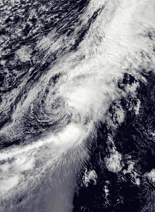
On February 27, an upper-level trough was cut off into an upper-level low and it began to interact with the tail end of a deteriorating cold front accompanied by a low-level vorticy. The two systems produced a broad area of low pressure associated with moderate convection which began to quickly develop a well-defined, albeit exposed circulation, coalescing into the classification of Subtropical Depression One on March 1. However, the system did not manage to intensify further due to unfavorable conditions and was classified as post-tropical the next day. It's remnants did not last long before being absorbed by another cold front later on March 2.
Subtropical Storm Andrea
| Subtropical storm (SSHWS) | |
  | |
| Duration | April 16 – April 19 |
|---|---|
| Peak intensity | 45 mph (75 km/h) (1-min) 1003 mbar (hPa) |
On April 13, a weak area of low pressure, non-tropical in nature had begun to interact and later merge with a developing nor'easter north of the Bahamas. Despite, early forecasts showing mixed extents of development (if any), shower and thunderstorm activity near the center of the non-tropical cyclone began to increase by April 14 leading to the development of subtropical characteristics over the next day or two. Consequently, the NHC classified Subtropical Depression Two on April 16. The system began to strengthen and was named Andrea, the first of the season, after it was concluded that the storm had achieved gale force winds. Further intensification was minimal as Andrea began to once again merge with the Extratropical that it had been interacting with. It had finally merged on April 19 leading to the final advisory of Post-tropical Cyclone Andrea.
Tropical Storm Brice
Main Article: Tropical Storm Brice (2055)
| Tropical storm (SSHWS) | |
  | |
| Duration | May 11 – May 15 |
|---|---|
| Peak intensity | 65 mph (100 km/h) (1-min) 990 mbar (hPa) |
A broad area of low pressure formed over the Southwestern Caribbean Sea on May 8 as a result of interaction between an upper-level low and a surface trough. The system slowly moved northward, gradually organizing eventually doing so enough to be designated Tropical Depression Three on May 11, the first tropical system of the season. With the system being named Brice 12 hours later, the storm began to accelerate it's intensification as it began a shift towards the Northeast. Brice finally reached a peak intensity of 65 mph (100 km/h) as it quickly approached the western coast of Florida. Brice finally made landfall late on May 14 before beginning to weaken. Brice had transitioned into a weak Extratropical cyclone that produced late-season snow in the Northeastern US.
Hurricane Chandra
Main Article: Hurricane Chandra (2055)
| Category 1 hurricane (SSHWS) | |
  | |
| Duration | May 28 – June 3 |
|---|---|
| Peak intensity | 75 mph (120 km/h) (1-min) 988 mbar (hPa) |
A large cyclonic gyre merged with a vigorous tropical wave on May 25 in the Southwestern Caribbean. The resulting disturbance would move generally West-northwestward and later make a turn to the North-northeast. Development of the storm throughout this point yielded the fourth tropical depression of the season on May 28. Having achieved gale force winds, the storm was given the name Chandra as it approached the US Gulf Coast. It would reach it's peak intensity of minimal hurricane status on June 1 before making landfall as a strong tropical storm in Alabama later that day. Further weakening followed as a result of ever increasing land interaction, leading to the eventual result of Chantal degenerating into a remnant low on June 3. It would be last seen over Southeastern Canada being absorbed by a frontal system on June 4.
Hurricane Daina
Main Article: Hurricane Daina (2055)
| Category 3 hurricane (SSHWS) | |
  | |
| Duration | June 7 – June 13 |
|---|---|
| Peak intensity | 115 mph (185 km/h) (1-min) 960 mbar (hPa) |
On June 2, a tropical wave exited the western coast of Africa and the NHC began to monitor it for tropical development. As the wave tracked westward, little organization occurred until later on due to dry air entrainment. However, convection began to increase beginning on June 5 and a rotation began to become increasingly apparent leading to the classification of Tropical Depression Five on June 7. Gradual intensification continued and the storm was named Daina early the next day. The storm gradually became better defined throughout the next three days as it would reach a peak intensity of 115 mph (185 km/h), equivalent to a major hurricane. However, this was short lived as Daina made landfall in Puerto Rico at it's peak intensity. The result was a weakening phase caused by a combination of land interaction and the unfavorable conditions of the higher latitudinal Atlantic during the early season.
Tropical Storm Erin
| Tropical storm (SSHWS) | |
  | |
| Duration | June 24 – June 26 |
|---|---|
| Peak intensity | 40 mph (65 km/h) (1-min) 1007 mbar (hPa) |
On June 22, a large area of disturbed weather began to slowly track from the Southwestern Caribbean Ocean inland over Belize and Guatemala. While over land, the disturbance began to organize amounting deep convection and eventually a closed low level circulation was found, leading to the classification of Tropical Depression Six on June 24. The depression would strengthen a mere 5 mph, amounting just enough to be granted named storm status on June 25. However, Erin immediately began to move into an area of drier air which prevented any further strengthening. As a result, the storm would weaken to a Tropical depression as it was coming ashore Southern Louisiana on June 26 and a remnant low shortly thereafter.
Hurricane Finley
Main Article: Hurricane Finley
| Category 5 hurricane (SSHWS) | |
  | |
| Duration | July 4 – July 13 |
|---|---|
| Peak intensity | 160 mph (260 km/h) (1-min) 924 mbar (hPa) |
Finley formed on July 4 from a tropical wave while east of the Caribbean Sea. The storm would first gradually then rapidly intensified after entering said body of water, eventually culminating to a Category 5 hurricane making landfall in Yucatan on July 9 and later a Category 3 landfall in Northern Mexico on July 12 before dissipating on July 13. Finley was initially thought to have reached a peak wind speed of 165 mph (270 km/h) but was found to have been slightly weaker with a peak of 160 mph (260 km/h) in post-season analysis.
Hurricane Georgia
| Category 3 hurricane (SSHWS) | |
  | |
| Duration | July 15 – July 25 |
|---|---|
| Peak intensity | 115 mph (185 km/h) (1-min) 956 mbar (hPa) |
On July 7, a tropical wave emerged off the coast of Africa. Marginal conditions limited organization until later on when the southern portion of the wave split off, which became Potential Tropical Cyclone Nine on July 16. A week following the wave's emergence, development had occurred, prompting the formation of Tropical Depression Eight on July 15 while a short distance south of the US Virgin Islands. The following day, the system was upgraded to Tropical Storm Georgia after moving through the Leeward Islands. Georgia would move slowly northwest, gradually intensifying before becoming a major hurricane on July 21. While doing so, Georgia accelerated Northeast and began to weaken while beginning an extratropical transition. This process was completed on July 25 when it was classified as a post-tropical cyclone.
Tropical Storm Harper
| Tropical storm (SSHWS) | |
  | |
| Duration | July 21 – July 24 |
|---|---|
| Peak intensity | 50 mph (85 km/h) (1-min) 997 mbar (hPa) |
On July 19, a non-tropical low began to be monitored for possible (sub)tropical development. The system began to acquire subtropical characteristics and Subtropical Depression Ten was classified on July 21. It was named Harper not long after and the system then began to assemble convection closer to it's center, therefore beginning to transition into a fully tropical cyclone. It was finally designated a Tropical storm on July 23 and ended up in the jet stream before transitioning to a post-tropical cyclone the next day, accelerating northeastward further.
Hurricane Inigo
| Category 1 hurricane (SSHWS) | |
  | |
| Duration | July 29 – August 4 |
|---|---|
| Peak intensity | 75 mph (120 km/h) (1-min) 985 mbar (hPa) |
A tropical wave emerged off the African coast on July 22, undergoing little to no organization until it emerged into the Caribbean Sea on July 27. The system developed over the next two days however before being designated Tropical Depression Eleven on July 29 and Tropical Storm Inigo soon after. Inigo would approach the Yucatan before making landfall on July 31. The inner core tightened up and Inigo remained well-defined on satellite imagery despite weakening due to land interaction. Inigo re-emerged over the Bay of Campeche on August 1 and began to quickly intensify again. Inigo attained hurricane status August 3 shortly before making landfall at it's 75 mph (120 km/h) peak intensity. Inigo weakened rapidly thereafter, degenerating into a remnant on August 4. The remnants would contribute in the formation of Hurricane Dorothea on August 7.
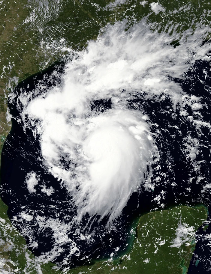
Tropical Storm Jerry
| Tropical storm (SSHWS) | |
  | |
| Duration | August 7 – August 12 |
|---|---|
| Peak intensity | 60 mph (95 km/h) (1-min) 992 mbar (hPa) |
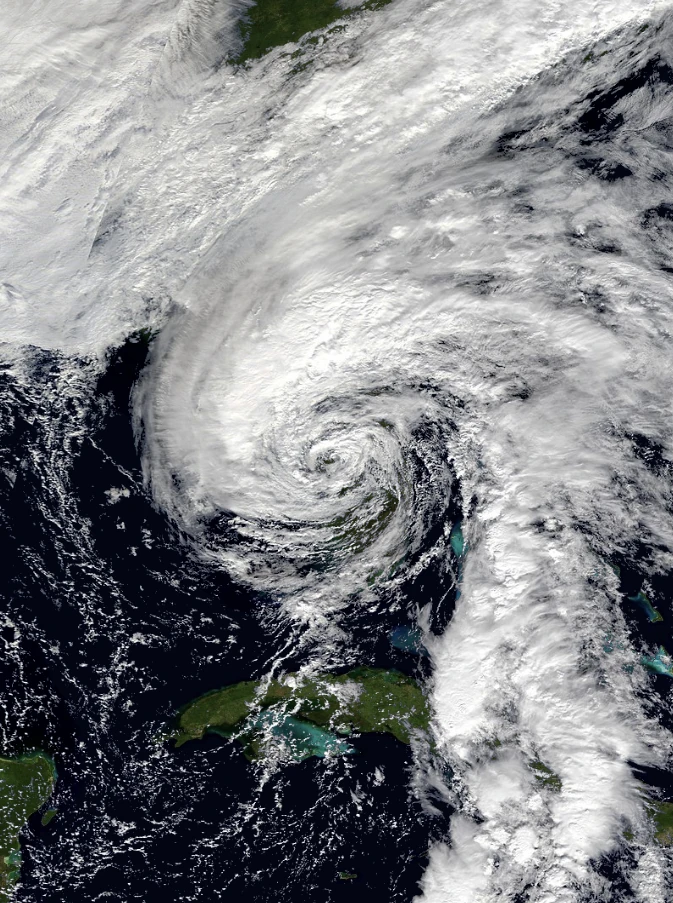
A tropical wave over the Greater Antilles was monitored for development on August 2. The wave moved into the Gulf of Mexico on August 3 and began to stall for a day while southeast of Texas. The wave accelerated organization on August 6, leading to the formation of a Tropical Depression on August 7 and was named Jerry later that day. The storm moved very slowly to the Northwest, strengthening steadily as it did so. Jerry would eventually reach a 60 mph (95 km/h) peak early on August 10 while approaching the Southwestern Louisiana coast. A state of emergency was issued as Jerry was expected to cause major flooding as a slow moving tropical cyclone. Jerry finally made landfall on the Gulf Coast, weakening thereafter before degenerating into a remnant on August 12. Jerry would accelerate Northeast temporarily before being absorbed by a frontal system late the next day.
Subtropical Storm Karen
| Subtropical storm (SSHWS) | |
  | |
| Duration | August 16 – August 21 |
|---|---|
| Peak intensity | 50 mph (85 km/h) (1-min) 1000 mbar (hPa) |
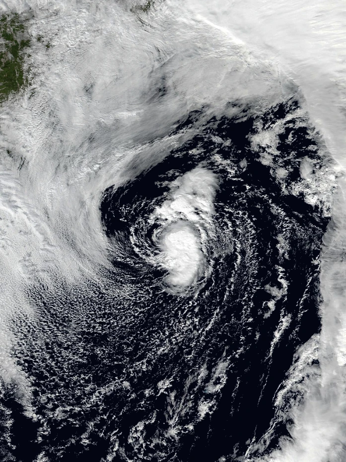
An upper level trough spawned an Extratropical cyclone over the Northern Atlantic on August 11. The radius of maximum winds on the cyclone began to contract on August 13, suggesting a subtropical transition which was completed on August 16. Six hours after designation as a Subtropical Depression, the storm attained gale force winds and was named Karen. Karen was initially forecasted to transition to a Tropical storm on August 17, but no such transition occurred despite sea surface temperatures being an anomalously warm 80°F (27°C). Karen accelerated northeast as a subtropical storm, strengthening to 50 mph (85 km/h). Despite initial forecasts predicting the system to turn post tropical by August 19, Karen remained a well-defined subtropical storm at an unprecedented latitude. It would finally begin to transition on August 20 and would complete this transition on August 21. Karen would remain a nameable cyclone to a record high latitude of 62.3°N, surpassing the 61.1°N set by Hurricane Faith in 1966.
Tropical Depression Fourteen
| Tropical depression (SSHWS) | |
 | |
| Duration | August 24 – August 26 |
|---|---|
| Peak intensity | 35 mph (55 km/h) (1-min) 1008 mbar (hPa) |
Hurricane Lincoln
| Category 4 hurricane (SSHWS) | |
 | |
| Duration | August 26 – September 6 |
|---|---|
| Peak intensity | 150 mph (240 km/h) (1-min) 931 mbar (hPa) |
Hurricane Maddie
| Category 5 hurricane (SSHWS) | |
 | |
| Duration | August 27 – September 6 |
|---|---|
| Peak intensity | 165 mph (270 km/h) (1-min) 916 mbar (hPa) |
Hurricane Nestor
| Category 3 hurricane (SSHWS) | |
 | |
| Duration | September 4 – September 11 |
|---|---|
| Peak intensity | 125 mph (205 km/h) (1-min) 946 mbar (hPa) |
Tropical Storm Oprah
| Tropical storm (SSHWS) | |
 | |
| Duration | September 4 – September 8 |
|---|---|
| Peak intensity | 60 mph (95 km/h) (1-min) 998 mbar (hPa) |
Hurricane Parker
| Category 2 hurricane (SSHWS) | |
 | |
| Duration | September 9 – September 19 |
|---|---|
| Peak intensity | 100 mph (155 km/h) (1-min) 963 mbar (hPa) |
Hurricane Rebekah
See Also: Medicane Jibril
| Category 3 hurricane (SSHWS) | |
 | |
| Duration | September 10 – September 17 |
|---|---|
| Peak intensity | 125 mph (205 km/h) (1-min) 940 mbar (hPa) |
Hurricane Sora
| Category 5 hurricane (SSHWS) | |
 | |
| Duration | September 10 – September 22 |
|---|---|
| Peak intensity | 190 mph (305 km/h) (1-min) 889 mbar (hPa) |
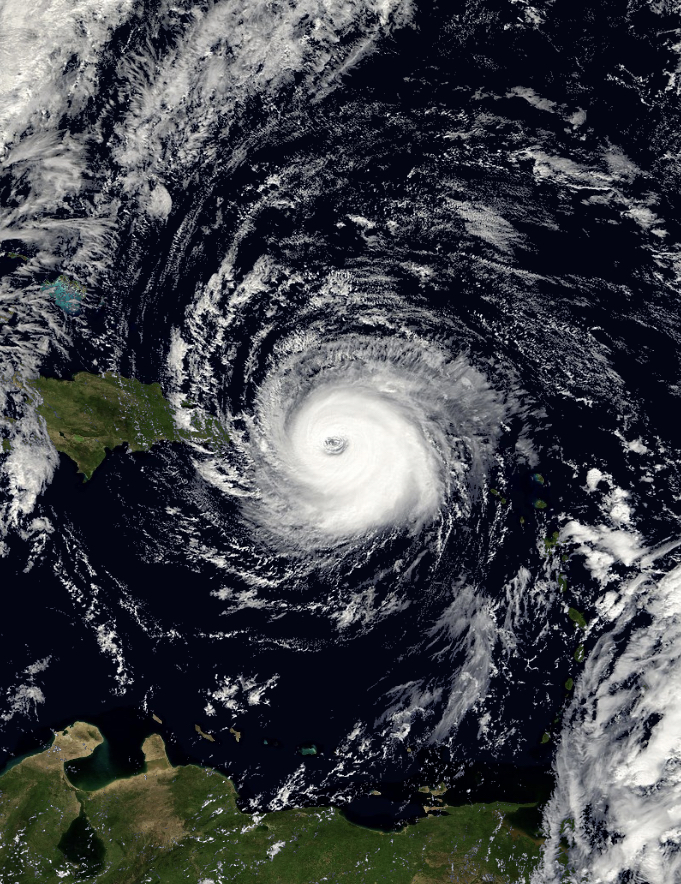
Hurricane Trinity
Main Article: Hurricane Trinity
| Category 5 hurricane (SSHWS) | |
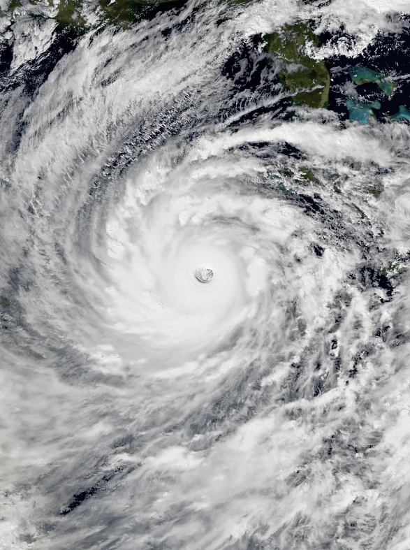  | |
| Duration | September 16 – September 29 |
|---|---|
| Peak intensity | 200 mph (325 km/h) (1-min) 881 mbar (hPa) |
Hurricane Van
| Category 1 hurricane (SSHWS) | |
 | |
| Duration | September 20 – September 30 |
|---|---|
| Peak intensity | 90 mph (150 km/h) (1-min) 982 mbar (hPa) |
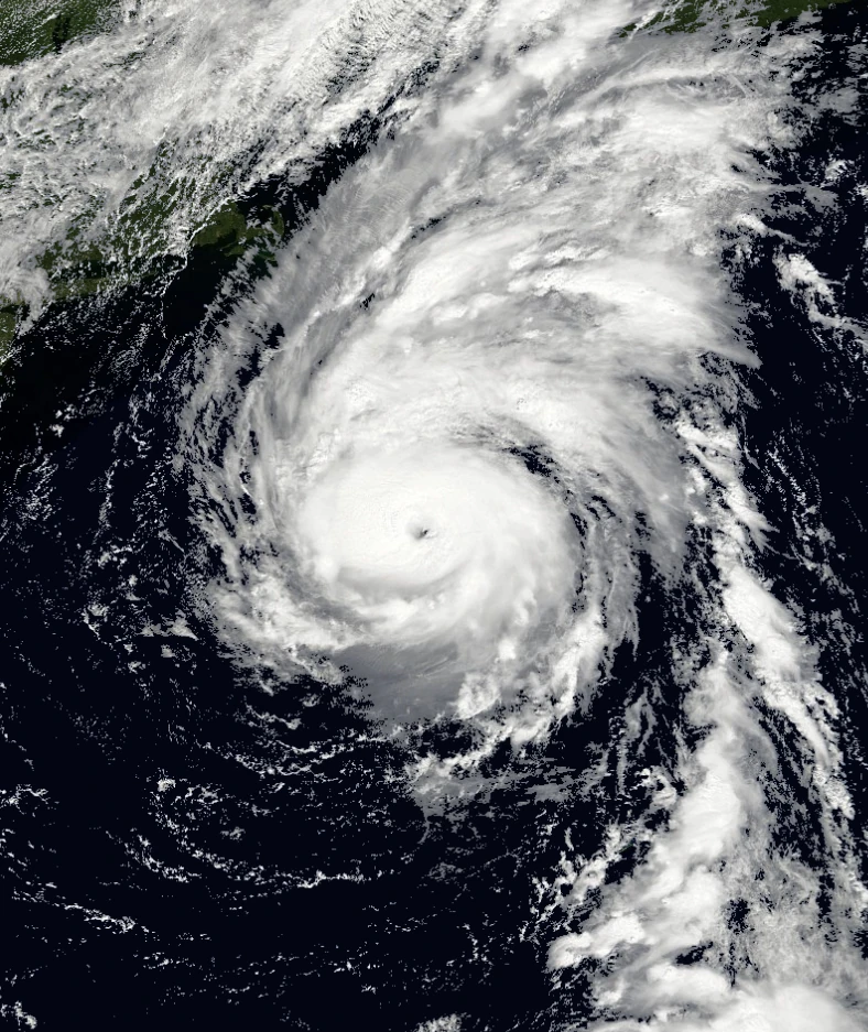
Hurricane Winona
| Category 5 hurricane (SSHWS) | |
 | |
| Duration | September 23 – October 4 |
|---|---|
| Peak intensity | 165 mph (270 km/h) (1-min) 914 mbar (hPa) |
Tropical Storm Alpha
| Tropical storm (SSHWS) | |
 | |
| Duration | October 4 – October 7 |
|---|---|
| Peak intensity | 65 mph (100 km/h) (1-min) 984 mbar (hPa) |
Hurricane Beta
| Category 2 hurricane (SSHWS) | |
 | |
| Duration | October 6 – October 11 |
|---|---|
| Peak intensity | 100 mph (155 km/h) (1-min) 977 mbar (hPa) |
Hurricane Gamma
| Category 3 hurricane (SSHWS) | |
 | |
| Duration | October 10 – October 20 |
|---|---|
| Peak intensity | 120 mph (195 km/h) (1-min) 930 mbar (hPa) |
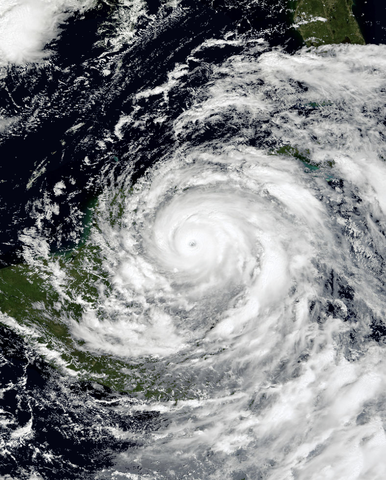
Hurricane Sonia
Main Article: Hurricane Sonia (2055)
| Category 5 hurricane (SSHWS) | |
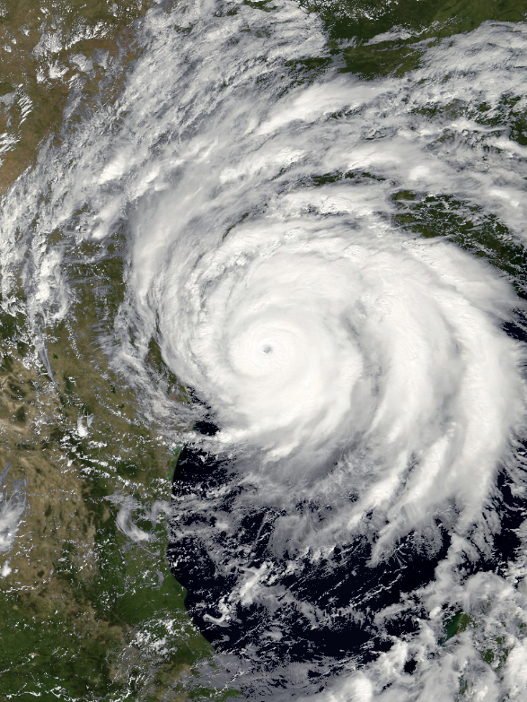  | |
| Duration | October 11 (Entered basin) – October 18 |
|---|---|
| Peak intensity | 165 mph (270 km/h) (1-min) 918 mbar (hPa) |
Hurricane Delta
Main Article: Medicane Kurumi
| Category 4 hurricane (SSHWS) | |
 | |
| Duration | October 11 – November 7 |
|---|---|
| Peak intensity | 130 mph (215 km/h) (1-min) 921 mbar (hPa) |
Tropical Storm Epsilon
| Tropical storm (SSHWS) | |
 | |
| Duration | October 19 – October 19 |
|---|---|
| Peak intensity | 40 mph (65 km/h) (1-min) 1012 mbar (hPa) |
Hurricane Zeta
| Category 2 hurricane (SSHWS) | |
 | |
| Duration | October 25 – November 2 |
|---|---|
| Peak intensity | 105 mph (165 km/h) (1-min) 964 mbar (hPa) |
Subtropical Storm Eta
| Subtropical storm (SSHWS) | |
 | |
| Duration | October 27 – October 28 |
|---|---|
| Peak intensity | 45 mph (75 km/h) (1-min) 997 mbar (hPa) |
Hurricane Theta
| Category 4 hurricane (SSHWS) | |
 | |
| Duration | November 5 – November 11 |
|---|---|
| Peak intensity | 155 mph (250 km/h) (1-min) 931 mbar (hPa) |
Hurricane Iota
See Also: November 2055 Mid-Atlantic nor'easter
| Category 1 hurricane (SSHWS) | |
 | |
| Duration | November 14 – November 19 |
|---|---|
| Peak intensity | 90 mph (150 km/h) (1-min) 986 mbar (hPa) |
Tropical Storm Kappa
| Tropical storm (SSHWS) | |
 | |
| Duration | November 20 – November 20 |
|---|---|
| Peak intensity | 40 mph (65 km/h) (1-min) 1009 mbar (hPa) |
Hurricane Lambda
| Category 1 hurricane (SSHWS) | |
 | |
| Duration | November 20 – November 25 |
|---|---|
| Peak intensity | 80 mph (130 km/h) (1-min) 974 mbar (hPa) |
Hurricane Mu
| Category 2 hurricane (SSHWS) | |
 | |
| Duration | December 20 – December 25 |
|---|---|
| Peak intensity | 100 mph (155 km/h) (1-min) 966 mbar (hPa) |
Other System

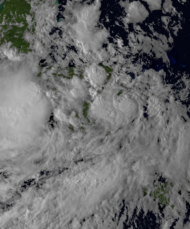
Potential Tropical Cyclone Nine on July 18 while approaching Central America.
A tropical wave emerged off the coast of Africa on July 7. The wave split into two parts, the northernmost one of which would eventually amount to Hurricane Georgia on July 15. The southern portion of the wave would develop somewhat over the next several days, eventually trekking into the Caribbean Sea on July 13 where most of it's development would take place. The cyclone would be designated Potential Tropical Cyclone Nine, late on July 16 while a moderate distance to the east of Honduras due to it's potential threat to Central America. Nine continued west, with repeated recon flights and examination of ASCAT passes in an attempt to find a closed circulation, to no avail. The near-cyclone would attain gale force winds on July 18 while coming off the Northeastern Honduras coast. The storm developed substancially between it's final reconnaissance flight (in the Atlantic) 2100 UTC July 17 and the estimated landfall time at 0600 UTC July 18. Post analysis did not upgrade Nine to a tropical cyclone as there was no way to confirm that the circulation had closed as the storm had lost any notable direct observation in order to assess a proper LLC. The system had achieved a 90% chance of formation before landfall. The system would emerge over the East Pacific basin where it would eventually form into the powerful and long lived Hurricane Beatrice, 4 days later.
Storm Names
The following list of names was used for named storms that formed in the North Atlantic in 2055. The names not retired from this list will be used again in the 2061 season. This was the same list used in the 2049 season, with the exception of the names Parker, Trinity and Winona which replaced Pablo, Tanya and Wendy. The names Parker, Trinity and Winona were used for the first time this year.
|
|
Retirement
On March 26, 2056, at the 78th session of the RA IV hurricane committee, the World Meteorological Organization retired the names Jerry, Maddie, Sora, Trinity and Winona from its rotating naming lists due to the number of deaths and amount of damage they caused, and they will not be used again for another Atlantic hurricane. They will be replaced with Joshua, Morgan, Sawyer, Thea and Wynter respectively, for the 2061 season. The WMO did not retire any names of the greek alphabet as it was ruled to be not practical to do so.
The name Sonia was also retired and replaced with Stella for the 2061 Pacific hurricane season, dealing significant damages in both the Atlantic and East Pacific basins.
Season Effects
This is a table of all the storms that formed in the 2055 Atlantic hurricane season. It includes their duration, names, affected areas, damages, and death totals. Deaths in parentheses are additional and indirect (an example of an indirect death would be a traffic accident), but were still related to that storm. Damage and deaths include totals while the storm was extratropical, a tropical wave, or a low, and all the damage figures are in 2017 USD. Potential tropical cyclones are not included in this table.
| Saffir–Simpson hurricane wind scale | ||||||
| TD | TS | C1 | C2 | C3 | C4 | C5 |
| Storm name |
Dates active | Storm category at peak intensity |
Max 1-min wind mph (km/h) |
Min. press. (mbar) |
Areas affected | Damage (USD) |
Deaths | |||
|---|---|---|---|---|---|---|---|---|---|---|
| One | March 1 – March 2 | Subtropical depression | 35 | 1009 | None | None | None | |||
| Andrea | April 16 – April 19 | Subtropical storm | 45 | 1003 | East Coast of the US, Atlantic Canada | Minimal | 2 | |||
| Brice | May 11 – May 15 | Tropical storm | 65 | 990 | Cuba, Southeastern US | $104.3 million | 4 (3) | |||
| Chandra | May 28 – June 3 | Category 1 hurricane | 75 | 988 | Southeastern US, Midwest US | $173.5 million | 1 (1) | |||
| Daina | June 7 – June 13 | Category 3 hurricane | 115 | 960 | Lesser Antilles, Puerto Rico, Hispaniola | $704.6 million | 18 (5) | |||
| Erin | June 24 – June 26 | Tropical storm | 40 | 1007 | Belize, Mexico, Louisiana | Minimal | None | |||
| Finley | July 4 – July 13 | Category 5 hurricane | 160 | 920 | Windward Islands, Jamaica, Cayman Islands, Yucatan, Mexico | $1.17 billion | 21 (3) | |||
| Georgia | July 15 – July 25 | Category 3 hurricane | 115 | 956 | Lesser Antilles, Leeward Islands, Puerto Rico | $2 million | None | |||
| Harper | August 21 – August 24 | Tropical storm | 50 | 997 | None | None | None | |||
| Inigo | July 29 – August 4 | Category 1 hurricane | 75 | 985 | Belize, Mexico | $30 million | 3 | |||
| Jerry | August 7 – August 12 | Tropical storm | 60 | 992 | US Gulf Coast, Midwest US | $6.4 billion | 23 | |||
| Karen | August 16 – August 21 | Subtropical storm | 50 | 1000 | Faroe Islands, United Kingdom, Scotland, Denmark, Norway | $775 million | 6 (2) | |||
| Thirteen | August 24 – August 26 | Tropical depression | 35 | 1008 | Cape Verde | None | None | |||
| Lincoln | August 26 – September 6 | Category 4 hurricane | 150 | 931 | Leeward Islands, Bahamas, East Coast of the US | $70 million | 3 | |||
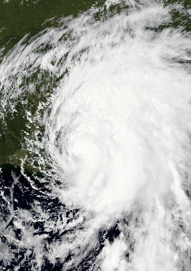
| Maddie | August 27 – September 6 | Category 5 hurricane | 165 | 914 | Lesser Antilles, Windward Islands, Belize, Yucatan, Texas, Louisiana, Midwest US | $160.37 billion | 273 | |||
| Nestor | September 4 – September 10 | Category 3 hurricane | 125 | 946 | Bermuda | Minimal | 1 | |||
| Oprah | September 4 – September 8 | Tropical storm | 60 | 998 | Cayman Islands, Cuba, Yucatan, Mexico | $317 million | 14 | |||
| Parker | September 9 – September 19 | Category 2 hurricane | 100 | 963 | Bahamas, East Coast of the US, Atlantic Canada, Greenland | $104.3 million | 5 (1) | |||
| Rebekah | September 10 – September 17 | Category 3 hurricane | 125 | 940 | Cape Verde, Madeira Islands, Portugal, Spain | $53.1 million | 7 | |||
| Sora | September 10 – September 22 | Category 5 hurricane | 190 | 889 | Lesser Antilles, US Virgin Islands, Puerto Rico, Hispaniola, Bahamas, East Coast of the US, Nova Scotia | $101.88 billion | 4,603 (513) | |||
| Trinity | September 16 – September 29 | Category 5 hurricane | 200 | 880 | South America, Honduras, Nicaragua, Belize, Yucatan, Florida, East Coast of the US | $108.3 billion | 614 | |||
| Van | September 20 – September 30 | Category 1 hurricane | 90 | 982 | Lesser Antilles, Greater Antilles, Florida, Louisiana, Midwest US | $980 million | 10 (3) | |||
| Winona | September 23 – October 4 | Category 5 hurricane | 165 | 916 | Honduras, Belize, Yucatan, Guatemala, US Gulf Coast, Southeastern US, Midwest US, Great Lakes Region, Northeastern US, Southeastern Canada | $23.8 billion | 39 (17) | |||
| Alpha | October 4 – October 7 | Tropical storm | 65 | 984 | Central America, Mexico, Southeastern US | $275 million | 2 | |||
| Beta | October 6 – October 11 | Category 2 hurricane | 100 | 977 | South America, Honduras, Belize, Yucatan, Cuba, US Gulf Coast, Southeastern US | $486.72 million | 30 | |||
| Gamma | October 10 – October 20 | Category 3 hurricane | 120 | 930 | Lesser Antilles, Leeward Islands, US Virgin Islands, Bahamas, Florida, Southeastern US | $10.93 billion | 1,037 | |||
| Sonia | October 11 – October 18 | Category 5 hurricane | 175 | 903 | Texas, Louisiana, Midwest US (after crossover) | $97.3 billion | 194 | |||
| Delta | October 11 – November 7 | Category 4 hurricane | 130 | 921 | Azores, Portugal, Spain, Morocco, Algeria | $856.3 million | 7 (25) | |||
| Epsilon | October 19 – October 19 | Tropical storm | 40 | 1012 | Honduras, Cayman Islands, Cuba, Bahamas | $1 million | None | |||
| Zeta | October 25 – November 2 | Category 2 hurricane | 105 | 964 | None | None | None | |||
| Eta | October 27 – October 28 | Subtropical storm | 45 | 999 | Spain, Portugal, France | Minimal | None | |||
| Theta | November 5 – November 11 | Category 4 hurricane | 155 | 931 | South America, Central America, Cayman Islands, Cuba, Bahamas | $4.19 billion | 73 (14) | |||
| Iota | November 14 – November 19 | Category 1 hurricane | 90 | 986 | Central America, Belize, Yucatan, Cuba, Southeastern US, East Coast of the US, Atlantic Canada | $74.5 million | 3 | |||
| Kappa | November 20 – November 20 | Tropical storm | 40 | 1009 | Jamaica, Cayman Islands, Cuba, Florida, Bahamas, East Coast of the US, Canada | $2.03 million | None | |||
| Lambda | November 20 – November 25 | Category 1 hurricane | 80 | 974 | None | None | None | |||
| Mu | December 20 – December 25 | Category 2 hurricane | 100 | 966 | Madeira Islands, Portugal, Spain, France | $100 million | None | |||
| Season aggregates | ||||||||||
| 36 systems | March 1 – December 25 | 200 | 880 | $519.44 billion | 6,993 (587) | |||||
See Also
- 2049 Atlantic hurricane season
- 2057 Pacific hurricane season
- 2026 Pacific typhoon season
- 2032 North Indian Ocean cyclone season