No edit summary Tag: rte-wysiwyg |
No edit summary Tag: rte-wysiwyg |
||
| Line 2: | Line 2: | ||
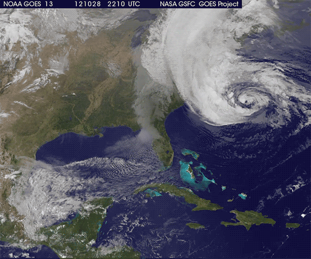
A Category 7 storm would most likely have winds between 215 and 245 mph, And minimum pressure of maybe 835-843 millibars. The storm would be maybe just as big as Typhoon Tip, maybe even larger, have and eye as small as only 1 mile wide or as large as 300 miles, The tropical storm wind field may extend out twice as far than the largest tropical storm wind field recorded, and the hurricane wind field would also be twice as large. Maximum wave heights from these Category-7 cyclones may be as high as 65 feet, or maybe 90 feet. These storms are capable of causing Millions, Billions, even a full tricentillion(a 1 with 909 zeros after it.) in damage and kill as much as 1 quadvingintillion(a one with 100,000 zeros after it.). |
A Category 7 storm would most likely have winds between 215 and 245 mph, And minimum pressure of maybe 835-843 millibars. The storm would be maybe just as big as Typhoon Tip, maybe even larger, have and eye as small as only 1 mile wide or as large as 300 miles, The tropical storm wind field may extend out twice as far than the largest tropical storm wind field recorded, and the hurricane wind field would also be twice as large. Maximum wave heights from these Category-7 cyclones may be as high as 65 feet, or maybe 90 feet. These storms are capable of causing Millions, Billions, even a full tricentillion(a 1 with 909 zeros after it.) in damage and kill as much as 1 quadvingintillion(a one with 100,000 zeros after it.). |
||
==An average Category 7== |
==An average Category 7== |
||
| − | |||
| ⚫ | During Late-August on into September, there would be very low shear, maybe even none. Water temps would be above average, nearly 90°F maybe. Atmospheric moisture would be, well, moist. A wave off of Africa develops into a Tropical Depression, like loads of other storms that have formed. During the next few days this storm would rapidly strengthen to a Category 4 Hurricane with winds as high as 130 mph. So far the storm has gained a look similar to Hurricane Ivan from 2004. The hurricane was forecasted to get stronger with winds topping 155 mph, almost Category five status. However, what became of this Hurricane later on, was completely unexpected. It strengthened to an unprecedented Category ''SEVEN'' Hurricane with winds of 260 mph because of 98.6°F. The hurricane has entered the gulf, its intensity remains at Category 7 status. Its forecasted to hit a place that had been already dealing with earlier monsters, [[Wikipedia:New Orleans|New Orleans, Louisiana]], and its forecasted to hit at peak strength. But before the storm makes landfall, the gulf coast is already receiving winds of into an incredible 100 mph, Tampa had a wind gust of nearly a monstrous 140 mph. In Tallahassee, a tsunami 60 feet in the air completely wiped out it and other cities or counties miles north of it. Then At 4:30 PM on September 17th, hurricane makes landfall as a weak Category 7, burbon street would be completely flooded and trashed, new Orleans football |
||
| ⚫ | |||
| ⚫ | not only fail but literally completely tear out of the ground, lift up and get blown away like a toy. The most dramatic part, Louisiana, The west part of Florida, Mississippi, Alabama, and some of Texas and as far as 200 miles inland became part of the gulf because of super tsunamis and tidal waves.- The hurricane would also spawn loads of tornadoes, even one just like the 1999 Oklahoma F-5 tornado, but this tornado would be in Indianapolis, Indiana. Once the hurricane has passed, As much as $500 billion in damages and killed 100,000. The storm had been named "Lee", which would be replaced with Leonard. Category-6 Category-7 SSHS Destruction |
||
| − | {{Clear}} |
||
| − | |||
| − | |||
| − | |||
| − | |||
| − | |||
| − | |||
{{Infobox hurricane new |
{{Infobox hurricane new |
||
| Line 23: | Line 12: | ||
|Type1= |
|Type1= |
||
|Type2= |
|Type2= |
||
| ⚫ | |WarningCenter=NHC|Type = cat7}}During Late-August on into September, there would be very low shear, maybe even none. Water temps would be above average, nearly 90°F maybe. Atmospheric moisture would be, well, moist. A wave off of Africa develops into a Tropical Depression, like loads of other storms that have formed. During the next few days this storm would rapidly strengthen to a Category 4 Hurricane with winds as high as 130 mph. So far the storm has gained a look similar to Hurricane Ivan from 2004. The hurricane was forecasted to get stronger with winds topping 155 mph, almost Category five status. However, what became of this Hurricane later on, was completely unexpected. It strengthened to an unprecedented Category ''SEVEN'' Hurricane with winds of 260 mph because of 98.6°F. The hurricane has entered the gulf, its intensity remains at Category 7 status. Its forecasted to hit a place that had been already dealing with earlier monsters, [[Wikipedia:New Orleans|New Orleans, Louisiana]], and its forecasted to hit at peak strength. But before the storm makes landfall, the gulf coast is already receiving winds of into an incredible 100 mph, Tampa had a wind gust of nearly a monstrous 140 mph. In Tallahassee, a tsunami 60 feet in the air completely wiped out it and other cities or counties miles north of it. Then At 4:30 PM on September 17th, hurricane makes landfall as a weak Category 7, burbon street would be completely flooded and trashed, new Orleans football |
||
| − | |WarningCenter=NHC|Type = cat7}} |
||
| ⚫ | |||
| − | {{Clear}} |
||
| ⚫ | not only fail but literally completely tear out of the ground, lift up and get blown away like a toy. The most dramatic part, Louisiana, The west part of Florida, Mississippi, Alabama, and some of Texas and as far as 200 miles inland became part of the gulf because of super tsunamis and tidal waves.- The hurricane would also spawn loads of tornadoes, even one just like the 1999 Oklahoma F-5 tornado, but this tornado would be in Indianapolis, Indiana. Once the hurricane has passed, As much as $500 billion in damages and killed 100,000. The storm had been named "Lee", which would be replaced with Leonard. Category-6 Category-7 SSHS Destruction {{Clear}} |
||
[[Category:Infobox templates]] |
[[Category:Infobox templates]] |
||
[[Category:Future Storms]] |
[[Category:Future Storms]] |
||
Revision as of 21:37, 26 August 2015
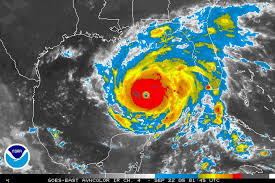
Category 7 Hurricane Guistavavo at record peak intensity.
A Category 7 storm would most likely have winds between 215 and 245 mph, And minimum pressure of maybe 835-843 millibars. The storm would be maybe just as big as Typhoon Tip, maybe even larger, have and eye as small as only 1 mile wide or as large as 300 miles, The tropical storm wind field may extend out twice as far than the largest tropical storm wind field recorded, and the hurricane wind field would also be twice as large. Maximum wave heights from these Category-7 cyclones may be as high as 65 feet, or maybe 90 feet. These storms are capable of causing Millions, Billions, even a full tricentillion(a 1 with 909 zeros after it.) in damage and kill as much as 1 quadvingintillion(a one with 100,000 zeros after it.).
An average Category 7
| Category 7 hurricane (NHC) | |
 | |
| Duration | August 26 – September 20 |
|---|---|
| Peak intensity | 260 mph (415 km/h) (1-min) 871 mbar (hPa) |
During Late-August on into September, there would be very low shear, maybe even none. Water temps would be above average, nearly 90°F maybe. Atmospheric moisture would be, well, moist. A wave off of Africa develops into a Tropical Depression, like loads of other storms that have formed. During the next few days this storm would rapidly strengthen to a Category 4 Hurricane with winds as high as 130 mph. So far the storm has gained a look similar to Hurricane Ivan from 2004. The hurricane was forecasted to get stronger with winds topping 155 mph, almost Category five status. However, what became of this Hurricane later on, was completely unexpected. It strengthened to an unprecedented Category SEVEN Hurricane with winds of 260 mph because of 98.6°F. The hurricane has entered the gulf, its intensity remains at Category 7 status. Its forecasted to hit a place that had been already dealing with earlier monsters, New Orleans, Louisiana, and its forecasted to hit at peak strength. But before the storm makes landfall, the gulf coast is already receiving winds of into an incredible 100 mph, Tampa had a wind gust of nearly a monstrous 140 mph. In Tallahassee, a tsunami 60 feet in the air completely wiped out it and other cities or counties miles north of it. Then At 4:30 PM on September 17th, hurricane makes landfall as a weak Category 7, burbon street would be completely flooded and trashed, new Orleans football dome which had taken Katrina- Nearly got lifted off the ground by a near 300 mph wind gust, the levees that failed during Katrina, but had withstood Gustav
not only fail but literally completely tear out of the ground, lift up and get blown away like a toy. The most dramatic part, Louisiana, The west part of Florida, Mississippi, Alabama, and some of Texas and as far as 200 miles inland became part of the gulf because of super tsunamis and tidal waves.- The hurricane would also spawn loads of tornadoes, even one just like the 1999 Oklahoma F-5 tornado, but this tornado would be in Indianapolis, Indiana. Once the hurricane has passed, As much as $500 billion in damages and killed 100,000. The storm had been named "Lee", which would be replaced with Leonard. Category-6 Category-7 SSHS Destruction