Tag: Visual edit |
(→How to make tropical cyclone infoboxes?: Updating) Tag: Visual edit |
||
| Line 22: | Line 22: | ||
{{Ambox|border = yellow|image = [[File:Document.png|50px]]|info = '''Note''': This section serves as a guide to add infoboxes in the classic rich-text editor and the source editor, but can be also be used in VisualEditor (in source mode or not).}}For making hurricane infoboxes, use the following information: |
{{Ambox|border = yellow|image = [[File:Document.png|50px]]|info = '''Note''': This section serves as a guide to add infoboxes in the classic rich-text editor and the source editor, but can be also be used in VisualEditor (in source mode or not).}}For making hurricane infoboxes, use the following information: |
||
| + | If you're using [[Help:VisualEditor|VisualEditor]], open the toolbar's settings menu and click on Source Editor. If you're using [[Help:Classic editor|classic editor]], click the Source tab above the edit area. |
||
| − | First, you type in <code><nowiki>{{Infobox hurricane new</nowiki></code>. Then you specify which basin your hypothetical tropical cyclone is in (using <code><nowiki>| Basin = (basin code)</nowiki></code>. Here is the full list of basin codes: |
||
| − | * North Atlantic: Atl |
||
| − | * South Atlantic: SAtl |
||
| − | * Eastern/Central Pacific: EPac |
||
| − | * Western Pacific: WPac |
||
| − | * North Indian Ocean: NIO |
||
| − | * Southern Hemisphere: SHem |
||
| − | * South-West Indian Ocean: SWI |
||
| − | * Australian Region: Aus |
||
| − | * South Pacific: SPac |
||
| + | Copy this to the page: |
||
| − | You should then type in an appropriate image that shows your storm at peak intensity, if present. It should say: <code><nowiki>| Image = (name of image).(file format)</nowiki></code>. File formats can vary. |
||
| + | <pre> |
||
| − | * OPTIONAL: Use <code><nowiki>| Track = (file name of track).(file format)</nowiki></code> if you have a track of the storm. |
||
| + | <nowiki> |
||
| + | {{Infobox hurricane new |
||
| + | | Basin = (Insert basin, eg. Atl, SAtl, EPac, WPac, NIO, SHem, SWI, Aus, SPac) |
||
| + | | Image = (Any image file) |
||
| + | | Formed = (Formation date) |
||
| + | | Dissipated = (Dissipation date) |
||
| + | | 1-min winds = (The storm's wind speeds, in knots) |
||
| + | | Pressure = (The storm's pressure) |
||
| + | | Type = (If a storm from another basin, use storm type) |
||
| + | | WarningCenter = (If a custom storm, type the warning center here) |
||
| + | }} |
||
| + | </nowiki> |
||
| + | </pre> |
||
| ⚫ | |||
| − | You then type in the date the cyclone formed. Type it in as <code><nowiki>| Formed = (date of formation)</nowiki></code>. |
||
| − | |||
| − | Afterwards, you type in the date your cyclone dissipated. Type it in as <code><nowiki>| Dissipated = (date of dissipation)</nowiki></code>. |
||
| − | |||
| − | You then, type in how strong your cyclone is (in knots). You can use <code><nowiki>| 1-min winds = </nowiki></code> (for the Atlantic/East Pacific), <code><nowiki>| 3-min winds = </nowiki></code> (for South-West Indian Ocean/North Indian Ocean), or <code><nowiki>| 10-min winds = </nowiki></code> (for West Pacific). '''The value must be a number!''' |
||
| − | * OPTIONAL: Type <code><nowiki>| Gusts= (gusts in knots)</nowiki></code> to tell how strong gusts were. '''This value must be a number!''' |
||
| − | |||
| − | Once you're done, you type in how strong your cyclone is in mbars/hPa. Type in <code><nowiki>| Pressure = (pressure in mbars/hPa)</nowiki></code> in the template. |
||
| − | * The following is only needed for Category 6+ storms or subtropical cyclones: |
||
| − | ** Enter <code><nowiki> | Type = (category name)</nowiki></code> to specify your category. You can find a list of categories [[Template:Tropical cyclone template values|here]]. |
||
| − | ** Specify which warning center your cyclone is being warned on. Examples include "CPHC", "IMD", "JMA" and "NHC". |
||
| − | |||
| − | Finally, after you've finished everything, type in <code><nowiki>}}</nowiki></code> in the end to complete your template. |
||
| − | |||
| ⚫ | |||
Template values include: |
Template values include: |
||
| − | <div class="mw-collapsible">{{Tropical cyclone template values}} |
+ | <div class="mw-collapsible">{{Tropical cyclone template values}} |
| + | </div> |
||
| − | |||
==== Examples ==== |
==== Examples ==== |
||
Revision as of 01:37, 19 January 2020
Are you new to the Hypothetical Hurricanes Wiki? Do you want to learn more about how to make a hypothetical tropical cyclone season here? Well, you have come to the right place! This article is a guide to making your very own tropical cyclone season on this wiki!
Steps
How to make a tropical cyclone season?
There are several ways to make a tropical cyclone season.
- Go to the top right of the community header and click on the paper icon (located to the right of the "15,718 pages" section). From there, the "Create a new article" box will pop up asking you what you want to call your season/article (you can also skip this by directly going to Special:CreatePage).
- When choosing an article name, you enter the year you want the season to take place (e.g., a past year such as 2018) and what tropical cyclone basin you want it to take place in (e.g., the East Pacific basin). Enter this information in the "Write your page title here" box.
- You can also decide between a standard page layout or a blank page. The standard layout provides image and video placeholders as well as section headings.
Here are some tropical cyclone basin examples:
- Atlantic (Atlantic hurricane season);
- Eastern and Central Pacific (Pacific hurricane season);
- Western Pacific (Pacific typhoon season);
- Southern Pacific (South Pacific cyclone season);
- South-Western Indian Ocean (South-West Indian Ocean cyclone season);
- Australian region (Australian region cyclone season);
- Northern Indian Ocean (North Indian Ocean cyclone season).
After this step, you are redirected to the season creation page.
How to make tropical cyclone infoboxes?
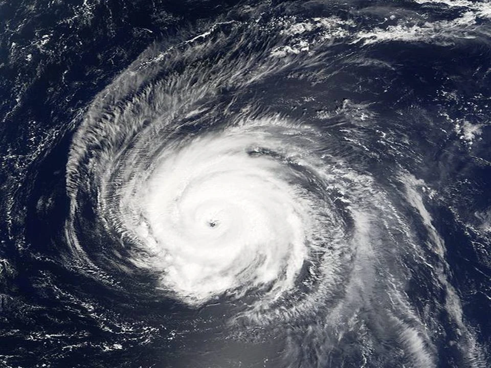
 |80px|link=]]
For making hurricane infoboxes, use the following information:
If you're using VisualEditor, open the toolbar's settings menu and click on Source Editor. If you're using classic editor, click the Source tab above the edit area.
Copy this to the page:
{{Infobox hurricane new
| Basin          = (Insert basin, eg. Atl, SAtl, EPac, WPac, NIO, SHem, SWI, Aus, SPac)
| Image          = (Any image file)
| Formed         = (Formation date)
| Dissipated     = (Dissipation date)
| 1-min winds    = (The storm's wind speeds, in knots)
| Pressure       = (The storm's pressure)
| Type           = (If a storm from another basin, use storm type)
| WarningCenter  = (If a custom storm, type the warning center here)
}}
Some of the options you can use for the Type field are listed in this table below. It's very extensive and includes custom TC template values made by other users. Asking their permission first before using their custom values is advised. Template values include:
| Values used for tropical cyclone templates | |||
|---|---|---|---|
| Basin | Value | Hexadecimal | Category |
| North Indian Ocean | |||
| niodepression | #80ccff | Depression | |
| deepdepression | #5ebaff | Deep depression | |
| cyclstorm | #00faf4 | Cyclonic storm | |
| svrcyclstorm | #ccffff | Severe cyclonic storm | |
| vsvrcyclstorm | #ffffcc | Very severe cyclonic storm | |
| esvrcyclstorm | #ffc140 | Extremely severe cyclonic storm | |
| sprcyclstorm | #ff6060 | Super cyclonic storm | |
| excyclstorm | #ff1493 | Extreme cyclonic storm | |
| Southern Hemisphere | |||
| shemdepression | #5ebaff | Tropical depression | |
| shemtc | #ffffcc | Tropical cyclone | |
| shemsvrtc | #ffe775 | Severe tropical cyclone | |
| South-West Indian Ocean | |||
| subdisturbance | #80ccff | Sub-tropical disturbance | |
| swiodisturbance | #80ccff | Tropical disturbance | |
| swsubdep | #5ebaff | Subtropical depression | |
| swiodepression | #5ebaff | Tropical depression | |
| mtstorm | #00faf4 | Moderate tropical storm | |
| swiosts | #ccffff | Severe tropical storm | |
| swiotc | #ffffcc | Tropical cyclone | |
| intense | #ffc140 | Intense tropical cyclone | |
| vintense | #ff6060 | Very intense tropical cyclone | |
| Australian Region and South Pacific | |||
| disturbance | #80ccff | Tropical disturbance | |
| spdepression | #5ebaff | Tropical depression | |
| low | #5ebaff | Tropical low | |
| Aus1 | #00faf4 | Category 1 tropical cyclone | |
| Aus2 | #ccffff | Category 2 tropical cyclone | |
| Aus3 | #ffffcc | Category 3 severe tropical cyclone | |
| Aus4 | #ffc140 | Category 4 severe tropical cyclone | |
| Aus5 | #ff6060 | Category 5 severe tropical cyclone | |
| North-West Pacific Ocean | |||
| nwpdepression | #5ebaff | Tropical depression | |
| nwpstorm | #00faf4 | Tropical storm | |
| STS | #ccffff | Severe tropical storm | |
| typhoon | #fdaf9a | Typhoon | |
| hyperphoon | #ff99ff | Hyperphoon | |
| Saffir–Simpson Hurricane Scale | |||
| potential | #80ccff | Potential tropical cyclone | |
| depression | #5ebaff | Tropical depression | |
| subdepression | #5ebaff | Subtropical depression | |
| MD | #5ebaff | Monsoon depression | |
| storm | #00faf4 | Tropical storm | |
| subtropical | #00faf4 | Subtropical storm | |
| cat1 | #ffffcc | Category 1 tropical cyclone | |
| cat2 | #ffe775 | Category 2 tropical cyclone | |
| cat3 | #ffc140 | Category 3 tropical cyclone | |
| cat4 | #ff8f20 | Category 4 tropical cyclone | |
| cat5 | #ff6060 | Category 5 tropical cyclone | |
| cat6 | #8b0000 | Category 6 tropical cyclone | |
| cat7 | #cc0033 | Category 7 tropical cyclone | |
| cat8 | #cc0066 | Category 8 tropical cyclone | |
| cat9 | #9B30FF | Category 9 tropical cyclone | |
| cat10 | #F9A7B0 | Category 10 tropical cyclone | |
| hycane | #ff99ff | Hyperclone | |
| megacane | #FFCCCC | Megacane | |
| infastorm | #00CC33 | Infinite Storm | |
| miniblackhole | #99CCFF | Mini Black Hole | |
| New NIO scale | |||
| tpeniotd | #5ebaff | Tropical depression | |
| tpeniots | #00faf4 | Tropical storm | |
| tpenio1 | #ffffcc | Cyclone | |
| tpenio2 | #ffe775 | Moderate cyclone | |
| tpenio3 | #ffc140 | Major cyclone | |
| tpenio4 | #ff8f20 | Major cyclone | |
| tpenio5 | #ff6060 | Super cyclone | |
| Anti Storms | |||
| antidepression | #5ebaff | Tropical Antidepression | |
| antistorm | #00faf4 | Tropical Antistorm | |
| anticat1 | #ffffcc | Category -1 Antihurricane | |
| anticat2 | #ffe775 | Category -2 Antihurricane | |
| anticat3 | #ffc140 | Category -3 Antihurricane | |
| anticat4 | #ff8f20 | Category -4 Antihurricane | |
| anticat5 | #ff6060 | Category -5 Antihurricane | |
| antihycane | #ff99ff | Anti hypercane | |
Examples
Here are some storm examples:
Hurricane Huko
{{Infobox hurricane new
| Basin          = Atl
| Image          = Fiona 2016.jpg
| Formed         = October 25
| Dissipated     = October 30
| 1-min winds    = 175
| Pressure       = 918
| Type           = cat6
| WarningCenter  = CPHC
}}
The above becomes:
| Category 6 hurricane (CPHC) | |
 | |
| Duration | October 25 – October 30 |
|---|---|
| Peak intensity | 200 mph (325 km/h) (1-min) 918 mbar (hPa) |
Another example:
Cyclonic Storm Phet-Kurt
This:
{{Infobox hurricane new
| Basin          = NIO
| Image          = 04W.2020.jpg
| Formed         = June 6
| Dissipated     = June 9
| 3-min winds    = 40
| Pressure       = 994
| Type           = cyclstorm
| WarningCenter  = IMD
}}
Becomes:
| Cyclonic storm (IMD) | |
 | |
| Duration | June 6 – June 9 |
|---|---|
| Peak intensity | 75 km/h (45 mph) (3-min) 994 hPa (mbar) |
Other
- For more help on making season articles, visit this Wikipedia page.
- For help on individual storm articles, visit this Wikipedia page.
How-to videos
- A guide on making storm tracks (Microsoft Paint)
- [1] (paint.NET)
- A guide on making an Atlantic hurricane season
- A guide on making seasonal effects
- A guide on making seasonal forecasts
- A guide on making ACE index ratings
- A guide on making timelines (part 1) (part 2)
- A guide on making infoboxes for currently active hurricanes