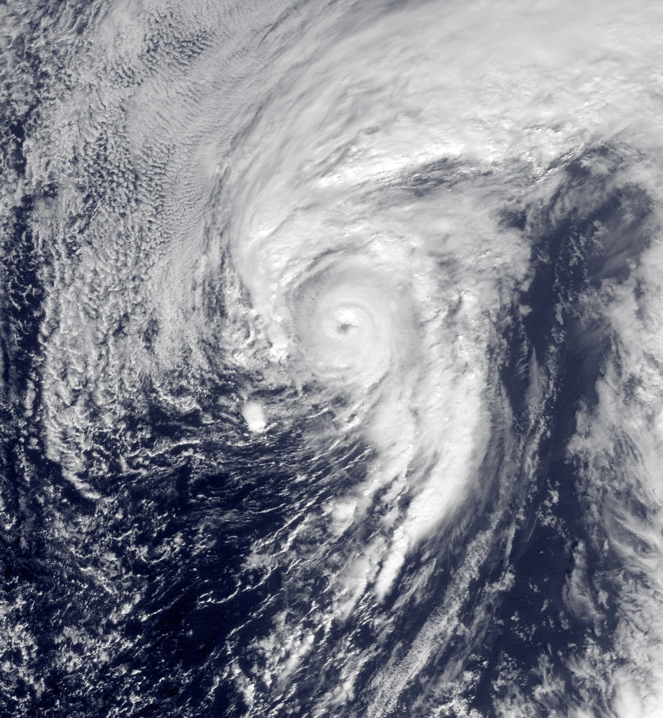
 The SMWC was the first to accurately predict Hurricane Alex of 2016, and were most reliable in forecasts and tracks for the storm. | |
| General information | |
|---|---|
| Formed | February 22, 2016 |
| Jurisdiction | United States government |
| Headquarters | Cleveland, Ohio, USA |
The Sass Master Weather Center is a meteorological service center found in Cleveland, Ohio and is dedicated to forecasting and tracking hurricanes and other tropical cyclones at all times, most notably in the Atlantic, serving all communities in the United States, the Caribbean, Mexico, and Latin America. However, the SMWC also tracks cyclones in the Western and Eastern Pacific, as well as in the Indian Ocean and Mediterranean Sea, as well as Usercanes for HHW. Founded on February 22, 2016 by Sassmaster15, the SMWC prides itself on accurate forecasts of storms all over the world, due to the helpful and knowledgeable staff of the Center.
The SMWC uses their own scales to rate storm and hurricane intensities, which is widely known around the world as the SMIS - Sass Master Intensity Scale. The SMIS rates subtropical/tropical invests and cyclones after dissipation based on pressure, wind speed, damages, and fatalities. This world re-owned scale has been utilized to successfully evaluate multiple tropical cyclones intensities' worldwide (see below for more information).
The SMWC proves to be a reliable agency when providing updates on any given storm across the globe. The SMWC is top notch when spotting and reporting on a storm in order to keep people updated and safe. The SMWC uses an exclusive watches/warnings system for any given area should a tropical storm or cyclone be approaching. The SMWC strives for excellence in these areas, as false watches or warnings are misleading and will cause the center to lose all established credibility.
The SMWC is also in partnership with several other meteorological centers, including the KMC (Keranique Meteorological Center), BNWC (Bob Nekaro Weather Center), and more!
Usercane Center[]
SMWC Usercane Center - This where you can find all the updates for the HHW usercanes!
Staff Members[]
Comment below for a job!!
Executives[]
Sassmaster15 - CEO; Founder/Supervisor
CURRENTLY HIRING
Forecasters[]
Bobnekaro - Lead Forecaster (Oversees Forecasting Department; Makes forecasts for the North Atlantic Basins. Will also make forecasts for AMO & ENSO.)
Hypercane - Forecaster (Makes forecasts for the South Atlantic, NIO, & Mediterranean Basins)
Floyd - Forecaster (Makes forecasts for the EPac & South/North Atlantic Basins)
CURRENTLY HIRING
Storm Chasers[]
Azure - Lead Storm Chaser (Head of Storm Chasing, Oversees Department; Administrator of this Department)
Bumblebee - Storm Chaser
Bugging - Storm Chaser
Storm Trackers[]
Hypothetical - Lead Storm Tracker (Oversees the Storm Tracking Department; Serves Executive Position in this Department)
Jdcomix - Storm Tracker
Money - Storm Tracker
CURRENTLY HIRING
Reporters[]
Keranique - Head Reporter (Oversees Reporting Department & Newsroom; Delivers Forecasts/Reports)
CURRENTLY HIRING
Post-Season Evaluators[]
Collin - Post-Season Evaluator
Darren - Post-Season Evaluator
CURRENTLY HIRING
Job Descriptions[]
NOTE: This sections contains descriptions for each position available. If you would like to view the staff members, see "STAFF MEMBERS." If you would like to apply for a job, request your position of choice in the comments section.
Executives[]
Executives are responsible for the management and everyday functions of the SMWC. There are executive positions available within each department, as well as executive positions available to people who wish to oversee the everyday productions of the SMWC.
Forecasters[]
Forecasters are responsible for watching their assigned basins for any signs of activity. They are to make forecasts for all systems and cyclones based on weather patterns, basin activity level, conditions for development, and models used by other centers. Forecasters are also required to write all predictions in the form of written reports. Finally, forecasters are also required to work with storm trackers in order to accurately predict the intensity and path of any given storm.
Storm Trackers[]
Working with forecasters, storm trackers are responsible for tracking storms and their intensities by creating tracks for every cyclone in their assigned basin, as well as monitoring radar/forecast models in order to assist Forecasters in building their predictions.
Storm Chasers (DEPARTMENT FULL)[]
A storm chaser's job is to go out and actually chase any land-born or landfalled storm or cyclone. Their job is to first-handedly examine any storms in their assigned area and report back to HQ on the conditions experienced, as well as record video footage/take pictures of any and all assigned storms, in order to help build accurate forecasts and better rate the storms/cyclones currently active. Storm chasers are also responsible for performing recon flights into any given storm and report back with data on the storm's statistics and intensity.
Reporters[]
Reporters are news anchors and experienced meteorologists who take information from Forecaster's and deliver them to the general public via television/radio broadcasts. Reporters are responsible for making the public aware of any current watches/warnings. Reporters are to be careful as to make sure no information sent out is false and/or misleading!
Post-Season Evaluators[]
People in this position are to evaluate past hurricane seasons for their assigned basins. Using data from the SMIS, as well as reports from Storm Chasers/Trackers and other outside models, they will re-evaluate past hurricanes based on damages and intensity in order to determine the intensities, damages, and death toll from each individual cyclone as well as the entire season as a whole.
SMIS Scale[]
Tropical Cyclones*[]
| Classification | Wind Speeds |
|---|---|
| Tropical Invest (SMWC) | <29 MPH |
| Tropical Depression (SMWC) | 30-39 MPH |
| Tropical Storm (SMWC) | 40-59 MPH |
| Severe Tropical Storm (SMWC) | 60-75 MPH |
| Category 1 Hurricane (SMWC) | 76-90 MPH |
| Category 2 Severe Hurricane (SMWC) | 91-109 MPH |
| Category 3 Major Hurricane (SMWC) | 110-130 MPH |
| Category 4 Major Hurricane (SMWC) | 131-155 MPH |
| Category 5 Major Hurricane (SMWC) | 156-199 MPH |
| Category 6 Catastrophic Hurricane (SMWC) | 200-250 MPH |
| Superstorm (SMWC) | 250+ MPH |
- This scale also applies to SUBTROPICAL cyclones.
Extratropical/Post-Tropical Cyclones[]
| Classification | Wind Speeds |
|---|---|
| Extratropical Depression (SMWC) | <36 MPH |
| Extratropical Storm (SMWC) | 37-70 MPH |
| Extratropical C1 (SMWC) | 71-85 MPH |
| Extratropical C2 (SMWC) | 86-97 MPH |
| Extratropical C3 (SMWC) | 98-118 MPH |
| Extratropical C4 (SMWC) | 119-132 MPH |
| Extratropical C5 (SMWC) | >133 MPH |
Polar Cyclones[]
| Classification | Wind Speeds |
|---|---|
| Polar Disturbance (SMWC) | <15 MPH |
| Polar Depression (SMWC) | 16-35 MPH |
| Polar Storm (SMWC) | 36-58 MPH |
| Minimal Polar Cyclone (SMWC) | 59-80 MPH |
| Moderate Polar Cyclone (SMWC) | 81-100 MPH |
| Severe Polar Cyclone (SMWC) | 101-144 MPH |
| Polar Vortex (SMWC) | 145+ MPH |
Usercanes[]
| Classification | Intensity (mph) | Type |
|---|---|---|
| Post-Tropical/Extratropical Cyclone | Variable | Banned/Retired/Inactive User |
| Tropical Invest | <29 mph | New User / <5 edits |
| Tropical Depression | 30-38 mph | 5-9 edits |
| Tropical Storm | 39-59 mph | 10+ edits |
| Severe Tropical Storm | 60-73 mph | Autopatrolled User |
| Category 1 Hurricane | 74-95 mph | Chat Moderator |
| Category 2 Hurricane | 96-110 mph | Rollback |
| Category 3 Major Hurricane | 111-129 mph | Junior Administrator |
| Category 4 Major Hurricane | 130-156 mph | Administrator |
| Category 5 Major Hurricane | 157-195 mph | Bureaucrat |
| Category 6 Major Hurricane | 196+ mph | Bureaucrat |
Damage Statistics[]
Tropical Invest[]
Little to no damage will occur
Invests typically cause no damage whatsoever upon land. Though, these systems are to be taken seriously given the fact they can unexpectedly intensify. In addition, they are capable of producing tornadoes, some of which have caused serious destruction. Invests are known for producing torrential rainfall, with several inches of accumulation possible in a short period of time, leading to landslides and catastrophic flooding.
Tropical Depression[]
Minor damage will occur
Depressions, both tropical and subtropical, can inflict damage upon land. Like invests, the threat from heavy rainfall is great, typically more severe and destructive than that of an invest. Flooding is more a more serious threat, with rainfall totals from these systems leading to accumulations several inches high. Regions with poor drainage can be severely affected by these systems, especially those where heavy rainfall is a regularity. Gusty winds are also possible, as these storms are capable of blowing down tree branches and knocking out electrical power. Falling branches may clog roads and damage infrastructure. Other unsecured and lightweight items may be blown around by these storms.
Tropical Storm[]
Moderate damage will occur
Winds at or above 35 knots typically describe a tropical storm. It is at this stage of a tropical cyclone's life that it is assigned a name from a list, based on the basin in which it occurs.
A tropical storm is when people are required to purchase supplies in anticipation of some destruction and/or the closing of public services. Roads and bridges may close temporarily during the storm's passage, and some/all boating and airline services maybe suspended for an indefinite period of time. Public offices and services may close at their own discretion; the same applies to businesses.
Damage from a tropical storm typically becomes more noticeable than that of its precursors. Some flooding is certain, especially in low-lying areas and regions with poor/ineffective drainage systems. Effects from waves and surf is evident, with beach erosion and destruction to piers and harbors possible. Ponding and street flooding can occur from heavy rainfall inland, with the inundation of homes possible, but unlikely. Excessive amounts of rainfall can devastate agriculture and lead to millions in losses. High winds can blow down tree limbs and uproot smaller trees. Power outages are to be expected, sometimes affecting entire towns. In poorly-developed nations, the destruction that occurs during a tropical storm can be compared to a Category 4 or 5 storm striking a well-developed, urban area.
Severe Tropical Storm[]
High winds will cause moderate damage
A severe tropical storm, also referred to as a Category 0 hurricane, will typically cause damage of some sort. It is at this point in a tropical cyclone's life that conditions may deteriorate to the point where it is unsafe for an individual to be outdoors, and that the threat the storm poses to one's life is more significant than those of its precursors. Should a storm of this caliber be approaching, taking shelter is advised. Residents under the risk of being hit by this storm should take the necessary precautions and purchase supplies to last through the aftermath of the storm.
The threat of wind damage is great during a severe tropical storm. Most trees of a smaller size will be blown over or uprooted, while larger trees will lose branches amidst the high winds. Signs may blow over, and damage to roofing materials may occur. Power lines may be damaged by the winds or flying debris, with some outages lasting up to a week. Lightweight and unsecured objects will become airborne, making the risk of death from being outside significantly greater during this type of storm. Effects from rainfall may result in flash flooding, and, in regions where heavy rainfall is not uncommon, ground saturation and mudslides. Accumulations may reach several inches deep, leading to some roads becoming impassible. Storm surge also becomes a threat during a severe tropical storm, sometimes achieving five feet in height. Rough surf will result in beach erosion and damage to piers and docks.
Category 1 hurricane[]
Damaging winds will cause serious damage
A tropical cyclone with winds of at least 66 knots is described as a hurricane. At this intensity, evacuating from high-risk areas is recommended but not mandatory. Curfews are enforced during nighttime hours to avoid looting and serious injury. Being outside during a hurricane can be downright dangerous due to adverse conditions. Taking shelter in a building is advised.
Property damage is inevitable during a hurricane. Frame and poorly-constructed dwellings maybe subject to roof damage, while well-constructed houses sustain very little damage. Electrical outages are likely, typically lasting anywhere from several days to two weeks. Most trees are bent or uprooted, with some defoliation possible. Again, the threat of trees falling on vehicles and/or houses is great. Electrical wires are typically snapped during a hurricane, with sparks from live wires sometimes igniting nearby buildings. Debris and other lightweight objects will become dangerous projectiles and litter the ground after the storm departs an area.
The threat of flooding is great. Torrential rainfall may submerge roads, rendering them impassible. In low-lying and other areas prone to flooding, the inundation of homes and businesses is possible. Storm surge typically peaks at 4–5 feet in height and may flood coastal areas. Beach erosion is inevitable. Rough surf may cause even secured watercraft to snap their moorings and be driven aground. Strong, wind-driven waves may cause damage to buildings and other property.
Category 2 hurricane[]
Very dangerous winds will cause extensive damage
A Category 2 storm can be an extremely dangerous and life-threatening event. Evacuations may or may not be mandatory, depending on the intensity of the cyclone and risk it poses to an area. Curfews are enforced, coupled with the closure and suspension of both public offices and services. Certain towns may designate local shelters for all residents of a specified area. The risk of serious injury and/or death is high during a Category 2 hurricane.
The risk of wind damage is extremely likely during this type of storm. Manufactured and frame houses typically sustain considerable damage, mainly to sections of roofs which may peel off. Exterior doors and windows may be blown in, allowing the winds to blow apart a structure from the interior. Mobile homes are typically blown off their foundations, leading to irreparable destruction. Poorly-built structures can sometimes suffer complete structural failure; mainly barns and other buildings of the sort. Most trees are uprooted or snapped, while sturdier ones are stripped of foliage and limbs. Electrical losses can be severe, sometimes affecting entire regions. Outages of this type may last up to several weeks. Debris is typically scattered throughout an area by high winds, occasionally clogging roads.
Storm surges produced by a hurricane of this type may reach up to eight feet in height and wash away beaches, dunes, boardwalks, and even portions of roads. Inland flooding from heavy rainfall is likely, rendering most roads and sidewalks uncrossable. Flash flooding may inundate homes and businesses, leaving some uninhabitable, depending on the severity of destruction. Based on the severity of the flooding, water contamination may occur; sometimes lasting for several weeks. In addition, high water levels may destroy drainage systems, causing sewers to backflow and overflow. Rough surf and wind-driven waves can destroy vessels and maritime structures.
Category 3 major hurricane[]
SMWC Custom Watches/Warnings[]
| Warning (SMWC) | Conditions Expected | Time |
|---|---|---|
| Tropical Depression Watch | Conditions for a Tropical Depression are likely
within the next 24–48 hours. |
24–48 hours |
| Tropical Depression Warning | Tropical Depression-like conditions are ideal in the
next 12–24 hours. |
12–24 hours |
| Tropical Storm Watch | Conditions for a Tropical Storm are likely within the next 24–48 hours. | 24–48 hours |
| Tropical Storm Warning | Tropical Storm-like conditions are expected within the next 12–24 hours. | 12–24 hours. |
| Severe Tropical Storm
Warning |
**NOTE: The SMWC issues a "Severe TS Watch" under the "Tropical Storm Watch" Tab**
Conditions from a Severe Tropical Storm are expected within the next 12–24 hours. |
12–24 hours |
| Hurricane Watch | Conditions for a Category 1 hurricane are likely in the next 24–48 hours | 24–48 hours |
| Hurricane Warning | Category 1 Hurricane conditions are expected in the next 12–24 hours. | 12–24 hours |
| Severe Hurricane Watch | Conditions for a Category 2 hurricane are likely in the next 24–48 hours. | 24–48 hours |
| Severe Hurricane Warning | Category 2 hurricane conditions are expected in the next 12–24 hours. | 12–24 hours |
| Major Hurricane Watch | Conditions for any given Major Hurricane are likely in the next 24–48 hours. | 24–48 hours |
| Major Hurricane Warning | Major Hurricane conditions are expected in the next 12–24 hours. | 12–24 hours |
| Catastrophic Hurricane Warning | Catastrophic Hurricane conditions are expected in the next 24–48 hours.
**NOTE: The SMWC does not use a "Catastrophic Hurricane Watch" at the moment** |
24–48 hours |
| Infinite/Record-Breaking Storm Watch
&/or Warning |
Conditions for any given Infinite Storm/Record-Breaking
storm are favorable, but unlikely. Most often it is not near possible. |
N/A |